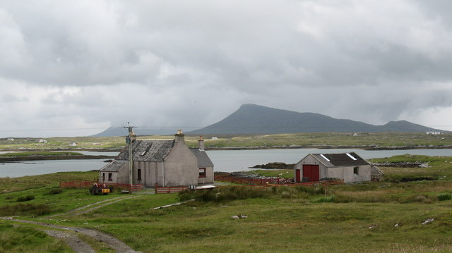
Lochan Dubh

Lake, Pool, Pond, Freshwater Marsh in Inverness-shire

Scotland

Lochan Dubh
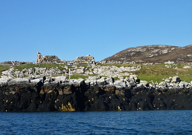
Ruined buildings at Buaile-mhòr
Ruined buildings at Buaile-mhòr Credit: Toby Speight

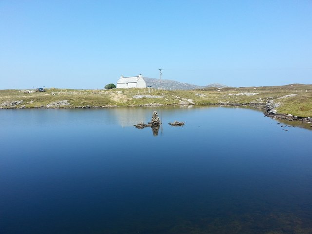
Lochan Dubh is a picturesque freshwater loch situated in Inverness-shire, Scotland. Nestled in the heart of the Scottish Highlands, this natural beauty spot offers a serene and tranquil environment for visitors to enjoy.

Covering an area of approximately 20 acres, Lochan Dubh is surrounded by lush greenery and rolling hills, creating a stunning backdrop for outdoor enthusiasts. The loch is fed by several small streams that flow down from the nearby mountains, ensuring a constant supply of fresh water. Its crystal-clear waters are home to a variety of aquatic life, including trout and eels.

The loch's shoreline is dotted with dense vegetation, providing a habitat for numerous bird species, such as ducks, swans, and herons. This makes Lochan Dubh a popular spot for birdwatching, as visitors can observe these graceful creatures in their natural habitat.

The calm waters of Lochan Dubh also attract outdoor enthusiasts who enjoy fishing or boating. Anglers can try their luck at catching trout, while boaters can leisurely explore the loch, taking in the breathtaking scenery that surrounds them.

In addition to its natural beauty, Lochan Dubh is also steeped in history and folklore. Legend has it that the loch was once home to a mythical creature known as the "Lochan Dubh Monster," said to resemble a large serpent-like creature. While there have been no recent sightings, the Lochan Dubh Monster remains a subject of local folklore and intrigue.

Overall, Lochan Dubh offers visitors a chance to immerse themselves in the serenity of the Scottish Highlands and connect with nature in a truly remarkable setting. Whether it's fishing, boating, birdwatching, or simply enjoying the peaceful surroundings, Lochan Dubh has something to offer for everyone seeking respite from the hustle and bustle of everyday life.

If you have any feedback on the listing, please let us know in the comments section below.

Lochan Dubh Images

Images are sourced within 2km of 57.484709/-7.2242273 or Grid Reference NF8755. Thanks to Geograph Open Source API. All images are credited.

Ruined buildings at Buaile-mhòr
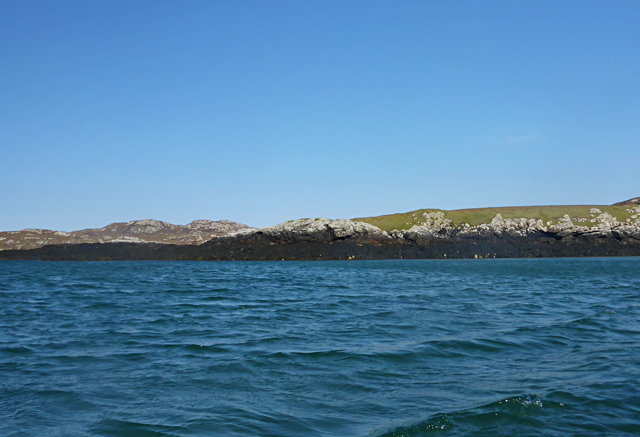
Rubh' an t-Sagairt
Rubh' an t-Sagairt
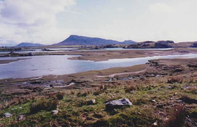
Gearraidh Dubh Looking over the shore near Gearraidh Dubh towards Eabhal.
Gearraidh Dubh
Looking over the shore near Gearraidh Dubh towards Eabhal.
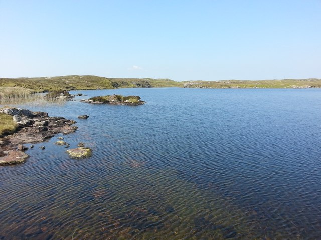
Loch na Faoileag on Grimsay One of many small islets on Loch na Faoileag on the Isle of Grimsay
Loch na Faoileag on Grimsay
One of many small islets on Loch na Faoileag on the Isle of Grimsay
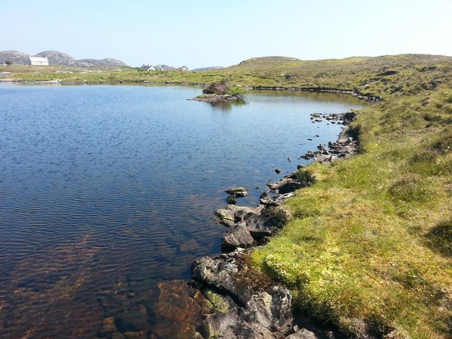
Loch na Faoileag Shoreline A view along the shoreline to north west finger on Loch na Faoileag (Isle of Grimsay) .Taken on the opposite bank from the roadside.
Loch na Faoileag Shoreline
A view along the shoreline to north west finger on Loch na Faoileag (Isle of Grimsay) .Taken on the opposite bank from the roadside.
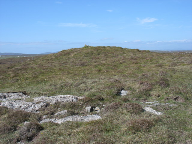
Loch na Faoileag Cairn A small cairn situated at the south-eastern end of Loch na Faoileag.
Loch na Faoileag Cairn
A small cairn situated at the south-eastern end of Loch na Faoileag.
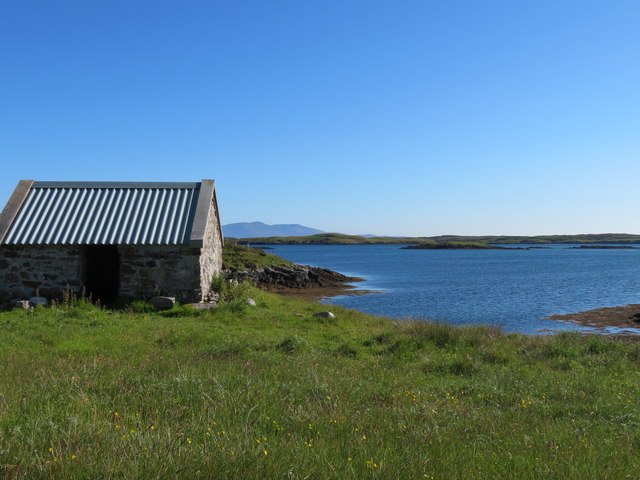
Bagh Sgotbheinn Not all Hebridean buildings fall into disrepair. I note that Dave Fergusson's 2007 photograph includes this small building, but now, twelve years later it has a new roof and is looking well cared for.
Bagh Sgotbheinn
Not all Hebridean buildings fall into disrepair. I note that Dave Fergusson's 2007 photograph includes this small building, but now, twelve years later it has a new roof and is looking well cared for.
Kallin Harbour, Grimsay
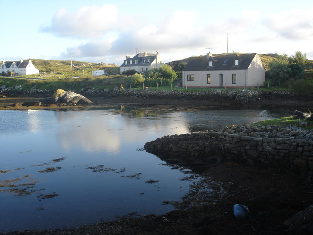
Old harbour, Grimsay A crofthouse sitting on a reclaimed piece of land at Baymore (Bagh mor) which was the main harbour on the island before the Kallin (Ceallan) development.  The harbour is littered with lots of old creels and other flotsam and there are many old stone piers.
Old harbour, Grimsay
A crofthouse sitting on a reclaimed piece of land at Baymore (Bagh mor) which was the main harbour on the island before the Kallin (Ceallan) development. The harbour is littered with lots of old creels and other flotsam and there are many old stone piers.
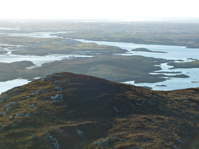
The summit region of Grimsay Grimsay is a low island between North Uist and Benbecula. It is difficult to be certain of its highest point, but this eminence, 25m or so above Mean Sea Level, is a good contender.
The summit region of Grimsay
Grimsay is a low island between North Uist and Benbecula. It is difficult to be certain of its highest point, but this eminence, 25m or so above Mean Sea Level, is a good contender.
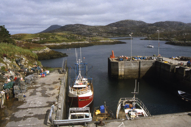
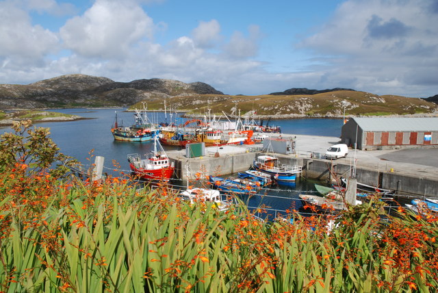
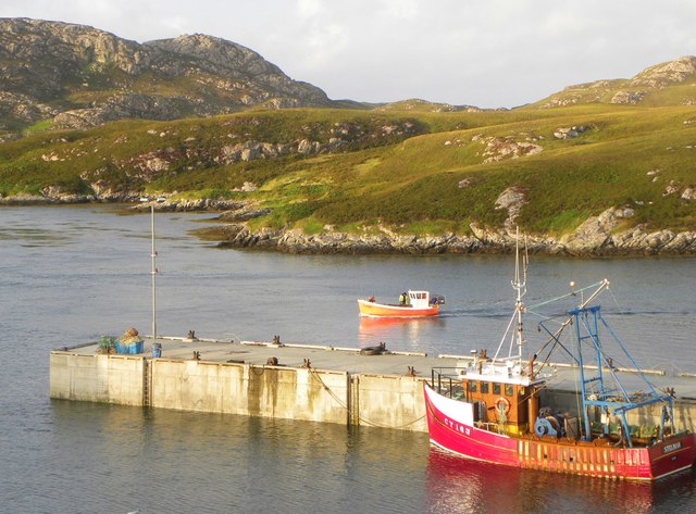
Kallin Harbour The smaller vessels in the harbour are inshore lobster boats which use creels to trap crabs and lobsters.  The larger vessels are offshore prawn boats which use trawl nets to catch the shellfish.
Kallin Harbour
The smaller vessels in the harbour are inshore lobster boats which use creels to trap crabs and lobsters. The larger vessels are offshore prawn boats which use trawl nets to catch the shellfish.
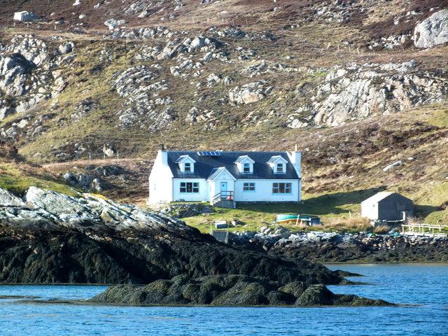
Cottage on Ronay Ronay
Cottage on Ronay
Ronay
Isle of Ronay View towards North Uist
Isle of Ronay
View towards North Uist
Sandy inlet on the coast of Grimsay One of a maze of inlets and channels around Grimsay. This view is interesting as there are remains of old field walls [possibly iron age/centre picture] visible in the sand, indicating a lower sea level at some time. Cloud capped Eabhal rises in the distance.
Sandy inlet on the coast of Grimsay
One of a maze of inlets and channels around Grimsay. This view is interesting as there are remains of old field walls [possibly iron age/centre picture] visible in the sand, indicating a lower sea level at some time. Cloud capped Eabhal rises in the distance.
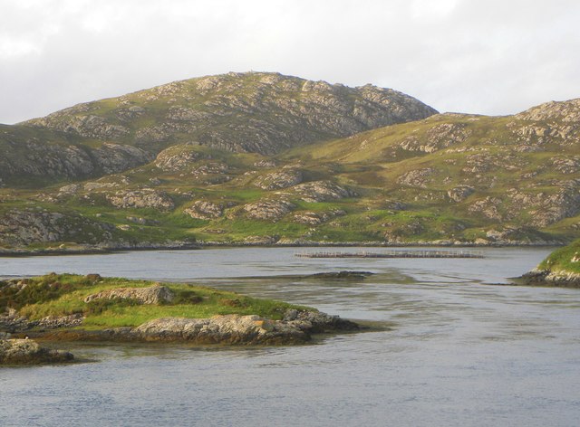
Vallastrome, Kallin The view along the Vallastrome channel towards the biggest hill on the island of Ronaigh. The trig point at 115m can just be seen.
Vallastrome, Kallin
The view along the Vallastrome channel towards the biggest hill on the island of Ronaigh. The trig point at 115m can just be seen.
Coming in to harbour Small fishing boat entering Kallin harbour on a summer evening. This little boat has a 'FY' registration for Fowey in Cornwall, but arrived at Kallin on the back of a lorry. The 'Stelimar'is a local boat based here.
Coming in to harbour
Small fishing boat entering Kallin harbour on a summer evening. This little boat has a 'FY' registration for Fowey in Cornwall, but arrived at Kallin on the back of a lorry. The 'Stelimar'is a local boat based here.
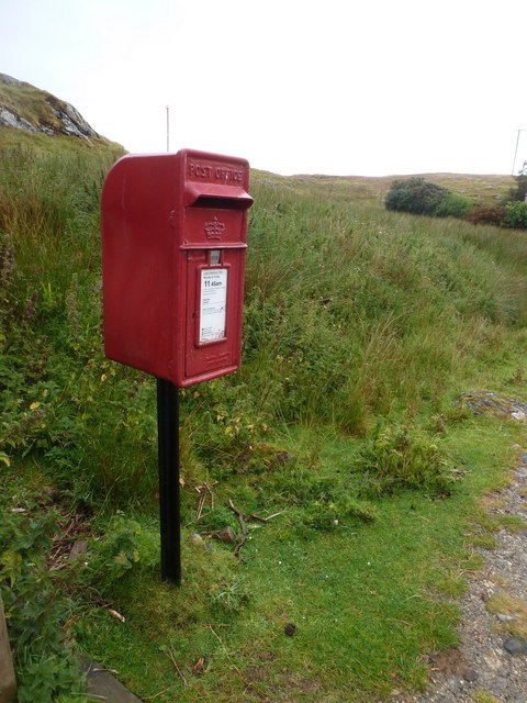
Baymore: postbox № HS6 15 One of four postboxes on the island of Grimsay. Apart from the one on the main road close to the post office, they are emptied at 11:45am on weekdays and at 9:30am on Saturdays.
Baymore: postbox № HS6 15
One of four postboxes on the island of Grimsay. Apart from the one on the main road close to the post office, they are emptied at 11:45am on weekdays and at 9:30am on Saturdays.
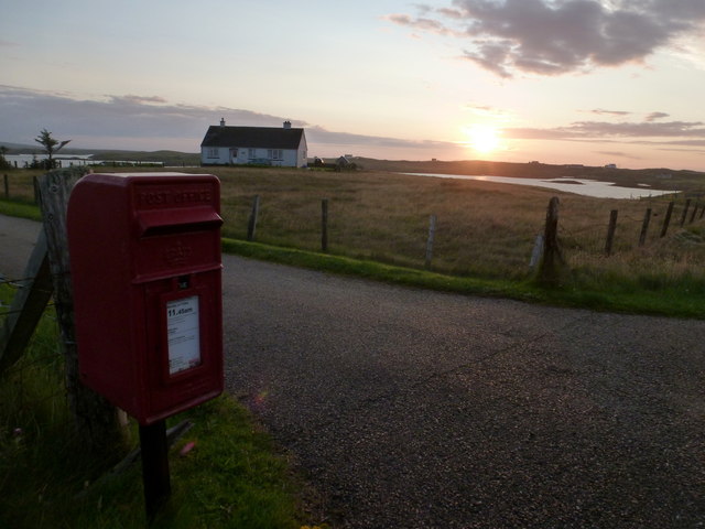
Kallin: postbox № HS6 25 One of four postboxes on the island of Grimsay. Apart from the one on the main road close to the post office, they are emptied at 11:45am on weekdays and at 9:30am on Saturdays.
Kallin: postbox № HS6 25
One of four postboxes on the island of Grimsay. Apart from the one on the main road close to the post office, they are emptied at 11:45am on weekdays and at 9:30am on Saturdays.
Show me another place!

Lochan Dubh is located at Grid Ref: NF8755 (Lat: 57.484709, Lng: -7.2242273)

Unitary Authority: Na h-Eileanan an Iar

Police Authority: Highlands and Islands

What 3 Words

///vies.mouths.downsize. Near Balivanich, Na h-Eileanan Siar

Related Wikis

Grimsay

Grimsay (Scottish Gaelic: Griomasaigh) is a tidal island in the Outer Hebrides of Scotland. == Geography == Grimsay is the largest of the low-lying stepping...

Flodaigh

Flodaigh is a tidal island lying to the north of Benbecula and south of Grimsay in the Outer Hebrides, Scotland. It is connected to Benbecula by a causeway...

Fraoch-Eilean

Fraoch-eilean is a small island with an uncertain population north of Benbecula in the Outer Hebrides of Scotland. It is about 55 hectares (140 acres...

Ronay

Ronay (Scottish Gaelic: Rònaigh) is an island in the Outer Hebrides of Scotland, which lies a short distance off the east coast of Grimsay. == Geography... ==

Nearby Amenities

Located within 500m of 57.484709,-7.2242273
Bus Stop
Grimsay Island
Local Ref: MORE
Naptan AtcoCode: 6010731675
Naptan Bearing: N
Naptan CommonName: Grimsay Island
Naptan Indicator: Baymore
Naptan Landmark: Baymore
Naptan NaptanCode: 94723529
Naptan Street: Baymore
Naptan Verified: no
Source: naptan_import
Lat/Long: 57.4881997/-7.221983
Passing Place
Lat/Long: 57.4875942/-7.2207528
Passing Place
Lat/Long: 57.4823757/-7.2288022
Passing Place
Lat/Long: 57.4842403/-7.2295849
Barrier: cattle_grid
Lat/Long: 57.4866526/-7.2196289
Am Bàgh Mòr
Alt Name: Bagh More
Name En: Baymore
Name Gd: Am Bàgh Mòr
Place: village
Lat/Long: 57.4879179/-7.2209063
Passing Place
Lat/Long: 57.4847027/-7.2304454
Historical Boat Building
Board Type: history
Information: board
Tourism: information
Lat/Long: 57.484478/-7.2307527
Uist Wool
Contact Facebook: UistWool
Contact Instagram: uistwool
Contact Pinterest: uistwool
Contact Twitter: uistwool
Shop: wool
Website: https://www.uistwool.com/
Lat/Long: 57.4845659/-7.2296302
Na Ceallan
Alt Name: Kallin
Direction: NNW
Traffic Sign: city_limit
Lat/Long: 57.4838998/-7.2295524
Na Ceallan
Alt Name: Kallin
Direction: NW
Traffic Sign: city_limit
Lat/Long: 57.4862715/-7.2185782
Am Bàgh Mòr
Alt Name: Baymore
Direction: SE
Traffic Sign: city_limit
Lat/Long: 57.4862657/-7.2185661
Post Box
Collection Times: Mo-Fr 11:45; Sa 09:30
Drive Through: yes
Operator: Royal Mail
Post Box Mounting: pole
Post Box Type: lamp
Ref: HS6 15
Royal Cypher: scottish_crown
Lat/Long: 57.4882242/-7.2218035
Ceanairidh
Alt Name: Ceannairidh
Place: isolated_dwelling
Lat/Long: 57.4848384/-7.2297871
Bàgh Mòr
Natural: bay
Lat/Long: 57.4880044/-7.2192514
Post Box
Collection Times: Mo-Fr 11:45; Sa 09:30
Operator: Royal Mail
Post Box Mounting: pole
Post Box Type: lamp
Royal Cypher: scottish_crown
Lat/Long: 57.4812167/-7.2269227
Power: pole
Lat/Long: 57.4854467/-7.2313447
Power: pole
Lat/Long: 57.4851713/-7.2303737
Power: pole
Lat/Long: 57.4849037/-7.2294551
Power: pole
Lat/Long: 57.4843488/-7.2285975
Power: pole
Lat/Long: 57.4837438/-7.228063
Power: pole
Lat/Long: 57.4805167/-7.2251545
Power: pole
Lat/Long: 57.4871014/-7.2218326
Power: pole
Lat/Long: 57.4867544/-7.2208628
Power: pole
Lat/Long: 57.4864093/-7.2199083
Power: pole
Lat/Long: 57.4860089/-7.21887
Power: pole
Lat/Long: 57.4855333/-7.2176168
Power: pole
Lat/Long: 57.4852266/-7.2168053
Power: pole
Lat/Long: 57.4849639/-7.2161155
Power: pole
Lat/Long: 57.4859566/-7.2180192
Power: pole
Lat/Long: 57.4861674/-7.218537
Power: pole
Lat/Long: 57.4864276/-7.2191454
Power: pole
Lat/Long: 57.4866065/-7.219575
Passing Place
Lat/Long: 57.4885825/-7.222077
Passing Place
Lat/Long: 57.4881599/-7.2216171
Barrier: cattle_grid
Lat/Long: 57.4862488/-7.2184072
Passing Place
Lat/Long: 57.4814926/-7.2272801
Passing Place
Lat/Long: 57.4832687/-7.2293111
Generator Method: wind_turbine
Generator Source: wind
Generator Type: horizontal_axis
Power: generator
Lat/Long: 57.4851642/-7.2286285
Generator Method: wind_turbine
Generator Source: wind
Generator Type: horizontal_axis
Power: generator
Lat/Long: 57.4846141/-7.2282134
Power: pole
Lat/Long: 57.4817943/-7.2263088
Power: pole
Lat/Long: 57.4831057/-7.227487
Power: pole
Lat/Long: 57.4811783/-7.2257317
Power: pole
Lat/Long: 57.4872868/-7.2212134
Power: pole
Lat/Long: 57.486948/-7.220394
Power: pole
Lat/Long: 57.480638/-7.2273068
Power: pole
Lat/Long: 57.4808817/-7.2277011
Power: pole
Lat/Long: 57.4831897/-7.2296276
Power: pole
Lat/Long: 57.4841048/-7.2288129
Power: pole
Lat/Long: 57.4835858/-7.2292742
The data included in this document is from www.openstreetmap.org. The data is made available under ODbL.

Have you been to Lochan Dubh?

Leave your review of Lochan Dubh below (or comments, questions and feedback).