Loch a' Mhuilinn

Lake, Pool, Pond, Freshwater Marsh in Inverness-shire

Scotland

Loch a' Mhuilinn
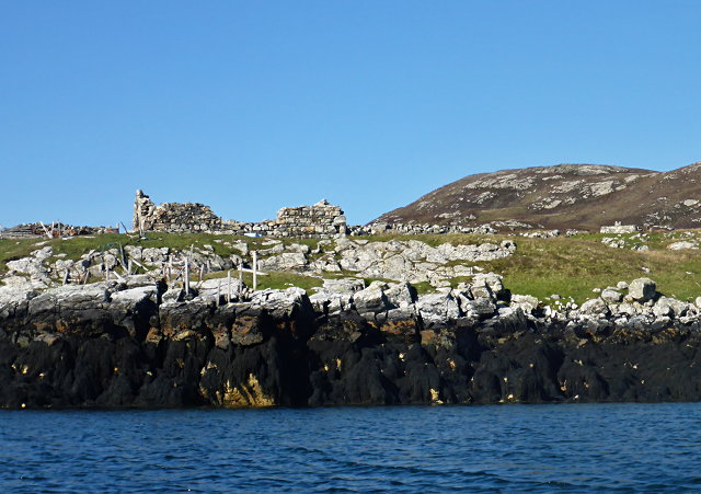
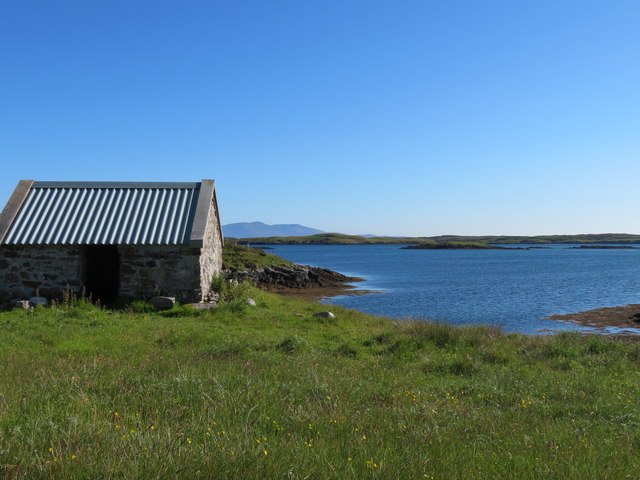
Ruined buildings at Buaile-mhòr
Ruined buildings at Buaile-mhòr Credit: Toby Speight

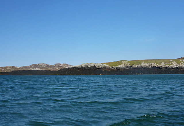
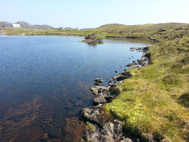
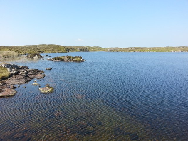
Loch a' Mhuilinn, located in Inverness-shire, Scotland, is a picturesque body of water that can be classified as a lake or a freshwater marsh. It is situated in a stunning natural setting, surrounded by rolling hills and lush greenery.

Covering an area of approximately 50 acres, Loch a' Mhuilinn is relatively small in size but offers a serene and tranquil atmosphere. Its name translates to "Mill Loch" in English, which suggests its historical connection to nearby mills that may have once utilized its waters.

The lake is fed by several small streams and springs that flow into it from the surrounding hills, ensuring a constant supply of freshwater. The water is typically calm and clear, allowing visitors to appreciate the beauty of the submerged vegetation and wildlife that call the loch home.

The presence of various aquatic plants, such as water lilies and reeds, offers a rich habitat for a diverse range of species. Birdwatchers can spot a variety of waterfowl, including ducks and swans, gracefully gliding across the surface of the water. Additionally, the loch supports a healthy population of fish, making it a popular spot for anglers looking to catch trout or pike.

Surrounded by a network of walking trails, Loch a' Mhuilinn provides an excellent opportunity for outdoor enthusiasts to explore the surrounding countryside and enjoy the peaceful ambiance. Its natural beauty and tranquil environment make it a popular destination for locals and tourists alike, seeking refuge from the hustle and bustle of everyday life.

If you have any feedback on the listing, please let us know in the comments section below.

Loch a' Mhuilinn Images

Images are sourced within 2km of 57.482194/-7.2182705 or Grid Reference NF8755. Thanks to Geograph Open Source API. All images are credited.

Ruined buildings at Buaile-mhòr
Rubh' an t-Sagairt
Rubh' an t-Sagairt
Loch na Faoileag on Grimsay One of many small islets on Loch na Faoileag on the Isle of Grimsay
Loch na Faoileag on Grimsay
One of many small islets on Loch na Faoileag on the Isle of Grimsay
Loch na Faoileag Shoreline A view along the shoreline to north west finger on Loch na Faoileag (Isle of Grimsay) .Taken on the opposite bank from the roadside.
Loch na Faoileag Shoreline
A view along the shoreline to north west finger on Loch na Faoileag (Isle of Grimsay) .Taken on the opposite bank from the roadside.
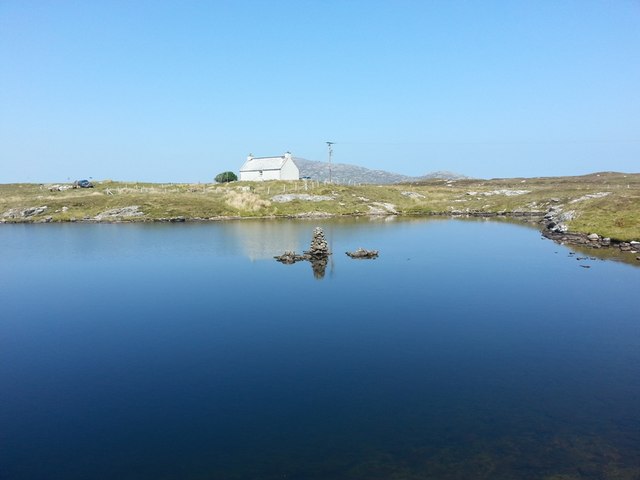
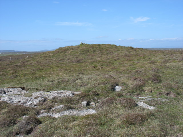
Loch na Faoileag Cairn A small cairn situated at the south-eastern end of Loch na Faoileag.
Loch na Faoileag Cairn
A small cairn situated at the south-eastern end of Loch na Faoileag.
Bagh Sgotbheinn Not all Hebridean buildings fall into disrepair. I note that Dave Fergusson's 2007 photograph includes this small building, but now, twelve years later it has a new roof and is looking well cared for.
Bagh Sgotbheinn
Not all Hebridean buildings fall into disrepair. I note that Dave Fergusson's 2007 photograph includes this small building, but now, twelve years later it has a new roof and is looking well cared for.
Kallin Harbour, Grimsay
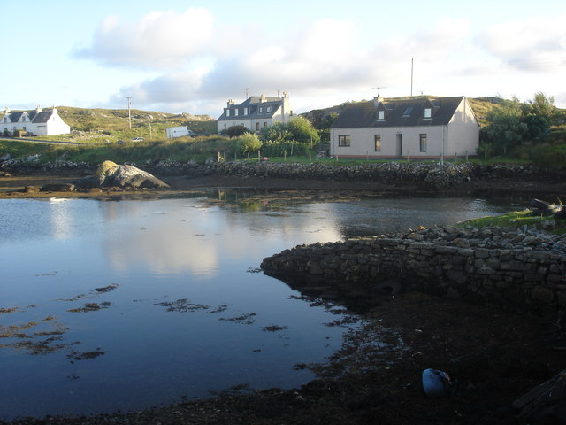
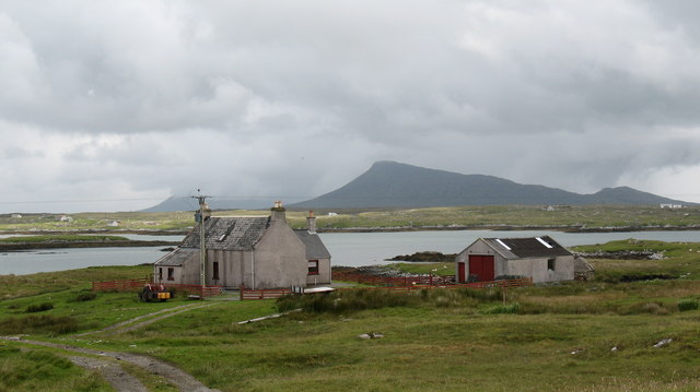
Old harbour, Grimsay A crofthouse sitting on a reclaimed piece of land at Baymore (Bagh mor) which was the main harbour on the island before the Kallin (Ceallan) development.  The harbour is littered with lots of old creels and other flotsam and there are many old stone piers.
Old harbour, Grimsay
A crofthouse sitting on a reclaimed piece of land at Baymore (Bagh mor) which was the main harbour on the island before the Kallin (Ceallan) development. The harbour is littered with lots of old creels and other flotsam and there are many old stone piers.
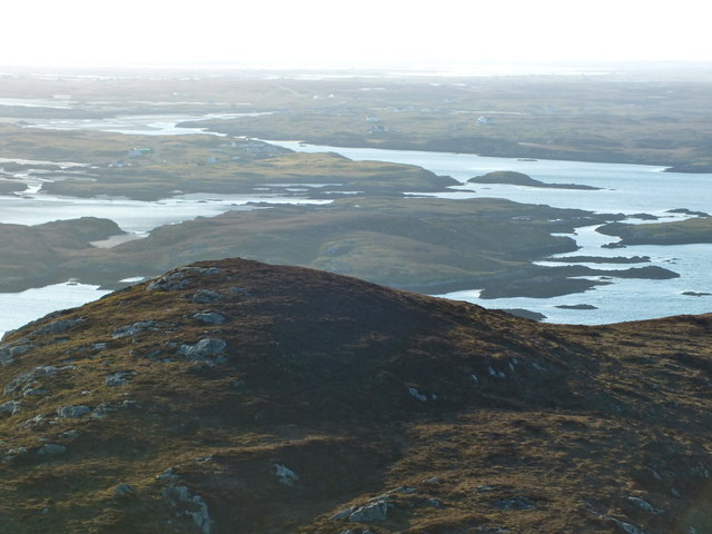
The summit region of Grimsay Grimsay is a low island between North Uist and Benbecula. It is difficult to be certain of its highest point, but this eminence, 25m or so above Mean Sea Level, is a good contender.
The summit region of Grimsay
Grimsay is a low island between North Uist and Benbecula. It is difficult to be certain of its highest point, but this eminence, 25m or so above Mean Sea Level, is a good contender.
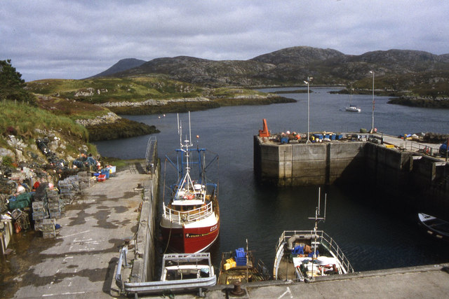
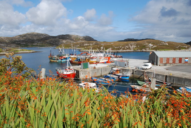
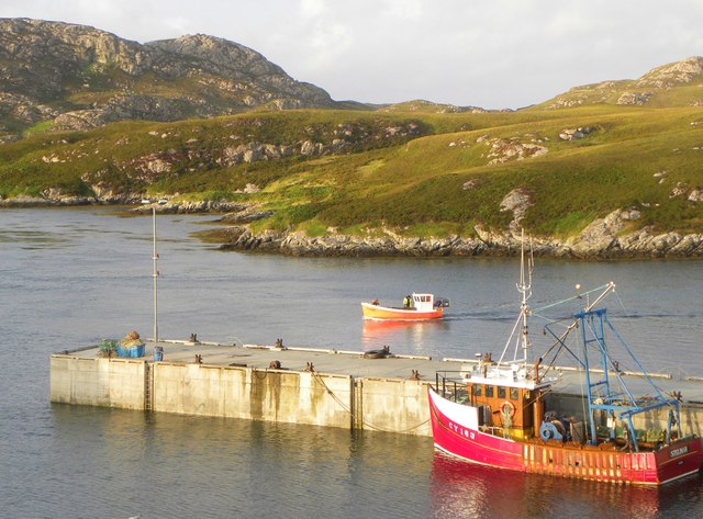
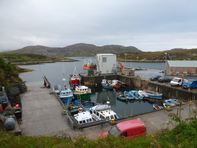
Kallin Harbour The smaller vessels in the harbour are inshore lobster boats which use creels to trap crabs and lobsters.  The larger vessels are offshore prawn boats which use trawl nets to catch the shellfish.
Kallin Harbour
The smaller vessels in the harbour are inshore lobster boats which use creels to trap crabs and lobsters. The larger vessels are offshore prawn boats which use trawl nets to catch the shellfish.
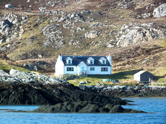
Cottage on Ronay Ronay
Cottage on Ronay
Ronay
Isle of Ronay View towards North Uist
Isle of Ronay
View towards North Uist
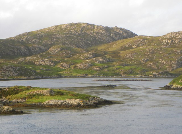
Vallastrome, Kallin The view along the Vallastrome channel towards the biggest hill on the island of Ronaigh. The trig point at 115m can just be seen.
Vallastrome, Kallin
The view along the Vallastrome channel towards the biggest hill on the island of Ronaigh. The trig point at 115m can just be seen.
Coming in to harbour Small fishing boat entering Kallin harbour on a summer evening. This little boat has a 'FY' registration for Fowey in Cornwall, but arrived at Kallin on the back of a lorry. The 'Stelimar'is a local boat based here.
Coming in to harbour
Small fishing boat entering Kallin harbour on a summer evening. This little boat has a 'FY' registration for Fowey in Cornwall, but arrived at Kallin on the back of a lorry. The 'Stelimar'is a local boat based here.
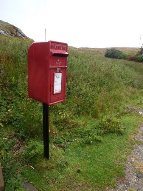
Baymore: postbox № HS6 15 One of four postboxes on the island of Grimsay. Apart from the one on the main road close to the post office, they are emptied at 11:45am on weekdays and at 9:30am on Saturdays.
Baymore: postbox № HS6 15
One of four postboxes on the island of Grimsay. Apart from the one on the main road close to the post office, they are emptied at 11:45am on weekdays and at 9:30am on Saturdays.
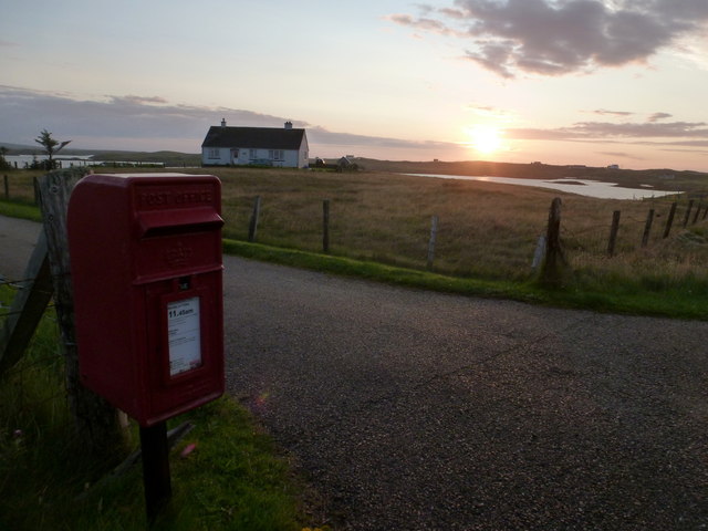
Kallin: postbox № HS6 25 One of four postboxes on the island of Grimsay. Apart from the one on the main road close to the post office, they are emptied at 11:45am on weekdays and at 9:30am on Saturdays.
Kallin: postbox № HS6 25
One of four postboxes on the island of Grimsay. Apart from the one on the main road close to the post office, they are emptied at 11:45am on weekdays and at 9:30am on Saturdays.
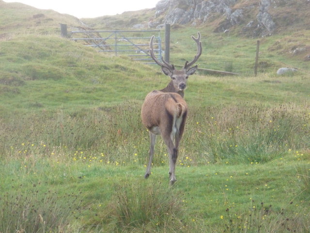
Kallin: a deer He spotted me as soon as I spotted him!
Kallin: a deer
He spotted me as soon as I spotted him!
Kallin: the harbour Looking across the harbour from the road above.
Kallin: the harbour
Looking across the harbour from the road above.
Show me another place!

Loch a' Mhuilinn is located at Grid Ref: NF8755 (Lat: 57.482194, Lng: -7.2182705)

Unitary Authority: Na h-Eileanan an Iar

Police Authority: Highlands and Islands

What 3 Words

///majoring.famous.crowbar. Near Balivanich, Na h-Eileanan Siar

Related Wikis

Grimsay

Grimsay (Scottish Gaelic: Griomasaigh) is a tidal island in the Outer Hebrides of Scotland. == Geography == Grimsay is the largest of the low-lying stepping...

Ronay

Ronay (Scottish Gaelic: Rònaigh) is an island in the Outer Hebrides of Scotland, which lies a short distance off the east coast of Grimsay. == Geography... ==

Flodaigh

Flodaigh is a tidal island lying to the north of Benbecula and south of Grimsay in the Outer Hebrides, Scotland. It is connected to Benbecula by a causeway...

Fraoch-Eilean

Fraoch-eilean is a small island with an uncertain population north of Benbecula in the Outer Hebrides of Scotland. It is about 55 hectares (140 acres...

Nearby Amenities

Located within 500m of 57.482194,-7.2182705
Passing Place
Lat/Long: 57.4786823/-7.2187946
Passing Place
Lat/Long: 57.4802124/-7.2253004
Passing Place
Lat/Long: 57.4787419/-7.2206927
Na Ceallan
Alt Name: Kallin
Direction: NW
Traffic Sign: city_limit
Lat/Long: 57.4862715/-7.2185782
Am Bàgh Mòr
Alt Name: Baymore
Direction: SE
Traffic Sign: city_limit
Lat/Long: 57.4862657/-7.2185661
Òban Uaine
Natural: bay
Lat/Long: 57.478673/-7.2229743
Power: pole
Lat/Long: 57.4805167/-7.2251545
Power: pole
Lat/Long: 57.4790551/-7.2216042
Power: pole
Lat/Long: 57.4785701/-7.2204989
Power: pole
Lat/Long: 57.4780962/-7.2193561
Power: pole
Lat/Long: 57.4778502/-7.2187556
Power: pole
Lat/Long: 57.4823264/-7.2104986
Power: pole
Lat/Long: 57.4864093/-7.2199083
Power: pole
Lat/Long: 57.4860089/-7.21887
Power: pole
Lat/Long: 57.4855333/-7.2176168
Power: pole
Lat/Long: 57.4852266/-7.2168053
Power: pole
Lat/Long: 57.4849639/-7.2161155
Power: pole
Lat/Long: 57.4847751/-7.2156006
Power: pole
Lat/Long: 57.4844823/-7.2148104
Power: pole
Lat/Long: 57.4842145/-7.2141156
Power: pole
Lat/Long: 57.4839711/-7.2134614
Power: pole
Lat/Long: 57.4837012/-7.2127536
Power: pole
Lat/Long: 57.4833967/-7.2119677
Power: pole
Lat/Long: 57.4828817/-7.2112592
Power: pole
Lat/Long: 57.4859566/-7.2180192
Power: pole
Lat/Long: 57.4861674/-7.218537
Power: pole
Lat/Long: 57.4864276/-7.2191454
Power: pole
Lat/Long: 57.4866065/-7.219575
Barrier: cattle_grid
Lat/Long: 57.4862488/-7.2184072
Barrier: cattle_grid
Lat/Long: 57.4848187/-7.2145864
Passing Place
Lat/Long: 57.4792484/-7.2223533
Power: pole
Lat/Long: 57.4817943/-7.2263088
Power: pole
Lat/Long: 57.4811783/-7.2257317
Power: pole
Lat/Long: 57.4840712/-7.211173
Power: pole
Lat/Long: 57.4839566/-7.2122485
Booth: K6
Covered: booth
Disused Amenity: telephone
Man Made: telephone_box
Lat/Long: 57.4785807/-7.2183525
Passing Place
Lat/Long: 57.4850909/-7.2153155
Passing Place
Lat/Long: 57.4852293/-7.2156833
Passing Place
Lat/Long: 57.4841655/-7.2124514
Power: pole
Lat/Long: 57.4842074/-7.2117032
Power: pole
Lat/Long: 57.4797873/-7.223366
Power: pole
Lat/Long: 57.4783213/-7.2157055
Power: pole
Lat/Long: 57.4783766/-7.2188141
Power: pole
Lat/Long: 57.4785518/-7.2184775
Passing Place
Lat/Long: 57.4784034/-7.2152049
The data included in this document is from www.openstreetmap.org. The data is made available under ODbL.

Have you been to Loch a' Mhuilinn?

Leave your review of Loch a' Mhuilinn below (or comments, questions and feedback).