Loch Steineabhat
Lake, Pool, Pond, Freshwater Marsh in Inverness-shire
Scotland
Loch Steineabhat

Loch Steineabhat, located in Inverness-shire, is a stunning freshwater lake nestled amidst the scenic Scottish Highlands. Covering an area of approximately 1 square kilometer, this enchanting body of water offers a serene and tranquil setting for both locals and tourists alike.
Surrounded by lush greenery and rolling hills, Loch Steineabhat boasts crystal-clear waters that reflect the picturesque landscape. The lake is fed by numerous small streams and springs, ensuring a constant flow of fresh water. Its depth varies across different parts, reaching a maximum depth of around 10 meters.
The lake is home to a diverse range of flora and fauna. The surrounding marshland provides a habitat for various species of plants, including reeds, water lilies, and mosses. These marshes also attract a wide array of birdlife, with sightings of waterfowl such as ducks, geese, and swans being common. Additionally, the lake supports a healthy population of fish, including trout and perch, making it a popular spot for anglers.
For those seeking outdoor activities, Loch Steineabhat offers opportunities for boating, kayaking, and fishing. Its calm and peaceful waters make it an ideal destination for a leisurely paddle or a day of fishing. The scenic backdrop of the Scottish Highlands adds to the overall charm of the experience.
Overall, Loch Steineabhat is a natural gem that showcases the beauty and tranquility of the Scottish landscape. Whether one wishes to explore its diverse ecosystem or simply enjoy the peaceful ambiance, this freshwater lake offers a memorable and captivating experience for all visitors.
If you have any feedback on the listing, please let us know in the comments section below.
Loch Steineabhat Images
Images are sourced within 2km of 57.648997/-7.239283 or Grid Reference NF8774. Thanks to Geograph Open Source API. All images are credited.

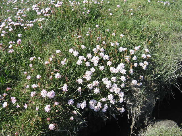
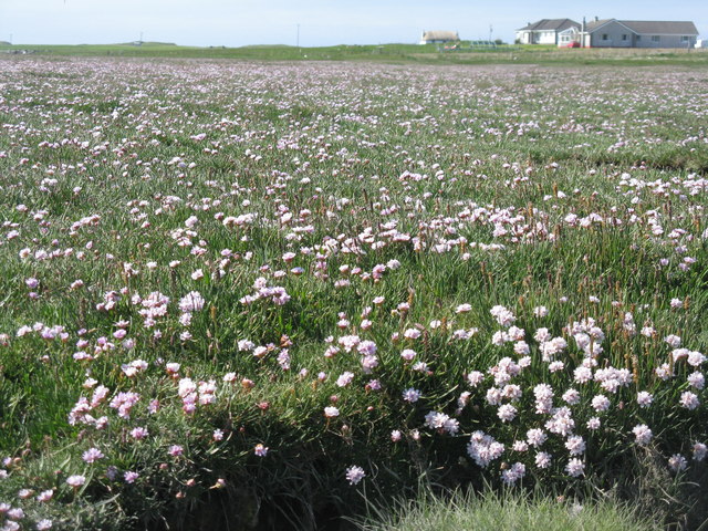
![Salt marsh at Trumaisgearraidh With a good flowering of Thrift [Armeria maritima].](https://s2.geograph.org.uk/geophotos/04/98/76/4987682_f3c46f91.jpg)

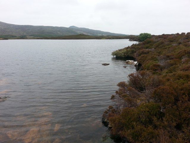
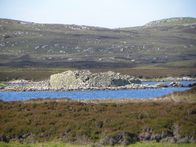
![View towards Loch an Duin The distant water translates as the Loch of the Dun, with the remains of Dun Torcuill in the middle distance [centre of photo]. The convoluted outline of the loch includes two other dun sites, both well out of sight from this point by the road.](https://s3.geograph.org.uk/geophotos/06/20/38/6203855_dded2482.jpg)
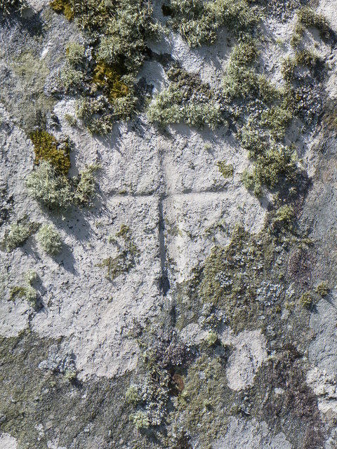
![Clach an t-Sagairt [with oystercatcher] The name translates as the 'Priest's Stone' and the incised cross [see detailed photo] may be early medieval.](https://s0.geograph.org.uk/geophotos/06/20/54/6205476_aeb4c05e.jpg)


Loch Steineabhat is located at Grid Ref: NF8774 (Lat: 57.648997, Lng: -7.239283)
Unitary Authority: Na h-Eileanan an Iar
Police Authority: Highlands and Islands
What 3 Words
///cheat.bits.beginning. Near Lochmaddy, Na h-Eileanan Siar
Nearby Locations
Related Wikis

Na Fir Bhrèige
Na Fir Bhrèige (pronounced [nə fiɾʲ ˈvɾʲeːkʲə]; can be translated from Gaelic into English as "The False Men") is a set of three standing stones on the...

Oronsay, Outer Hebrides
Oronsay (Gaelic Orasaigh) is a tidal island off North Uist in the Outer Hebrides. Lying to the north of Vallaquie Strand, the island has been uninhabited...

North Uist Machair and Islands
The North Uist Machair and Islands is a protected wetland area in the Outer Hebrides of Scotland. A total of 4,705 hectares comprises seven separate areas...

Ceallasaigh Mòr
Ceallasaigh Mòr (or Keallasay More) is a low-lying island in Loch Maddy off North Uist in the Outer Hebrides of Scotland. This an area of shallow lagoons...
Nearby Amenities
Located within 500m of 57.648997,-7.239283Have you been to Loch Steineabhat?
Leave your review of Loch Steineabhat below (or comments, questions and feedback).