Neostie Ness

Coastal Feature, Headland, Point in Shetland

Scotland

Neostie Ness

Lamba Stack and Bound Skerry Fine rock scenery with the sea-girt Lamba Stack in the foreground and the lighthouse on Bound Skerry, the most easterly point of Scotland,in the distance.
Lamba Stack and Bound Skerry Credit: Greg Fitchett

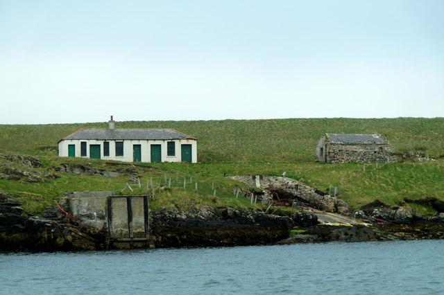
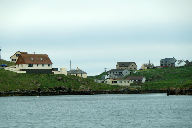
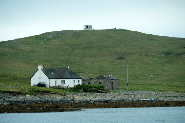
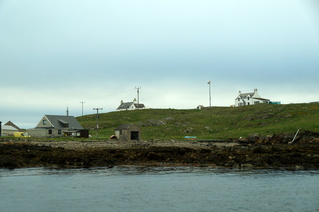
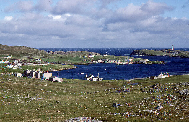
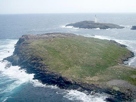
Neostie Ness is a prominent coastal feature located in the Shetland Islands, Scotland. It is a headland that extends into the North Sea, forming a distinctive point along the coastline. Neostie Ness is situated on the eastern side of the Shetland Mainland, near the village of Vidlin.

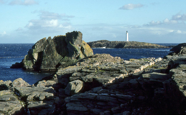
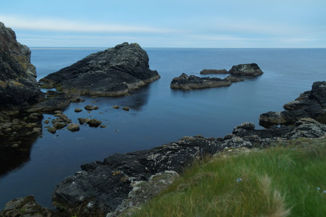
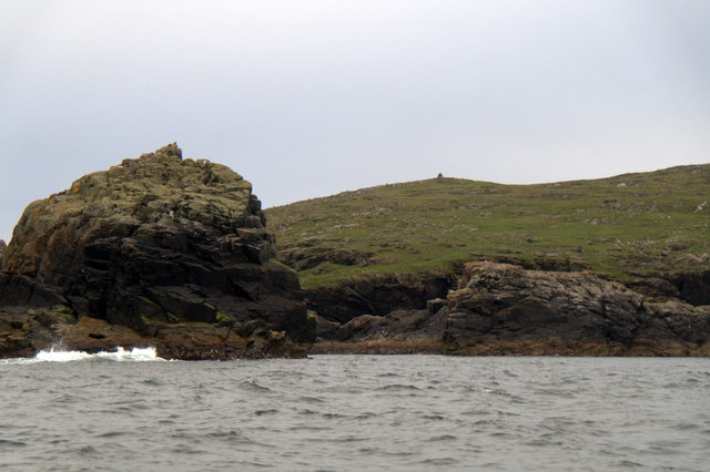
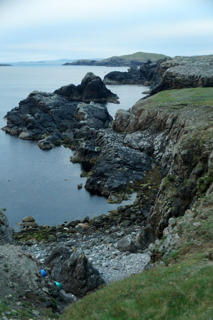
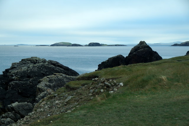
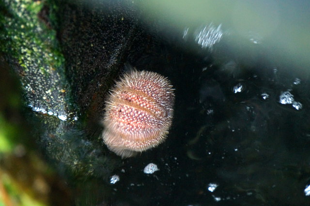
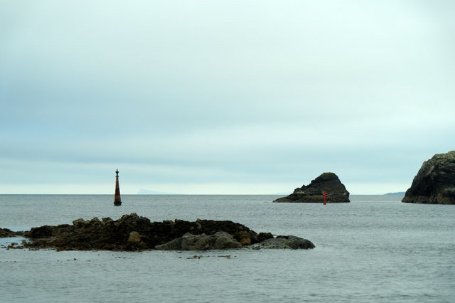
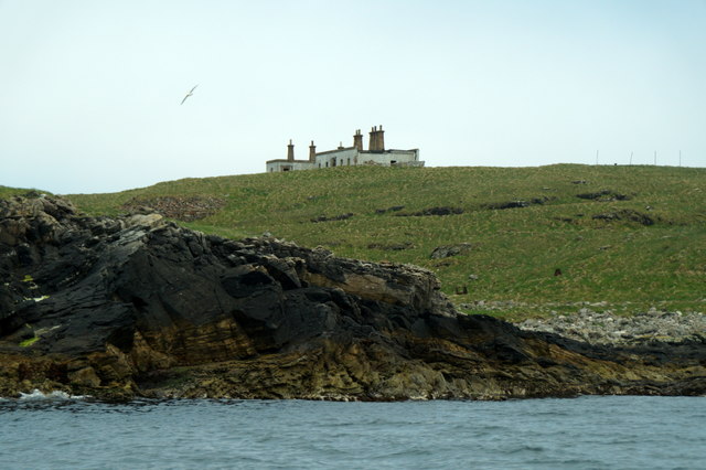
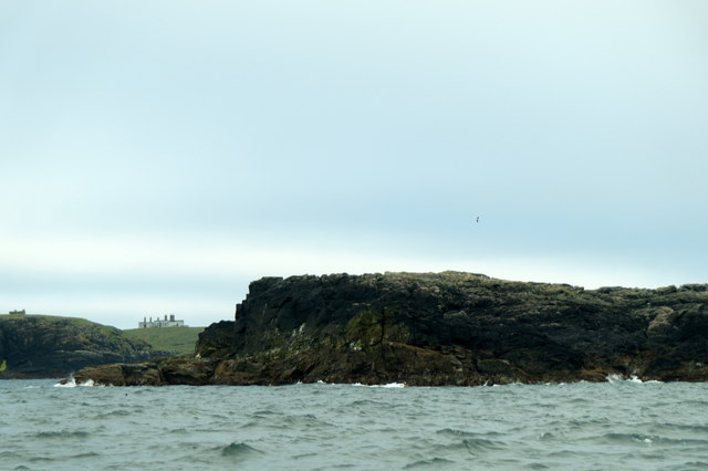
The headland is characterized by its rugged and rocky terrain, with steep cliffs that drop dramatically into the sea. These cliffs provide a nesting habitat for various seabird species, including puffins, guillemots, and kittiwakes. The area is a popular spot for birdwatchers and nature enthusiasts, offering stunning views of the surrounding ocean and the opportunity to observe these fascinating bird colonies.

Neostie Ness is also renowned for its geological significance. The headland is composed of ancient rock formations, primarily sandstone and shale, which have been shaped and eroded over millions of years by the relentless power of the sea. This has resulted in the creation of unique features, such as sea stacks and sea arches, adding to the picturesque beauty of the area.

Access to Neostie Ness is relatively easy, with a well-maintained coastal path leading visitors to the headland. The path offers breathtaking vistas along the way, showcasing the wild and untamed beauty of the Shetland coastline. Additionally, there are designated viewing points and benches where visitors can rest and take in the panoramic views.

Overall, Neostie Ness is a remarkable coastal feature that showcases the natural beauty and geological history of the Shetland Islands. Its rugged cliffs, diverse birdlife, and stunning views make it a must-visit destination for anyone exploring this remote and enchanting part of Scotland.

If you have any feedback on the listing, please let us know in the comments section below.
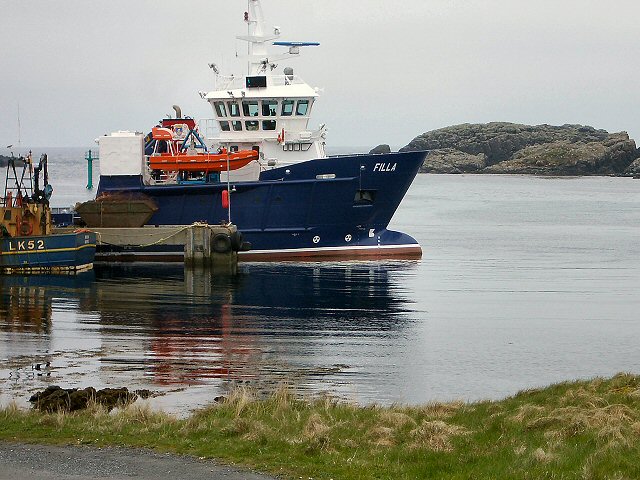
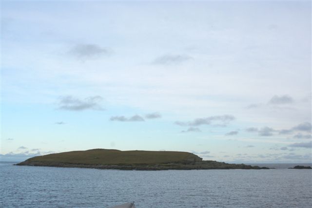
Neostie Ness Images

Images are sourced within 2km of 60.424821/-0.76821554 or Grid Reference HU6771. Thanks to Geograph Open Source API. All images are credited.

Lamba Stack and Bound Skerry Fine rock scenery with the sea-girt Lamba Stack in the foreground and the lighthouse on Bound Skerry, the most easterly point of Scotland,in the distance.
Lamba Stack and Bound Skerry
Fine rock scenery with the sea-girt Lamba Stack in the foreground and the lighthouse on Bound Skerry, the most easterly point of Scotland,in the distance.
Holm Geo, Out Skerries
Walrus (Odobenus rosmarus), Holm Geo, Out Skerries This individual has been touring northern Scotland for several weeks, and has finally paid Shetland a visit.
Walrus (Odobenus rosmarus), Holm Geo, Out Skerries
This individual has been touring northern Scotland for several weeks, and has finally paid Shetland a visit.
LK52 Renown at Out Skerries pier
Buildings on Grunay, Out Skerries
Lamba Stack and Bruray Ward, Out Skerries
Holm Geo, Out Skerries Looking towards the skerries known as the Benelips.
Holm Geo, Out Skerries
Looking towards the skerries known as the Benelips.
Holm Geo, Out Skerries
The view to the Benelips from Holm Geo, Out Skerries
Sea urchin on the pier at Out Skerries The Shetland name for the sea urchin in 'scaddy man's heid'.
Sea urchin on the pier at Out Skerries
The Shetland name for the sea urchin in 'scaddy man's heid'.
Houses on Out Skerries
House on Housay, Out Skerries
The south mouth of Out Skerries harbour
Houses on Bruray, Out Skerries
Building on Grunay, Out Skerries
Approaching Out Skerries from the north Flat Lamba Skerry in the foreground.
Approaching Out Skerries from the north
Flat Lamba Skerry in the foreground.
Out Skerries The view from Housay. In the centre foreground is the post office and across South Mouth is the ferry pier on Bruray with its airstrip visible on the left.
Out Skerries Lighthouse is on the small islet of Bound Skerry off Grunay.
Out Skerries
The view from Housay. In the centre foreground is the post office and across South Mouth is the ferry pier on Bruray with its airstrip visible on the left. Out Skerries Lighthouse is on the small islet of Bound Skerry off Grunay.
Out Skerries harbour The ferry has just berthed.
Out Skerries harbour
The ferry has just berthed.
Show me another place!

Neostie Ness is located at Grid Ref: HU6771 (Lat: 60.424821, Lng: -0.76821554)

Unitary Authority: Shetland Islands

Police Authority: Highlands and Islands

What 3 Words

///roughness.landlords.admire. Near Symbister, Shetland Islands

Related Wikis

Housay

Housay (Scots: Housay), also known as West Isle, is one of the three islands that form the Out Skerries island group, the most easterly part of the Shetland...

Out Skerries

The Out Skerries are an archipelago of islets, some inhabited, in Shetland, Scotland, and are the easternmost part of Shetland. Locally, they are usually...

Bruray

Bruray is one of the three Out Skerries islands of Shetland, and contains Scotland's most easterly settlement. It is separated from Housay by North Mouth...

Grunay

Grunay is an uninhabited island in the Out Skerries group, the most easterly part of Shetland, Scotland. Its area is 55.58 acres, or 22.49 hectares. The...

Bound Skerry

Bound Skerry is part of the Out Skerries group in the Shetland Islands. As well as being the most easterly island of that group, it is also the easternmost...

Outer Holm of Skaw

The Outer Holm of Skaw is a small, uninhabited islet, a rock outlier off the northeast coast of the island of Whalsay, in the Shetland Islands of Scotland...

Inner Holm of Skaw

The Inner Holm of Skaw is a small, uninhabited islet off the northern tip of the island of Whalsay, in the Shetland Islands of Scotland, north of the village...

Nista

Nista is a small islet of the Shetland Islands of Scotland, situated roughly 2 kilometres (1.2 mi) east off the coast of Whalsay. It lies to the north...

Nearby Amenities

Located within 500m of 60.424821,-0.76821554
Barrier: cattle_grid
Lat/Long: 60.4233681/-0.7635796
Leisure: marina
Lat/Long: 60.4236944/-0.7615585
Cinema
Lat/Long: 60.4228845/-0.7672486
Leisure: fitness_centre
Lat/Long: 60.4229806/-0.7671424
Power: pole
Lat/Long: 60.4228728/-0.7670738
Power: pole
Lat/Long: 60.4228797/-0.7662874
Power: pole
Lat/Long: 60.4226815/-0.7652919
Power: pole
Lat/Long: 60.424958/-0.7642852
Power: pole
Lat/Long: 60.4245602/-0.7654425
Power: pole
Lat/Long: 60.4239546/-0.7657213
Power: pole
Lat/Long: 60.4233573/-0.7660197
Power: pole
Lat/Long: 60.4223855/-0.7665523
Power: pole
Lat/Long: 60.4223208/-0.7674
Power: pole
Lat/Long: 60.4222383/-0.7684178
Power: pole
Lat/Long: 60.4221708/-0.7692209
Power: pole
Lat/Long: 60.4220428/-0.7708243
Power: pole
Lat/Long: 60.4219561/-0.7718449
Power: pole
Lat/Long: 60.4218584/-0.7730523
Power: pole
Lat/Long: 60.4217207/-0.774639
Power: pole
Lat/Long: 60.4227806/-0.7602224
Power: pole
Lat/Long: 60.4230338/-0.7609223
Power: pole
Lat/Long: 60.4228563/-0.7615915
Power: pole
Lat/Long: 60.4226443/-0.7624002
Power: pole
Lat/Long: 60.4226009/-0.7640106
Power: pole
Lat/Long: 60.4225232/-0.7649684
Power: pole
Lat/Long: 60.4230008/-0.763814
Power: pole
Lat/Long: 60.422859/-0.7633176
The data included in this document is from www.openstreetmap.org. The data is made available under ODbL.

Have you been to Neostie Ness?

Leave your review of Neostie Ness below (or comments, questions and feedback).