Bessi Holm

Coastal Feature, Headland, Point in Shetland

Scotland

Bessi Holm

Lighthouse on Bound Skerry, Out Skerries
Lighthouse on Bound Skerry, Out Skerries Credit: Mike Pennington

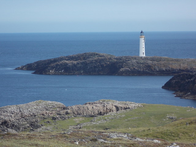
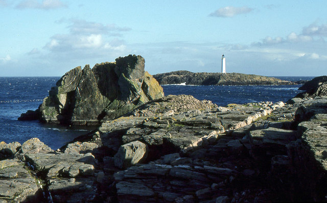
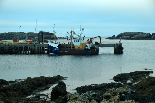
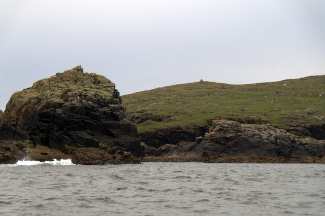
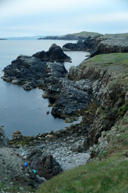
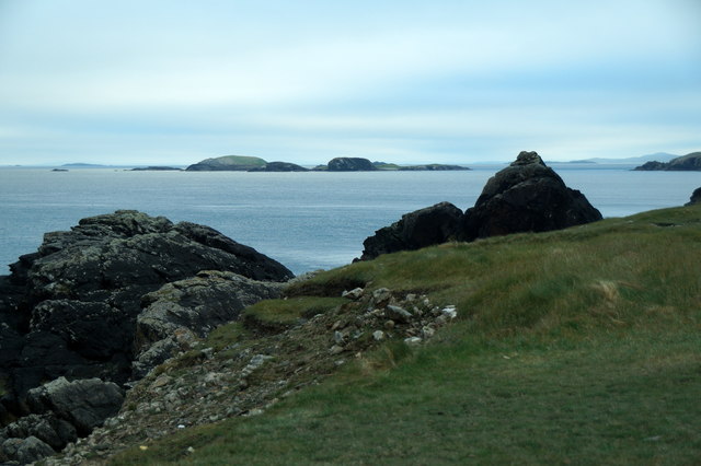
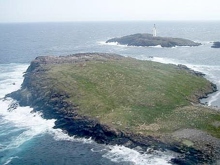
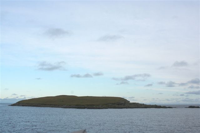
Bessi Holm is a prominent coastal feature located on the rugged coastline of the Shetland Islands, Scotland. Situated on the western coast of the main island, it is a distinctive headland that extends into the North Sea, forming a prominent point in the surrounding landscape.

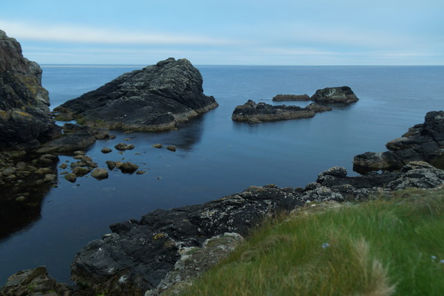
The headland is characterized by steep cliffs that rise dramatically from the sea, providing a breathtaking view of the surrounding ocean and coastline. The cliffs are composed of ancient sedimentary rocks, displaying layers of different colors and textures, which provide geological interest to the area.

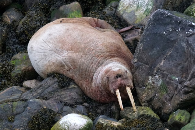
Bessi Holm is renowned for its diverse wildlife. The surrounding waters are home to various species of seabirds, including puffins, fulmars, and guillemots, which nest on the cliffs during the breeding season. Visitors can often witness these magnificent birds soaring above the sea or perched on rocky ledges.

The headland is also frequented by seals, which can often be spotted basking on the rocks or swimming in the nearby waters. The coastline around Bessi Holm offers an excellent opportunity for wildlife enthusiasts and photographers to observe and capture these fascinating creatures in their natural habitat.

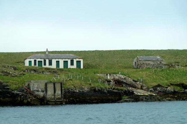
In addition to its natural beauty, Bessi Holm holds historical significance. The area is dotted with ancient archaeological sites, including the remnants of Iron Age settlements and burial grounds, providing a glimpse into the island's rich history.

Overall, Bessi Holm is a stunning coastal feature that offers a combination of natural beauty, diverse wildlife, and historical interest. It is a must-visit destination for those exploring the Shetland Islands and seeking a unique and captivating coastal experience.

If you have any feedback on the listing, please let us know in the comments section below.

Bessi Holm Images

Images are sourced within 2km of 60.419865/-0.75474621 or Grid Reference HU6871. Thanks to Geograph Open Source API. All images are credited.

Lighthouse on Bound Skerry, Out Skerries
Bound Skerry Light and lighthouse cottages on Grunay, Out Skerries
Lighthouse on Bound Skerry The lighthouse is the first sign of human habitation on the Out Skerries, approaching on the ferry from Vidlin
Lighthouse on Bound Skerry
The lighthouse is the first sign of human habitation on the Out Skerries, approaching on the ferry from Vidlin
Bound Skerry Lighthouse The characteristic Out Skerries lighthouse can be seen from almost anywhere on the islands. It is located on a small rocky island named Bound Skerry, the most easterly island of the Skerries.
Bound Skerry Lighthouse
The characteristic Out Skerries lighthouse can be seen from almost anywhere on the islands. It is located on a small rocky island named Bound Skerry, the most easterly island of the Skerries.
Bound Skerry Lighthouse
Out Skerries: Bound Skerry from the ferry The lighthouse stands at the easternmost extremity of Scotland.
Out Skerries: Bound Skerry from the ferry
The lighthouse stands at the easternmost extremity of Scotland.
Out Skerries: Bound Skerry from Bruray Ward Looking down from the top of Bruray Ward towards the lighthouse on the easternmost piece of Scotland, Bound Skerry.
Out Skerries: Bound Skerry from Bruray Ward
Looking down from the top of Bruray Ward towards the lighthouse on the easternmost piece of Scotland, Bound Skerry.
Out Skerries: Bound Skerry lighthouse The lighthouse stands on Bound Skerry, the easternmost piece of land in Scotland.
Out Skerries: Bound Skerry lighthouse
The lighthouse stands on Bound Skerry, the easternmost piece of land in Scotland.
Bound Skerry Lighthouse from the Out Skerries Ferry Three minutes after leaving the pier at Bruray you have a good view of the lighthouse.  The light is now automated.
Bound Skerry Lighthouse from the Out Skerries Ferry
Three minutes after leaving the pier at Bruray you have a good view of the lighthouse. The light is now automated.
Lamba Stack and Bound Skerry Fine rock scenery with the sea-girt Lamba Stack in the foreground and the lighthouse on Bound Skerry, the most easterly point of Scotland,in the distance.
Lamba Stack and Bound Skerry
Fine rock scenery with the sea-girt Lamba Stack in the foreground and the lighthouse on Bound Skerry, the most easterly point of Scotland,in the distance.
Holm Geo, Out Skerries
Walrus (Odobenus rosmarus), Holm Geo, Out Skerries This individual has been touring northern Scotland for several weeks, and has finally paid Shetland a visit.
Walrus (Odobenus rosmarus), Holm Geo, Out Skerries
This individual has been touring northern Scotland for several weeks, and has finally paid Shetland a visit.
LK52 Renown at Out Skerries pier
Buildings on Grunay, Out Skerries
Lamba Stack and Bruray Ward, Out Skerries
Holm Geo, Out Skerries Looking towards the skerries known as the Benelips.
Holm Geo, Out Skerries
Looking towards the skerries known as the Benelips.
Holm Geo, Out Skerries
The view to the Benelips from Holm Geo, Out Skerries
Show me another place!

Bessi Holm is located at Grid Ref: HU6871 (Lat: 60.419865, Lng: -0.75474621)

Unitary Authority: Shetland Islands

Police Authority: Highlands and Islands

What 3 Words

///blackouts.prosper.secure. Near Symbister, Shetland Islands

Related Wikis

Bruray

Bruray is one of the three Out Skerries islands of Shetland, and contains Scotland's most easterly settlement. It is separated from Housay by North Mouth...

Out Skerries

The Out Skerries are an archipelago of islets, some inhabited, in Shetland, Scotland, and are the easternmost part of Shetland. Locally, they are usually...

Housay

Housay (Scots: Housay), also known as West Isle, is one of the three islands that form the Out Skerries island group, the most easterly part of the Shetland...

Grunay

Grunay is an uninhabited island in the Out Skerries group, the most easterly part of Shetland, Scotland. Its area is 55.58 acres, or 22.49 hectares. The...

Bound Skerry

Bound Skerry is part of the Out Skerries group in the Shetland Islands. As well as being the most easterly island of that group, it is also the easternmost...

Outer Holm of Skaw

The Outer Holm of Skaw is a small, uninhabited islet, a rock outlier off the northeast coast of the island of Whalsay, in the Shetland Islands of Scotland...

Inner Holm of Skaw

The Inner Holm of Skaw is a small, uninhabited islet off the northern tip of the island of Whalsay, in the Shetland Islands of Scotland, north of the village...

Nista

Nista is a small islet of the Shetland Islands of Scotland, situated roughly 2 kilometres (1.2 mi) east off the coast of Whalsay. It lies to the north...

Nearby Amenities

Located within 500m of 60.419865,-0.75474621
Post Office
Skerries Post Office
Addr City: Shetland
Addr Postcode: ZE2 9AS
Opening Hours: Mo,Tu,Th 09:30-12:30
Ref Pol Id: 90167
Source: OS OpenData StreetView
Lat/Long: 60.4222072/-0.758341
Barrier: cattle_grid
Lat/Long: 60.4235035/-0.7590188
Bruray
Is In: Scotland;GB
Place: hamlet
Lat/Long: 60.4240586/-0.7552029
Ferry Terminal
Bruray Pier, Out Skerries
Ferry: yes
Operator: Shetland Islands Council
Public Transport: station
Lat/Long: 60.4227175/-0.7517574
Post Box
Operator: Royal Mail
Ref: ZE2 125
Lat/Long: 60.4222603/-0.7583732
Height: 8
Man Made: mast
Tower Construction: dish
Tower Type: communication
Lat/Long: 60.4233471/-0.7500174
Fuel
Independent Fuel Station
Lat/Long: 60.4225473/-0.7501715
Generator Method: wind_turbine
Generator Source: wind
Generator Type: horizontal_axis
Height: 10
Power: generator
Lat/Long: 60.4203915/-0.7637378
Shop: general
Lat/Long: 60.4222158/-0.758399
Power: pole
Lat/Long: 60.4212981/-0.7571885
Power: pole
Lat/Long: 60.4217207/-0.757841
Power: pole
Lat/Long: 60.4219258/-0.7581756
Power: pole
Lat/Long: 60.422263/-0.7587891
Power: pole
Lat/Long: 60.4225301/-0.7595225
Power: pole
Lat/Long: 60.4227806/-0.7602224
Power: pole
Lat/Long: 60.4230338/-0.7609223
Power: pole
Lat/Long: 60.4217854/-0.7590958
Power: pole
Lat/Long: 60.4228769/-0.7492272
Power: pole
Lat/Long: 60.4235486/-0.7498993
Power: pole
Lat/Long: 60.4236931/-0.7506243
Power: pole
Lat/Long: 60.424095/-0.7545951
Power: pole
Lat/Long: 60.4240455/-0.7555209
Power: pole
Lat/Long: 60.4237757/-0.7563408
Power: pole
Lat/Long: 60.423828/-0.757346
Power: pole
Lat/Long: 60.4235699/-0.7589257
Power: pole
Lat/Long: 60.4230318/-0.7595294
Power: pole
Lat/Long: 60.4235672/-0.7556143
The data included in this document is from www.openstreetmap.org. The data is made available under ODbL.

Have you been to Bessi Holm?

Leave your review of Bessi Holm below (or comments, questions and feedback).