Aith Ness

Coastal Feature, Headland, Point in Shetland

Scotland

Aith Ness

Slyde, East Burrafirth House at the end of the road, above Aith Voe.
Slyde, East Burrafirth Credit: Mike Pennington

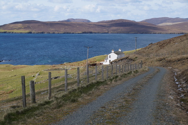
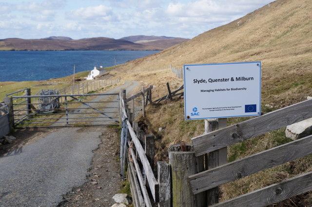
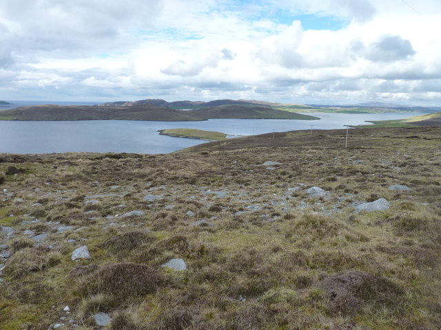
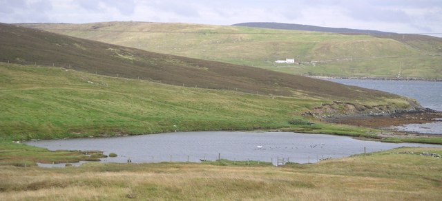
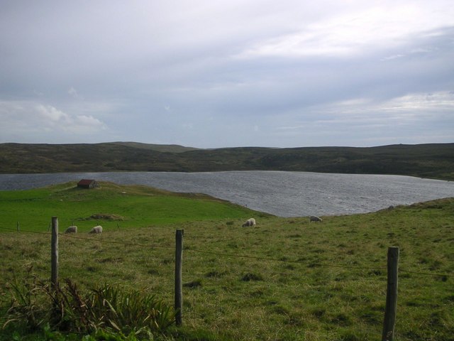
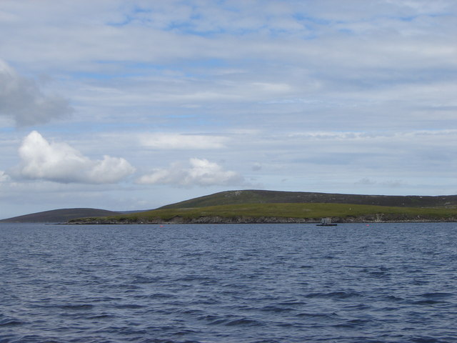
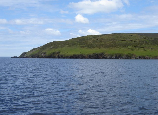
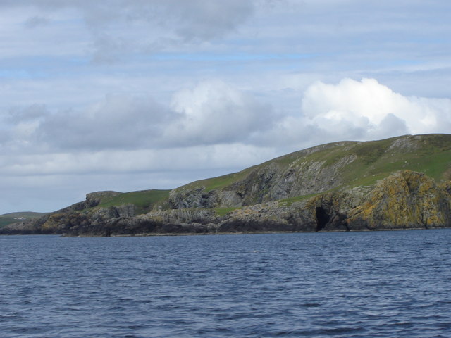
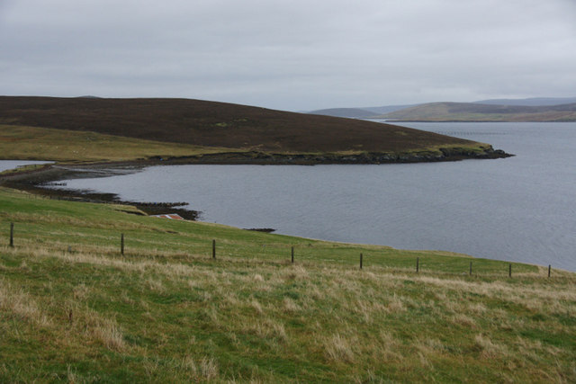
Aith Ness, located in the Shetland Islands, Scotland, is a prominent coastal feature known for its striking headland and point. Situated on the west coast of Shetland Mainland, it is positioned between the villages of Walls and Sandness. Aith Ness is renowned for its rugged beauty and dramatic landscape, attracting both locals and tourists alike.

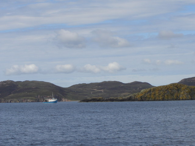
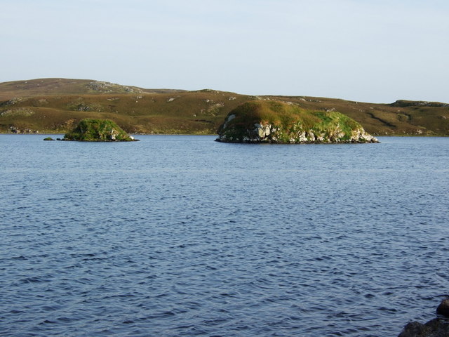
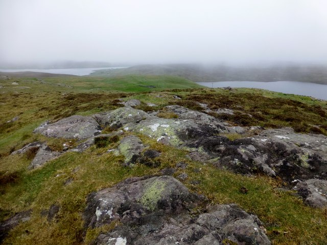
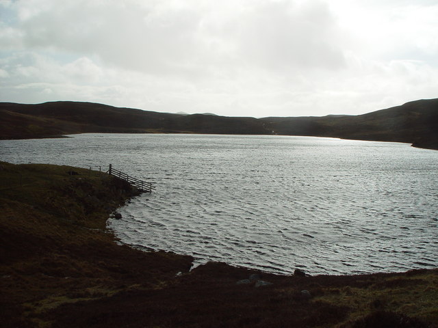
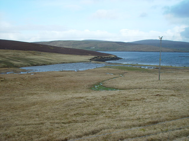
The headland at Aith Ness juts out into the North Atlantic Ocean, providing breathtaking panoramic views of the surrounding coastline and the vast expanse of the sea. Its rocky cliffs, carved by the relentless waves over centuries, offer a glimpse into the geological history of the region. The area is abundant in birdlife, with numerous seabirds nesting on the cliffs, including guillemots, puffins, and fulmars.

Aith Ness is also home to a small sandy beach, providing a contrast to the rugged terrain. This beach is a popular spot for beachcombing and taking leisurely walks along the shore. The crystal-clear waters surrounding the point make it a great location for fishing and diving activities.

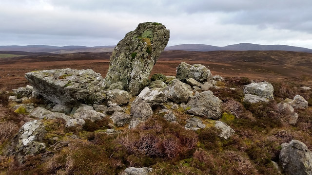
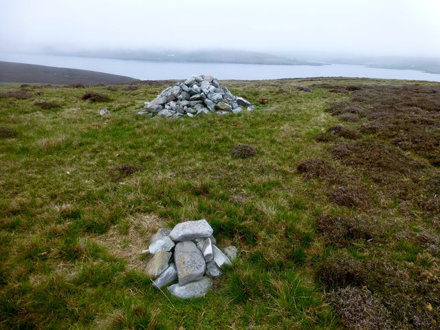
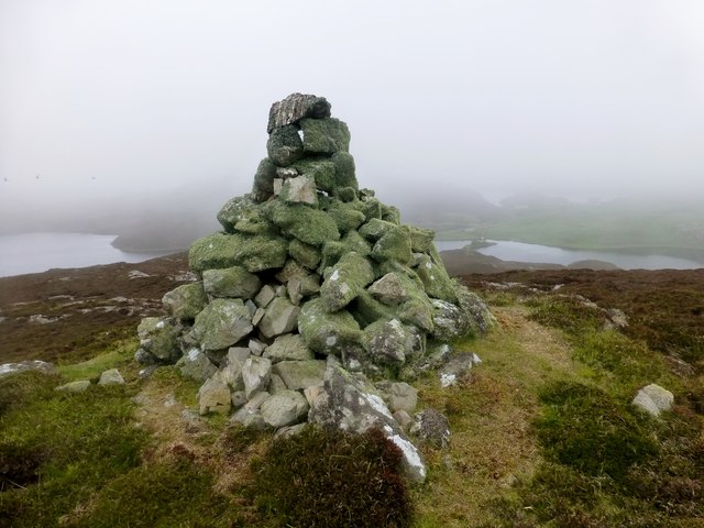
In addition to its natural beauty, Aith Ness has historical significance. The remains of an Iron Age broch, an ancient circular stone tower, can be found on the headland. This archaeological site offers a glimpse into the lives of the people who inhabited the area thousands of years ago.

Overall, Aith Ness is a captivating coastal feature in Shetland, combining natural beauty, rich biodiversity, and historical significance. It is a must-visit destination for nature enthusiasts, history buffs, and those seeking tranquility amidst the rugged Scottish landscape.

If you have any feedback on the listing, please let us know in the comments section below.

Aith Ness Images

Images are sourced within 2km of 60.315742/-1.3957858 or Grid Reference HU3359. Thanks to Geograph Open Source API. All images are credited.

Slyde, East Burrafirth House at the end of the road, above Aith Voe.
Slyde, East Burrafirth
House at the end of the road, above Aith Voe.
Sign at East Burrafirth Managing habitats for biodiversity, the sign proclaims.
Sign at East Burrafirth
Managing habitats for biodiversity, the sign proclaims.
Langstein Cairn Another ruined cairn within this grid square. This one is listed as being called "The Langstein" in Canmore. The upright stone stands about 5 feet high with the fallen one slightly longer at over 7 feet.
Langstein Cairn
Another ruined cairn within this grid square. This one is listed as being called "The Langstein" in Canmore. The upright stone stands about 5 feet high with the fallen one slightly longer at over 7 feet.
The tip of Moo Ness, Papa Little The island of Muckle Roe can be seen in the background
The tip of Moo Ness, Papa Little
The island of Muckle Roe can be seen in the background
Isles on Loch of Clousta Two small islets on the Loch of Clousta. Many of these small islets on Shetlands lochs have rich vegetation in comparison to the shores which have been intensively grazed by sheep.
Isles on Loch of Clousta
Two small islets on the Loch of Clousta. Many of these small islets on Shetlands lochs have rich vegetation in comparison to the shores which have been intensively grazed by sheep.
Hill of Braewick Bagged with Tricky Speirs.
Name: Hill of Braewick
Hill number: 104020
Height: 63m / 207ft
Area: 22: Shetland Islands
Class: 0
Grid ref: HU335577 (est)
Drop: 32m
Col: 31m
Hill of Braewick
Bagged with Tricky Speirs. Name: Hill of Braewick Hill number: 104020 Height: 63m / 207ft Area: 22: Shetland Islands Class: 0 Grid ref: HU335577 (est) Drop: 32m Col: 31m
Aith Ness Bagged with Tricky Speirs.
Name: Aith Ness
Hill number: 103976
Height: 78m / 256ft
Area: 22: Shetland Islands
Class: 0
Grid ref: HU327590 (est)
Drop: 65m
Col: 13m
Aith Ness
Bagged with Tricky Speirs. Name: Aith Ness Hill number: 103976 Height: 78m / 256ft Area: 22: Shetland Islands Class: 0 Grid ref: HU327590 (est) Drop: 65m Col: 13m
Berrgutters Summit Bagged with Tricky Speirs.
Name: Berrgutters
Hill number: 104017
Height: 64m / 210ft
Area: 22: Shetland Islands
Class: 0
Grid ref: HU317595 (est)
Drop: 38m
Col: 26m
Berrgutters Summit
Bagged with Tricky Speirs. Name: Berrgutters Hill number: 104017 Height: 64m / 210ft Area: 22: Shetland Islands Class: 0 Grid ref: HU317595 (est) Drop: 38m Col: 26m
Above Aith Voe The headland central in the photograph is Selie Ness and beyond that is the uninhabited island of Papa Little.
Above Aith Voe
The headland central in the photograph is Selie Ness and beyond that is the uninhabited island of Papa Little.
Loch of Clousta, Shetland Looking south from the north shoreline of the Loch of Clousta.
Loch of Clousta, Shetland
Looking south from the north shoreline of the Loch of Clousta.
Semi-derelict Crofthouse, Aithsness, Shetland the new fences and gates show that the croft is still being worked but the crofthouse is no longer inhabited.
Semi-derelict Crofthouse, Aithsness, Shetland
the new fences and gates show that the croft is still being worked but the crofthouse is no longer inhabited.
Bight of Braewick, Shetland A small freshwater lochan behind a beach on the west side of Aith Voe.
Bight of Braewick, Shetland
A small freshwater lochan behind a beach on the west side of Aith Voe.
Aithness beach shun Small brackish shallow lochan with dangerous soft bottom.
Aithness beach shun
Small brackish shallow lochan with dangerous soft bottom.
Loch of Aithness Deep loch by Shetland standards with a max depth of 53 feet, from a bathymetrical survey completed way back in 1903 by Johnston and Marshall.
Loch of Aithness
Deep loch by Shetland standards with a max depth of 53 feet, from a bathymetrical survey completed way back in 1903 by Johnston and Marshall.
Selie Ness from the sea
Green Banks, Papa Little The aptly named southern end of the uninhabited island of Papa Little.
Green Banks, Papa Little
The aptly named southern end of the uninhabited island of Papa Little.
Coastline at the entrance to the Stead of Aithsness
Braewick, near Aith Looking across to Aithsness.
Braewick, near Aith
Looking across to Aithsness.
Show me another place!

Aith Ness is located at Grid Ref: HU3359 (Lat: 60.315742, Lng: -1.3957858)

Unitary Authority: Shetland Islands

Police Authority: Highlands and Islands

What 3 Words

///segments.baked.grudging. Near Aith, Shetland Islands

Related Wikis

Braewick, Sandsting

Braewick is a settlement on the west Mainland of Shetland, Scotland. Braewick is on the western shore of Aith Voe and 1.2 mi (2 km) north of Aith itself...

Papa Little

Papa Little (Scots: Papa Little; Old Norse: Papey Litla, meaning "the little island of the priests") is an island in St Magnus Bay, Shetland, Scotland...

Clousta

Clousta is a hamlet on Mainaland, in the island's west, Shetland, Scotland. Approximately seventy people live here, many of whom are commuters, but local...

Aith

Aith, (Shetland dialect: Eid, Old Norse: Eið, meaning Isthmus, cf Eday), is a village on the Northern coast of the West Shetland Mainland, Scotland at...

Shetland

Shetland, also called the Shetland Islands and formerly Zetland, is an archipelago in Scotland lying between Orkney, the Faroe Islands, and Norway. It...

Vementry

Vementry (Old Norse: "Vemunðarey") is an uninhabited Scottish island in Shetland on the north side of the West Mainland, lying south of Muckle Roe. �...

Linga (near Vementry)

Linga is one of the Shetland Islands, near Vementry. It is one of many islands in Shetland called Linga. The island is uninhabited. == Geography and... ==

Linga, Busta Voe

Linga is a small, uninhabited island, 1 km (0.62 mi) east of Muckle Roe in the Shetland Islands. The island is roughly circular in shape and its highest...

Have you been to Aith Ness?

Leave your review of Aith Ness below (or comments, questions and feedback).