Garshall Green

Settlement in Staffordshire Stafford

England

Garshall Green

All Saint's Church, Milwich The first record of a church on this site is dated about 1140. The tower of the present building dates from the late 15th century, although the remainder of the church was rebuilt in the 1790s after the south walls and roof collapsed. The windows and casements look 15th century recycled.  

1857 water colour of the church 
 >> <span class="nowrap"><a title="https://www.search.staffspasttrack.org.uk/Details.aspx?&ResourceID=27995&PageIndex=4&SearchType=2&ThemeID=147" rel="nofollow ugc noopener" href="https://www.search.staffspasttrack.org.uk/Details.aspx?&ResourceID=27995&PageIndex=4&SearchType=2&ThemeID=147">Link</a><img style="margin-left:2px;" alt="External link" title="External link - shift click to open in new window" src="https://s1.geograph.org.uk/img/external.png" width="10" height="10"/></span>
All Saint's Church, Milwich Credit: Brian Deegan

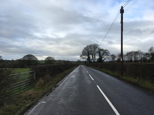
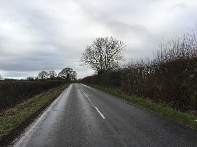
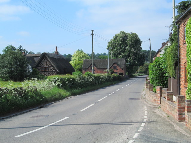
Garshall Green is a small village located in the county of Staffordshire, England. Situated approximately 6 miles southeast of the town of Stafford, it is nestled within a rural landscape characterized by lush green fields and rolling hills. The village falls within the civil parish of Seighford and benefits from its close proximity to the A34 road, providing convenient access to the wider region.

While Garshall Green is relatively small in size, consisting of only a handful of residential properties, it enjoys a close-knit community atmosphere. The village is renowned for its picturesque charm, with traditional cottages and stone-built houses dotting the landscape. The surrounding countryside offers plenty of opportunities for outdoor activities such as walking, cycling, and horse riding.

Despite its rural setting, Garshall Green benefits from being within close reach of essential amenities. The nearby town of Stafford provides a wide range of services, including supermarkets, shops, and healthcare facilities. Additionally, the village is well-connected to public transportation, with regular bus services running to and from Stafford.

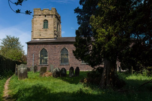
Garshall Green is also situated in an area of historical significance. Within a short distance, visitors can explore ancient landmarks such as the remains of Seighford Hall, a Grade II listed building dating back to the 17th century. Additionally, the village is within easy reach of the beautiful Cannock Chase Area of Outstanding Natural Beauty, offering further recreational opportunities and stunning natural landscapes.

If you have any feedback on the listing, please let us know in the comments section below.

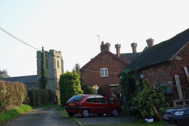
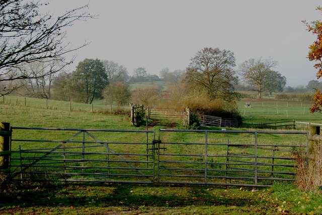
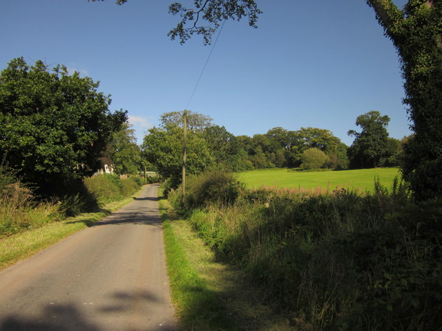
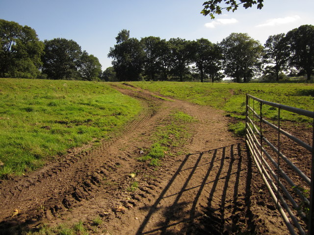
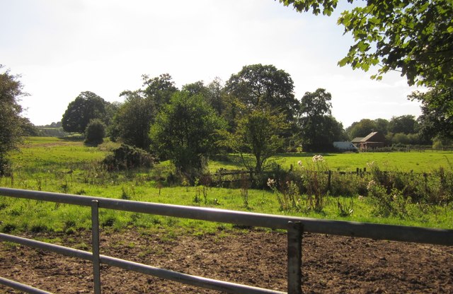
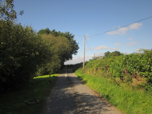
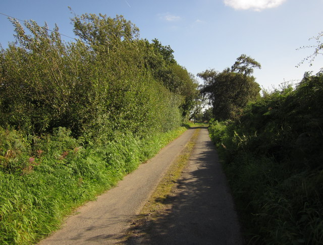
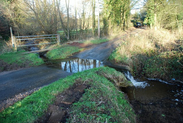
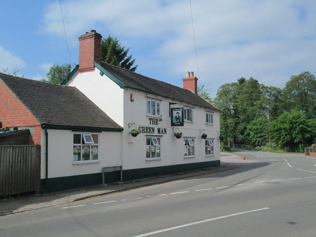
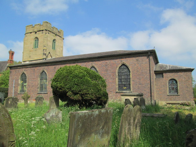
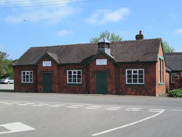
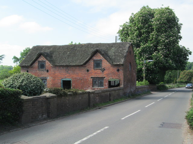
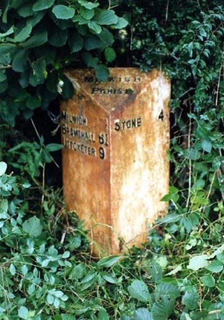
Garshall Green Images

Images are sourced within 2km of 52.90161/-2.046055 or Grid Reference SJ9733. Thanks to Geograph Open Source API. All images are credited.

All Saint's Church, Milwich The first record of a church on this site is dated about 1140. The tower of the present building dates from the late 15th century, although the remainder of the church was rebuilt in the 1790s after the south walls and roof collapsed. The windows and casements look 15th century recycled.  

1857 water colour of the church 
 >> <span class="nowrap"><a title="https://www.search.staffspasttrack.org.uk/Details.aspx?&ResourceID=27995&PageIndex=4&SearchType=2&ThemeID=147" rel="nofollow ugc noopener" href="https://www.search.staffspasttrack.org.uk/Details.aspx?&ResourceID=27995&PageIndex=4&SearchType=2&ThemeID=147">Link</a><img style="margin-left:2px;" alt="External link" title="External link - shift click to open in new window" src="https://s1.geograph.org.uk/img/external.png" width="10" height="10"/></span>
All Saint's Church, Milwich
The first record of a church on this site is dated about 1140. The tower of the present building dates from the late 15th century, although the remainder of the church was rebuilt in the 1790s after the south walls and roof collapsed. The windows and casements look 15th century recycled. 1857 water colour of the church >> LinkExternal link
B5027 near Milwich
B5027 near Milwich
B5027 near Milwich
B5027 near Milwich
Burnt out remains of The Wheatsheaf at Coton
Access to Milwich Church
Farm Track into the Valley near Milwich
Hall Lane Approaching <a href="https://www.geograph.org.uk/photo/459470">SJ9535 : Manor House, Hilderstone</a>. The wood on the right is named "New Forest" but is fairly modest in size.
Hall Lane
Approaching SJ9535 : Manor House, Hilderstone. The wood on the right is named "New Forest" but is fairly modest in size.
Field by Hall Lane An open gate into a pasture by the lane shown in <a href="https://www.geograph.org.uk/photo/3126295">SJ9535 : Hall Lane</a>. The trees ahead form an avenue across the park of Hilderstone Hall.
Field by Hall Lane
An open gate into a pasture by the lane shown in SJ9535 : Hall Lane. The trees ahead form an avenue across the park of Hilderstone Hall.
Towards Brook Farm Looking to the right from the same spot as <a href="https://www.geograph.org.uk/photo/3126311">SJ9534 : Field by Hall Lane</a>, looking across a small stream and pasture fields.
Towards Brook Farm
Looking to the right from the same spot as SJ9534 : Field by Hall Lane, looking across a small stream and pasture fields.
Butterhill Lane See <a href="https://www.geograph.org.uk/photo/80119">SD6501 : The Fleece pub, Westleigh Lane, Leigh</a> - this similar view is taken a little further back down the lane and at a different season.
Butterhill Lane
See SD6501 : The Fleece pub, Westleigh Lane, Leigh - this similar view is taken a little further back down the lane and at a different season.
Butterhill Lane Seen from near Oak House, the lane runs between low trees and a hedge towards Smallrice.
Butterhill Lane
Seen from near Oak House, the lane runs between low trees and a hedge towards Smallrice.
Garshall Green Ford This ford on Wheatlow Brook is found beside Brookhouse Farm at Garshall Green.
Garshall Green Ford
This ford on Wheatlow Brook is found beside Brookhouse Farm at Garshall Green.
The Green Man, Milwich A pub in Milwich. On the right is Sandon Lane, leading towards All Saints' Church.
The Green Man, Milwich
A pub in Milwich. On the right is Sandon Lane, leading towards All Saints' Church.
All Saints' Church, Milwich Viewed from the south-east.
All Saints' Church, Milwich
Viewed from the south-east.
Old school building at Milwich Above the doors facing the road are the signs "Infants and girls school AD 1833" and "Boys school AD 1833". It was a school until 1929.
Old school building at Milwich
Above the doors facing the road are the signs "Infants and girls school AD 1833" and "Boys school AD 1833". It was a school until 1929.
Former dwelling in Milwich A derelict building, perhaps used for storage, on the main road through Milwich.
Former dwelling in Milwich
A derelict building, perhaps used for storage, on the main road through Milwich.
The B5027 through Milwich Looking south-west from the junction with The Allways.
The B5027 through Milwich
Looking south-west from the junction with The Allways.
Old Milepost by the B5027, Uttoxeter Road, Milwich Cast iron post by the B5027, in parish of Milwich (Stafford District), Southeast of Dayhills, in hedge, on North side of road. Cochrane iron casting, erected by the County Council in the 20th century. 

Inscription reads:-
: MILWICH ¼ / BRAMSHALL 6¾ / UTTOXETER 9 : : MILWICH / PARISH : : STONE 4 :
Maker:-
: Cochrane & Co, Dudley. :

Staffordshire HER.
HER Number: 51330 <span class="nowrap"><a title="https://www.heritagegateway.org.uk/Gateway/Results_Single.aspx?uid=MST12553&resourceID=1010" rel="nofollow ugc noopener" href="https://www.heritagegateway.org.uk/Gateway/Results_Single.aspx?uid=MST12553&resourceID=1010">Link</a><img style="margin-left:2px;" alt="External link" title="External link - shift click to open in new window" src="https://s1.geograph.org.uk/img/external.png" width="10" height="10"/></span>

Milestone Society National ID: ST_UTSN09
Old Milepost by the B5027, Uttoxeter Road, Milwich
Cast iron post by the B5027, in parish of Milwich (Stafford District), Southeast of Dayhills, in hedge, on North side of road. Cochrane iron casting, erected by the County Council in the 20th century. Inscription reads:- : MILWICH ¼ / BRAMSHALL 6¾ / UTTOXETER 9 : : MILWICH / PARISH : : STONE 4 : Maker:- : Cochrane & Co, Dudley. : Staffordshire HER. HER Number: 51330 LinkExternal link Milestone Society National ID: ST_UTSN09
Show me another place!

Garshall Green is located at Grid Ref: SJ9733 (Lat: 52.90161, Lng: -2.046055)

Administrative County: Staffordshire

District: Stafford

Police Authority: Staffordshire

What 3 Words

///clogging.elevate.chiefs. Near Stone, Staffordshire

Related Wikis

Milwich

Milwich is a village and a civil parish in the English county of Staffordshire. == Location == The village is 7.8 miles (12.6 km) north east of the town...

Coton Hill, Staffordshire

Coton Hill is a hamlet in the English county of Staffordshire. Coton Hill is located east of the village of Milwich on the B5027 road between Stone and...

Hilderstone

Hilderstone is a village and a civil parish in the English county of Staffordshire. == Location == The village is 8.6 miles (13.8 km) north of the town...

Fradswell

Fradswell is a village in Staffordshire, England, approximately 7 miles (10 km) north-east of the town of Stafford and 7 miles (11 km) north of Colwich...

Fulford, Staffordshire

Fulford is a village and civil parish about 5 miles (8 km) north east of Stone, in the Stafford district, in the county of Staffordshire, England. The...

Sandon, Staffordshire

Sandon is a village in the civil parish of Sandon and Burston, in the Stafford district, in the county of Staffordshire, England. It is about 4.5 miles...

Leigh railway station (Staffordshire)

Leigh railway station was a railway station in Staffordshire, England. The railway line between Stoke-on-Trent and Uttoxeter was opened by the North Staffordshire...

Sandon railway station

Sandon railway station was a railway station opened by the North Staffordshire Railway to serve the village of Sandon, Staffordshire, England. For some...

Nearby Amenities

Located within 500m of 52.90161,-2.046055
Bus Stop
Holly Bank Farm
Bus: yes
Naptan AtcoCode: 3800C726901
Naptan Bearing: N
Naptan CommonName: Holly Bank Farm
Naptan Indicator: Opp
Naptan Landmark: Holly Bank Farm
Naptan Street: Main Rd
Naptan Verified: no
Public Transport: platform
Source: naptan_import
Lat/Long: 52.9058952/-2.0479955
The data included in this document is from www.openstreetmap.org. The data is made available under ODbL.

Have you been to Garshall Green?

Leave your review of Garshall Green below (or comments, questions and feedback).