Garros

Settlement in Inverness-shire

Scotland

Garros

Columnar Jointed Cliffs
Columnar Jointed Cliffs Credit: Matthew Chadwick

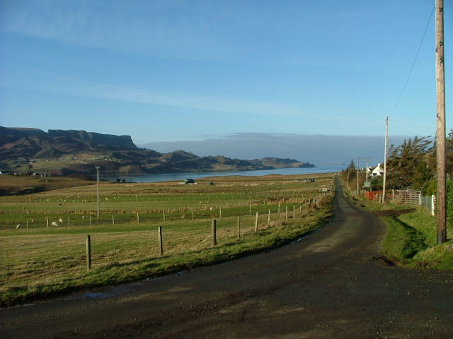
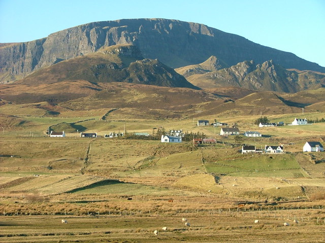
Garros is a small village located in the Inverness-shire region of Scotland. Situated amidst stunning natural beauty, it is nestled in the heart of the Scottish Highlands, approximately 9 miles southwest of Inverness, the region's main city. The village is surrounded by picturesque landscapes, including rolling hills, vast moorlands, and the sparkling waters of Loch Ness.

Garros is characterized by its tranquil and peaceful atmosphere, making it an ideal destination for those seeking a getaway from the hustle and bustle of city life. The village is primarily residential, with a small population of friendly and welcoming locals. The houses in Garros are mostly traditional Scottish cottages, adding to the charm of the area.

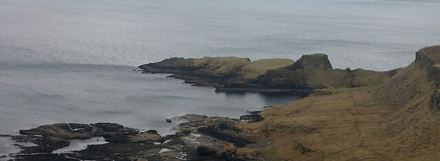
Nature enthusiasts will find plenty to explore in and around Garros. The surrounding area offers numerous walking trails, providing opportunities to immerse oneself in the breathtaking scenery. Loch Ness, renowned for its mythical monster, is a short distance away, attracting visitors from across the globe. Fishing is also a popular activity in the area, with the loch teeming with salmon and trout.

Despite its small size, Garros is conveniently located near essential amenities. The nearby city of Inverness offers a range of shops, restaurants, and entertainment options. Additionally, the village is well-connected by road, making it easy to explore other attractions in the region, such as the historic Culloden Battlefield or the famous Urquhart Castle.

In summary, Garros is a charming and idyllic village situated in the beautiful Inverness-shire region of Scotland. Its stunning natural surroundings, friendly community, and proximity to both nature and city amenities make it an appealing destination for visitors and residents alike.

If you have any feedback on the listing, please let us know in the comments section below.

Garros Images

Images are sourced within 2km of 57.588964/-6.1865442 or Grid Reference NG4963. Thanks to Geograph Open Source API. All images are credited.
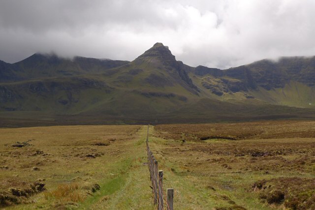
Columnar Jointed Cliffs
Unnamed Burn at Cul nan Cnoc The burn has carved a gorge in the soft Lealt Shale.
Unnamed Burn at Cul nan Cnoc
The burn has carved a gorge in the soft Lealt Shale.
Valtos Sandstone This sandstone is of Jurassic age, and was laid down in shallow lagoons about 165 million years ago. It readily forms concretions, which are lumps of harder material in the sandy matrix. Although the sandstone is named after Valtos here in Skye, the most dramatic examples of concretions are found in it on the Isle of Eigg - see <a href="https://www.geograph.org.uk/photo/3963134">NM4788 : Another Concretion</a> and nearby examples.
Valtos Sandstone
This sandstone is of Jurassic age, and was laid down in shallow lagoons about 165 million years ago. It readily forms concretions, which are lumps of harder material in the sandy matrix. Although the sandstone is named after Valtos here in Skye, the most dramatic examples of concretions are found in it on the Isle of Eigg - see NM4788 : Another Concretion and nearby examples.
Houses at Bhaltos (Valtos) Traditional stone houses at the north end of Bhaltos. (In Gaelic, the combination of 'bh' at the beginning of a word or name is pronounced as 'v' is pronounced in English and French.)
Houses at Bhaltos (Valtos)
Traditional stone houses at the north end of Bhaltos. (In Gaelic, the combination of 'bh' at the beginning of a word or name is pronounced as 'v' is pronounced in English and French.)
Dùn Dearg Dùn Dearg means 'red fort' and this probably refers to the colour of the columnar jointed lava on which it stands.
Dùn Dearg
Dùn Dearg means 'red fort' and this probably refers to the colour of the columnar jointed lava on which it stands.
The A855 north of Portree Looking towards Loch Mealt.
The A855 north of Portree
Looking towards Loch Mealt.
Dun Dearg, Valtos This fort occupies the summit of an isolated hillock that forms part of the coastal escarpment at Valtos, dropping some 60m to the sea on the NE.
Dun Dearg, Valtos
This fort occupies the summit of an isolated hillock that forms part of the coastal escarpment at Valtos, dropping some 60m to the sea on the NE.
Sheep sitting on a wall At Valtos.
Sheep sitting on a wall
At Valtos.
View from Culnaknock Trig Point
The Coastline of Skye, near Valtos
A855, Valtos The A855 runs 33 miles around North Skye from Portree <a href="https://www.geograph.org.uk/photo/7431346">NG4743 : A87, A855 junction, Portree</a> to Uig <a href="https://www.geograph.org.uk/photo/7386522">NG3964 : A855 / A87 junction</a>, via Staffin.
<span class="nowrap"><a title="https://www.sabre-roads.org.uk/wiki/index.php?title=A855" rel="nofollow ugc noopener" href="https://www.sabre-roads.org.uk/wiki/index.php?title=A855">Link</a><img style="margin-left:2px;" alt="External link" title="External link - shift click to open in new window" src="https://s1.geograph.org.uk/img/external.png" width="10" height="10"/></span>
A855, Valtos
The A855 runs 33 miles around North Skye from Portree NG4743 : A87, A855 junction, Portree to Uig NG3964 : A855 / A87 junction, via Staffin. LinkExternal link
A855, Cul nan Cnoc The A855 runs 33 miles around North Skye from Portree <a href="https://www.geograph.org.uk/photo/7431346">NG4743 : A87, A855 junction, Portree</a> to Uig <a href="https://www.geograph.org.uk/photo/7386522">NG3964 : A855 / A87 junction</a>, via Staffin.
<span class="nowrap"><a title="https://www.sabre-roads.org.uk/wiki/index.php?title=A855" rel="nofollow ugc noopener" href="https://www.sabre-roads.org.uk/wiki/index.php?title=A855">Link</a><img style="margin-left:2px;" alt="External link" title="External link - shift click to open in new window" src="https://s1.geograph.org.uk/img/external.png" width="10" height="10"/></span>
A855, Cul nan Cnoc
The A855 runs 33 miles around North Skye from Portree NG4743 : A87, A855 junction, Portree to Uig NG3964 : A855 / A87 junction, via Staffin. LinkExternal link
Entering Valtos, A855 The A855 runs 33 miles around North Skye from Portree <a href="https://www.geograph.org.uk/photo/7431346">NG4743 : A87, A855 junction, Portree</a> to Uig <a href="https://www.geograph.org.uk/photo/7386522">NG3964 : A855 / A87 junction</a>, via Staffin.
<span class="nowrap"><a title="https://www.sabre-roads.org.uk/wiki/index.php?title=A855" rel="nofollow ugc noopener" href="https://www.sabre-roads.org.uk/wiki/index.php?title=A855">Link</a><img style="margin-left:2px;" alt="External link" title="External link - shift click to open in new window" src="https://s1.geograph.org.uk/img/external.png" width="10" height="10"/></span>
Entering Valtos, A855
The A855 runs 33 miles around North Skye from Portree NG4743 : A87, A855 junction, Portree to Uig NG3964 : A855 / A87 junction, via Staffin. LinkExternal link
A855 The A855 runs 33 miles around North Skye from Portree <a href="https://www.geograph.org.uk/photo/7431346">NG4743 : A87, A855 junction, Portree</a> to Uig <a href="https://www.geograph.org.uk/photo/7386522">NG3964 : A855 / A87 junction</a>, via Staffin.
<span class="nowrap"><a title="https://www.sabre-roads.org.uk/wiki/index.php?title=A855" rel="nofollow ugc noopener" href="https://www.sabre-roads.org.uk/wiki/index.php?title=A855">Link</a><img style="margin-left:2px;" alt="External link" title="External link - shift click to open in new window" src="https://s1.geograph.org.uk/img/external.png" width="10" height="10"/></span>
A855
The A855 runs 33 miles around North Skye from Portree NG4743 : A87, A855 junction, Portree to Uig NG3964 : A855 / A87 junction, via Staffin. LinkExternal link
A855, Valtos The A855 runs 33 miles around North Skye from Portree <a href="https://www.geograph.org.uk/photo/7431346">NG4743 : A87, A855 junction, Portree</a> to Uig <a href="https://www.geograph.org.uk/photo/7386522">NG3964 : A855 / A87 junction</a>, via Staffin.
<span class="nowrap"><a title="https://www.sabre-roads.org.uk/wiki/index.php?title=A855" rel="nofollow ugc noopener" href="https://www.sabre-roads.org.uk/wiki/index.php?title=A855">Link</a><img style="margin-left:2px;" alt="External link" title="External link - shift click to open in new window" src="https://s1.geograph.org.uk/img/external.png" width="10" height="10"/></span>
A855, Valtos
The A855 runs 33 miles around North Skye from Portree NG4743 : A87, A855 junction, Portree to Uig NG3964 : A855 / A87 junction, via Staffin. LinkExternal link
A855 The A855 runs 33 miles around North Skye from Portree <a href="https://www.geograph.org.uk/photo/7431346">NG4743 : A87, A855 junction, Portree</a> to Uig <a href="https://www.geograph.org.uk/photo/7386522">NG3964 : A855 / A87 junction</a>, via Staffin.
<span class="nowrap"><a title="https://www.sabre-roads.org.uk/wiki/index.php?title=A855" rel="nofollow ugc noopener" href="https://www.sabre-roads.org.uk/wiki/index.php?title=A855">Link</a><img style="margin-left:2px;" alt="External link" title="External link - shift click to open in new window" src="https://s1.geograph.org.uk/img/external.png" width="10" height="10"/></span>
A855
The A855 runs 33 miles around North Skye from Portree NG4743 : A87, A855 junction, Portree to Uig NG3964 : A855 / A87 junction, via Staffin. LinkExternal link
Loch Mealt Another thrilling view of Loch Mealt, courtesy of the A855 just barely clipping this grid square. In the distant realm, the mighty 543 metre high hill, Meall na Suiramach, or, as the intrepid Victorian surveyors reckon it meant, "Quiraig Hill." See ‘OS1/16/5/20 | ScotlandsPlaces’. 2019. Scotlandsplaces.gov.uk <<span class="nowrap"><a title="https://scotlandsplaces.gov.uk/digital-volumes/ordnance-survey-name-books/inverness-shire-os-name-books-1876-1878/inverness-shire-skye-volume-05/20" rel="nofollow ugc noopener" href="https://scotlandsplaces.gov.uk/digital-volumes/ordnance-survey-name-books/inverness-shire-os-name-books-1876-1878/inverness-shire-skye-volume-05/20">Link</a><img style="margin-left:2px;" alt="External link" title="External link - shift click to open in new window" src="https://s1.geograph.org.uk/img/external.png" width="10" height="10"/></span> > [accessed 22 July 2023]

‌
Loch Mealt
Another thrilling view of Loch Mealt, courtesy of the A855 just barely clipping this grid square. In the distant realm, the mighty 543 metre high hill, Meall na Suiramach, or, as the intrepid Victorian surveyors reckon it meant, "Quiraig Hill." See ‘OS1/16/5/20 | ScotlandsPlaces’. 2019. Scotlandsplaces.gov.uk <LinkExternal link > [accessed 22 July 2023] ‌
The humble red post box, still a vital component in the realm of snail mail
Show me another place!

Garros is located at Grid Ref: NG4963 (Lat: 57.588964, Lng: -6.1865442)

Unitary Authority: Highland

Police Authority: Highlands and Islands

Also known as: Gearros

What 3 Words

///flooding.dwelled.snoozing. Near Uig, Highland

Related Wikis

Loch Mealt

Loch Mealt is an inland fresh-water loch on the Isle of Skye in Scotland. It lies close to Ellishadder and south of Staffin, on the eastern side of the...

Ellishadder

Ellishadder (Scottish Gaelic: Ealaiseadar) is a crofting township, situated close to the north shore of the freshwater Loch Mealt, on the Trotternish peninsula...

Lealt, Skye

Lealt (Scottish Gaelic: An Leathallt) is a crofting township, on the western coastline of the Sound of Raasay on the Trotternish peninsula of Skye, in...

Garafad

Garafad or Garafad, (Scottish Gaelic: An Garradh Fada) is a linear crofting settlement on the east coast of the Trotternish Peninsula of Skye in the...

Staffin

Staffin (Scottish Gaelic: Stafain) is a district with the Gaelic name An Taobh Sear, which translates as "the East Side", on the northeast coast of the...

Sgùrr a' Mhadaidh Ruaidh

Sgùrr a' Mhadaidh Ruaidh (Gaelic for: Peak of the red fox) is a summit in the Trotternish range of hills in the north of the Isle of Skye, Scotland. It...

Staffin Island

Staffin Island (possibly also known as Stenscholl Island) is an uninhabited islet off the east coast of the Trotternish peninsula of Skye in Scotland....

Brogaig

Brogaig (Scottish Gaelic: Brògaig), Norse for Burgh Bay, is a small coastal village, on the northwest coast of the Trotternish peninsula, close to Staffin...

Nearby Amenities

Located within 500m of 57.588964,-6.1865442
Barrier: cattle_grid
Source: survey
Lat/Long: 57.5890567/-6.1892981
Turning Circle
Lat/Long: 57.5889342/-6.1859264
Garros
Name Gd: Gearros
Place: hamlet
Source: survey
Lat/Long: 57.5891353/-6.1873125
Turning Circle
Lat/Long: 57.5881553/-6.1851173
The data included in this document is from www.openstreetmap.org. The data is made available under ODbL.

Have you been to Garros?

Leave your review of Garros below (or comments, questions and feedback).