Craig Graceless

Coastal Feature, Headland, Point in Kincardineshire

Scotland

Craig Graceless

Looking down into Trollochy Trollochy is a short, cliff girt inlet below Crawton.
Looking down into Trollochy Credit: Gordon Hatton

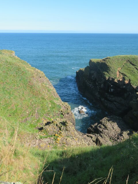
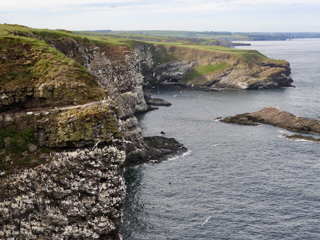
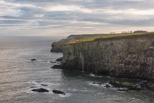
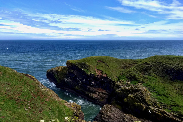
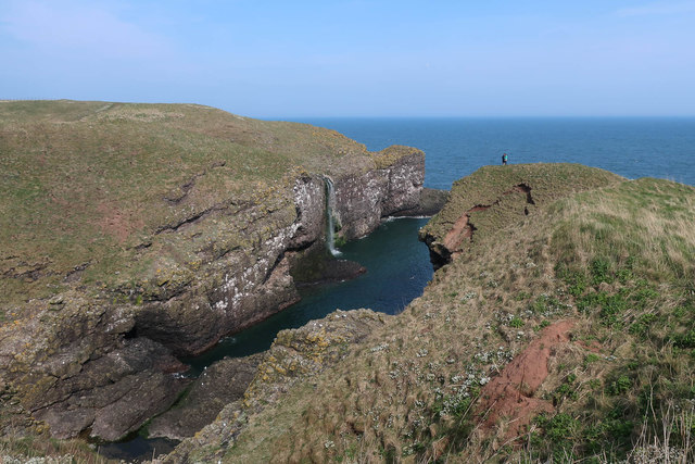
Craig Graceless is a prominent coastal feature located in Kincardineshire, Scotland. It is classified as a headland or point, jutting out into the North Sea. With its rugged cliffs and stunning views, it is a popular destination for nature enthusiasts and hikers.

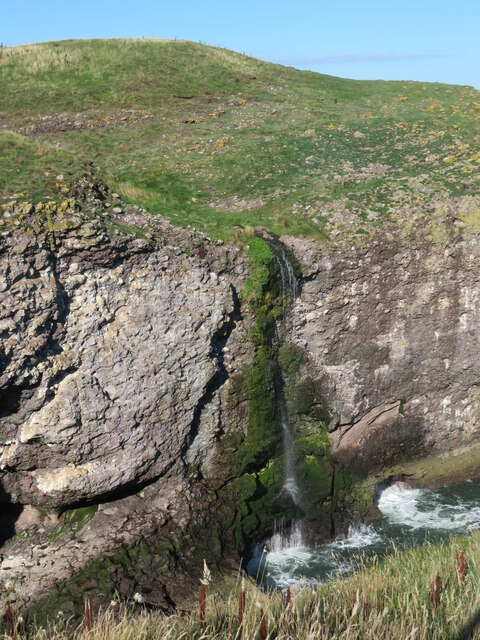
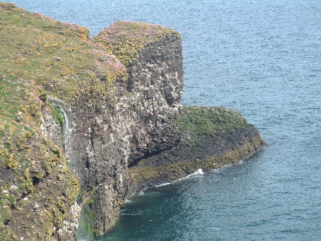
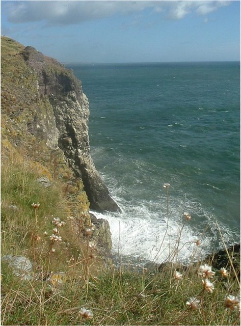
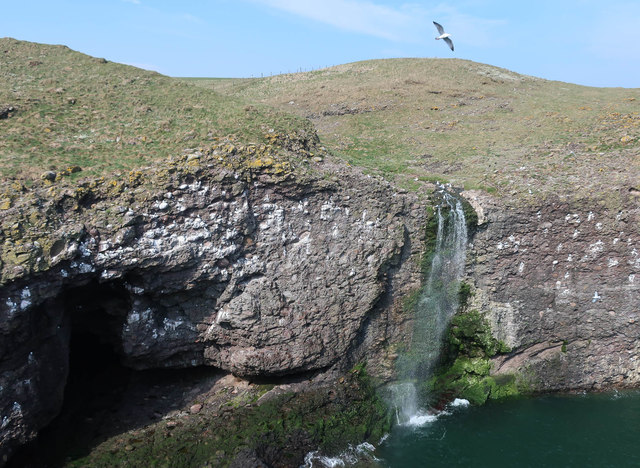
The headland is characterized by its steep and jagged cliffs, which rise to an impressive height of approximately 100 meters. These cliffs are composed of layers of sedimentary rocks, which provide important geological insights into the region's history.

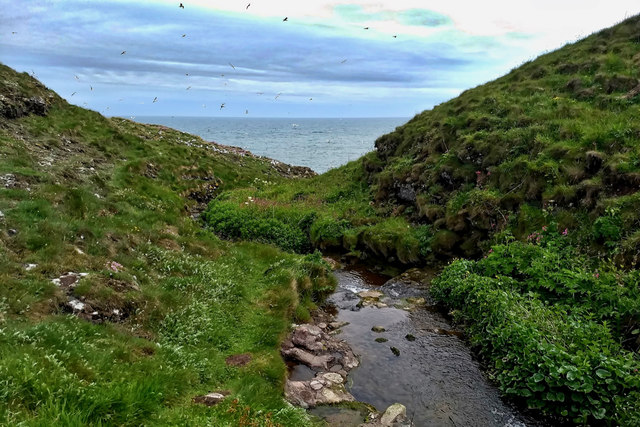
Craig Graceless offers breathtaking panoramic views of the surrounding coastline and the vast expanse of the North Sea. On a clear day, visitors can admire the distant horizon and perhaps catch a glimpse of passing ships or wildlife, such as seabirds or dolphins.

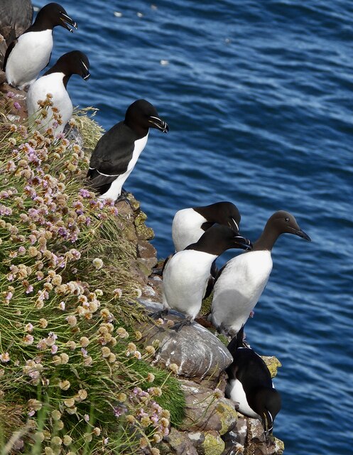
The headland also boasts a diverse range of flora and fauna. The cliffs provide an ideal nesting habitat for seabirds, including puffins, guillemots, and kittiwakes. The surrounding heathland and grassy areas are home to a variety of plant species, including wildflowers and grasses, adding to the area's natural beauty.

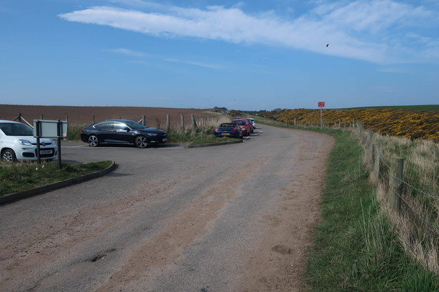
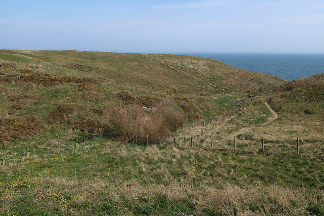
Access to Craig Graceless is available through a well-maintained footpath, which allows visitors to explore the headland safely. The path offers several vantage points and resting areas, allowing visitors to fully appreciate the stunning scenery and soak in the peaceful ambiance.

In conclusion, Craig Graceless is a captivating coastal feature in Kincardineshire, Scotland. Its dramatic cliffs, panoramic views, and abundant wildlife make it a must-visit destination for nature lovers and outdoor enthusiasts.

If you have any feedback on the listing, please let us know in the comments section below.

Craig Graceless Images

Images are sourced within 2km of 56.927261/-2.1981148 or Grid Reference NO8881. Thanks to Geograph Open Source API. All images are credited.

Looking down into Trollochy Trollochy is a short, cliff girt inlet below Crawton.
Looking down into Trollochy
Trollochy is a short, cliff girt inlet below Crawton.
Waterfall into the sea at Crawton A wee burn makes a dramatic plunge into the cliff bound inlet of Trollochy at Crawton.
Waterfall into the sea at Crawton
A wee burn makes a dramatic plunge into the cliff bound inlet of Trollochy at Crawton.
Baler at work Tractor with baler working a harvested field near Cowieswells Farm.
Baler at work
Tractor with baler working a harvested field near Cowieswells Farm.
Razorbills and Guillemots Lives most of the year at sea, coming to land to breed. Both birds depends on the health of the marine environment. Fishing nets, pollution at sea and declining fish stocks all threaten these birds.
Razorbills and Guillemots
Lives most of the year at sea, coming to land to breed. Both birds depends on the health of the marine environment. Fishing nets, pollution at sea and declining fish stocks all threaten these birds.
Cliffs at Crawley Bird Sanctuary Not so many birds to be seen on the cliff face due to the devastation of Bird flu on the bird population.
Cliffs at Crawley Bird Sanctuary
Not so many birds to be seen on the cliff face due to the devastation of Bird flu on the bird population.
Waterfall in Tremuda Bay The water from small burn draining the fields above forms the small but prominent waterfall.
Waterfall in Tremuda Bay
The water from small burn draining the fields above forms the small but prominent waterfall.
Trollochy A fascinating name for this inlet in the cliffs near the fishing village of Crawton.
Trollochy
A fascinating name for this inlet in the cliffs near the fishing village of Crawton.
Crawton Ness
Crawton Ness
Fowlsheugh RSPB Reserve
Sheer cliffs at Fowlsheugh RSPB This scene is from summertime where moderate numbers of pelagic birds can be seen, some at the late nesting season.
Sheer cliffs at Fowlsheugh RSPB
This scene is from summertime where moderate numbers of pelagic birds can be seen, some at the late nesting season.
Trollochy
Trollochy
Stream into Trollochy
Parking for Fowlsheugh A large seabird colony and RSPB reserve.
Parking for Fowlsheugh
A large seabird colony and RSPB reserve.
Path to the cliffs, Fowlsheugh
New house in Crawton
Trollochy Some of the many seabirds breeding at Fowlsheugh RSPB. Mostly Kittiwakes here.
Trollochy
Some of the many seabirds breeding at Fowlsheugh RSPB. Mostly Kittiwakes here.
Waterfall in Trollochy Some of the many seabirds breeding at Fowlsheugh RSPB. Mostly Kittiwakes here.
Waterfall in Trollochy
Some of the many seabirds breeding at Fowlsheugh RSPB. Mostly Kittiwakes here.
Show me another place!

Craig Graceless is located at Grid Ref: NO8881 (Lat: 56.927261, Lng: -2.1981148)

Unitary Authority: Aberdeenshire

Police Authority: North East

What 3 Words

///cabbages.micro.ledge. Near Stonehaven, Aberdeenshire

Related Wikis

Craiglethy

Craiglethy (Scottish Gaelic: Creag Liathach - meaning grey rock) is a small island/skerry off Fowlsheugh on the east coast of Aberdeenshire, Scotland in...

Thornyhive Bay

Thornyhive Bay is an embayment along the North Sea coast in Aberdeenshire, Scotland. This bay is situated approximately 2.5 miles south of the town of...

Fowlsheugh

Fowlsheugh is a coastal nature reserve in Kincardineshire, northeast Scotland, known for its 70-metre-high (230 ft) cliff formations and habitat supporting...

Crawton

Crawton is a former fishing community on the southeast Aberdeenshire coast in Scotland, deserted since 1927. Approximately three miles south of Stonehaven...

Nearby Amenities

Located within 500m of 56.927261,-2.1981148
Created By: almien_coastlines
Source: PGS
Lat/Long: 56.922885/-2.198626
Source: PGS
Lat/Long: 56.9231736/-2.1999257
Source: PGS
Lat/Long: 56.924341/-2.2002904
Source: PGS
Lat/Long: 56.9244164/-2.2008001
Source: PGS
Lat/Long: 56.9246715/-2.2006069
Source: PGS
Lat/Long: 56.9246662/-2.2003427
Source: PGS
Lat/Long: 56.9250288/-2.2002019
Source: PGS
Lat/Long: 56.925439/-2.1999069
Source: PGS
Lat/Long: 56.925465/-2.1995657
Created By: almien_coastlines
Source: PGS
Lat/Long: 56.924683/-2.199523
Source: PGS
Lat/Long: 56.9245784/-2.1992758
Source: PGS
Lat/Long: 56.9247735/-2.1981908
Source: PGS
Lat/Long: 56.9248722/-2.1977541
Source: PGS
Lat/Long: 56.9253091/-2.19783
Source: PGS
Lat/Long: 56.925504/-2.197863
Source: PGS
Lat/Long: 56.9256465/-2.1977659
Source: PGS
Lat/Long: 56.9264318/-2.1976203
Source: PGS
Lat/Long: 56.9278608/-2.1973507
Source: PGS
Lat/Long: 56.9278279/-2.1976927
Created By: almien_coastlines
Source: PGS
Lat/Long: 56.927874/-2.19805
Source: PGS
Lat/Long: 56.9276968/-2.1997803
Source: PGS
Lat/Long: 56.9279653/-2.1986213
Source: PGS
Lat/Long: 56.9295212/-2.1979486
Source: PGS
Lat/Long: 56.9296842/-2.1979406
Created By: almien_coastlines
Source: PGS
Lat/Long: 56.929793/-2.197776
Source: PGS
Lat/Long: 56.9306096/-2.1971944
Source: PGS
Lat/Long: 56.9309065/-2.1971573
Source: PGS
Lat/Long: 56.9313378/-2.1972416
Source: PGS
Lat/Long: 56.9317/-2.1977775
The data included in this document is from www.openstreetmap.org. The data is made available under ODbL.

Have you been to Craig Graceless?

Leave your review of Craig Graceless below (or comments, questions and feedback).