Trelung Ness

Coastal Feature, Headland, Point in Kincardineshire

Scotland

Trelung Ness

Razorbills and Guillemots Lives most of the year at sea, coming to land to breed. Both birds depends on the health of the marine environment. Fishing nets, pollution at sea and declining fish stocks all threaten these birds.
Razorbills and Guillemots Credit: Valerie Johnston

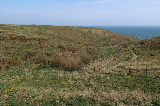
Trelung Ness is a prominent headland located in Kincardineshire, Scotland. Situated on the northeastern coast of the country, it stretches out into the North Sea, offering stunning views and natural beauty to visitors and locals alike.

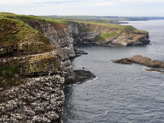
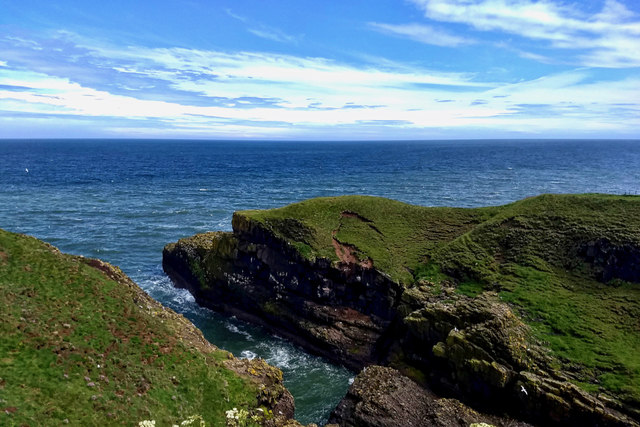
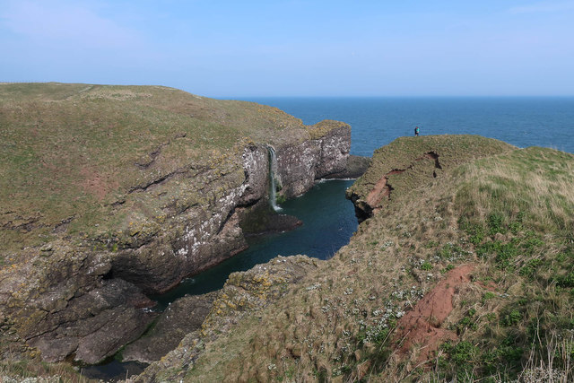
The headland is characterized by rugged cliffs that rise sharply from the sea, reaching heights of up to 30 meters (98 feet). These cliffs are composed of sandstone and shale, showcasing a variety of colors ranging from dark gray to reddish-brown. Over time, the powerful forces of erosion have sculpted the cliffs, creating fascinating features such as sea caves and arches.

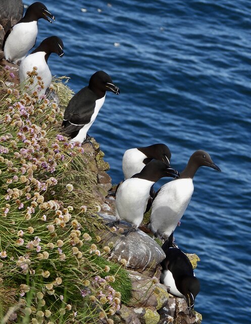
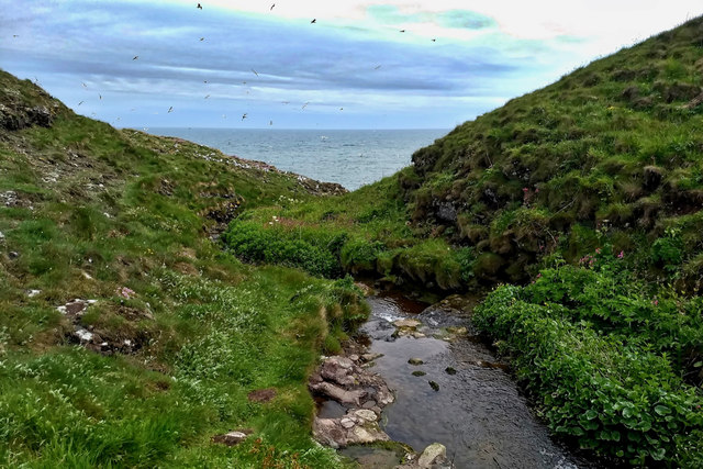
Trelung Ness is also home to a diverse range of wildlife. The surrounding waters are rich in marine life, making it an ideal spot for birdwatching and seal spotting. Visitors may be lucky enough to catch a glimpse of seabirds such as gannets, puffins, and guillemots, as well as seals basking on the rocky shores.

Aside from its natural beauty, Trelung Ness holds historical significance. The headland is home to the ruins of Dunnottar Castle, a medieval fortress perched on a cliff edge. This iconic landmark has witnessed numerous historical events and played a significant role in Scottish history.

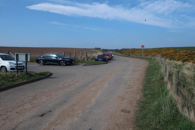
Trelung Ness is a popular destination for outdoor enthusiasts, offering stunning coastal walks and opportunities for rock climbing. Its dramatic cliffs, picturesque landscapes, and rich history make it a must-visit location for anyone exploring the Kincardineshire coastline.

If you have any feedback on the listing, please let us know in the comments section below.

Trelung Ness Images

Images are sourced within 2km of 56.92497/-2.1982997 or Grid Reference NO8881. Thanks to Geograph Open Source API. All images are credited.
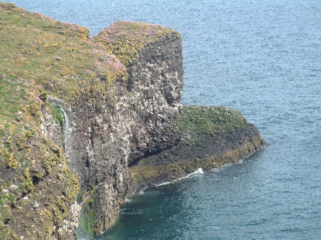
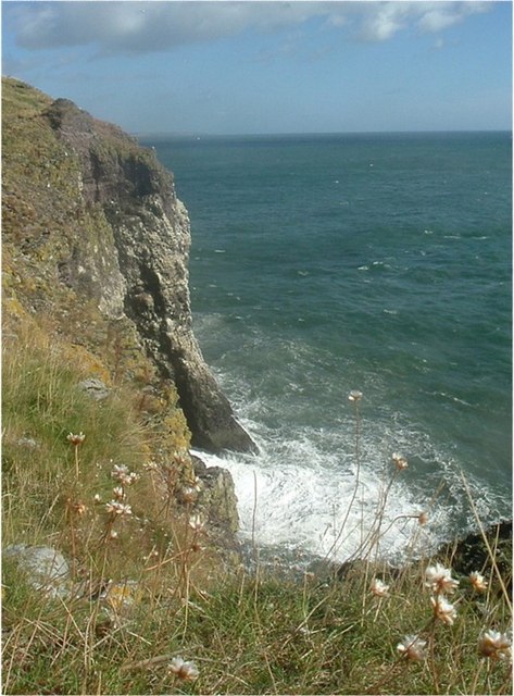
Razorbills and Guillemots Lives most of the year at sea, coming to land to breed. Both birds depends on the health of the marine environment. Fishing nets, pollution at sea and declining fish stocks all threaten these birds.
Razorbills and Guillemots
Lives most of the year at sea, coming to land to breed. Both birds depends on the health of the marine environment. Fishing nets, pollution at sea and declining fish stocks all threaten these birds.
Cliffs at Crawley Bird Sanctuary Not so many birds to be seen on the cliff face due to the devastation of Bird flu on the bird population.
Cliffs at Crawley Bird Sanctuary
Not so many birds to be seen on the cliff face due to the devastation of Bird flu on the bird population.
Waterfall in Tremuda Bay The water from small burn draining the fields above forms the small but prominent waterfall.
Waterfall in Tremuda Bay
The water from small burn draining the fields above forms the small but prominent waterfall.
Farmland near Mill of Uras
Trollochy A fascinating name for this inlet in the cliffs near the fishing village of Crawton.
Trollochy
A fascinating name for this inlet in the cliffs near the fishing village of Crawton.
Crawton Ness
Crawton Ness
Fowlsheugh RSPB Reserve
Crawton from Fowlsheugh "As late as 1860, even after the loss of men in earlier press-gang raids, Crawton was a prosperous fishing village with a fleet of 20 boats. At the turn of the century (1900) there were still 6 yawls and 3 drifters employing 30 fishermen." [NGMarr in The Deeside Field Ser.3 No.2 P.99]. By 1927 the fishing industry here was dead, and the village completely evacuated. The environs remain however a paradise for birdwatchers, botanists and geologists.
Crawton from Fowlsheugh
"As late as 1860, even after the loss of men in earlier press-gang raids, Crawton was a prosperous fishing village with a fleet of 20 boats. At the turn of the century (1900) there were still 6 yawls and 3 drifters employing 30 fishermen." [NGMarr in The Deeside Field Ser.3 No.2 P.99]. By 1927 the fishing industry here was dead, and the village completely evacuated. The environs remain however a paradise for birdwatchers, botanists and geologists.
Potato Fields In flower, unfortunately taken in the afternoon so I can't even say it was a crisp morning! --- Apologies.
Potato Fields
In flower, unfortunately taken in the afternoon so I can't even say it was a crisp morning! --- Apologies.
Sheer cliffs at Fowlsheugh RSPB This scene is from summertime where moderate numbers of pelagic birds can be seen, some at the late nesting season.
Sheer cliffs at Fowlsheugh RSPB
This scene is from summertime where moderate numbers of pelagic birds can be seen, some at the late nesting season.
Coastal prairie near the southern edge of Fowlsheugh Wildflowers are abundant at this locale as the photographer is looking north on the coastal terrace. Fowlsheugh is a national designated Site of Special Scientific Interest, and this area is noted for its prolific birdlife. The view is taken in summer after the peak of the bird nesting season.
Coastal prairie near the southern edge of Fowlsheugh
Wildflowers are abundant at this locale as the photographer is looking north on the coastal terrace. Fowlsheugh is a national designated Site of Special Scientific Interest, and this area is noted for its prolific birdlife. The view is taken in summer after the peak of the bird nesting season.
Trollochy
Trollochy
Stream into Trollochy
Parking for Fowlsheugh A large seabird colony and RSPB reserve.
Parking for Fowlsheugh
A large seabird colony and RSPB reserve.
Path to the cliffs, Fowlsheugh
New house in Crawton
Trollochy Some of the many seabirds breeding at Fowlsheugh RSPB. Mostly Kittiwakes here.
Trollochy
Some of the many seabirds breeding at Fowlsheugh RSPB. Mostly Kittiwakes here.
Show me another place!

Trelung Ness is located at Grid Ref: NO8881 (Lat: 56.92497, Lng: -2.1982997)

Unitary Authority: Aberdeenshire

Police Authority: North East

What 3 Words

///risking.richest.spreading. Near Stonehaven, Aberdeenshire

Related Wikis

Craiglethy

Craiglethy (Scottish Gaelic: Creag Liathach - meaning grey rock) is a small island/skerry off Fowlsheugh on the east coast of Aberdeenshire, Scotland in...

Thornyhive Bay

Thornyhive Bay is an embayment along the North Sea coast in Aberdeenshire, Scotland. This bay is situated approximately 2.5 miles south of the town of...

Fowlsheugh

Fowlsheugh is a coastal nature reserve in Kincardineshire, northeast Scotland, known for its 70-metre-high (230 ft) cliff formations and habitat supporting...

Crawton

Crawton is a former fishing community on the southeast Aberdeenshire coast in Scotland, deserted since 1927. Approximately three miles (5 km) south of...

Nearby Amenities

Located within 500m of 56.92497,-2.1982997
Created By: almien_coastlines
Source: PGS
Lat/Long: 56.921602/-2.198185
Created By: almien_coastlines
Source: PGS
Lat/Long: 56.921733/-2.19865
Created By: almien_coastlines
Source: PGS
Lat/Long: 56.921863/-2.198882
Created By: almien_coastlines
Source: PGS
Lat/Long: 56.922376/-2.199105
Created By: almien_coastlines
Source: PGS
Lat/Long: 56.922379/-2.199573
Created By: almien_coastlines
Source: PGS
Lat/Long: 56.922635/-2.199567
Created By: almien_coastlines
Source: PGS
Lat/Long: 56.92276/-2.199096
Created By: almien_coastlines
Source: PGS
Lat/Long: 56.922885/-2.198626
Created By: almien_coastlines
Source: PGS
Lat/Long: 56.922372/-2.198403
Source: PGS
Lat/Long: 56.9209985/-2.2005072
Source: PGS
Lat/Long: 56.9213604/-2.2000472
Source: PGS
Lat/Long: 56.9225159/-2.2008765
Source: PGS
Lat/Long: 56.9227616/-2.2012829
Source: PGS
Lat/Long: 56.9231736/-2.1999257
Source: PGS
Lat/Long: 56.924341/-2.2002904
Source: PGS
Lat/Long: 56.9244164/-2.2008001
Source: PGS
Lat/Long: 56.9246715/-2.2006069
Source: PGS
Lat/Long: 56.9246662/-2.2003427
Source: PGS
Lat/Long: 56.9250288/-2.2002019
Source: PGS
Lat/Long: 56.925439/-2.1999069
Source: PGS
Lat/Long: 56.925465/-2.1995657
Created By: almien_coastlines
Source: PGS
Lat/Long: 56.924683/-2.199523
Source: PGS
Lat/Long: 56.9245784/-2.1992758
Source: PGS
Lat/Long: 56.9247735/-2.1981908
Source: PGS
Lat/Long: 56.9248722/-2.1977541
Source: PGS
Lat/Long: 56.9253091/-2.19783
Source: PGS
Lat/Long: 56.925504/-2.197863
Source: PGS
Lat/Long: 56.9256465/-2.1977659
Source: PGS
Lat/Long: 56.9264318/-2.1976203
Source: PGS
Lat/Long: 56.9278608/-2.1973507
Source: PGS
Lat/Long: 56.9278279/-2.1976927
Created By: almien_coastlines
Source: PGS
Lat/Long: 56.927874/-2.19805
Source: PGS
Lat/Long: 56.9276968/-2.1997803
Source: PGS
Lat/Long: 56.9279653/-2.1986213
The data included in this document is from www.openstreetmap.org. The data is made available under ODbL.

Have you been to Trelung Ness?

Leave your review of Trelung Ness below (or comments, questions and feedback).