Brander
Coastal Feature, Headland, Point in Berwickshire
Scotland
Brander

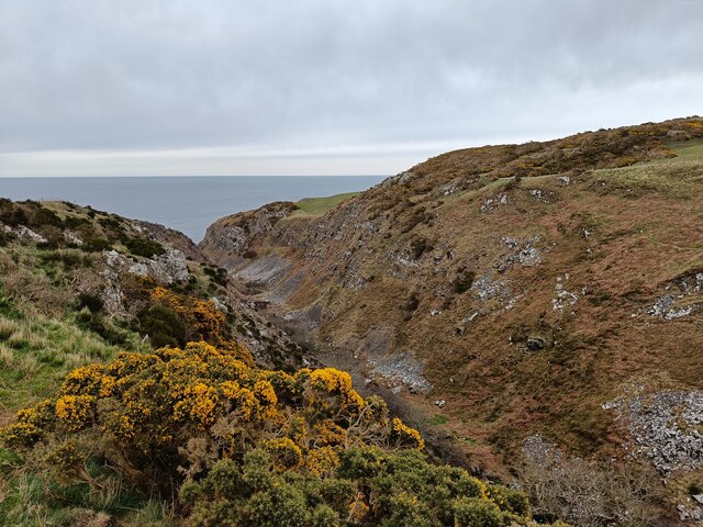
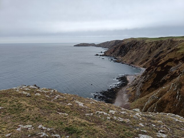
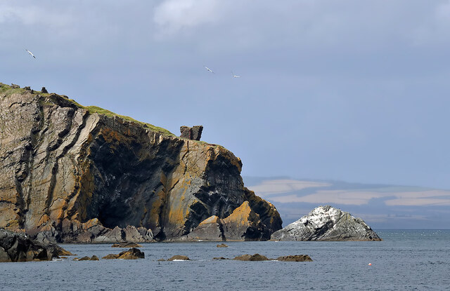
Brander is a picturesque coastal feature located in Berwickshire, Scotland. It is a prominent headland that stretches out into the North Sea, forming a distinctive point along the coastline. With its rugged cliffs and stunning views, Brander is a popular destination for tourists and locals alike.
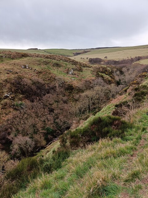
The headland is characterized by its steep and rocky terrain, which provides a dramatic backdrop against the crashing waves of the sea. At the tip of Brander, visitors can enjoy breathtaking panoramic views of the surrounding coastline, with the distant horizon offering glimpses of other nearby headlands and islands.
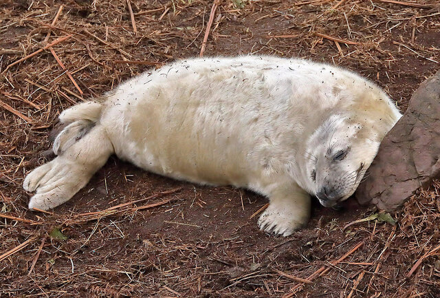
The area is rich in wildlife, with various seabirds nesting on the cliffs and seals often seen basking on the rocky shores. The coastal waters around Brander are also known for their abundance of marine life, making it a great spot for fishing and diving enthusiasts.
For those interested in history, Brander has its own tale to tell. The headland is home to the ruins of an ancient castle, which once stood as a strategic fortification against potential invaders. Exploring these ruins offers visitors a glimpse into the area's past and the significance it held in defending the coastline.
Access to Brander is relatively easy, with a well-maintained path leading from the nearby village. The surrounding area also provides ample parking facilities and picnic areas for visitors to enjoy. Whether it's for a leisurely stroll, birdwatching, or simply taking in the breathtaking views, Brander offers a unique coastal experience that is sure to captivate any visitor.
If you have any feedback on the listing, please let us know in the comments section below.
Brander Images
Images are sourced within 2km of 55.927626/-2.2058129 or Grid Reference NT8770. Thanks to Geograph Open Source API. All images are credited.


Brander is located at Grid Ref: NT8770 (Lat: 55.927626, Lng: -2.2058129)
Unitary Authority: The Scottish Borders
Police Authority: The Lothians and Scottish Borders
What 3 Words
///radiated.snitch.wove. Near Eyemouth, Scottish Borders
Nearby Locations
Related Wikis

Coldingham Loch
Coldingham Loch is a freshwater loch in the parish of Coldingham, in the Scottish Borders area of Scotland, in the former Berwickshire, between Coldingham...

A1107 road
The A1107 is a road in south-east Scotland, in the Scottish Borders. It is a non-trunk route from near Cockburnspath to near Burnmouth. It follows the...

St Abb's Head Lighthouse
St Abb's Head Lighthouse stands on the cliffs at the rocky promontory of St Abb's Head, near the village of St Abbs in Berwickshire. A signal station was...

St Abb's Head
St Abb's Head is a rocky promontory by the village of St Abbs in Scottish Borders, Scotland, and a national nature reserve administered by the National...
Nearby Amenities
Located within 500m of 55.927626,-2.2058129Have you been to Brander?
Leave your review of Brander below (or comments, questions and feedback).