Stanger Head

Coastal Feature, Headland, Point in Orkney

Scotland

Stanger Head

Penny farthing sculpture, Flotta, Orkney This is one of several sculptures made of recycled materials which can be found on Flotta.  See also <a href="https://www.geograph.org.uk/photo/882445">ND3494 : Oystercatchers on Flotta</a> and <a href="https://www.geograph.org.uk/photo/1864035">ND3793 : Doodlebug</a>.

In the distance to the left can be seen Flotta Kirk which also lies within the grid square.
Penny farthing sculpture, Flotta, Orkney Credit: Claire Pegrum

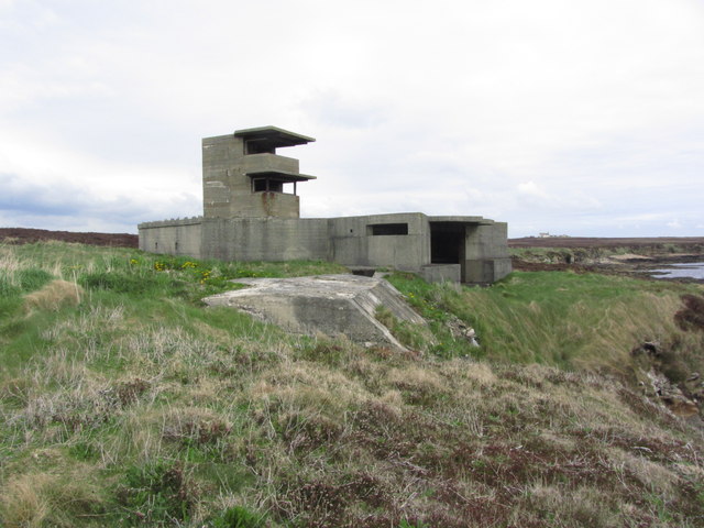
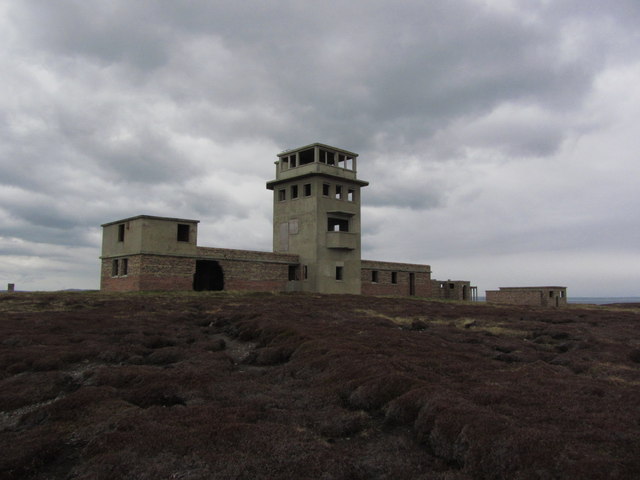
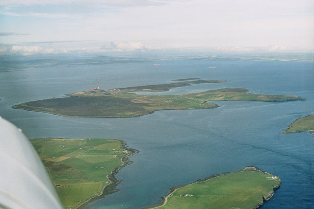
Stanger Head is a prominent coastal feature located on the Orkney Islands, an archipelago situated off the northeastern coast of Scotland. This headland, also known as Stanger Ness, is located on the east side of the Orkney Mainland, near the small village of St. Mary's.

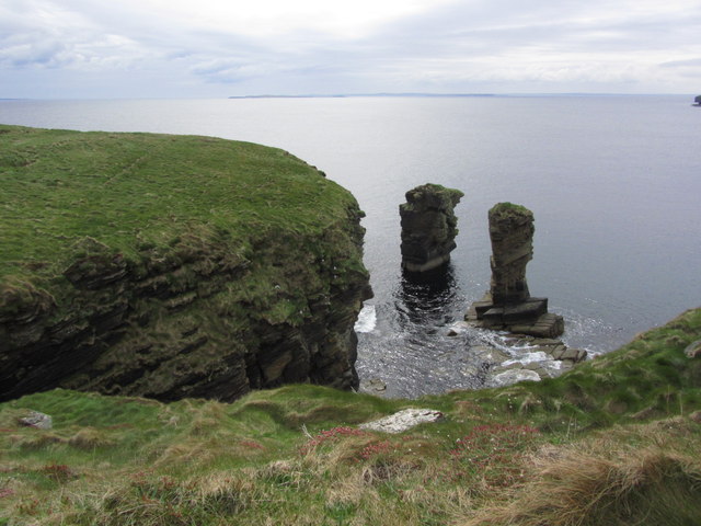
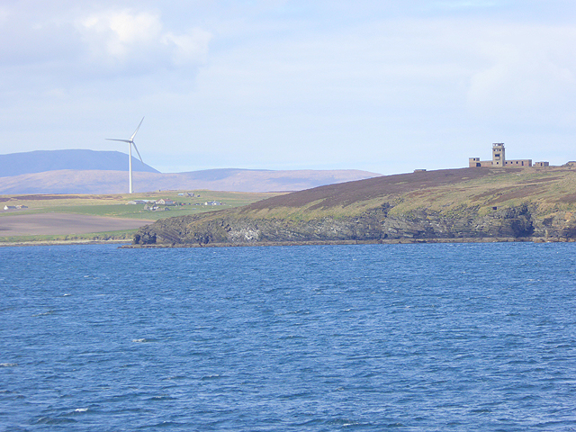
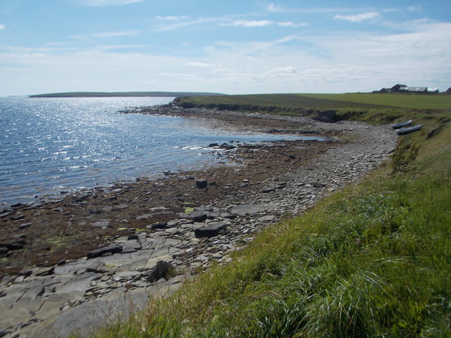
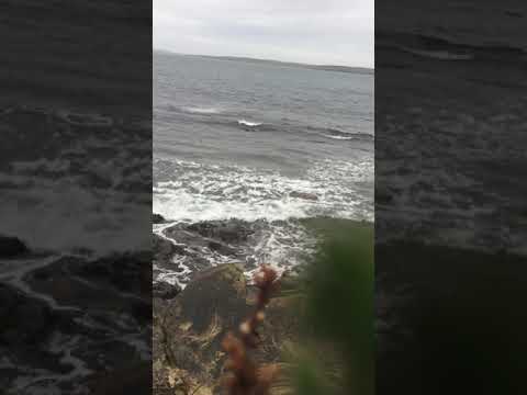
Stanger Head is characterized by its dramatic cliffs, rising up to approximately 30 meters (98 feet) above the North Sea. The cliffs are composed of sandstone and are known for their striking red and orange hues, which create a striking contrast against the blue of the sea. The headland offers breathtaking views of the surrounding coastline, with other notable landmarks such as the Brough of Deerness visible in the distance.

The area surrounding Stanger Head is rich in wildlife, making it a popular spot for birdwatching. Numerous seabirds, including fulmars, guillemots, and kittiwakes, can be observed nesting on the cliffs. Occasionally, visitors may also spot puffins, razorbills, and even seals swimming in the waters below.

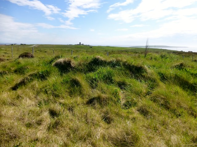
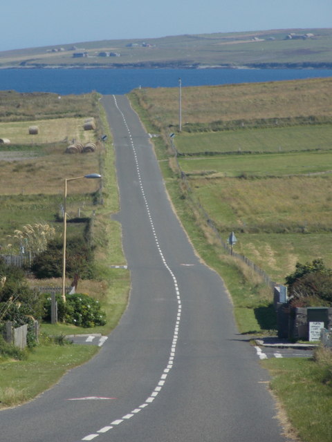
Access to Stanger Head is relatively easy, with a well-maintained coastal path leading to the headland. This path allows visitors to explore the area safely while taking in the stunning coastal scenery. Additionally, there is a small car park nearby for those arriving by car.

Stanger Head is a must-visit destination for nature enthusiasts and those seeking a serene coastal experience. Its rugged cliffs, abundant wildlife, and breathtaking views make it a truly remarkable coastal feature on the Orkney Islands.

If you have any feedback on the listing, please let us know in the comments section below.
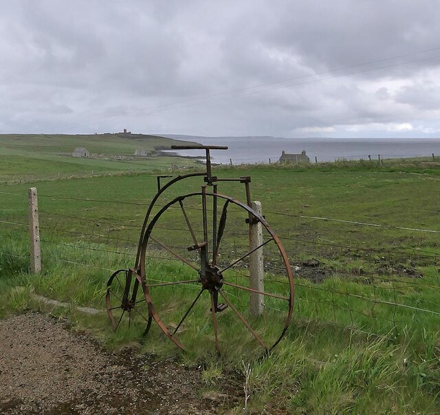
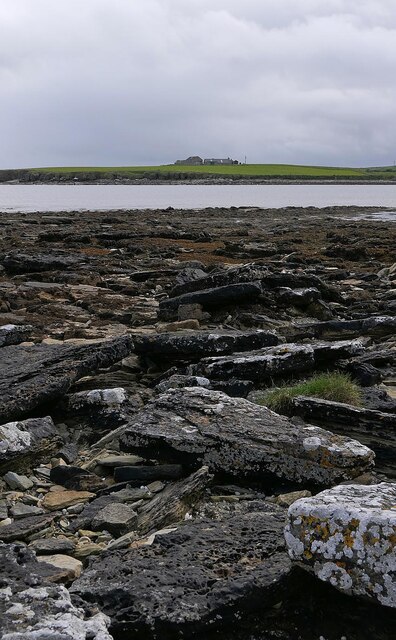
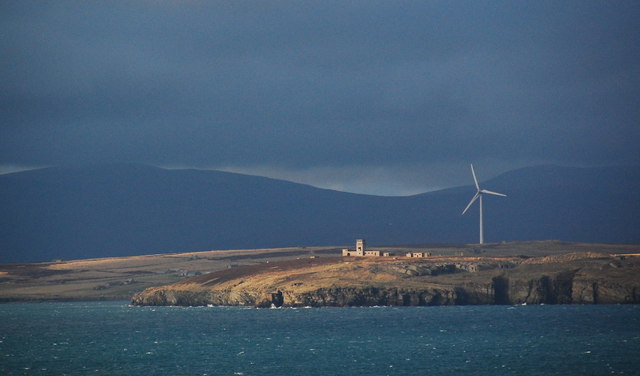
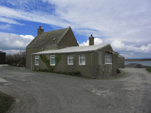
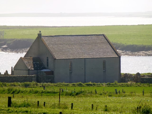
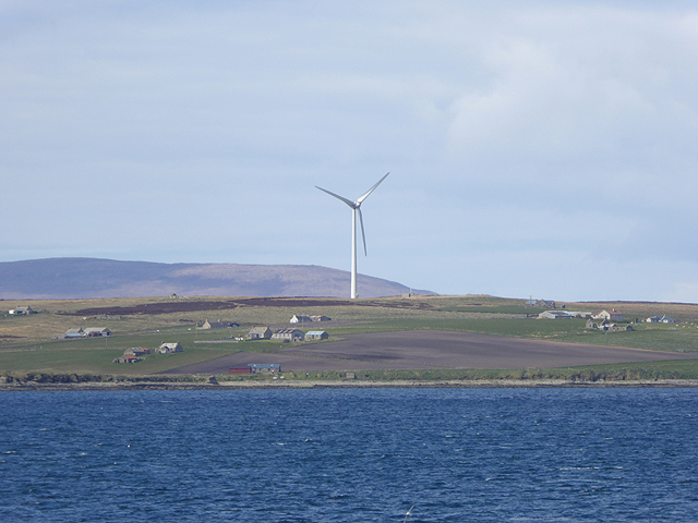
Stanger Head Images

Images are sourced within 2km of 58.814544/-3.0802721 or Grid Reference ND3792. Thanks to Geograph Open Source API. All images are credited.

Penny farthing sculpture, Flotta, Orkney This is one of several sculptures made of recycled materials which can be found on Flotta.  See also <a href="https://www.geograph.org.uk/photo/882445">ND3494 : Oystercatchers on Flotta</a> and <a href="https://www.geograph.org.uk/photo/1864035">ND3793 : Doodlebug</a>.

In the distance to the left can be seen Flotta Kirk which also lies within the grid square.
Penny farthing sculpture, Flotta, Orkney
This is one of several sculptures made of recycled materials which can be found on Flotta. See also ND3494 : Oystercatchers on Flotta and ND3793 : Doodlebug. In the distance to the left can be seen Flotta Kirk which also lies within the grid square.
Kirkie Taing, Flotta, Orkney Looking across Kirk Bay towards the farm called Banks which also lies within the grid square.

This rocky outcrop, which is covered at high tide, lies to the south east of Flotta's church, or kirk.  Taing is derived from the Old Norse word Tangi meaning tongue.
Kirkie Taing, Flotta, Orkney
Looking across Kirk Bay towards the farm called Banks which also lies within the grid square. This rocky outcrop, which is covered at high tide, lies to the south east of Flotta's church, or kirk. Taing is derived from the Old Norse word Tangi meaning tongue.
Stanger Head, Flotta The control tower for the WW2 coastal defences at Stanger Head is conspicuous in the sunlight. Flotta wind turbine beyond and the high hills of Hoy in the distance.
Stanger Head, Flotta
The control tower for the WW2 coastal defences at Stanger Head is conspicuous in the sunlight. Flotta wind turbine beyond and the high hills of Hoy in the distance.
Flotta; the Peerie Museum An excellent little museum with an in-depth history of the island and much World Wars 1 and 2 memorabilia.
Flotta; the Peerie Museum
An excellent little museum with an in-depth history of the island and much World Wars 1 and 2 memorabilia.
Flotta; The Buchanan Battery
Flotta; The Cletts, Rock stacks at Stanger Head
Flotta; Signal station above Stanger Head
Kenzie's Tower Arrived by ferry to bag both TuMPs on Flotta with Alex Cameron, Jim Bloomer and Tricky Speirs on a sunny afternoon.
Name: Kenzie's Tower
Hill number: 12252
Height: 42m / 138ft
Parent (Ma/M): none
Area: 23: Orkney Islands
Class: 0
Grid ref: ND371933 (est)
Drop: 30m
Col: 12m  ND365938
Kenzie's Tower
Arrived by ferry to bag both TuMPs on Flotta with Alex Cameron, Jim Bloomer and Tricky Speirs on a sunny afternoon. Name: Kenzie's Tower Hill number: 12252 Height: 42m / 138ft Parent (Ma/M): none Area: 23: Orkney Islands Class: 0 Grid ref: ND371933 (est) Drop: 30m Col: 12m ND365938
A Small Kirk On Flotta A small Kirk on Flotta with a view of Kirk Bay.
A Small Kirk On Flotta
A small Kirk on Flotta with a view of Kirk Bay.
Isle of Flotta A relic of the World War II defences of Scapa Flow can be seen on Stanger Head in the foreground. Beyond is the wind turbine on West Hill <a href="https://www.geograph.org.uk/gridref/ND3593">ND3593</a> whilst the hills of Hoy can be seen in the distance. 

Viewed from the MV Pentalina at ND388912.
Isle of Flotta
A relic of the World War II defences of Scapa Flow can be seen on Stanger Head in the foreground. Beyond is the wind turbine on West Hill ND3593 whilst the hills of Hoy can be seen in the distance. Viewed from the MV Pentalina at ND388912.
Isle of Flotta A giant wind turbine crowns West Hill. The hills of Hoy beyond.
Isle of Flotta
A giant wind turbine crowns West Hill. The hills of Hoy beyond.
Flotta: west side of Kirk Bay Looking along the stony western shore of this bay on the southern side of the island.
Flotta: west side of Kirk Bay
Looking along the stony western shore of this bay on the southern side of the island.
Flotta: the B9046 heads across the island Looking along this straight B road, the main road across the island, from the crossroads to the west of the main village.
Flotta: the B9046 heads across the island
Looking along this straight B road, the main road across the island, from the crossroads to the west of the main village.
Flotta: the post office The stores and post office are contained within this outbuilding behind the subpostmaster's house; the current postmaster, David Sinclair, whose name is featured on the sign, has been in the post for 50 years, having taken over in 1965.

This is about as much of the building that can easily be photographed as the house is right alongside us.
Flotta: the post office
The stores and post office are contained within this outbuilding behind the subpostmaster's house; the current postmaster, David Sinclair, whose name is featured on the sign, has been in the post for 50 years, having taken over in 1965. This is about as much of the building that can easily be photographed as the house is right alongside us.
Flotta: postbox № KW16 49 The island's postbox occupies a central location with regard to the majority of the residences, unlike the post office. It is set into a stone pillar by the school and may have once had some kind of rain-cover fitted - there are two small holes in the canopy over the slot.
Flotta: postbox № KW16 49
The island's postbox occupies a central location with regard to the majority of the residences, unlike the post office. It is set into a stone pillar by the school and may have once had some kind of rain-cover fitted - there are two small holes in the canopy over the slot.
Flotta: the kirk The church occupies a scenic setting just above the shore of Kirk Bay, and was built in 1871.

See <a href="https://www.geograph.org.uk/photo/4714807">ND3693 : Flotta: inside the kirk</a> for an interior view.
Flotta: the kirk
The church occupies a scenic setting just above the shore of Kirk Bay, and was built in 1871. See ND3693 : Flotta: inside the kirk for an interior view.
Flotta: inside the kirk The plain but light and attractive interior of <a href="https://www.geograph.org.uk/photo/4714800">ND3693 : Flotta: the kirk</a>, built in 1871.
Flotta: inside the kirk
The plain but light and attractive interior of ND3693 : Flotta: the kirk, built in 1871.
Flotta: a sea view from the kirk Looking out of one of the south-facing windows of <a href="https://www.geograph.org.uk/photo/4714800">ND3693 : Flotta: the kirk</a>.
Flotta: a sea view from the kirk
Looking out of one of the south-facing windows of ND3693 : Flotta: the kirk.
Show me another place!

Stanger Head is located at Grid Ref: ND3792 (Lat: 58.814544, Lng: -3.0802721)

Unitary Authority: Orkney Islands

Police Authority: Highlands and Islands

What 3 Words

///preparing.rider.snappy. Near St Margaret's Hope, Orkney Islands

Related Wikis

Whome

Whome is the largest settlement on the Orkney island of Flotta, Scotland. The village is situated on the B9046, the main road across Flotta. Views from...

Switha

Switha is a small uninhabited island towards the south of Orkney, Scotland, approximately 41 hectares in area. == Geography and geology == Switha lies...

Flotta

Flotta () is a small island in Orkney, Scotland, lying in Scapa Flow. The island is known for its large oil terminal and is linked by Orkney Ferries to...

Flotta Isle Airport

Flotta Isle Airport (IATA: FLH) is a small airport located on the Orkney isle of Flotta. The asphalt runway orientation is at 16/34, with an elevation...

Related Videos

Flotta Z Battery.

Brief walkabout of the Z Battery on Flotta, Orkney.

Nearby Amenities

Located within 500m of 58.814544,-3.0802721
House Geo
Natural: bay
Lat/Long: 58.8150268/-3.0884274
Geo of Easter Riff
Natural: cape
Lat/Long: 58.8146268/-3.0849298
Geo of Kemun
Natural: bay
Lat/Long: 58.8143712/-3.0822905
Fallen Gloup
Place: locality
Lat/Long: 58.8155601/-3.0787929
Ronie Geo
Natural: bay
Lat/Long: 58.8181044/-3.0789431
Seamark Light Character: Fl
Seamark Light Colour: red
Seamark Light Height: 25
Seamark Light Period: 5
Seamark Light Range: 8
Seamark Light Reference: A 3610.2
Seamark Light Sequence: 0.2+(4.8)
Seamark Type: light_minor
Source: US NGA Pub. 114. 2011-05-26.
Lat/Long: 58.8160333/-3.0788333
The data included in this document is from www.openstreetmap.org. The data is made available under ODbL.

Have you been to Stanger Head?

Leave your review of Stanger Head below (or comments, questions and feedback).