Head of Crees

Coastal Feature, Headland, Point in Caithness

Scotland

Head of Crees

Gill's Bay The Ferry Terminal on the North coast to St Margaret's Hope on Orkney
Gill's Bay Credit: G McK

Head of Crees is a prominent coastal feature located in Caithness, Scotland. It is a headland that juts out into the North Sea, forming a distinctive point along the rugged coastline. The headland is situated about 8 miles northeast of the town of Thurso.

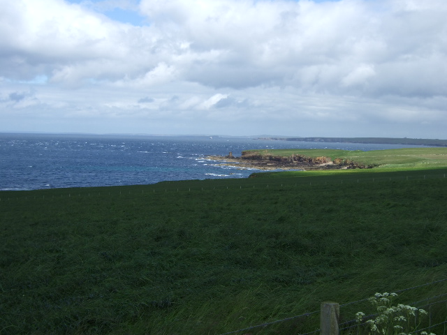
At Head of Crees, the coastline is characterized by steep cliffs, which rise to a height of approximately 100 feet above sea level. The cliffs are composed of sedimentary rocks, primarily sandstone and shale, which exhibit various colors and textures, adding to the scenic beauty of the area.

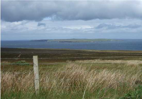
The headland offers breathtaking views of the surrounding coastal landscape, with panoramic vistas of the North Sea stretching out into the horizon. Visitors to Head of Crees can witness the power of the crashing waves against the cliffs, creating a dramatic and awe-inspiring spectacle.

The area is home to a diverse range of wildlife, including seabirds such as fulmars, kittiwakes, and guillemots. These birds can often be seen nesting on the cliff ledges, adding to the natural charm of the site. The surrounding waters are also rich in marine life, with occasional sightings of seals and dolphins.

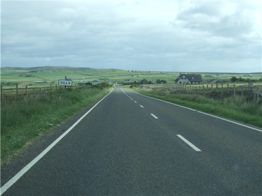
Head of Crees is a popular spot for outdoor enthusiasts, attracting hikers, birdwatchers, and photographers. The headland is accessible via a coastal path, which offers a scenic and invigorating walk along the clifftops. As a designated Site of Special Scientific Interest, the area is protected, preserving its natural beauty and ecological significance.

In conclusion, Head of Crees is a stunning headland in Caithness, Scotland, known for its dramatic cliffs, breathtaking views, and diverse wildlife. It is a must-visit destination for nature lovers and those seeking an escape into the rugged beauty of the Scottish coast.

If you have any feedback on the listing, please let us know in the comments section below.

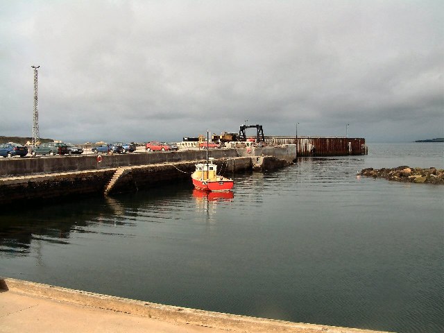
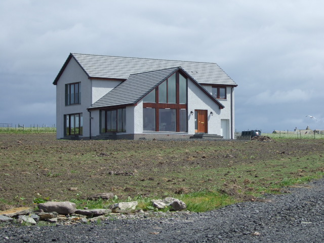
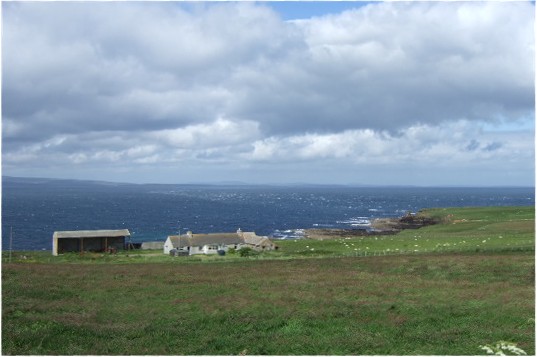
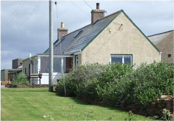
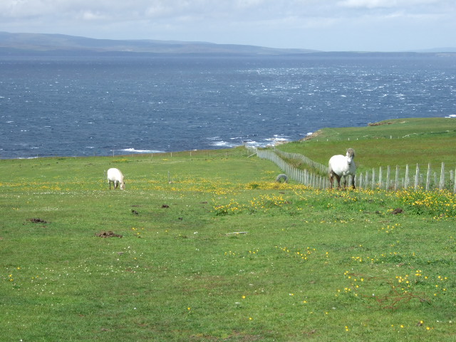
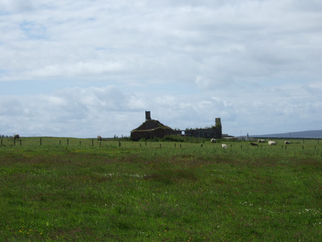
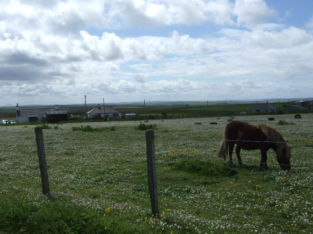
Head of Crees Images

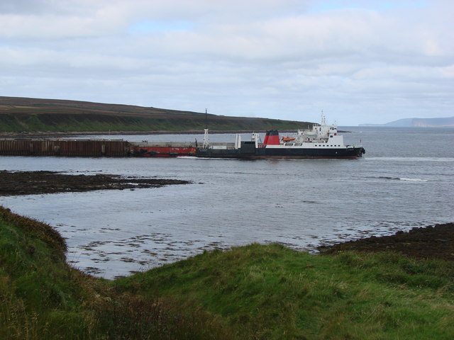
Images are sourced within 2km of 58.6514/-3.1751076 or Grid Reference ND3174. Thanks to Geograph Open Source API. All images are credited.

Gill's Bay The Ferry Terminal on the North coast to St Margaret's Hope on Orkney
Gill's Bay
The Ferry Terminal on the North coast to St Margaret's Hope on Orkney
Gill's Bay Ferry Terminal The vehicle ferry to South Ronaldsay leaves here every hour.
Gill's Bay Ferry Terminal
The vehicle ferry to South Ronaldsay leaves here every hour.
Tigh na Mara
Tigh na Mara
View towards Men of Mey and st John's Point The Tower of Mey (Stack) can just be discerned.
View towards Men of Mey and st John's Point
The Tower of Mey (Stack) can just be discerned.
Maligoe Near St John's Point, by the Pentland Firth.
Maligoe
Near St John's Point, by the Pentland Firth.
St John's Cottage Aka 'Tea Cosy' from the cafe annexe. An old heavy-duty clothes wringer can be seen here, outside the porch.
St John's Cottage
Aka 'Tea Cosy' from the cafe annexe. An old heavy-duty clothes wringer can be seen here, outside the porch.
Horses by St John's Point Backed by the Pentland Firth and Orkney.
Horses by St John's Point
Backed by the Pentland Firth and Orkney.
Windy Ha'
Windy Ha'
Mey Hill junction St John's road joining A846.
Mey Hill junction
St John's road joining A846.
Ferndale Near Windy Ha'.
Ferndale
Near Windy Ha'.
Approach to Gills On A846 from Mey.
Approach to Gills
On A846 from Mey.
View towards Stroma island In the Pentland Firth; from near Gills.
View towards Stroma island
In the Pentland Firth; from near Gills.
Junction for Gills Bay ferry terminal Off A836.
Junction for Gills Bay ferry terminal
Off A836.
'The Cottage' House on A836, near access to Gills Bay ferry terminal.
'The Cottage'
House on A836, near access to Gills Bay ferry terminal.
Development construction at Gills Bay Improvements to the ferry terminal, for boats to South Ronaldsay (Orkney), under way. See <span class="nowrap"><a title="http://www.caithness.org/atoz/gills/index.htm" rel="nofollow ugc noopener" href="http://www.caithness.org/atoz/gills/index.htm">Link</a><img style="margin-left:2px;" alt="External link" title="External link - shift click to open in new window" src="https://s1.geograph.org.uk/img/external.png" width="10" height="10"/></span> - since 2001 the shortest/safest Pentland Firth crossing.
Development construction at Gills Bay
Improvements to the ferry terminal, for boats to South Ronaldsay (Orkney), under way. See LinkExternal link - since 2001 the shortest/safest Pentland Firth crossing.
Sailings timetable For the Pentland Ferry between Gills Bay and St Margarets Hope (South Ronaldsay, Orkney).
Sailings timetable
For the Pentland Ferry between Gills Bay and St Margarets Hope (South Ronaldsay, Orkney).
A836 at East Mey A view looking to the northeast along the A836 at East Mey.
A836 at East Mey
A view looking to the northeast along the A836 at East Mey.
Gills Bay Harbour The ferry arriving from the Orkneys.
Gills Bay Harbour
The ferry arriving from the Orkneys.
Show me another place!

Head of Crees is located at Grid Ref: ND3174 (Lat: 58.6514, Lng: -3.1751076)

Unitary Authority: Highland

Police Authority: Highlands and Islands

What 3 Words

///aquatics.unite.lurching. Near John o' Groats, Highland

Related Wikis

East Mey

East Mey is a scattered crofting village in northern Caithness, Scottish Highlands and is in the Scottish council area of Highland. == References ==

Gills Bay

Gills Bay, which is situated about 3 mi (4.8 km) west of John o' Groats with the community of Gills close by, has one of the longest stretches of low-lying...

Gills, Caithness

Galltair is a remote coastal, scattered crofting township and former fishing village, on the north coast of Caithness, Scottish Highlands, in the Scottish...

Canisbay Parish Church

Canisbay Parish Church is a Church of Scotland church in Canisbay, Scotland, that dates back to the early 1600s and is the most northernly church on mainland...
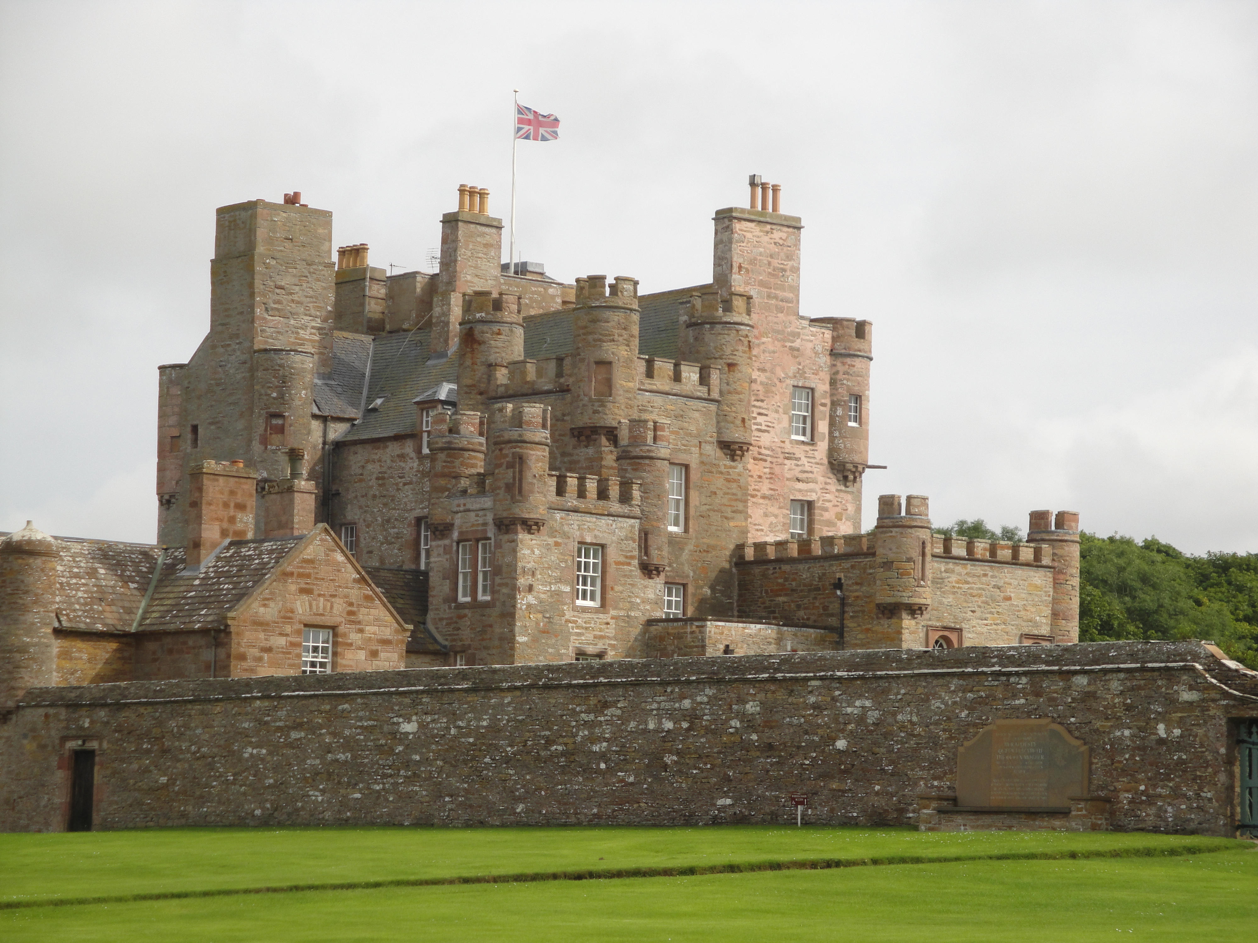
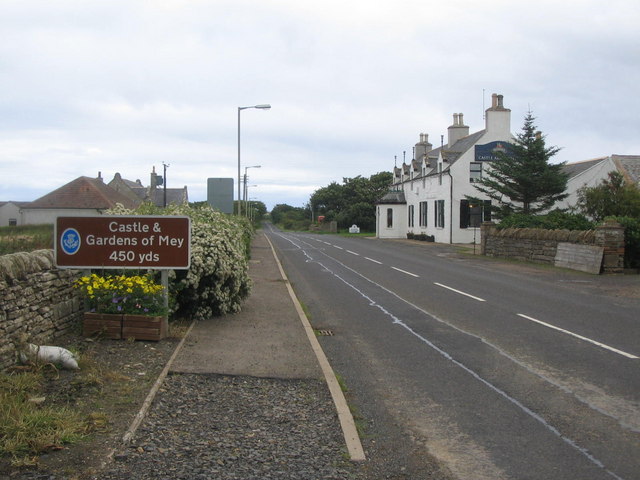
Castle of Mey

The Castle of Mey (also known for a time as Barrogill Castle) is located in Caithness, on the north coast of Scotland, about 6 miles (10 km) west of John...

MeyGen

MeyGen (full name MeyGen tidal energy project) will be the world's largest tidal energy plant, which is currently in construction. The first phase of the...

Mey, Highland

Mey is a remote village, located on the north coast of Scotland in Caithness, Scottish Highlands and is in the Scottish council area of Highland.Mey lies...

Canisbay

Canisbay is a rural hamlet located about one mile (1.5 kilometres) southwest of Huna and two and a half miles (four kilometres) southwest of John o' Groats...

Nearby Amenities

Located within 500m of 58.6514,-3.1751076
Source: PGS
Lat/Long: 58.6477243/-3.1716119
Source: PGS
Lat/Long: 58.6486526/-3.1715428
Source: PGS
Lat/Long: 58.6490593/-3.1715546
Source: PGS
Lat/Long: 58.649481/-3.1716623
Source: PGS
Lat/Long: 58.6497984/-3.1718779
Source: PGS
Lat/Long: 58.6503614/-3.1721471
Source: PGS
Lat/Long: 58.6508709/-3.1730401
Source: PGS
Lat/Long: 58.6510822/-3.1732971
Source: PGS
Lat/Long: 58.6514209/-3.173832
Source: PGS
Lat/Long: 58.6518211/-3.1741533
Source: PGS
Lat/Long: 58.6520705/-3.1746668
Source: PGS
Lat/Long: 58.6523097/-3.1752768
Source: PGS
Lat/Long: 58.652497/-3.1757608
Source: PGS
Lat/Long: 58.6524285/-3.1763355
Source: PGS
Lat/Long: 58.6522336/-3.176582
Created By: almien_coastlines
Source: PGS
Lat/Long: 58.652033/-3.176734
Source: PGS
Lat/Long: 58.6517158/-3.1767708
Source: PGS
Lat/Long: 58.6514423/-3.1767708
Source: PGS
Lat/Long: 58.6510684/-3.1767707
Source: PGS
Lat/Long: 58.6508171/-3.1768781
Source: PGS
Lat/Long: 58.6506106/-3.1773608
Source: PGS
Lat/Long: 58.6505213/-3.1778866
Source: PGS
Lat/Long: 58.6504934/-3.1782084
Source: PGS
Lat/Long: 58.6504655/-3.1785303
Source: PGS
Lat/Long: 58.6507111/-3.1791311
Source: PGS
Lat/Long: 58.6510237/-3.1793886
Source: PGS
Lat/Long: 58.6512693/-3.1795603
Source: PGS
Lat/Long: 58.6514925/-3.1796032
Created By: almien_coastlines
Source: PGS
Lat/Long: 58.651773/-3.179679
Created By: almien_coastlines
Source: PGS
Lat/Long: 58.652029/-3.17968
Created By: almien_coastlines
Source: PGS
Lat/Long: 58.652285/-3.179682
Source: PGS
Lat/Long: 58.6528751/-3.1798639
Source: PGS
Lat/Long: 58.6534929/-3.1800268
Source: PGS
Lat/Long: 58.6539431/-3.1804832
Created By: almien_coastlines
Source: PGS
Lat/Long: 58.654203/-3.180918
Created By: almien_coastlines
Source: PGS
Lat/Long: 58.654458/-3.181411
The data included in this document is from www.openstreetmap.org. The data is made available under ODbL.

Have you been to Head of Crees?

Leave your review of Head of Crees below (or comments, questions and feedback).