Trerathick Point

Coastal Feature, Headland, Point in Cornwall

England

Trerathick Point

Car park and campsite off the B3276 near Efflins
Car park and campsite off the B3276 near Efflins Credit: Roy Hughes

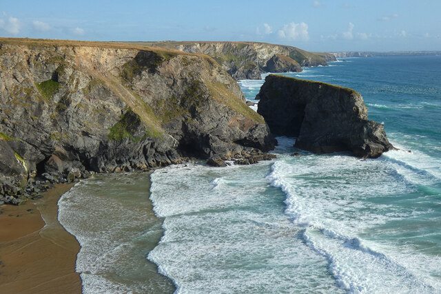
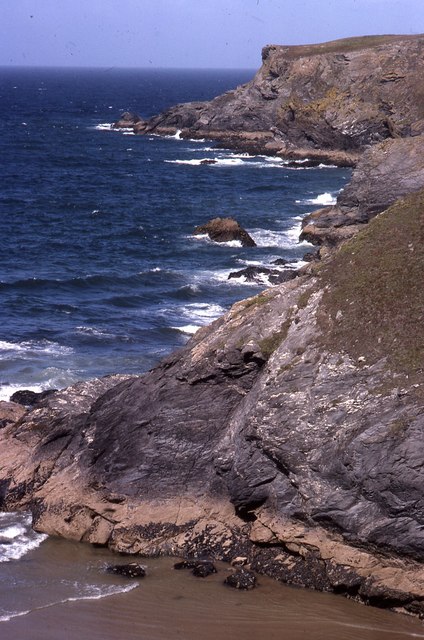
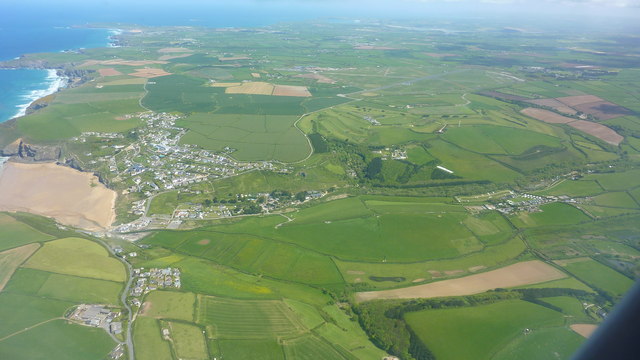
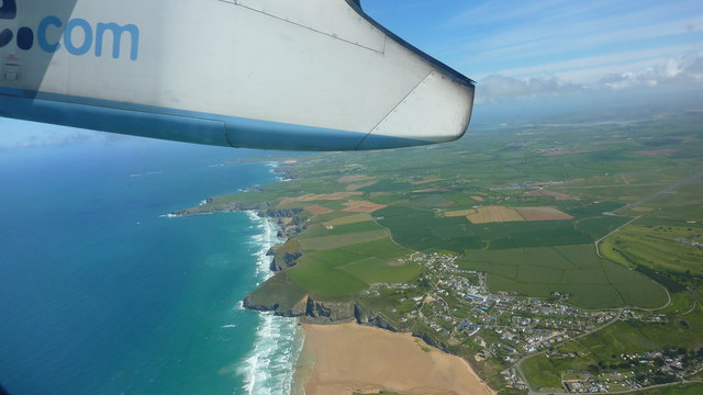
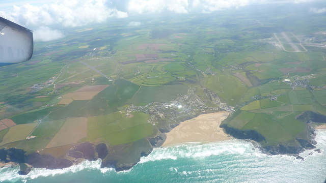
Trerathick Point is a stunning coastal feature located in Cornwall, England. It is a prominent headland that extends out into the Atlantic Ocean, offering breathtaking views and a unique natural landscape.

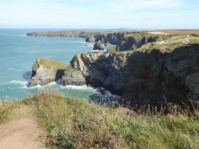
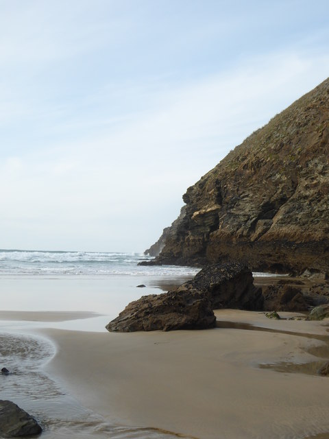
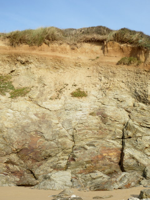
Situated near the village of Portreath, Trerathick Point is known for its rugged cliffs, which provide a dramatic backdrop to the surrounding area. The cliffs are composed of slate and granite, showcasing the geological diversity of the region.

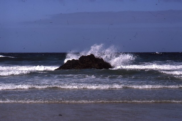
At the tip of Trerathick Point, there is a small, rocky outcrop that is exposed during low tide. This is a popular spot for visitors to explore and admire the diverse marine life that inhabits the rock pools.

The headland is also home to a variety of bird species, making it a haven for birdwatchers. From Trerathick Point, it is possible to spot seabirds such as gulls, cormorants, and even the occasional peregrine falcon.

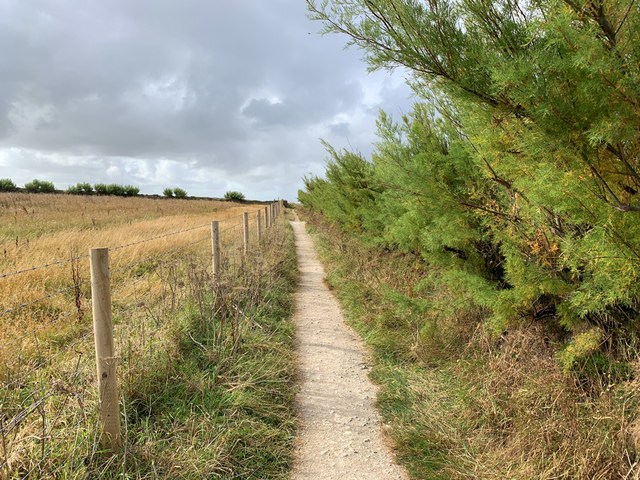
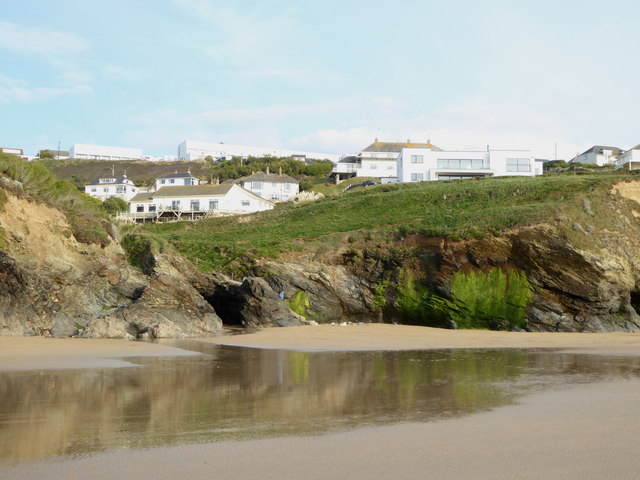
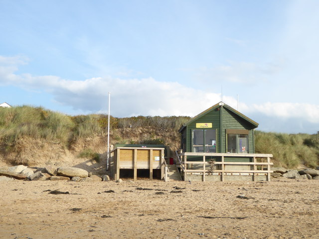
Trerathick Point is easily accessible by foot, with several paths and trails leading to its magnificent cliffs. Walking along the coastal path, visitors can immerse themselves in the area's natural beauty, with panoramic views of the ocean and the nearby beaches.

The headland is a popular destination for outdoor enthusiasts, offering opportunities for hiking, picnicking, and photography. Its unspoiled surroundings and tranquil atmosphere make it a perfect escape from the hustle and bustle of everyday life.

In summary, Trerathick Point is a stunning headland in Cornwall, boasting impressive cliffs, diverse marine and bird life, and breathtaking views. It is a must-visit location for nature lovers and those seeking a peaceful coastal retreat.

If you have any feedback on the listing, please let us know in the comments section below.

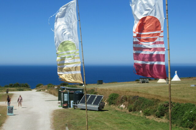
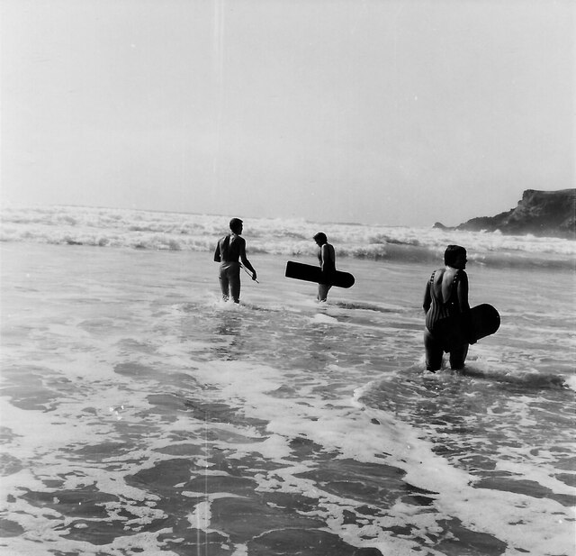
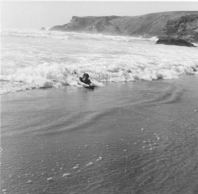
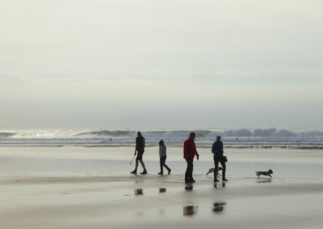
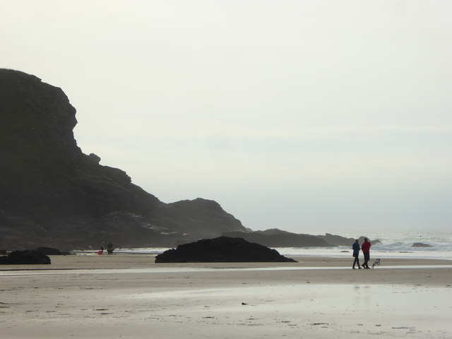
Trerathick Point Images

Images are sourced within 2km of 50.478592/-5.0363155 or Grid Reference SW8468. Thanks to Geograph Open Source API. All images are credited.

Car park and campsite off the B3276 near Efflins
Coastline, St Eval With Diggory's Island to the right in a view southwards at Pentire Steps.
Coastline, St Eval
With Diggory's Island to the right in a view southwards at Pentire Steps.
Surfers with wooden bellyboards, Pentire Cove 1966 In 2023 wooden surfboards are becoming popular again because they do not pollute the sea with plastic fragments. This photograph harks back to the period from 1940s to the present when we have used wooden bellyboards at this beach and nearby Porthcothan. Park Head is visible on the right.
Surfers with wooden bellyboards, Pentire Cove 1966
In 2023 wooden surfboards are becoming popular again because they do not pollute the sea with plastic fragments. This photograph harks back to the period from 1940s to the present when we have used wooden bellyboards at this beach and nearby Porthcothan. Park Head is visible on the right.
Belly board in surf, Pentire Cove 1966 Surfing on a belly board the body is part on the board, arms to the front holding the end of the board.
Belly board in surf, Pentire Cove 1966
Surfing on a belly board the body is part on the board, arms to the front holding the end of the board.
Pentire Steps with Park Head beyond Pentire Steps were a pathway cut into the cliff to the right of the photo. Parts have crumbled away but it is possible to scramble down onto the rocks. There is another cliff path into Pentire Cove, the sand in the foreground which is covered at high tide. Photo is scan from 35mm Kodachrome slide.
Pentire Steps with Park Head beyond
Pentire Steps were a pathway cut into the cliff to the right of the photo. Parts have crumbled away but it is possible to scramble down onto the rocks. There is another cliff path into Pentire Cove, the sand in the foreground which is covered at high tide. Photo is scan from 35mm Kodachrome slide.
Pentire Cove at half tide At low tide the rock in the centre is surrounded by sand; at high tide all of the sand in the cove is under water. Here the photo is taken from sand at the top of the cove.
Pentire Cove at half tide
At low tide the rock in the centre is surrounded by sand; at high tide all of the sand in the cove is under water. Here the photo is taken from sand at the top of the cove.
South West Coast Path diversion The path has been diverted inland near Pentire to avoid collapsing cliff tops.
South West Coast Path diversion
The path has been diverted inland near Pentire to avoid collapsing cliff tops.
Landscape Around Trenance Taken from a Flybe flight just after take-off from Newquay Airport bound for London Gatwick.
Landscape Around Trenance
Taken from a Flybe flight just after take-off from Newquay Airport bound for London Gatwick.
Atlantic Coast North of Newquay Taken from a Flybe flight just after take-off from Newquay Airport heading for London Gatwick.
Atlantic Coast North of Newquay
Taken from a Flybe flight just after take-off from Newquay Airport heading for London Gatwick.
Mawgan Porth Beach Taken from a Flybe flight, which has just taken off from Newquay Airport (visible in the background) on the way to London Gatwick.
Mawgan Porth Beach
Taken from a Flybe flight, which has just taken off from Newquay Airport (visible in the background) on the way to London Gatwick.
St Eval airfield radio transmitter station St Eval airfield radio transmitter station.  It is on the site of a former airfield which closed in the 1950s.
St Eval airfield radio transmitter station
St Eval airfield radio transmitter station. It is on the site of a former airfield which closed in the 1950s.
Bedruthan Steps
Bedruthan Steps
Dog walkers on the beach at Mawgan Porth
Berryl's Point at the south end of Mawgan Porth beach
The northern end of Mawgan Porth beach
Houses above Mawgan Porth beach
Head exposed in the cliffs at Mawgan Porth
The lifeguards' hut at Mawgan Porth Closed up for the winter.
The lifeguards' hut at Mawgan Porth
Closed up for the winter.
Show me another place!

Trerathick Point is located at Grid Ref: SW8468 (Lat: 50.478592, Lng: -5.0363155)

Unitary Authority: Cornwall

Police Authority: Devon and Cornwall

What 3 Words

///chart.century.princely. Near Newquay, Cornwall

Related Wikis

Trenance

Trenance (Cornish: Trenans) is a hamlet adjoining Mawgan Porth in Cornwall, England, United Kingdom. Trenance Point is a headland nearby.There are also...

Carnewas and Bedruthan Steps

Carnewas and Bedruthan Steps (Cornish: Karn Havos, meaning "rock-pile of summer dwelling" and Cornish: Bos Rudhen, meaning "Red-one's dwelling") is a stretch...

River Menalhyl

The River Menalhyl (Cornish: Dowr Melynheyl, meaning river of the estuary mill) is a river in Cornwall, England, that flows through the civil parishes...

St Columb Canal

St Columb Canal sometimes referred to as Edyvean's Canal, was an abortive canal scheme in Cornwall, England, designed for the carriage of sea sand for...

Nearby Amenities

Located within 500m of 50.478592,-5.0363155
Source: PGS
Lat/Long: 50.4776604/-5.037003
Source: PGS
Lat/Long: 50.4776673/-5.0368421
National Trust shop and Cafe
Name En: Carnewas at Bedruthan - National Trust Shop and Café
Phone: +44 1637 860563
Tourism: information
Website: https://www.nationaltrust.org.uk/carnewas-and-bedruthan-steps/
Lat/Long: 50.4815206/-5.0322318
Toilets
Lat/Long: 50.4814711/-5.0322317
Cafe
Carnewas Tea Room
Lat/Long: 50.4814217/-5.0322505
Bench
Backrest: no
Lat/Long: 50.4758151/-5.0359486
Bench
Backrest: no
Lat/Long: 50.4815195/-5.0341226
Tourism: viewpoint
Lat/Long: 50.4826586/-5.0334058
Bench
Backrest: no
Survey Date: 2023-08-19
Lat/Long: 50.482669/-5.0334003
Bench
Backrest: no
Survey Date: 2023-08-19
Lat/Long: 50.4819498/-5.0336634
Bench
Backrest: no
Survey Date: 2023-08-19
Lat/Long: 50.4808194/-5.034521
The data included in this document is from www.openstreetmap.org. The data is made available under ODbL.

Have you been to Trerathick Point?

Leave your review of Trerathick Point below (or comments, questions and feedback).