Trenance Point

Coastal Feature, Headland, Point in Cornwall

England

Trenance Point

Coastline, St Eval With Diggory's Island to the right in a view southwards at Pentire Steps.
Coastline, St Eval Credit: Andrew Smith

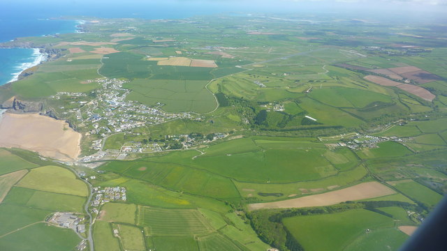
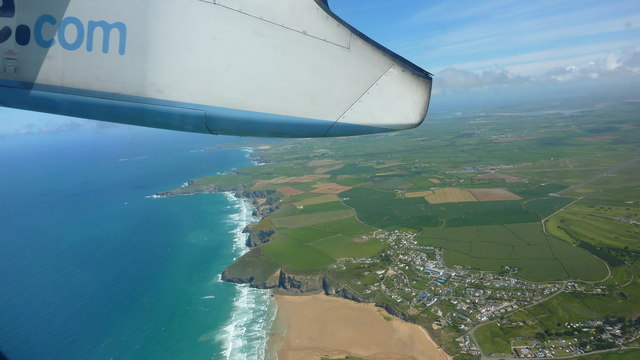
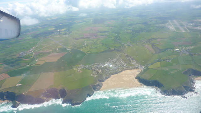
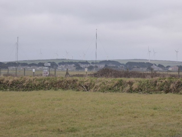
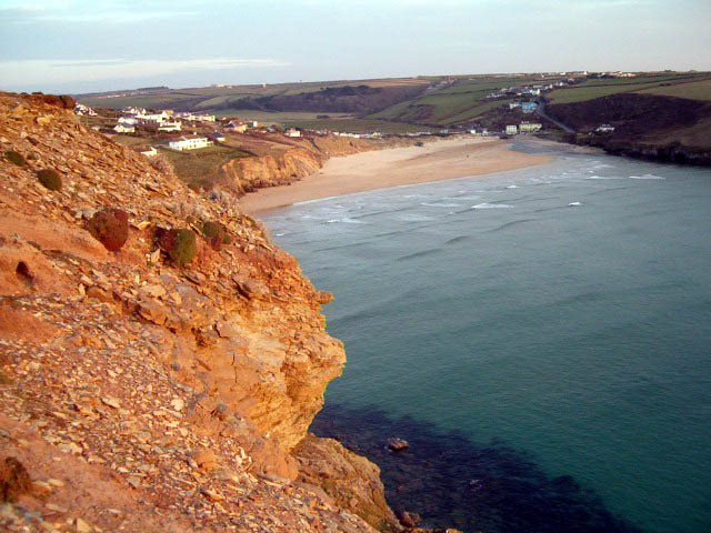
Trenance Point is a prominent headland located on the coastline of Cornwall, England. Situated near the town of Newquay, it offers breathtaking views of the Atlantic Ocean and is a popular destination for locals and tourists alike.

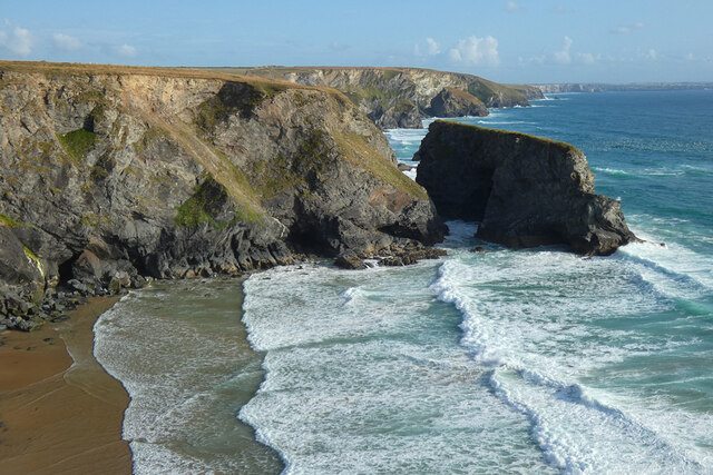
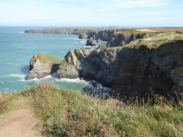
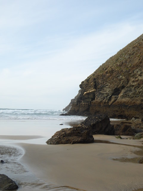
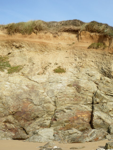
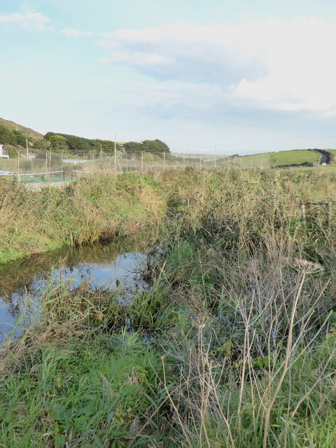
The headland is characterized by its rugged cliffs, which stand tall against the crashing waves below. The cliffs are comprised of sedimentary rocks, displaying layers of different colors and textures, making them an interesting geological feature to explore.

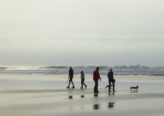
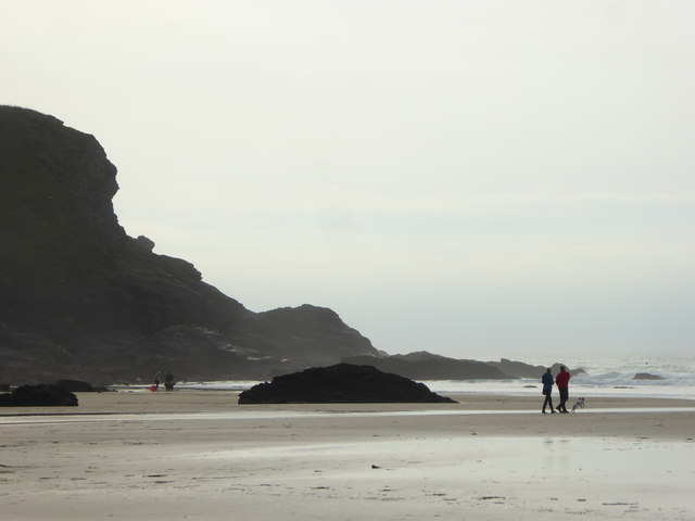
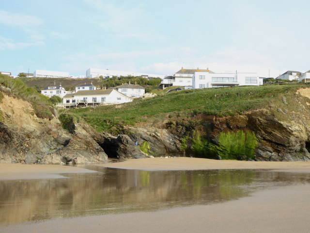
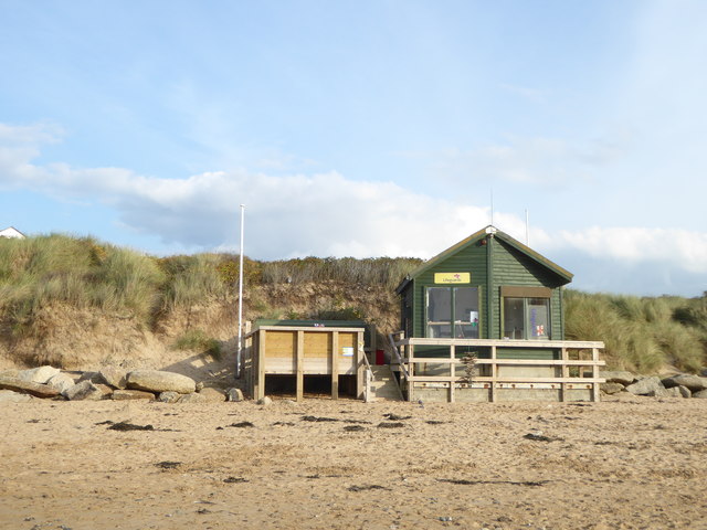
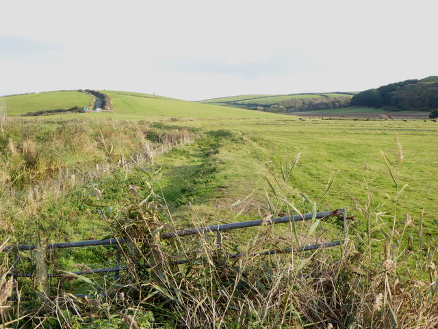
Trenance Point is surrounded by beautiful sandy beaches, providing opportunities for sunbathing, swimming, and various water sports. The headland itself offers fantastic walking trails, allowing visitors to immerse themselves in the natural beauty of the area. Hiking along the cliff tops offers panoramic vistas of the ocean, as well as the chance to observe diverse bird species nesting on the cliffs.

The headland also boasts a rich history, with remnants of ancient settlements and fortifications found in the vicinity. These historical features add an element of intrigue to the area, attracting history enthusiasts and archaeology buffs.

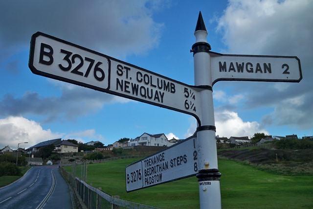
Trenance Point is easily accessible, with nearby parking facilities and a well-maintained footpath leading to the headland. It is a popular spot for photography enthusiasts, who flock to capture the stunning sunsets and dramatic coastal scenery.

Overall, Trenance Point is a captivating coastal feature in Cornwall, offering a combination of natural beauty, outdoor activities, and historical significance, making it a must-visit destination for anyone exploring the region.

If you have any feedback on the listing, please let us know in the comments section below.

Trenance Point Images

Images are sourced within 2km of 50.47414/-5.0376792 or Grid Reference SW8468. Thanks to Geograph Open Source API. All images are credited.

Coastline, St Eval With Diggory's Island to the right in a view southwards at Pentire Steps.
Coastline, St Eval
With Diggory's Island to the right in a view southwards at Pentire Steps.
Landscape Around Trenance Taken from a Flybe flight just after take-off from Newquay Airport bound for London Gatwick.
Landscape Around Trenance
Taken from a Flybe flight just after take-off from Newquay Airport bound for London Gatwick.
Atlantic Coast North of Newquay Taken from a Flybe flight just after take-off from Newquay Airport heading for London Gatwick.
Atlantic Coast North of Newquay
Taken from a Flybe flight just after take-off from Newquay Airport heading for London Gatwick.
Mawgan Porth Beach Taken from a Flybe flight, which has just taken off from Newquay Airport (visible in the background) on the way to London Gatwick.
Mawgan Porth Beach
Taken from a Flybe flight, which has just taken off from Newquay Airport (visible in the background) on the way to London Gatwick.
St Eval airfield radio transmitter station St Eval airfield radio transmitter station.  It is on the site of a former airfield which closed in the 1950s.
St Eval airfield radio transmitter station
St Eval airfield radio transmitter station. It is on the site of a former airfield which closed in the 1950s.
Bedruthan Steps
Bedruthan Steps
Dog walkers on the beach at Mawgan Porth
Berryl's Point at the south end of Mawgan Porth beach
The northern end of Mawgan Porth beach
Houses above Mawgan Porth beach
Head exposed in the cliffs at Mawgan Porth
The lifeguards' hut at Mawgan Porth Closed up for the winter.
The lifeguards' hut at Mawgan Porth
Closed up for the winter.
The River Menalhyl behind Mawgan Porth beach
Fields in the River Menalhyl valley at Mawgan Porth
The sea at the bottom of Bedruthan Steps The waves coming into the beach at the bottom of Bedruthan Steps, a National Trust site (<span class="nowrap"><a title="https://www.nationaltrust.org.uk/carnewas-and-bedruthan-steps/features/the-history-and-legend-of-bedruthan-steps)" rel="nofollow ugc noopener" href="https://www.nationaltrust.org.uk/carnewas-and-bedruthan-steps/features/the-history-and-legend-of-bedruthan-steps)">Link</a><img style="margin-left:2px;" alt="External link" title="External link - shift click to open in new window" src="https://s1.geograph.org.uk/img/external.png" width="10" height="10"/></span>
The sea at the bottom of Bedruthan Steps
The waves coming into the beach at the bottom of Bedruthan Steps, a National Trust site (LinkExternal link
Coast at Bedruthan Steps
SW coast path
SW coast path
Old Direction Sign - Signpost by the B3276, Mawgan Porth Cone finial - 'BMC/TBS' cast on pillar; Cornwall CC iron spear by the B3276, in parish of Mawgan in Pydar (Restormel District), Mawgan Porth, at back of footpath.

Surveyed

Milestone Society National ID: CW_SW8567.
Old Direction Sign - Signpost by the B3276, Mawgan Porth
Cone finial - 'BMC/TBS' cast on pillar; Cornwall CC iron spear by the B3276, in parish of Mawgan in Pydar (Restormel District), Mawgan Porth, at back of footpath. Surveyed Milestone Society National ID: CW_SW8567.
Show me another place!

Trenance Point is located at Grid Ref: SW8468 (Lat: 50.47414, Lng: -5.0376792)

Unitary Authority: Cornwall

Police Authority: Devon and Cornwall

What 3 Words

///sprains.tester.traps. Near Newquay, Cornwall

Related Wikis

Trenance

Trenance (Cornish: Trenans) is a hamlet adjoining Mawgan Porth in Cornwall, England, United Kingdom. Trenance Point is a headland nearby.There are also...

River Menalhyl

The River Menalhyl (Cornish: Dowr Melynheyl, meaning river of the estuary mill) is a river in Cornwall, England, that flows through the civil parishes...

St Columb Canal

St Columb Canal sometimes referred to as Edyvean's Canal, was an abortive canal scheme in Cornwall, England, designed for the carriage of sea sand for...

Mawgan Porth

Mawgan Porth (in Cornish: Porth Maugan, meaning "St. Mawgan's cove", or Porth Glyvyan, meaning "cove of the Gluvian River") is a beach and small settlement...

Nearby Amenities

Located within 500m of 50.47414,-5.0376792
Source: PGS
Lat/Long: 50.4776604/-5.037003
Source: PGS
Lat/Long: 50.4776673/-5.0368421
Source: PGS
Lat/Long: 50.4723483/-5.0374107
Source: PGS
Lat/Long: 50.4722909/-5.0371605
Source: PGS
Lat/Long: 50.4722773/-5.0369566
Source: PGS
Lat/Long: 50.4722773/-5.0367743
Source: PGS
Lat/Long: 50.4722568/-5.0366026
Source: PGS
Lat/Long: 50.4712462/-5.0350147
Source: PGS
Lat/Long: 50.470785/-5.034367
Source: PGS
Lat/Long: 50.4705052/-5.0342917
Bench
Backrest: no
Lat/Long: 50.4758151/-5.0359486
Bench
Backrest: no
Lat/Long: 50.4707104/-5.0335085
The data included in this document is from www.openstreetmap.org. The data is made available under ODbL.

Have you been to Trenance Point?

Leave your review of Trenance Point below (or comments, questions and feedback).