Lizard Point

Coastal Feature, Headland, Point in Cornwall

England

Lizard Point

View across Kynance Cove in Cornwall Looking south-west from near the South West Coast Path. On the left is Gull Rock, and the grass topped Asparagus Island is straight ahead.

The image has been scanned from a Kodak Gold 100 negative dating from August 1990.
View across Kynance Cove in Cornwall Credit: Roger D Kidd

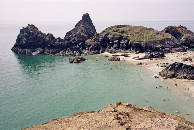
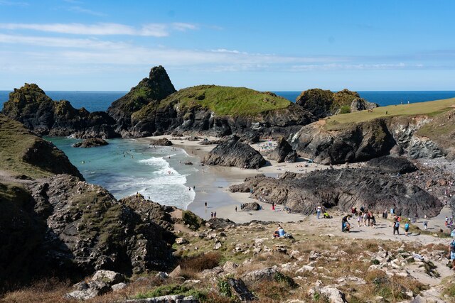
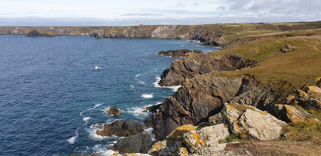
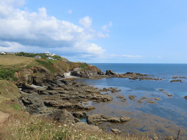
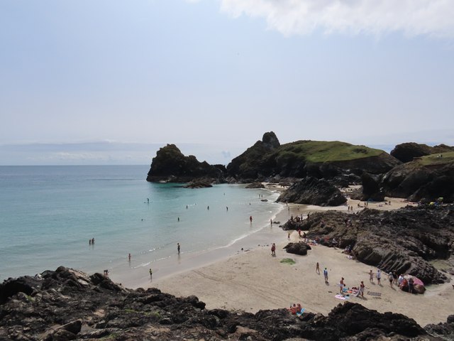
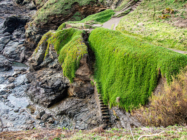
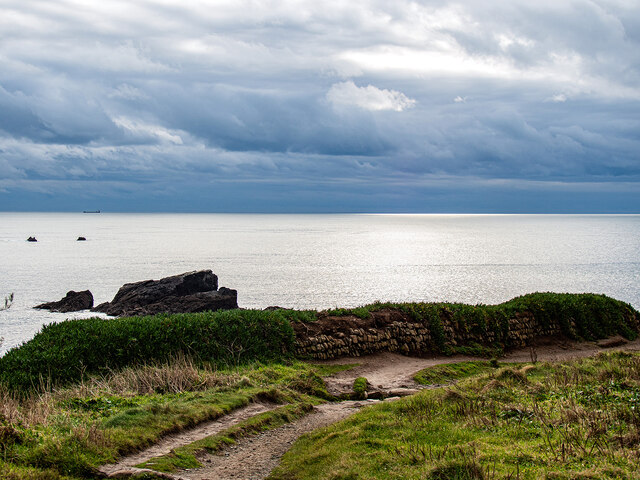
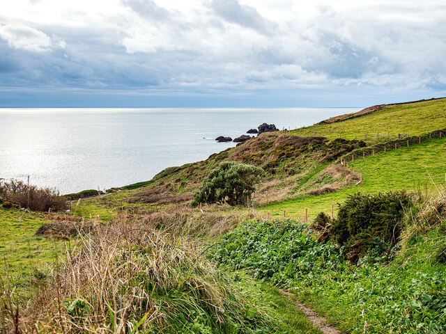
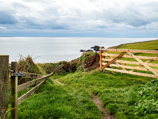
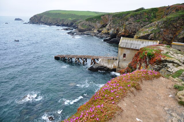
Lizard Point is the most southerly point of mainland Great Britain, located in Cornwall, England. It is a prominent headland that juts out into the Atlantic Ocean, offering stunning views of the surrounding coastline. The area is known for its rugged cliffs, rocky shores, and diverse marine life.

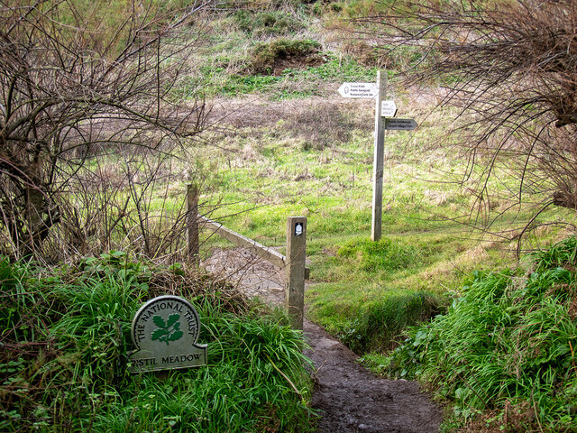
Lizard Point is a popular destination for tourists and outdoor enthusiasts, who come to explore the coastal paths, take in the panoramic views, and spot wildlife such as seals, dolphins, and seabirds. The area is also rich in history, with a lighthouse dating back to the 18th century standing as a prominent landmark.

The unique geology of Lizard Point includes serpentine rock, which gives the area its name. This rare type of rock is found in only a few places in the world, making Lizard Point a geologically significant site.

Overall, Lizard Point is a beautiful and diverse coastal feature that offers a mix of natural beauty, wildlife, and history for visitors to enjoy.

If you have any feedback on the listing, please let us know in the comments section below.
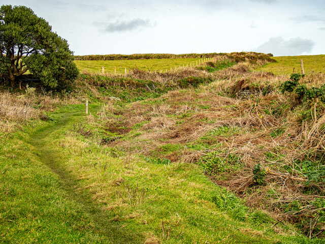
Lizard Point Images

Images are sourced within 2km of 49.960988/-5.213118 or Grid Reference SW6911. Thanks to Geograph Open Source API. All images are credited.

View across Kynance Cove in Cornwall Looking south-west from near the South West Coast Path. On the left is Gull Rock, and the grass topped Asparagus Island is straight ahead.

The image has been scanned from a Kodak Gold 100 negative dating from August 1990.
View across Kynance Cove in Cornwall
Looking south-west from near the South West Coast Path. On the left is Gull Rock, and the grass topped Asparagus Island is straight ahead. The image has been scanned from a Kodak Gold 100 negative dating from August 1990.
Kynance Cove beach
Kynance Cove beach
Cliffs below Pistil Meadow A view of the cliffs below Pistil Meadow, from the S W Coastal Path.
Cliffs below Pistil Meadow
A view of the cliffs below Pistil Meadow, from the S W Coastal Path.
Kynance Cove from Pistil Meadow headland Asparagus Island and Kynance Cove from Pistil Meadow headland.
Kynance Cove from Pistil Meadow headland
Asparagus Island and Kynance Cove from Pistil Meadow headland.
Cliffs near Pentreath Beach Some cliffs on the S W Coastal Path between Pentreath Beach and Lizard Point.
Cliffs near Pentreath Beach
Some cliffs on the S W Coastal Path between Pentreath Beach and Lizard Point.
Polpeor Cove
Polpeor Cove
Crane Ledges
Crane Ledges
Fields near Lizard village
Kynance Cove
Kynance Cove
Steps down to Polpeor Cove After you!
Steps down to Polpeor Cove
After you!
Entering Pistil Meadow Legend has it that this was the burial site of 200 souls lost in the wreck of the Royal Anne Galley in 1721. This has now probably been disproved by a study conducted in 2014-16 <span class="nowrap"><a title="https://thisismast.org//research/pistil-meadow-and-the-royal-anne.html" rel="nofollow ugc noopener" href="https://thisismast.org//research/pistil-meadow-and-the-royal-anne.html">Link</a><img style="margin-left:2px;" alt="External link" title="External link - shift click to open in new window" src="https://s1.geograph.org.uk/img/external.png" width="10" height="10"/></span>
Entering Pistil Meadow
Legend has it that this was the burial site of 200 souls lost in the wreck of the Royal Anne Galley in 1721. This has now probably been disproved by a study conducted in 2014-16 LinkExternal link
Looking out from Pistil Meadow Shag Rock on the left.
Looking out from Pistil Meadow
Shag Rock on the left.
Bridleway leading from Pistil Meadow to Lizard Village
Looking down on Pistil Meadow From the bridleway down from Lizard Village.
Looking down on Pistil Meadow
From the bridleway down from Lizard Village.
Farm gates by the bridleway Down from Lizard Village.
Farm gates by the bridleway
Down from Lizard Village.
The Lizard Lifeboat Station The Lizard Lifeboat Station at Lizard Point, below the Lighthouse.
The Lizard Lifeboat Station
The Lizard Lifeboat Station at Lizard Point, below the Lighthouse.
The Lizard Lighthouse Foghorn The Lizard Foghorn comprises two diaphone horns operated by compressed air, nowadays electrically operated giving one three second blast every thirty seconds when air moisture exceeds a certain figure.  Originally it was operated by a steam compressor, changed to diesel operation after 1907.
The Lizard Lighthouse Foghorn
The Lizard Foghorn comprises two diaphone horns operated by compressed air, nowadays electrically operated giving one three second blast every thirty seconds when air moisture exceeds a certain figure. Originally it was operated by a steam compressor, changed to diesel operation after 1907.
Lizard Methodist Church
Show me another place!

Lizard Point is located at Grid Ref: SW6911 (Lat: 49.960988, Lng: -5.213118)

Unitary Authority: Cornwall

Police Authority: Devon and Cornwall

What 3 Words

///tangling.nappy.energy. Near Landewednack, Cornwall

Related Wikis

Lizard Point, Cornwall

Lizard Point (from Cornish an Lysardh 'the high court') in Cornwall is at the southern tip of the Lizard Peninsula. It is situated half-a-mile (800 m...

Lizard Lighthouse

The Lizard Lighthouse is a lighthouse at Lizard Point, Cornwall, England, built to guide vessels passing through the English Channel. It was often the...

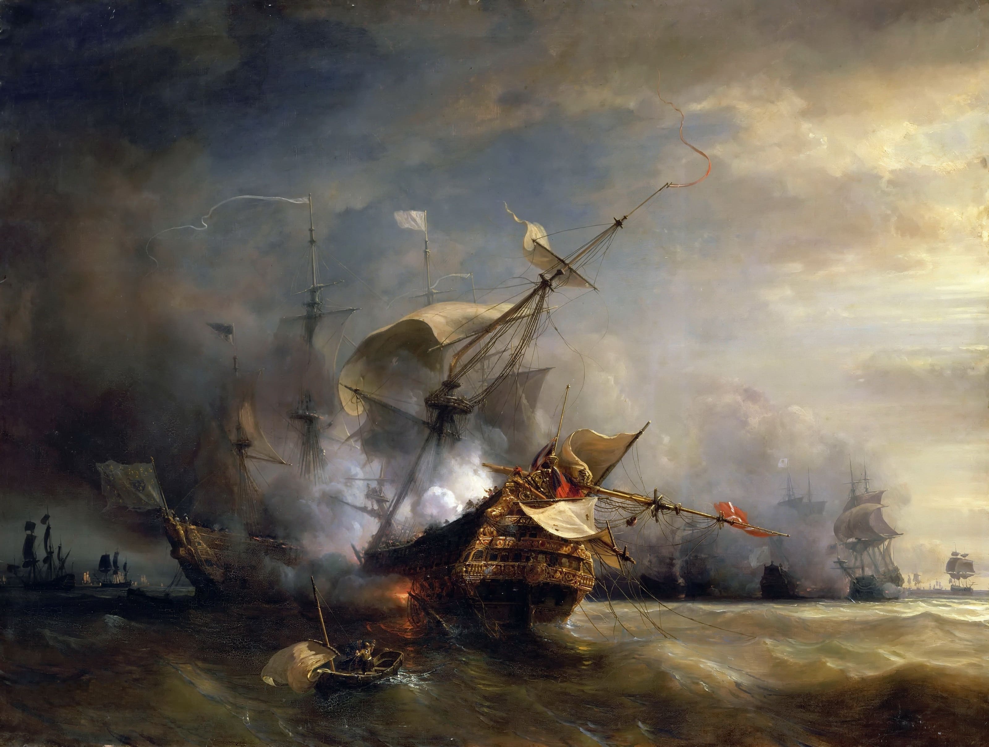
Battle at The Lizard

The naval Battle of the Lizard (French: Combat du Cap Lézard) took place on 21 October 1707 during the War of the Spanish Succession near Lizard Point...

Bugaled Breizh

MFV Bugaled Breizh is a French trawler from Loctudy, Finistère, whose sinking with all hands in 90 metres of water in the English Channel on 15 January...

Nearby Amenities

Located within 500m of 49.960988,-5.213118
Layer: 1
Lat/Long: 49.9600285/-5.2104433
Layer: 0
Lat/Long: 49.9600322/-5.2102559
Tourism: viewpoint
Lat/Long: 49.9593455/-5.2066152
Tourism: viewpoint
Lat/Long: 49.9600168/-5.2104994
Bench
Lat/Long: 49.9600625/-5.2089535
Barrier: stile
Material: stone
Source: survey;gps
Stile: stepover
Lat/Long: 49.9603909/-5.2144635
Direction: ESE-NNE
Tourism: viewpoint
Lat/Long: 49.9607646/-5.2153945
Bench
Survey Date: 2023-10-22
Lat/Long: 49.9615801/-5.2150833
Bench
Backrest: yes
Survey Date: 2023-10-22
Lat/Long: 49.9607682/-5.2152751
Bench
Survey Date: 2023-10-22
Lat/Long: 49.9599929/-5.2092478
Life Ring
Emergency: life_ring
Survey Date: 2023-10-22
Lat/Long: 49.9594185/-5.2068919
The data included in this document is from www.openstreetmap.org. The data is made available under ODbL.

Have you been to Lizard Point?

Leave your review of Lizard Point below (or comments, questions and feedback).