Rubha na Fiunarain

Coastal Feature, Headland, Point in Argyllshire

Scotland

Rubha na Fiunarain

Causeway to Island of Danna, Knapdale This is the causeway that joins the Island of Danna to the Taynish peninsula in Knapdale.
Causeway to Island of Danna, Knapdale Credit: S C Grove

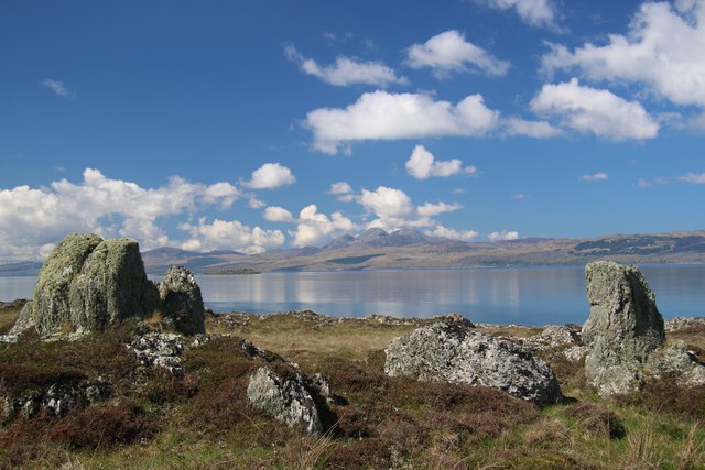
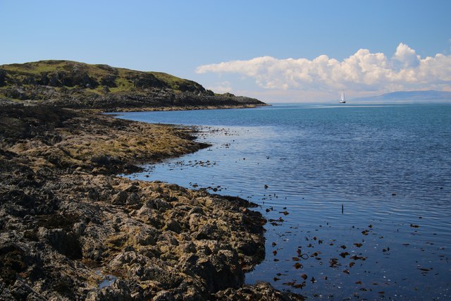
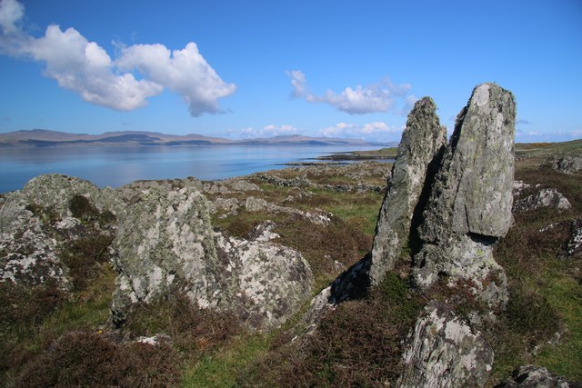
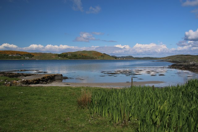
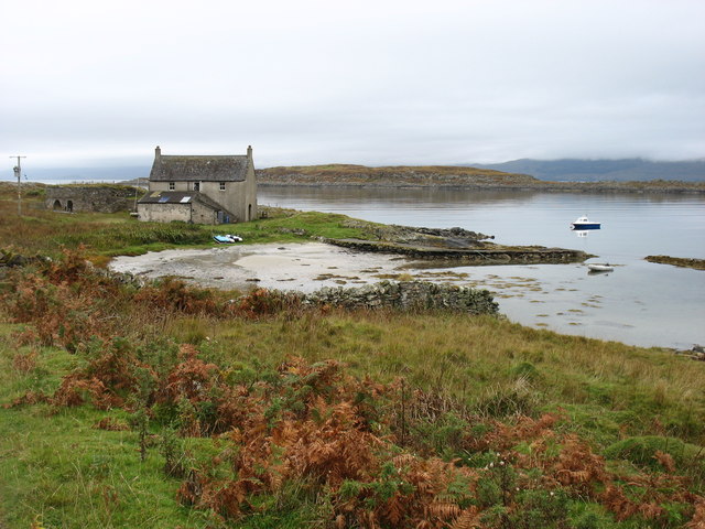
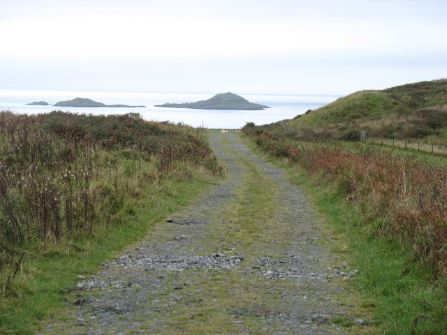
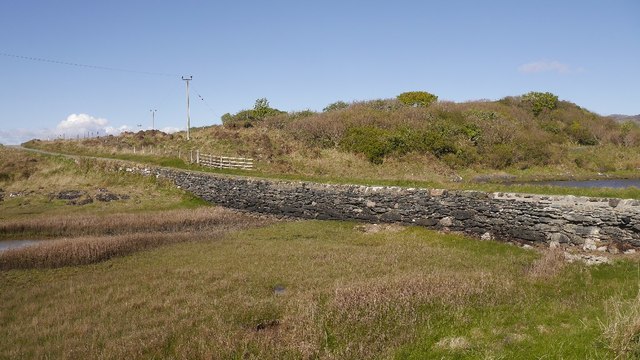
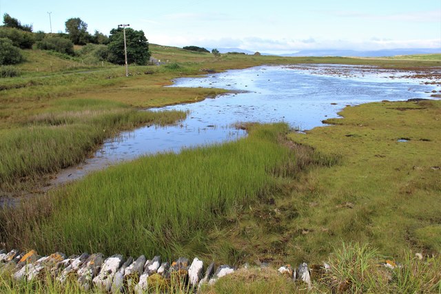
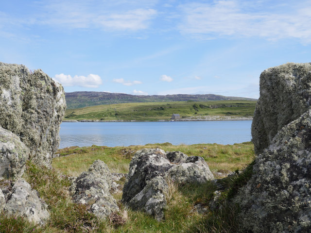
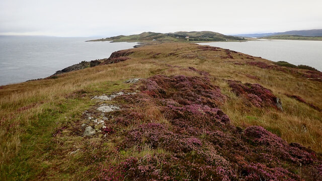
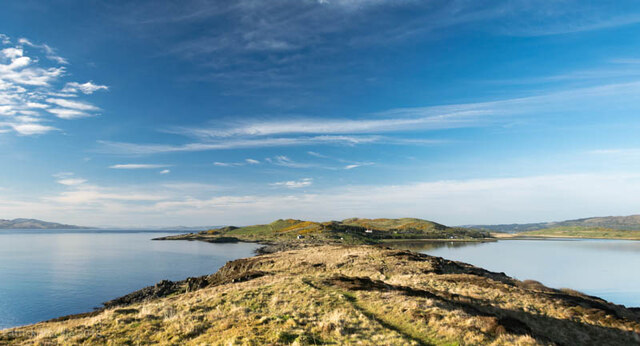
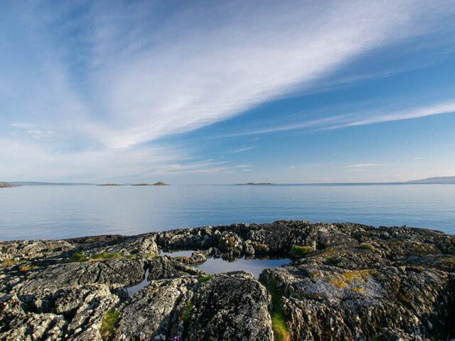
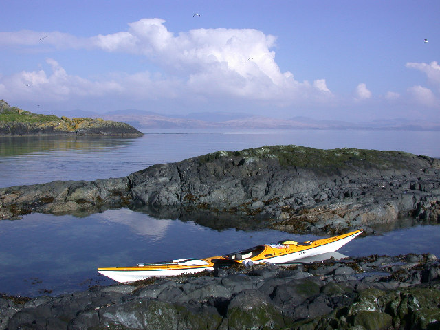
Rubha na Fiunarain is a captivating headland located in Argyllshire, Scotland. Situated along the picturesque coastal area, it is a prominent feature that stands out for its natural beauty and historical significance. This headland stretches out into the Atlantic Ocean, offering breathtaking views of the surrounding landscape.

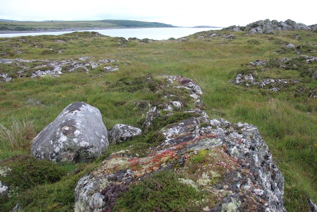
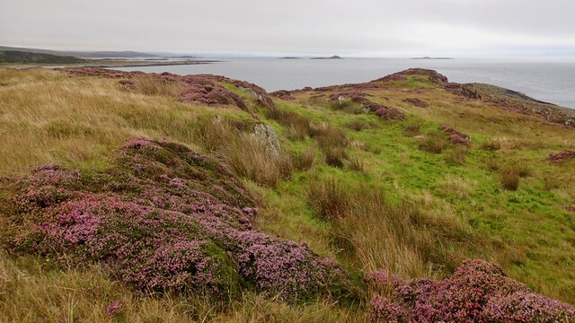
Covered in lush green vegetation, Rubha na Fiunarain boasts an abundance of plant and animal life. The headland is home to various species of seabirds, including puffins, gannets, and guillemots, making it a popular spot for birdwatching enthusiasts. The diverse flora adds to the enchanting atmosphere, with wildflowers, heather, and ferns adorning the cliffs and slopes.

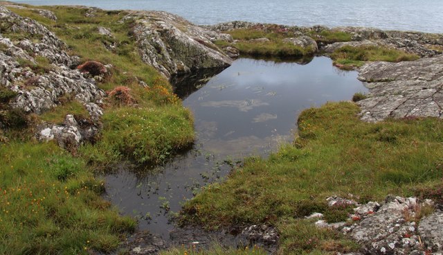
The rugged coastline of Rubha na Fiunarain showcases the power and beauty of the ocean. The crashing waves and jagged rocks create a dramatic scene that is both awe-inspiring and humbling. Adventurous visitors can explore the rocky shores and discover hidden coves and tidal pools teeming with marine life.

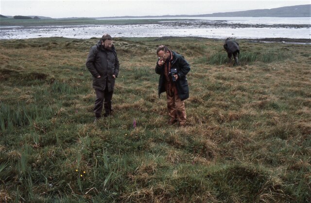
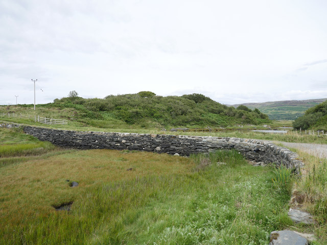
In addition to its natural splendor, Rubha na Fiunarain holds historical significance. The headland is dotted with ancient ruins and archaeological sites, including a Viking burial ground dating back to the 9th century. These remnants of the past provide a glimpse into the rich history of the area and offer a sense of connection to those who have walked these shores before.

Whether you are drawn to its stunning vistas, diverse wildlife, or historical landmarks, Rubha na Fiunarain is a captivating destination that showcases the best of Scotland's coastal beauty.

If you have any feedback on the listing, please let us know in the comments section below.

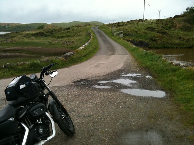
Rubha na Fiunarain Images

Images are sourced within 2km of 55.956412/-5.6920494 or Grid Reference NR6979. Thanks to Geograph Open Source API. All images are credited.

Causeway to Island of Danna, Knapdale This is the causeway that joins the Island of Danna to the Taynish peninsula in Knapdale.
Causeway to Island of Danna, Knapdale
This is the causeway that joins the Island of Danna to the Taynish peninsula in Knapdale.
Rubha na Cille The narrow promontory known as Rubha na Cille contains many unusual volcanic rock formations. Here, some halfway down the peninsula, two rocks frame the distant Paps across the Sound of Jura.
Rubha na Cille
The narrow promontory known as Rubha na Cille contains many unusual volcanic rock formations. Here, some halfway down the peninsula, two rocks frame the distant Paps across the Sound of Jura.
West coast of Rubha na Cille A still day on the Sound of Jura side of the narrow promontory.
West coast of Rubha na Cille
A still day on the Sound of Jura side of the narrow promontory.
Rock formations at Rubha na Cille The narrow promontory of Rubha na Cille is littered with many examples of these volcanic rocks.
Rock formations at Rubha na Cille
The narrow promontory of Rubha na Cille is littered with many examples of these volcanic rocks.
Port nan Gallan This peaceful view on the Island of Danna faces northwards into Loch na Cille. To the left is an old quay that has now been replaced by a more modern one a few metres to the south.
Port nan Gallan
This peaceful view on the Island of Danna faces northwards into Loch na Cille. To the left is an old quay that has now been replaced by a more modern one a few metres to the south.
Port nan Gallan, Island of Danna Across the small sea-loch Loch na Cille is the peninsula of Rubha na Cille. Jura is in the distance.
Port nan Gallan, Island of Danna
Across the small sea-loch Loch na Cille is the peninsula of Rubha na Cille. Jura is in the distance.
The main track on Danna Offshore can be seen the islands of Eilean Ghamhna (left, in <a href="https://www.geograph.org.uk/gridref/NR6875">NR6875</a>) and Corr Eilean (in <a href="https://www.geograph.org.uk/gridref/NR6775">NR6775</a>).
The main track on Danna
Offshore can be seen the islands of Eilean Ghamhna (left, in NR6875) and Corr Eilean (in NR6775).
Looking for butterflies Members of the British Butterfly Conservation Society (now called Butterfly Conservation) looking for signs of marsh fritillary butterflies in the area between the road and the shore, just north of the causeway over to the Island of Danna. 
The late Gerry Rodway (with camera) is looking at an orchid in front of him. Gerry was the curator in charge of the orchid collection at Glasgow Botanic gardens for many years.
Looking for butterflies
Members of the British Butterfly Conservation Society (now called Butterfly Conservation) looking for signs of marsh fritillary butterflies in the area between the road and the shore, just north of the causeway over to the Island of Danna. The late Gerry Rodway (with camera) is looking at an orchid in front of him. Gerry was the curator in charge of the orchid collection at Glasgow Botanic gardens for many years.
Danna causeway A short stone structure across the tidal channel which separates Danna from the Knapdale mainland.
Danna causeway
A short stone structure across the tidal channel which separates Danna from the Knapdale mainland.
Rocks on Rubha na Cille
Rock pool on Rubha na Cille
Tidal channel at Island of Danna
Loch na Cille from Rubha na Cille A view to the sea loch through the prominent rock formations on the Rubha na Cille promontory.

This photograph was taken during the Coronavirus (COVID-19) pandemic of 2020.
Loch na Cille from Rubha na Cille
A view to the sea loch through the prominent rock formations on the Rubha na Cille promontory. This photograph was taken during the Coronavirus (COVID-19) pandemic of 2020.
The causeway at the Island of Danna The stone causeway permits access to the Island of Danna (right) from the Tayvallich peninsula (left).  This image was taken at low tide.

This photograph was taken during the Coronavirus (COVID-19) pandemic of 2020.
The causeway at the Island of Danna
The stone causeway permits access to the Island of Danna (right) from the Tayvallich peninsula (left). This image was taken at low tide. This photograph was taken during the Coronavirus (COVID-19) pandemic of 2020.
Rhuba na Cille
Rhuba na Cille
Rubha na Cille
Rubha na Cille
Looking back along Rubha na Cille This narrow peninsula provides a spectacular panorama looking back towards the mainland. The Sound of Jura to the left and Loch na Cille to the right.
Looking back along Rubha na Cille
This narrow peninsula provides a spectacular panorama looking back towards the mainland. The Sound of Jura to the left and Loch na Cille to the right.
The end of Rubha na Cille Lookning down the Sound of Jura towards the MacCormac Isles.
The end of Rubha na Cille
Lookning down the Sound of Jura towards the MacCormac Isles.
Show me another place!

Rubha na Fiunarain is located at Grid Ref: NR6979 (Lat: 55.956412, Lng: -5.6920494)

Unitary Authority: Argyll and Bute

Police Authority: Argyll and West Dunbartonshire

What 3 Words

///locator.decisions.unfocused. Near Ardrishaig, Argyll & Bute

Related Wikis

Keills Chapel

Keills Chapel is a small chapel located in the west Highlands, Scotland, near the village of Tayvallich, Knapdale.The chapel dates from the 11th century...

Island of Danna

The Island of Danna or Danna (Scottish Gaelic: Danna), is an inhabited tidal island in Argyll and Bute. == Geography == It is connected to the mainland...

Loch Sween

Loch Sween (Scottish Gaelic: Loch Suain or Loch Suibhne) is a sea loch located near Lochgilphead, Argyll and Bute, Scotland. Castle Sween is located on...

Sound of Jura

The Sound of Jura (Scottish Gaelic: An Linne Rosach) is a strait in Argyll and Bute, Scotland. It is one of the several Sounds of Scotland. It is to the...

Kilmory Knap Chapel

Kilmory Knap Chapel is a 13th-century Christian chapel, located at the tiny hamlet of Kilmory, in Knapdale, Argyll and Bute, on the west coast of Scotland...

Kilmory, Knapdale

Kilmory (Scottish Gaelic: Cill Mhoire) is a hamlet in the civil parish of South Knapdale, on Knapdale, Argyll and Bute, Scotland. It is situated near the...

Eilean Mòr, MacCormaig Isles

Eilean Mòr ("Big Isle") is one of the MacCormaig Isles situated near the entrance to Loch Sween in the Sound of Jura, Argyll and Bute, Scotland. Eilean...

Taynish National Nature Reserve

Taynish National Nature Reserve (Scottish Gaelic: Tèarmann Nàdair Nàiseanta Taighnis) is situated southwest of the village of Tayvallich in the council...

Nearby Amenities

Located within 500m of 55.956412,-5.6920494
Source: PGS
Lat/Long: 55.9588231/-5.6862834
Source: PGS
Lat/Long: 55.9583438/-5.6866844
Source: PGS
Lat/Long: 55.9580426/-5.6866557
Source: PGS
Lat/Long: 55.9570059/-5.690791
Source: PGS
Lat/Long: 55.9571112/-5.6908063
Source: PGS
Lat/Long: 55.9574818/-5.6915051
Source: PGS
Lat/Long: 55.957546/-5.6916812
Source: PGS
Lat/Long: 55.9572358/-5.6920017
Source: PGS
Lat/Long: 55.9570318/-5.6922838
Source: PGS
Lat/Long: 55.9567792/-5.6923442
Source: PGS
Lat/Long: 55.955004/-5.6858077
Loch na Cille
Natural: bay
Source: OS7
Lat/Long: 55.9566439/-5.6988232
Source: PGS
Lat/Long: 55.9556711/-5.6872319
Power: pole
Lat/Long: 55.9520532/-5.693002
Power: pole
Lat/Long: 55.9526029/-5.6926721
Power: pole
Lat/Long: 55.953133/-5.6923154
Power: pole
Lat/Long: 55.9537366/-5.6921545
Power: pole
Lat/Long: 55.9545415/-5.6964782
Power: pole
Lat/Long: 55.9546842/-5.695349
Power: pole
Lat/Long: 55.9548478/-5.6942144
Power: pole
Lat/Long: 55.9546661/-5.6930798
Power: pole
Lat/Long: 55.9545175/-5.6922081
Power: pole
Lat/Long: 55.9544109/-5.6915349
Power: pole
Lat/Long: 55.9546331/-5.6909126
Power: pole
Lat/Long: 55.9548793/-5.6901643
Power: pole
Lat/Long: 55.9551474/-5.6893381
Power: pole
Lat/Long: 55.9552758/-5.6873265
Power: pole
Lat/Long: 55.9558659/-5.6870878
Power: pole
Lat/Long: 55.9563014/-5.6866345
Power: pole
Lat/Long: 55.9567669/-5.6861839
Power: pole
Lat/Long: 55.9573525/-5.685626
Power: pole
Lat/Long: 55.9579876/-5.6849957
The data included in this document is from www.openstreetmap.org. The data is made available under ODbL.

Have you been to Rubha na Fiunarain?

Leave your review of Rubha na Fiunarain below (or comments, questions and feedback).