Rubha Port a' Bhàta

Coastal Feature, Headland, Point in Inverness-shire

Scotland

Rubha Port a' Bhàta

 Alder at Kinlochmoidart/Ceann Loch Muideirt A magnificent specimen on the shores of Loch Moidart.
Alder at Kinlochmoidart/Ceann Loch Muideirt Credit: M J Richardson

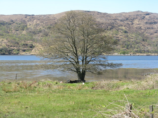
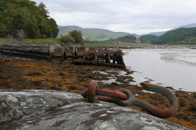
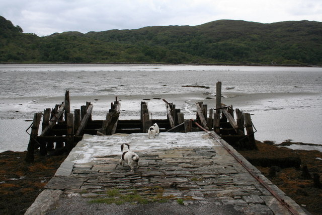
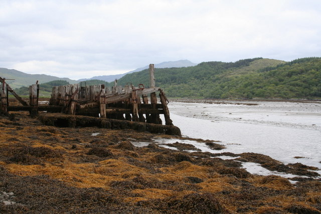
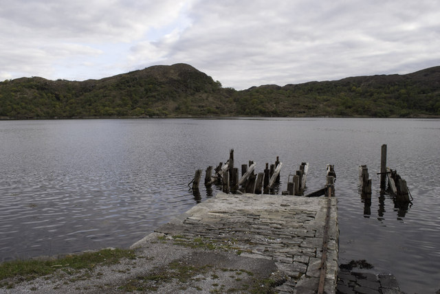
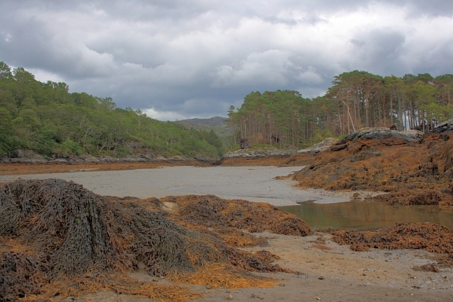
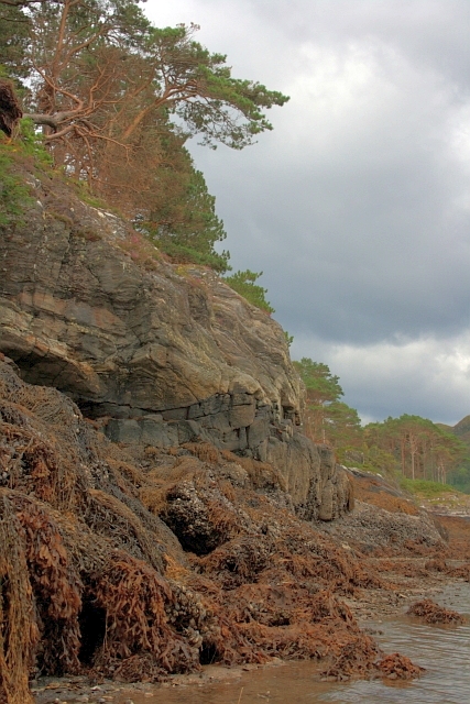
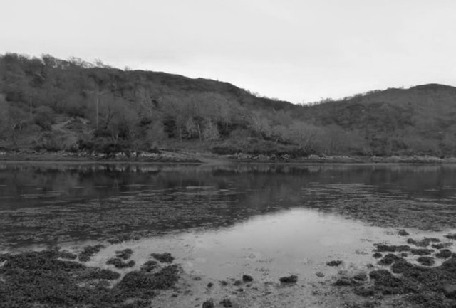
Rubha Port a' Bhàta is a striking coastal feature located in Inverness-shire, Scotland. This stunning headland, also known as the Point of the Boats, is situated on the southeastern shore of Loch Ewe, near the village of Aultbea.

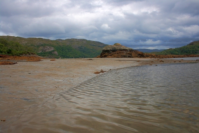
The headland is characterized by its rugged cliffs and breathtaking panoramic views of the surrounding landscape. Rising to an elevation of approximately 100 meters, Rubha Port a' Bhàta offers an excellent vantage point to admire the vast expanse of the loch and the picturesque hills that encircle it.

The cliffs of Rubha Port a' Bhàta are made up of ancient Lewisian gneiss, a type of metamorphic rock known for its durability and distinctive coloration. These cliffs provide nesting sites for a variety of seabirds, including fulmars, kittiwakes, and guillemots, making it a popular spot for birdwatching enthusiasts.

The headland is also steeped in history, with remnants of World War II bunkers and gun emplacements still visible along its cliffs. These structures serve as a reminder of the strategic importance of Loch Ewe during the war, when it served as a vital naval base for convoys heading to the Arctic.

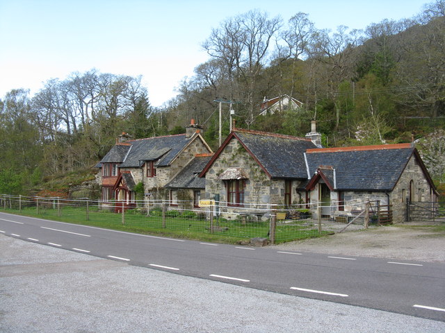
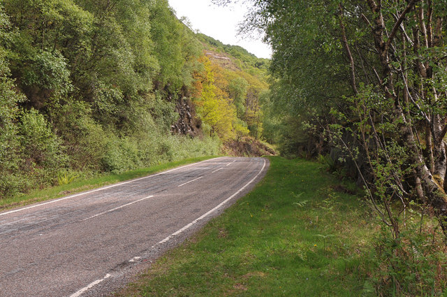
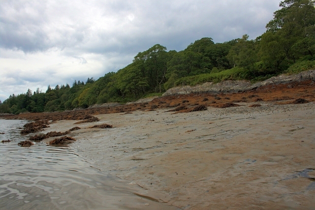
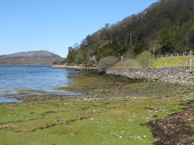
Rubha Port a' Bhàta is easily accessible, with a well-maintained footpath that leads visitors along the coastline. The headland is a popular destination for hikers and nature lovers alike, offering a tranquil escape from the hustle and bustle of daily life. Whether it's the stunning views, the diverse wildlife, or the historical significance, Rubha Port a' Bhàta is a must-visit location for anyone exploring the scenic wonders of Inverness-shire.

If you have any feedback on the listing, please let us know in the comments section below.

Rubha Port a' Bhàta Images

Images are sourced within 2km of 56.791051/-5.7962463 or Grid Reference NM6873. Thanks to Geograph Open Source API. All images are credited.

 Alder at Kinlochmoidart/Ceann Loch Muideirt A magnificent specimen on the shores of Loch Moidart.
Alder at Kinlochmoidart/Ceann Loch Muideirt
A magnificent specimen on the shores of Loch Moidart.
Houses at Kinnacarra The one by the road was originally a school.
Houses at Kinnacarra
The one by the road was originally a school.
Gated road to Shona Beag
A861 near Shona Beag
A861 at Kylesbeg
A861 at Kylesbeg
A861 and Loch Moidart
Set in stone; the old pier at Kinlochmoidart Slowly but surely the old pier returns to powder whilst the galvanised mooring hook defies the elements.
Set in stone; the old pier at Kinlochmoidart
Slowly but surely the old pier returns to powder whilst the galvanised mooring hook defies the elements.
Going, going, soon to be gone........... Slowly but surely the old pier is being digested by the elements.
Going, going, soon to be gone...........
Slowly but surely the old pier is being digested by the elements.
The old pier viewed from the east
The ubiquitous rhododendron by the loch side
Kinlochmoidart Pier (Dis-used) May 2012 Compare with the other images of the same feature for this square - slow decay
Kinlochmoidart Pier (Dis-used) May 2012
Compare with the other images of the same feature for this square - slow decay
Channel Between Shona Beag and Eilean na Gruagaig A narrow channel between two islands, Shona Beag on the left, Eilean na Gruagaig on the right. Dry at low tide.
Channel Between Shona Beag and Eilean na Gruagaig
A narrow channel between two islands, Shona Beag on the left, Eilean na Gruagaig on the right. Dry at low tide.
Shoreline of Eilean an Fheidh
Low Tide, Loch Moidart Off the coast of Shona Beag.
Low Tide, Loch Moidart
Off the coast of Shona Beag.
Low Tide, Loch Moidart Off the coast of Shona Beag.
Low Tide, Loch Moidart
Off the coast of Shona Beag.
Dorlin House in 1964 This mansion house was commandeered by the Royal Navy during the Second World War (HMS Dorlin) and was demolished some time in the later 1960s (digitalised from an original slide).
Dorlin House in 1964
This mansion house was commandeered by the Royal Navy during the Second World War (HMS Dorlin) and was demolished some time in the later 1960s (digitalised from an original slide).
Tidal ford to Shona Beag About mid tide.
Tidal ford to Shona Beag
About mid tide.
Shore at Kinlochmoidart With the remains of a pier. In the distance is Invermoidart and Eilean Shona.
Shore at Kinlochmoidart
With the remains of a pier. In the distance is Invermoidart and Eilean Shona.
Show me another place!

Rubha Port a' Bhàta is located at Grid Ref: NM6873 (Lat: 56.791051, Lng: -5.7962463)

Unitary Authority: Highland

Police Authority: Highlands and Islands

What 3 Words

///union.procured.pill. Near Arisaig, Highland

Related Wikis

Loch Moidart

Loch Moidart is a sea loch (sea inlet) in the district of Moidart in Highland, Scotland. It is on the west coast of Scotland, and runs about 8 km (5 miles...

Castle Tioram

Castle Tioram (; Scottish Gaelic: Caisteal Tioram, meaning "dry castle") is a ruined castle that sits on the tidal island Eilean Tioram in Loch Moidart...

Morar, Moidart and Ardnamurchan National Scenic Area

Morar, Moidart and Ardnamurchan is a national scenic area (NSA) covering the coastal scenery of three peninsulas in the western Highlands of Scotland...

Ardmolich

Ardmolich (Scottish Gaelic: An Àird Mholach) and Kinlochmoidart (Ceann Loch Mùideart) are settlements at the east head of Loch Moidart in the Moidart region...

Nearby Amenities

Located within 500m of 56.791051,-5.7962463
Source: PGS
Lat/Long: 56.7892451/-5.7892765
Source: PGS
Lat/Long: 56.7906659/-5.7916074
Source: PGS
Lat/Long: 56.7914014/-5.7935529
Source: PGS
Lat/Long: 56.7914007/-5.7930361
Source: PGS
Lat/Long: 56.7913502/-5.7938923
Source: PGS
Lat/Long: 56.7914488/-5.7926264
Source: PGS
Lat/Long: 56.7905715/-5.791417
Source: PGS
Lat/Long: 56.7900327/-5.7907142
Source: PGS
Lat/Long: 56.7903722/-5.7910298
Source: PGS
Lat/Long: 56.7908657/-5.7918625
Source: PGS
Lat/Long: 56.7904664/-5.791231
Source: PGS
Lat/Long: 56.7898831/-5.7906183
Source: PGS
Lat/Long: 56.7897565/-5.7904435
Source: PGS
Lat/Long: 56.7894333/-5.7895631
Source: PGS
Lat/Long: 56.7889383/-5.7891798
Source: PGS
Lat/Long: 56.7891242/-5.7891634
Source: PGS
Lat/Long: 56.7897097/-5.7903405
Source: PGS
Lat/Long: 56.7903305/-5.7909668
Source: PGS
Lat/Long: 56.7913535/-5.7923779
Source: PGS
Lat/Long: 56.7914282/-5.792538
Source: PGS
Lat/Long: 56.7914574/-5.7927181
Source: PGS
Lat/Long: 56.791236/-5.7941941
Source: PGS
Lat/Long: 56.7913906/-5.7937507
Source: PGS
Lat/Long: 56.7917904/-5.7946855
Source: PGS
Lat/Long: 56.7917178/-5.7948607
Source: PGS
Lat/Long: 56.7917028/-5.7948189
Source: PGS
Lat/Long: 56.7917109/-5.7947887
Source: PGS
Lat/Long: 56.7917877/-5.794601
Source: PGS
Lat/Long: 56.7917071/-5.7944621
Source: PGS
Lat/Long: 56.7915106/-5.7945127
Source: PGS
Lat/Long: 56.7914715/-5.7945125
Source: PGS
Lat/Long: 56.7914314/-5.7944936
Source: PGS
Lat/Long: 56.7912071/-5.7940362
Source: PGS
Lat/Long: 56.7913903/-5.7931066
Source: PGS
Lat/Long: 56.7913958/-5.7924535
Source: PGS
Lat/Long: 56.7911129/-5.7920806
Source: PGS
Lat/Long: 56.7898124/-5.7905383
Source: PGS
Lat/Long: 56.789571/-5.7898566
Source: PGS
Lat/Long: 56.7893729/-5.7894059
Source: PGS
Lat/Long: 56.7891662/-5.7891786
Source: PGS
Lat/Long: 56.7893413/-5.7893573
Source: PGS
Lat/Long: 56.7895253/-5.7897452
Source: PGS
Lat/Long: 56.7907179/-5.7916896
Source: PGS
Lat/Long: 56.7914479/-5.7928506
Source: PGS
Lat/Long: 56.7910861/-5.7940463
Source: PGS
Lat/Long: 56.7912861/-5.7939913
Source: PGS
Lat/Long: 56.7916539/-5.7944394
Source: PGS
Lat/Long: 56.7917721/-5.7947336
Source: PGS
Lat/Long: 56.7918363/-5.7952949
Source: PGS
Lat/Long: 56.7918129/-5.7953302
Source: PGS
Lat/Long: 56.7917704/-5.7953394
Source: PGS
Lat/Long: 56.7917201/-5.7953207
Source: PGS
Lat/Long: 56.7916758/-5.7952788
Source: PGS
Lat/Long: 56.7916287/-5.7951897
Source: PGS
Lat/Long: 56.7915253/-5.7948986
Source: PGS
Lat/Long: 56.7914468/-5.7947853
Source: PGS
Lat/Long: 56.7914883/-5.7948324
Source: PGS
Lat/Long: 56.7913903/-5.7947512
Source: PGS
Lat/Long: 56.7912097/-5.7947007
Source: PGS
Lat/Long: 56.7910682/-5.7946343
Source: PGS
Lat/Long: 56.7910653/-5.7948134
Source: PGS
Lat/Long: 56.7910758/-5.7948826
Source: PGS
Lat/Long: 56.7911399/-5.7950256
Source: PGS
Lat/Long: 56.7910949/-5.7949442
Source: PGS
Lat/Long: 56.7913099/-5.7952518
Source: PGS
Lat/Long: 56.7913717/-5.7953878
Power: pole
Lat/Long: 56.7946067/-5.7914901
Power: pole
Lat/Long: 56.7946669/-5.7932925
Power: pole
Lat/Long: 56.7949372/-5.7953846
Power: pole
Lat/Long: 56.7954028/-5.7979059
The data included in this document is from www.openstreetmap.org. The data is made available under ODbL.

Have you been to Rubha Port a' Bhàta?

Leave your review of Rubha Port a' Bhàta below (or comments, questions and feedback).