Gallows Green

Settlement in Worcestershire Wychavon

England

Gallows Green

Three Wells, timber framed house in Hadzor, Worcestershire
Three Wells, timber framed house in Hadzor, Worcestershire Credit: Jeff Gogarty

Gallows Green is a small village located in the county of Worcestershire, England. Situated approximately 7 miles northwest of the city of Worcester, it falls within the administrative district of Wychavon. With a population of just over 200 residents, Gallows Green is known for its picturesque countryside setting and tranquil atmosphere.

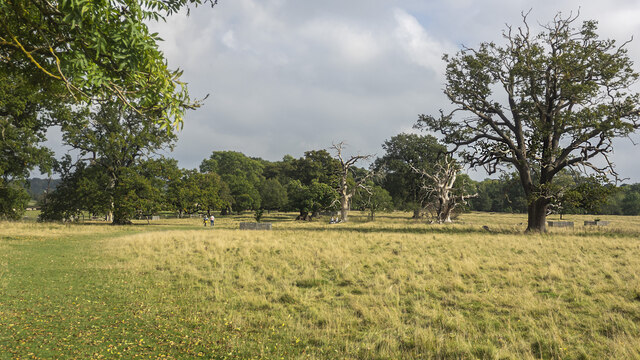
The village is surrounded by rolling hills and lush green fields, providing stunning views and a sense of rural charm. Its idyllic location makes it a popular choice for those seeking a peaceful and close-knit community.

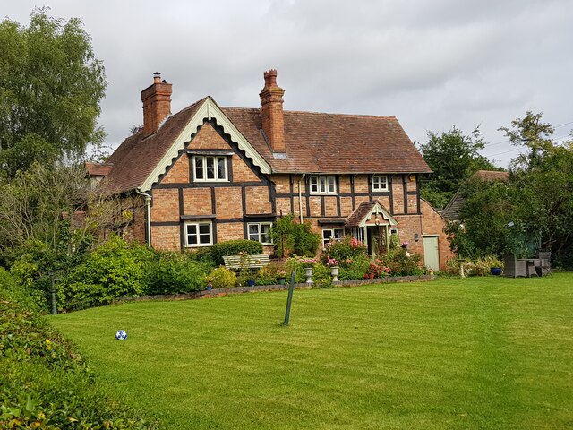
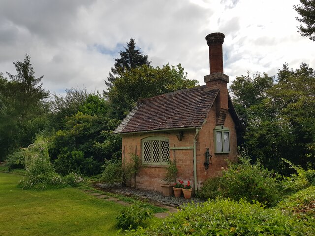
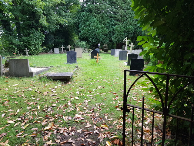
Gallows Green itself is characterized by a collection of traditional cottages and farmhouses, many of which date back several centuries. The village retains a strong sense of history and heritage, with several listed buildings and historical landmarks in the area, including the prominent St. Mary's Church.

Despite its small size, Gallows Green benefits from a range of amenities and services. These include a local pub, a village hall, and a primary school, ensuring that residents have access to essential facilities without the need to travel extensively.

The village is an excellent base for those who enjoy outdoor activities, as it is surrounded by numerous walking trails and nature reserves. The nearby Worcester Woods Country Park and the Malvern Hills Area of Outstanding Natural Beauty offer opportunities for hiking, wildlife spotting, and enjoying the scenic beauty of the region.

In summary, Gallows Green is a charming village in Worcestershire, boasting a picturesque countryside setting, a close-knit community, and a rich historical heritage.

If you have any feedback on the listing, please let us know in the comments section below.

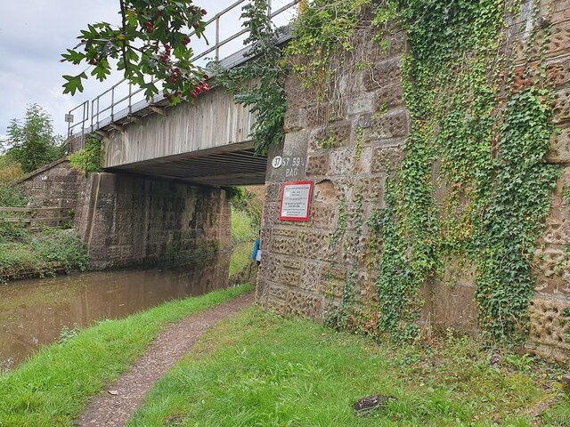
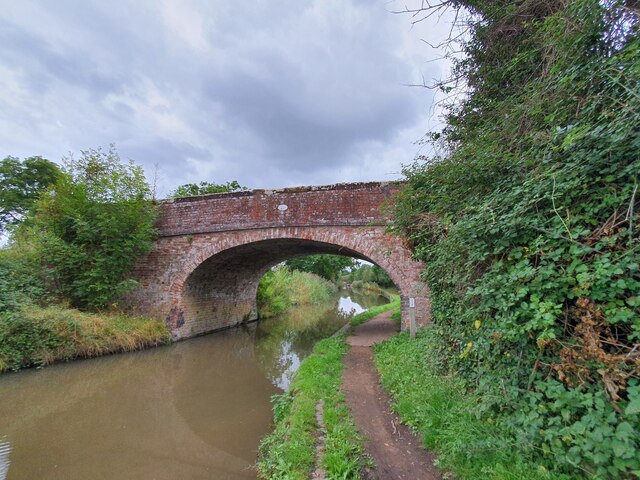
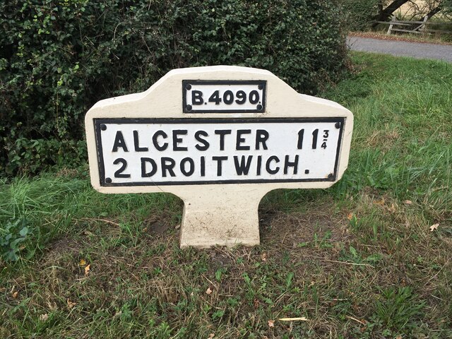
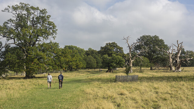
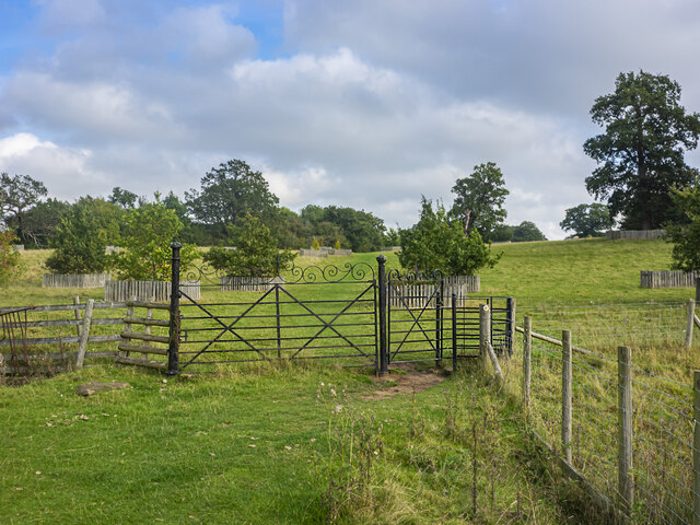
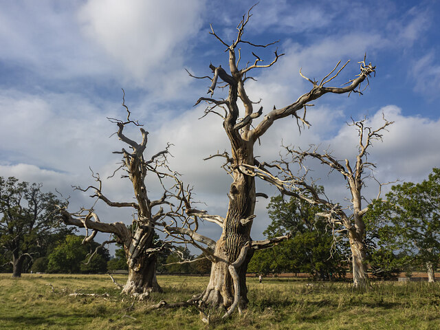
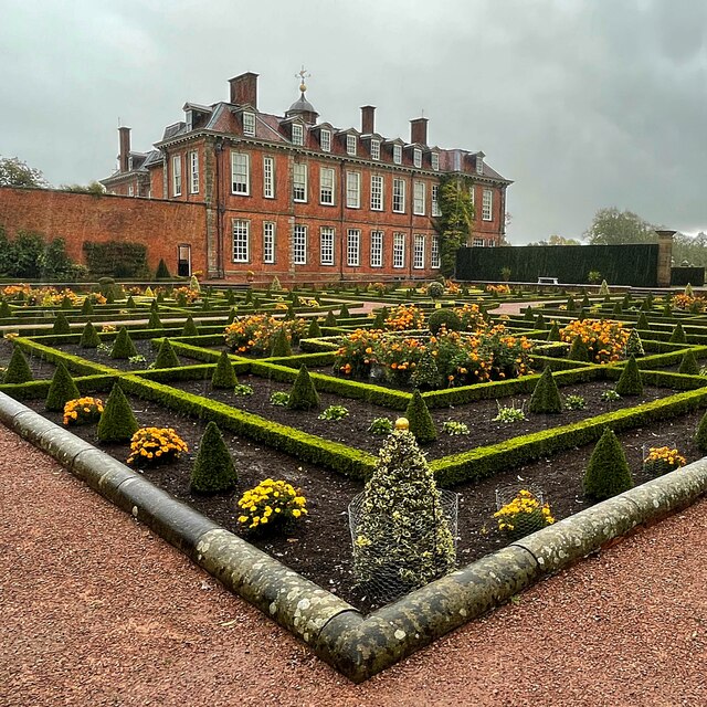
Gallows Green Images

Images are sourced within 2km of 52.262388/-2.099603 or Grid Reference SO9362. Thanks to Geograph Open Source API. All images are credited.

Three Wells, timber framed house in Hadzor, Worcestershire
The Wash House Chapel In the garden of Three Wells, Hadzor.
The Wash House Chapel
In the garden of Three Wells, Hadzor.
Small cemetery at Hadzor
Ordnance Survey Bench Mark This mark is located on railway bridge number 37 that spans the Worcester to Birmingham canal. These marks were used by Ordnance Survey for mapping purposes.
<a href="https://www.geograph.org.uk/photo/6961993">SO9263 : Bridge 37, Worcester to Birmingham canal</a>
Ordnance Survey Bench Mark
This mark is located on railway bridge number 37 that spans the Worcester to Birmingham canal. These marks were used by Ordnance Survey for mapping purposes. SO9263 : Bridge 37, Worcester to Birmingham canal
Bridge 37, Worcester to Birmingham canal This railway bridge spans the Worcester to Birmingham canal. This bridge also has an Ordnance Survey bench mark.
<a href="https://www.geograph.org.uk/photo/6961985">SO9263 : Ordnance Survey Bench Mark</a>
Bridge 37, Worcester to Birmingham canal
This railway bridge spans the Worcester to Birmingham canal. This bridge also has an Ordnance Survey bench mark. SO9263 : Ordnance Survey Bench Mark
Bridge 38 Worcester to Birmingham Canal This bridge spans the Worcester to Birmingham canal. The bridge also has an Ordnance Survey bench mark.
<a href="https://www.geograph.org.uk/photo/6962010">SO9363 : Ordnance Survey Bench Mark</a>
Bridge 38 Worcester to Birmingham Canal
This bridge spans the Worcester to Birmingham canal. The bridge also has an Ordnance Survey bench mark. SO9363 : Ordnance Survey Bench Mark
Ordnance Survey Bench Mark This mark is located on bridge number 38 which spans the Worcester to Birmingham canal. These marks were used by Ordnance Survey for mapping purposes.
<a href="https://www.geograph.org.uk/photo/6962006">SO9363 : Bridge 38 Worcester to Birmingham Canal</a>
Ordnance Survey Bench Mark
This mark is located on bridge number 38 which spans the Worcester to Birmingham canal. These marks were used by Ordnance Survey for mapping purposes. SO9363 : Bridge 38 Worcester to Birmingham Canal
Replacement Milestone, B4090, Salt Way, 20m West of Junction with Goosehill Lane The milestone is located on the verge by drive to farm on the north side of road. Parish of Hanbury (Wychavon District). Metal plate attached to concrete post, Bradley post design, erected by the County Council in the 21st century. Replacement milestone produced by the Milestone Society Worcestershire group in 2008.

Inscription reads:-
B4090 / ALCESTER 11¾ / 2 DROITWICH. / C.C.W.

Milestone Society National ID: WO_DWAC02R
Replacement Milestone, B4090, Salt Way, 20m West of Junction with Goosehill Lane
The milestone is located on the verge by drive to farm on the north side of road. Parish of Hanbury (Wychavon District). Metal plate attached to concrete post, Bradley post design, erected by the County Council in the 21st century. Replacement milestone produced by the Milestone Society Worcestershire group in 2008. Inscription reads:- B4090 / ALCESTER 11¾ / 2 DROITWICH. / C.C.W. Milestone Society National ID: WO_DWAC02R
NT Hanbury Hall View across the autumnal formal garden towards the South-west facade.
NT Hanbury Hall
View across the autumnal formal garden towards the South-west facade.
Still Life at Hanbury An autumnal display near the entrance to Hanbury Hall.
Still Life at Hanbury
An autumnal display near the entrance to Hanbury Hall.
Dahlia display Within the walled garden at Hanbury Hall.
Dahlia display
Within the walled garden at Hanbury Hall.
A walk in the park A fine autumn afternoon at NT Hanbury Hall.
A walk in the park
A fine autumn afternoon at NT Hanbury Hall.
Hanbury Hall parkland A fine walk around the park at NT Hanbury Hall.
Hanbury Hall parkland
A fine walk around the park at NT Hanbury Hall.
Hanbury Hall parkland There are several dead skeletal oaks within the estate.
Hanbury Hall parkland
There are several dead skeletal oaks within the estate.
Gate on the estate A fine piece of ironwork on a public path through the NT Hanbury Hall estate.
Gate on the estate
A fine piece of ironwork on a public path through the NT Hanbury Hall estate.
Skeletal oaks at Hanbury There are several dead skeletal oaks within the estate.
Skeletal oaks at Hanbury
There are several dead skeletal oaks within the estate.
The parterre garden at Hanbury Hall A recreation of the garden designed by George London in 1705.
The parterre garden at Hanbury Hall
A recreation of the garden designed by George London in 1705.
Hanbury Hall National Trust property in Worcestershire built in 1701.
Hanbury Hall
National Trust property in Worcestershire built in 1701.
Show me another place!

Gallows Green is located at Grid Ref: SO9362 (Lat: 52.262388, Lng: -2.099603)

Administrative County: Worcestershire

District: Wychavon

Police Authority: West Mercia

What 3 Words

///shield.foreheads.cheered. Near Wychbold, Worcestershire

Related Wikis

Droitwich Road railway station

Droitwich Road railway station served the town of Droitwich Spa, Worcestershire, England, from 1840 to 1855 on the Birmingham and Gloucester Railway....
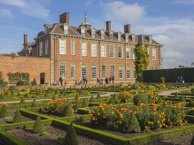
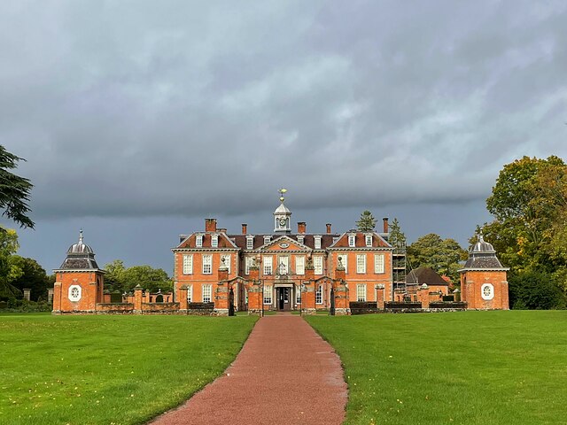
Hanbury Hall

Hanbury Hall is a large 18th-century stately home standing in parkland at Hanbury, Worcestershire. The main range has two storeys and is built of red brick...

Mere Green, Worcestershire

Mere Green is a hamlet in the English county of Worcestershire. It is located south of the village of Hanbury roughly midway between Worcester and Redditch...

Hadzor

Hadzor is a small village near Droitwich, Worcestershire, England. There are around fourteen houses and a Roman Catholic church in the village, although...

Chateau Impney

Chateau Impney Hotel & Exhibition Centre is a Grade II* listed 19th-century house built in the style of an elaborate French château near Droitwich Spa...

St Mary the Virgin, Hanbury

The church of St Mary the Virgin is an Anglican parish church in the village of Hanbury, Worcestershire. Its earliest parts date from about 1210 and it...

Dodderhill

Dodderhill is a civil parish, near Droitwich, Worcestershire, England, located on the River Salwarpe. The parish is bisected by the M5 motorway, constructed...

Dunhampstead

Dunhampstead is a small village in the English county of Worcestershire. It is located about 6 miles to the north-east of Worcester and around half a...

Nearby Amenities

Located within 500m of 52.262388,-2.099603
Bus Stop
Cross-in-Hand
Bus: yes
Naptan AtcoCode: 2000G323310
Naptan Bearing: SE
Naptan BusStopType: CUS
Naptan CommonName: Cross-in-Hand
Naptan Indicator: adj
Naptan Landmark: School Lane
Naptan NaptanCode: wocgmagj
Naptan Street: Saltway
Naptan Verified: no
Public Transport: platform
Source: naptan_import
Lat/Long: 52.2621715/-2.0928367
Bus Stop
B4090- School Rd Junction
Bus: yes
Naptan AtcoCode: 2000G662002
Naptan Bearing: NW
Naptan BusStopType: CUS
Naptan CommonName: B4090- School Rd Junction
Naptan Indicator: Adj
Naptan Landmark: School Lane
Naptan NaptanCode: wocdpjtw
Naptan Street: Saltway
Naptan Verified: no
Public Transport: platform
Source: naptan_import
Lat/Long: 52.2620633/-2.0931881
Gallows Green
Place: hamlet
Source: NPE
Lat/Long: 52.2623468/-2.1019243
Power: pole
Lat/Long: 52.2612446/-2.1053977
Huntingdrop Farm Cottage
Location Transition: yes
Power: pole
Transformer: distribution
Voltage Primary: 11000
Lat/Long: 52.2611695/-2.106579
Huntingdrop Common
Place: locality
Source: bing;OS OpenData StreetView
Lat/Long: 52.2589566/-2.1027217
Power: pole
Lat/Long: 52.2653439/-2.1035264
Power: pole
Lat/Long: 52.2643524/-2.1036458
Network Rail Gallows Green
Power: pole
Transformer: distribution
Voltage Primary: 11000
Lat/Long: 52.2633798/-2.1037766
Power: pole
Lat/Long: 52.2628963/-2.1041434
Power: pole
Lat/Long: 52.26222/-2.1046758
Power: pole
Lat/Long: 52.261544/-2.1052008
Parking
Parking: layby
Source: bing
Lat/Long: 52.2626107/-2.0956394
Power: pole
Lat/Long: 52.2639133/-2.1025327
Power: pole
Lat/Long: 52.2634873/-2.1013954
Power: pole
Lat/Long: 52.2633937/-2.1001335
Power: pole
Lat/Long: 52.2631622/-2.0960726
Power: pole
Lat/Long: 52.2631926/-2.0973245
Power: pole
Lat/Long: 52.2631261/-2.097529
Gallows Green
Power: pole
Transformer: distribution
Voltage Primary: 11000
Lat/Long: 52.2632172/-2.098213
Power: pole
Lat/Long: 52.2631824/-2.0949172
Power: pole
Lat/Long: 52.2633104/-2.0936834
Cross In Hand
Power: pole
Transformer: distribution
Voltage Primary: 11000
Lat/Long: 52.2634083/-2.0927715
The data included in this document is from www.openstreetmap.org. The data is made available under ODbL.

Have you been to Gallows Green?

Leave your review of Gallows Green below (or comments, questions and feedback).