Rubha na h-Oitire

Coastal Feature, Headland, Point in Argyllshire

Scotland

Rubha na h-Oitire

Fence, Druimbuidhe There is a lot of damage here from a fire in the previous Spring. This was particularly serious as Druimbuidhe is inhabited.
Fence, Druimbuidhe Credit: Richard Webb

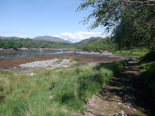
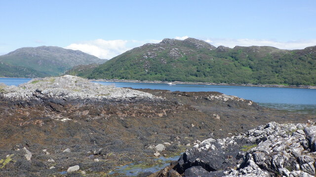
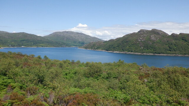
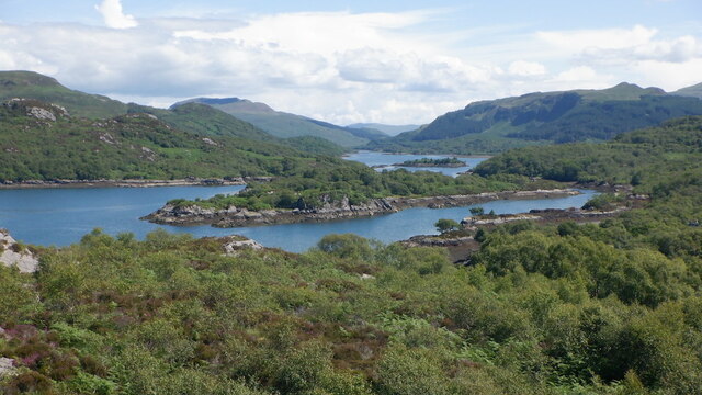
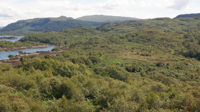
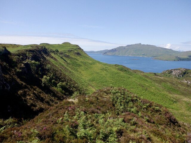
Rubha na h-Oitire, also known as Otter Head, is a prominent headland located in Argyllshire on the west coast of Scotland. This coastal feature stretches out into the Atlantic Ocean, offering breathtaking views of the surrounding landscape.

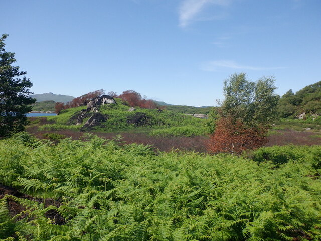
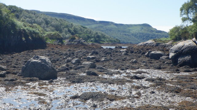
Standing tall at an elevation of approximately 100 meters, Rubha na h-Oitire boasts rugged cliffs that have been shaped by centuries of erosion from the relentless waves. The headland is characterized by its rocky terrain, which includes exposed bedrock and boulders scattered along the shoreline.

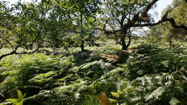
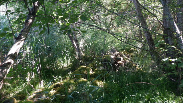
The area surrounding Otter Head is rich in biodiversity, making it a haven for wildlife enthusiasts. The headland is particularly renowned for its otter population, which can often be spotted playing and hunting in the nearby waters. Seabirds, such as gannets, puffins, and guillemots, also frequent the area, adding to the vibrant ecosystem.

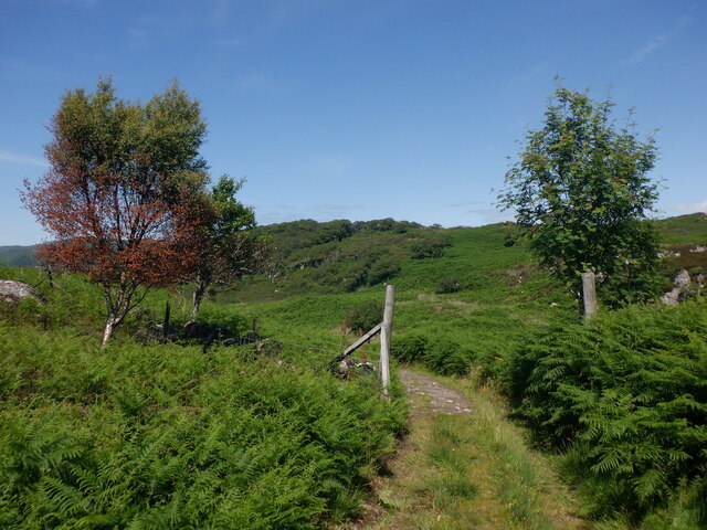
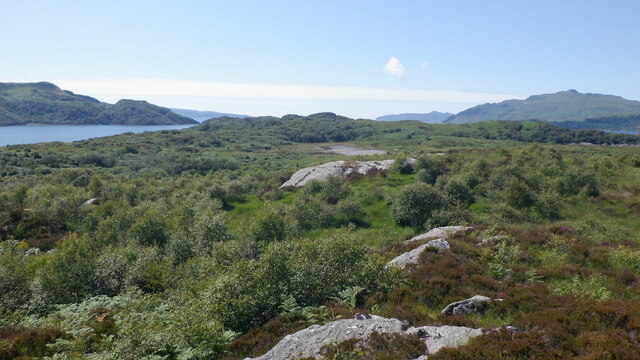
Visitors to Rubha na h-Oitire can enjoy various recreational activities, including hiking along the headland's coastal paths. The trails offer stunning panoramic views of the ocean, nearby islands, and the Argyllshire coastline. The headland is also a popular spot for birdwatching and photography, as it provides a unique vantage point to observe the diverse avian species.

In addition to its natural beauty, Rubha na h-Oitire holds historical significance. The headland is home to ancient ruins, including the remains of a medieval fort, which stands as a testament to the area's rich cultural heritage.

Overall, Rubha na h-Oitire is a picturesque and ecologically diverse headland, offering visitors a chance to experience the raw beauty of the Scottish coast.

If you have any feedback on the listing, please let us know in the comments section below.

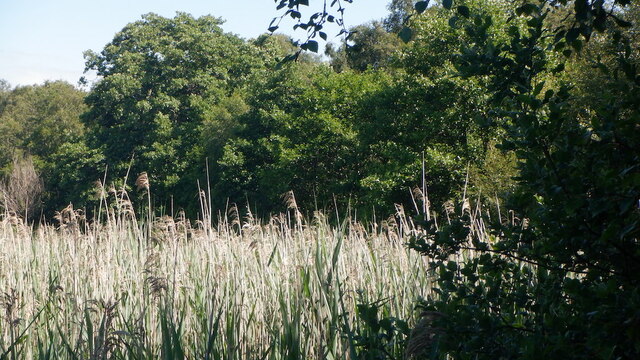
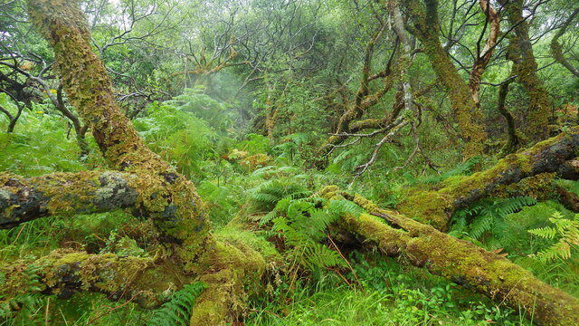
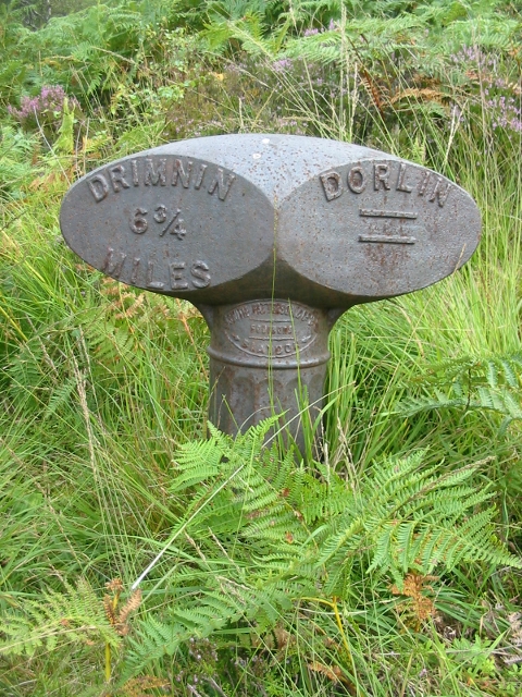
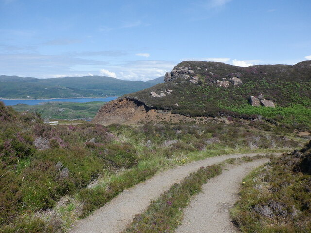
Rubha na h-Oitire Images

Images are sourced within 2km of 56.653424/-5.9203415 or Grid Reference NM5958. Thanks to Geograph Open Source API. All images are credited.

Fence, Druimbuidhe There is a lot of damage here from a fire in the previous Spring. This was particularly serious as Druimbuidhe is inhabited.
Fence, Druimbuidhe
There is a lot of damage here from a fire in the previous Spring. This was particularly serious as Druimbuidhe is inhabited.
Fire damage, Druimbuidhe
Road to Doirlinn The road is much rougher east of inhabited Druimbuidhe. The scenery remains awesome.
Road to Doirlinn
The road is much rougher east of inhabited Druimbuidhe. The scenery remains awesome.
Tyre swing, Doirlinn Long unused and covered in lichen. There is always something poignant about old children's swings and tree houses.
Tyre swing, Doirlinn
Long unused and covered in lichen. There is always something poignant about old children's swings and tree houses.
Crossing to Oronsay As the name suggests Oronsay is a tidal island and the short strait at Doirlinn dries around low tide.
Crossing to Oronsay
As the name suggests Oronsay is a tidal island and the short strait at Doirlinn dries around low tide.
Sailean Bàn The strait between Morvern and the tidal island of Oronsay at low water.
Sailean Bàn
The strait between Morvern and the tidal island of Oronsay at low water.
Birch wood, Oronsay This would be familiar to anyone who has done battle with the birch woods of Arctic Norway. Oronsay is covered in stunted birches which can make the going arduous.

Advice to anyone lost in the woods of Oronsay: stand up.
Birch wood, Oronsay
This would be familiar to anyone who has done battle with the birch woods of Arctic Norway. Oronsay is covered in stunted birches which can make the going arduous. Advice to anyone lost in the woods of Oronsay: stand up.
Oronsay birk woods This would be familiar to anyone who has done battle with the birch woods of Arctic Norway. Oronsay is covered in stunted birches which can make the going arduous.

Advice to anyone lost in the woods of Oronsay: stand up.
Oronsay birk woods
This would be familiar to anyone who has done battle with the birch woods of Arctic Norway. Oronsay is covered in stunted birches which can make the going arduous. Advice to anyone lost in the woods of Oronsay: stand up.
Summit area, Torr a Choilich A small hill on rough, wooded (with tiny trees) Oronsay.
Summit area, Torr a Choilich
A small hill on rough, wooded (with tiny trees) Oronsay.
Eilean nan Eildean A small island in Loch Sunart with the larger Carna  behind it. View from Oronsay.
Eilean nan Eildean
A small island in Loch Sunart with the larger Carna behind it. View from Oronsay.
Woodland, Doirlinn Scrub birch and willow on Morvern, seen from Oronsay which was visited by walking across at low water.
Woodland, Doirlinn
Scrub birch and willow on Morvern, seen from Oronsay which was visited by walking across at low water.
Ruin, Oronsay Near the drying strait by Doirlinn.
Ruin, Oronsay
Near the drying strait by Doirlinn.
Woodland and marsh, Druimbuidhe The wall has a reedbed on one side and woodland on the other.
Woodland and marsh, Druimbuidhe
The wall has a reedbed on one side and woodland on the other.
Reedbed, Druimbuidhe
Eilean nan Eildean Loch Sunart This tiny uninhabited Scottish island is thick with moss-clad trees, bracken and tangled undergrowth.
Eilean nan Eildean Loch Sunart
This tiny uninhabited Scottish island is thick with moss-clad trees, bracken and tangled undergrowth.
Old Milepost by track in Dorlin, Morvern parish Blaydon casting by the track, in parish of Morvern (Lochaber District), Dorlin, on footpath to old ferry, just above shoreline.

Inscription reads:-
: DRIMNIN / 6¾ / MILES : : DORLIN / = :
Maker:-
: SMITH PATTERSON / FOUNDERS / BLAYDON : 

HES Category C listed.
Reference: LB52597 <span class="nowrap"><a title="http://portal.historicenvironment.scot/designation/LB52597" rel="nofollow ugc noopener" href="http://portal.historicenvironment.scot/designation/LB52597">Link</a><img style="margin-left:2px;" alt="External link" title="External link - shift click to open in new window" src="https://s1.geograph.org.uk/img/external.png" width="10" height="10"/></span>

Surveyed

Milestone Society National ID: HI_DRDO07
Old Milepost by track in Dorlin, Morvern parish
Blaydon casting by the track, in parish of Morvern (Lochaber District), Dorlin, on footpath to old ferry, just above shoreline. Inscription reads:- : DRIMNIN / 6¾ / MILES : : DORLIN / = : Maker:- : SMITH PATTERSON / FOUNDERS / BLAYDON : HES Category C listed. Reference: LB52597 LinkExternal link Surveyed Milestone Society National ID: HI_DRDO07
Road above Sornagan The road to Druimbuidhe at the point where it starts a long descent to Loch Sunart.
Road above Sornagan
The road to Druimbuidhe at the point where it starts a long descent to Loch Sunart.
Scarp above Sornagan The edge of the basalt plateau in western Morvern.
Scarp above Sornagan
The edge of the basalt plateau in western Morvern.
Show me another place!

Rubha na h-Oitire is located at Grid Ref: NM5958 (Lat: 56.653424, Lng: -5.9203415)

Unitary Authority: Highland

Police Authority: Highlands and Islands

What 3 Words

///evolution.broker.various. Near Drimnin, Highland

Related Wikis

Oronsay, Loch Sunart

Oronsay is an uninhabited island in Loch Sunart, Scotland. It is low-lying, barren and rocky, deeply indented with sea lochs.The island encloses Loch Drumbuie...

Barr River, Morvern

Barr River is a short watercourse in Morvern in the Scottish Highlands. Its principal tributaries are the Allt Ghleann Sleibhtecoire and the Allt na Lice...

Càrna

Carna or Càrna is an island in Loch Sunart, an arm of the sea, close to the Ardnamurchan peninsula, on the west coast of Scotland. == Geography == Carna...

Glenborrodale Bay

Glenborrodale Bay is a remote tidal, 200° orientated, coastal embayment, located on the southern coastline of the west to east orientated Ardnamurchan...

Nearby Amenities

Located within 500m of 56.653424,-5.9203415
Source: PGS
Lat/Long: 56.652196/-5.9179819
Ford: yes
Lat/Long: 56.6520827/-5.9173761
Ford: yes
Lat/Long: 56.6531727/-5.9149776
Druimbuidhe
Place: locality
Lat/Long: 56.6520125/-5.9143326
The data included in this document is from www.openstreetmap.org. The data is made available under ODbL.

Have you been to Rubha na h-Oitire?

Leave your review of Rubha na h-Oitire below (or comments, questions and feedback).