Aird an Eisg

Coastal Feature, Headland, Point in Ross-shire

Scotland

Aird an Eisg

Looking North West across Lochan
Looking North West across Lochan Credit: Mike Dunn

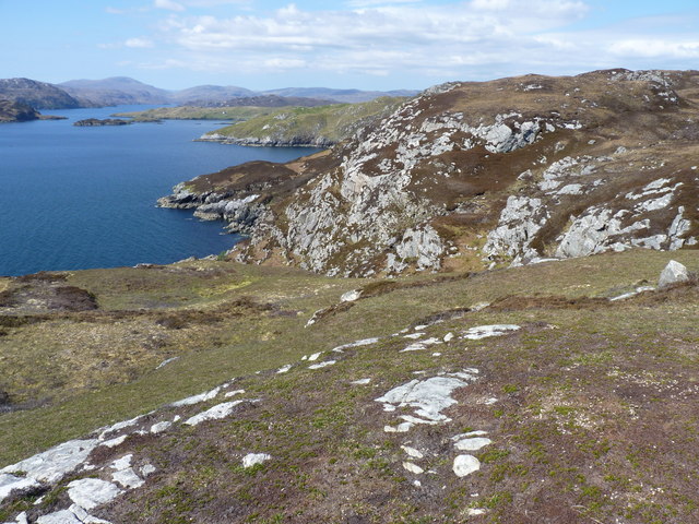
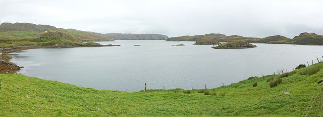
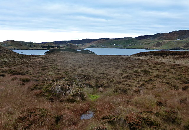
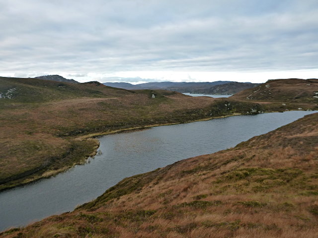
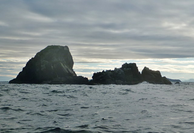
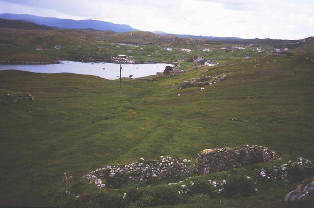
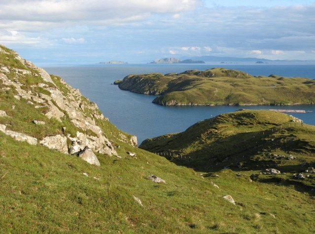
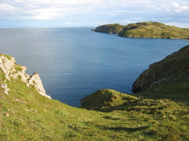
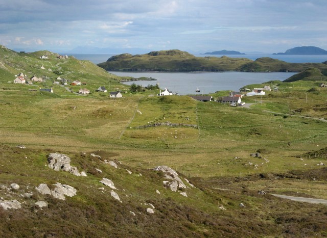
Aird an Eisg is a prominent headland located in Ross-shire, a county in the Scottish Highlands. Situated on the picturesque coastline, this coastal feature is renowned for its stunning natural beauty and unique geological formations.

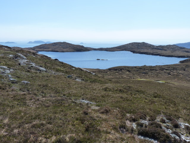
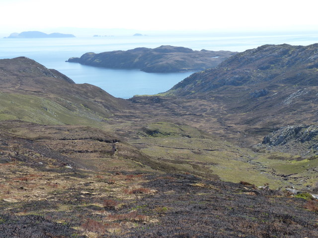
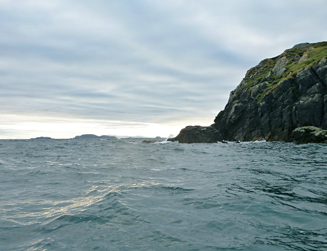
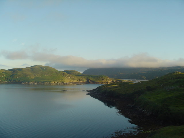
With its name translating to "Point of the Fish," Aird an Eisg offers breathtaking panoramic views of the North Sea and the surrounding rugged landscape. The headland is characterized by its towering cliffs, which have been eroded over centuries by the relentless power of the ocean waves. These cliffs provide a nesting site for various seabird species, including puffins, guillemots, and razorbills, making it a popular spot for birdwatchers and nature enthusiasts.

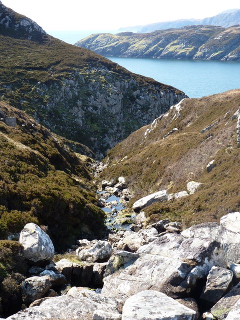
The rocky shoreline of Aird an Eisg is punctuated by caves and arches, created by the constant erosive action of the sea. These natural formations add an element of intrigue and fascination to the area, attracting visitors who are captivated by the raw power of nature. The headland is also home to a diverse range of marine life, with seals and dolphins often seen frolicking in the surrounding waters.

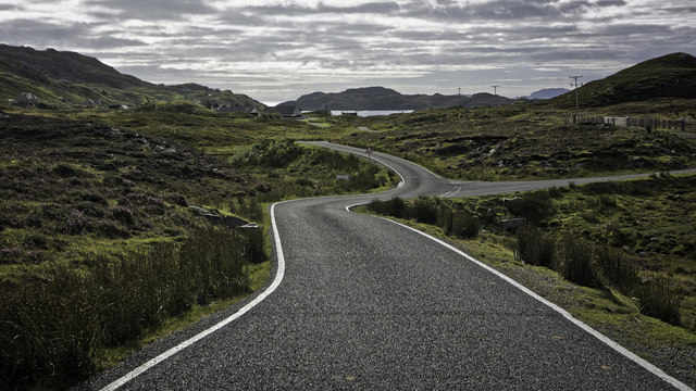
Access to Aird an Eisg is relatively easy, with a well-maintained footpath leading to the headland. Visitors can enjoy leisurely walks along the cliff tops, taking in the breathtaking views and immersing themselves in the tranquility of this remote coastal gem. Whether it's for birdwatching, photography, or simply appreciating the awe-inspiring beauty of nature, Aird an Eisg offers a captivating experience for all who venture to its shores.

If you have any feedback on the listing, please let us know in the comments section below.

Aird an Eisg Images

Images are sourced within 2km of 58.011657/-6.4309217 or Grid Reference NB3811. Thanks to Geograph Open Source API. All images are credited.

Looking North West across Lochan
The shoreline looking west into Loch Sealg
Looking down a gully towards Eilean Liubhaird
Moorland with Lochan Tobhta Ruairidh Dhuibh
Looking down Gleann Ceann Eastail with Eilean Liubhaird beyond
Caolas a Tuath A panoramic view down the length of the channel.
Caolas a Tuath
A panoramic view down the length of the channel.
Eilean Liubhaird Eilean Liubhaird is a small island south of Lemreway - the village in the background of this view.
Eilean Liubhaird
Eilean Liubhaird is a small island south of Lemreway - the village in the background of this view.
Leac Reidh This is the eastern extremity of Eilean Liubhaird.
Leac Reidh
This is the eastern extremity of Eilean Liubhaird.
Loch na Buaile This is the largest body of fresh water on Eilean Liubhaird.
Loch na Buaile
This is the largest body of fresh water on Eilean Liubhaird.
Stac a' Bhàigh A small rocky islet just off Eilean Liubhaird.
Stac a' Bhàigh
A small rocky islet just off Eilean Liubhaird.
B8060 nearing Leumrabhagh
Leumrabhagh Crofting/fishing community in Pairc. ruin of old house in foreground. The crofters here are currently pusueing a buyout of the land they work.
Leumrabhagh
Crofting/fishing community in Pairc. ruin of old house in foreground. The crofters here are currently pusueing a buyout of the land they work.
Leumrabhagh A pretty port in a sheltered inlet of Loch Sealg.
Leumrabhagh
A pretty port in a sheltered inlet of Loch Sealg.
Lemreway Island - Eilean Iubhaird A stunning view from the road end at Aird a' Chaolais looking across the sea loch to Eilean Iubhaird
Lemreway Island - Eilean Iubhaird
A stunning view from the road end at Aird a' Chaolais looking across the sea loch to Eilean Iubhaird
Evening near Leumrabhagh View from a small hill to the east of the village of Leumrabhagh.  A fish farm can be seen just in front of Eilean Liubhaird, and in the far distance the cliffs of the Shiant Islands catch the evening sun.
Evening near Leumrabhagh
View from a small hill to the east of the village of Leumrabhagh. A fish farm can be seen just in front of Eilean Liubhaird, and in the far distance the cliffs of the Shiant Islands catch the evening sun.
Northern Marsh Orchid (Dactylorhiza purpurella) Northern Marsh Orchids are commonly found in the Outer Hebrides, where the wet peaty conditions suit it.
Northern Marsh Orchid (Dactylorhiza purpurella)
Northern Marsh Orchids are commonly found in the Outer Hebrides, where the wet peaty conditions suit it.
Looking down Gleann Chinn Eastall This glen, on croft land to the east of Leumrabhagh, descends very steeply to the sea.
Looking down Gleann Chinn Eastall
This glen, on croft land to the east of Leumrabhagh, descends very steeply to the sea.
Near Leumrabhagh Looking towards the village of Leumrabhagh from a vantage point to the north of the village.
Near Leumrabhagh
Looking towards the village of Leumrabhagh from a vantage point to the north of the village.
Show me another place!

Aird an Eisg is located at Grid Ref: NB3811 (Lat: 58.011657, Lng: -6.4309217)

Unitary Authority: Na h-Eileanan an Iar

Police Authority: Highlands and Islands

What 3 Words

///kite.immediate.palaces. Near Leurbost, Na h-Eileanan Siar

Nearby Locations

Tòb Lemreway Aird an Eisg

Related Wikis

Eilean Liubhaird

Eilean Liubhaird or Eilean Iubhard is an island in the Outer Hebrides, to the east of Lewis. == Geography and geology == The rock is "gneiss bedrock with...

Orinsay

Orinsay (Scottish Gaelic: Orasaigh) is a crofting village on the Isle of Lewis in the district of Pairc, in the Outer Hebrides, Scotland. The settlement...

Stiomrabhaig

Stiomrabhaig is an abandoned crofter's village on the Isle of Lewis in the Outer Hebrides. == History == The United Kingdom Census 1851 shows that the...

Gravir

Gravir (Scottish Gaelic: Grabhair), is a village on the shore of Loch Odhairn (a sea loch) in the Park district of the Isle of Lewis. Gravir is within...

Nearby Amenities

Located within 500m of 58.011657,-6.4309217
Created By: dmgroom_coastlines
Lat/Long: 58.01344/-6.4323
Passing Place
Lat/Long: 58.0147084/-6.4318208
Passing Place
Lat/Long: 58.0159023/-6.4327032
Barrier: cattle_grid
Lat/Long: 58.0130046/-6.4284913
Tòb Leumrabhaigh
Name En: Tob Lemreway
Name Gd: Tòb Leumrabhaigh
Natural: bay
Lat/Long: 58.0128175/-6.4346645
Power: pole
Lat/Long: 58.0133177/-6.4286282
Power: pole
Lat/Long: 58.0135529/-6.429039
Power: pole
Lat/Long: 58.0139251/-6.4294291
Power: pole
Lat/Long: 58.0142499/-6.429948
Power: pole
Lat/Long: 58.0145417/-6.4303844
Power: pole
Lat/Long: 58.0149281/-6.4310214
Power: pole
Lat/Long: 58.0152498/-6.4314107
Power: pole
Lat/Long: 58.0155978/-6.4318304
Power: pole
Lat/Long: 58.0158963/-6.4323217
Rhubha Gholl Shuil
Natural: cape
Lat/Long: 58.010266/-6.4380504
Rubha nan Cudaigean
Natural: cape
Lat/Long: 58.0096003/-6.4247266
The data included in this document is from www.openstreetmap.org. The data is made available under ODbL.

Have you been to Aird an Eisg?

Leave your review of Aird an Eisg below (or comments, questions and feedback).