Rubha na Mòine

Coastal Feature, Headland, Point in Ross-shire

Scotland

Rubha na Mòine

Loch Eisgean and the houses at Eisgein
Loch Eisgean and the houses at Eisgein Credit: Mike Dunn

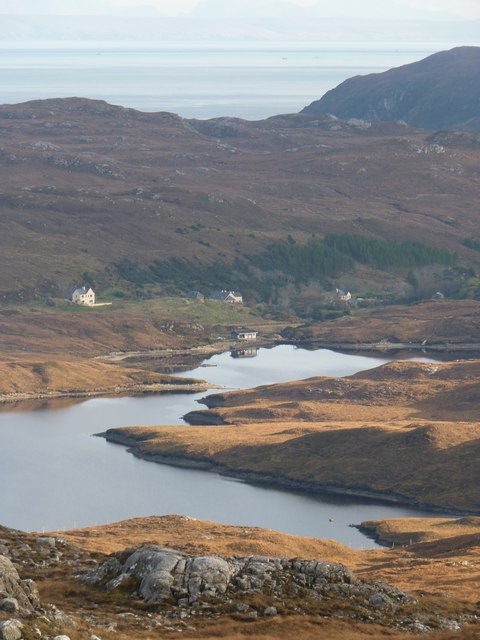
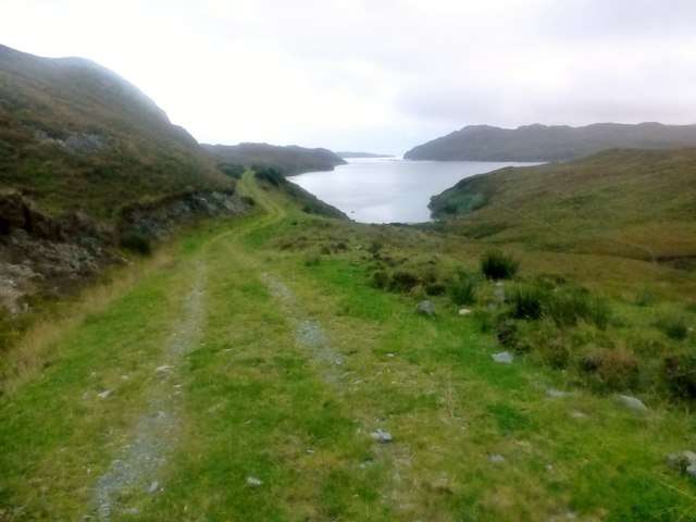
Rubha na Mòine is a prominent coastal feature located in Ross-shire, Scotland. It is a headland that juts out into the North Atlantic Ocean, forming a distinctive point along the rugged coastline. The name "Rubha na Mòine" translates to "Point of the Moss" in Gaelic.

The headland is characterized by its steep cliffs, which rise dramatically from the sea, offering breathtaking views of the surrounding landscape. These cliffs are composed of ancient rock formations, displaying layers of sedimentary rocks that have been shaped by erosion over millions of years.

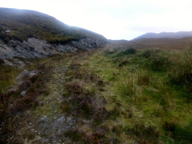
At the top of Rubha na Mòine, there is a grassy plateau covered in a vibrant carpet of moss and heather, giving the headland its name. This provides a stark contrast to the rugged cliffs below, adding to the visual appeal of the area. The plateau is a popular spot for hikers and nature enthusiasts, who come to enjoy the panoramic vistas of the ocean and the distant mountains.

The headland also serves as an important habitat for a variety of bird species. Seabirds such as puffins, guillemots, and razorbills can be spotted nesting in the cliffs, while birds of prey like peregrine falcons soar above, hunting for food.

Rubha na Mòine is a must-visit destination for those seeking to experience the wild beauty of the Scottish coast. With its stunning cliffs, picturesque views, and diverse wildlife, it offers a truly memorable experience for visitors of all ages.

If you have any feedback on the listing, please let us know in the comments section below.

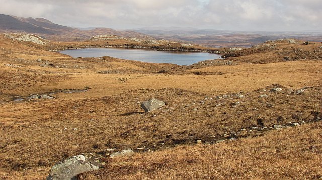
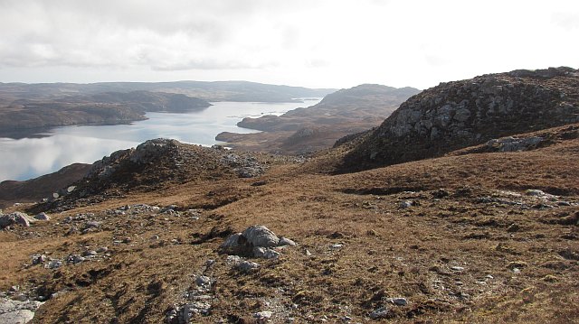
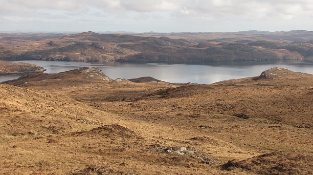
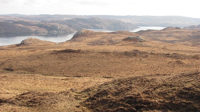
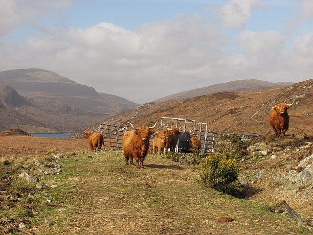
Rubha na Mòine Images

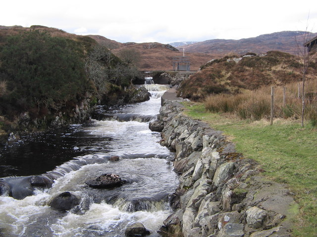
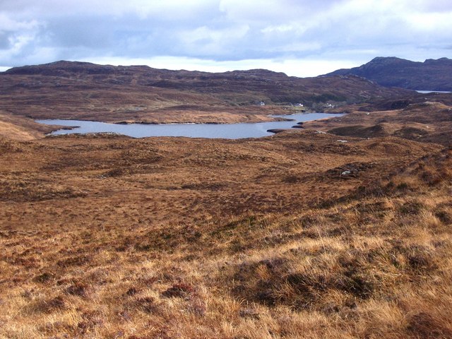
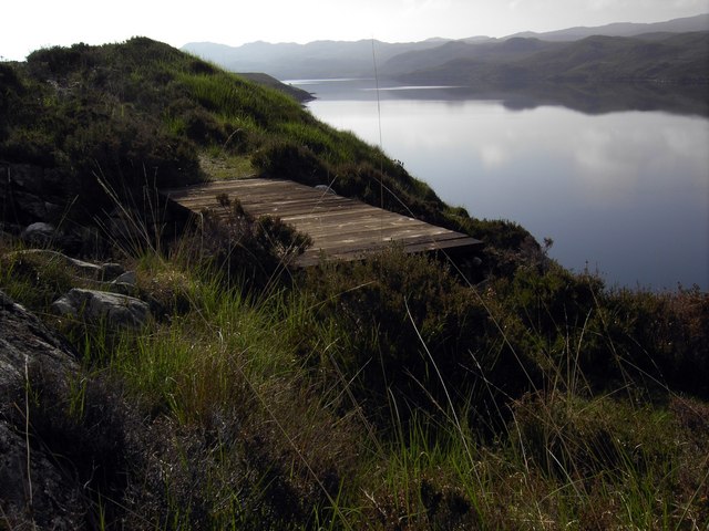
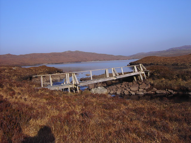
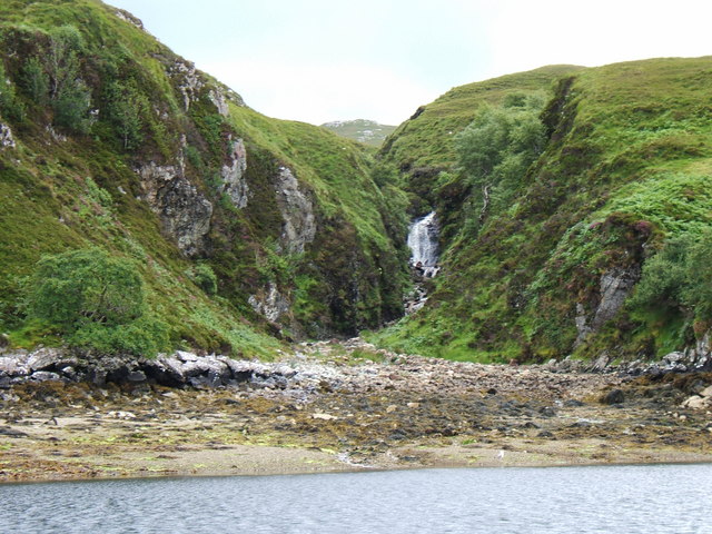
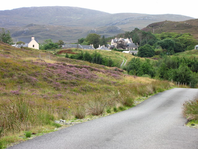
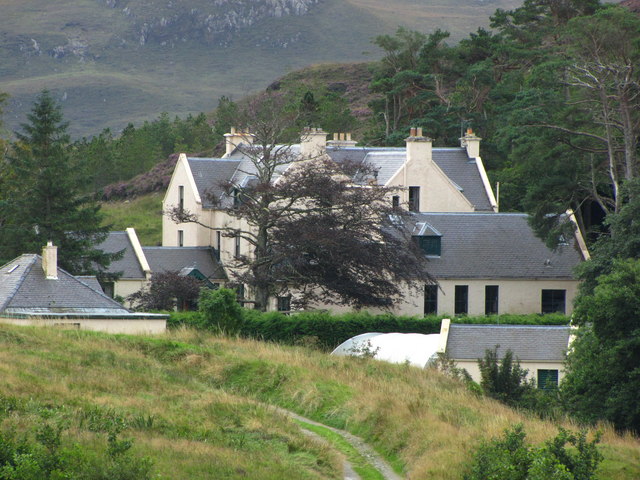
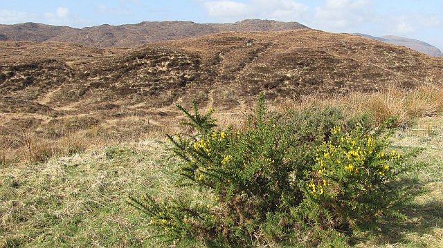
Images are sourced within 2km of 58.006705/-6.5280032 or Grid Reference NB3210. Thanks to Geograph Open Source API. All images are credited.

Loch Eisgean and the houses at Eisgein
Rough Overgrown Track This rough overgrown track still fails to confirm that we are nearing the end of our walk out of the Park/Pairc.
Rough Overgrown Track
This rough overgrown track still fails to confirm that we are nearing the end of our walk out of the Park/Pairc.
Coastal View Near Tòb Eisgein The track is looking better maintained as a coastal view opens up on our route to Eisgein.
Coastal View Near Tòb Eisgein
The track is looking better maintained as a coastal view opens up on our route to Eisgein.
Loch Eisgean River Loch Eisgean River has a very short journey to the sea.  This is were I met my lift back to Tarbert.
Loch Eisgean River
Loch Eisgean River has a very short journey to the sea. This is were I met my lift back to Tarbert.
Loch Cleit a' Ghuib Choille Lochan south of Loch Sealg. Very easy going underfoot here.
The distant view is towards Beinn Mholach near Stornoway.
Loch Cleit a' Ghuib Choille
Lochan south of Loch Sealg. Very easy going underfoot here. The distant view is towards Beinn Mholach near Stornoway.
Moorland, south of Loch Sealg Grassy slopes above Loch Sealg. The part of Pairc south of Loch Sealg is uninhabited now, but before it was cleared there were seventy families here.
Moorland, south of Loch Sealg
Grassy slopes above Loch Sealg. The part of Pairc south of Loch Sealg is uninhabited now, but before it was cleared there were seventy families here.
Garbh Allt Moorland beside the Garbh Allt, a burn flowing northwards into Loch Sealg. The inlet of Tòb Eisgein is visible across the loch.
Garbh Allt
Moorland beside the Garbh Allt, a burn flowing northwards into Loch Sealg. The inlet of Tòb Eisgein is visible across the loch.
Druim na Crich Moorland south of Loch Sealg. Part of the long uninhabited area (cleared) of Pairc, south of the loch.
Druim na Crich
Moorland south of Loch Sealg. Part of the long uninhabited area (cleared) of Pairc, south of the loch.
Tob Eisgein, Isle of Lewis View of boats on Tob Eisgein from the jetty at Eisgein on Loch Sealg
Tob Eisgein, Isle of Lewis
View of boats on Tob Eisgein from the jetty at Eisgein on Loch Sealg
Loch Eisgean River The outlet stream from Loch Eisgean on its short journey to the sea
Loch Eisgean River
The outlet stream from Loch Eisgean on its short journey to the sea
Loch Eisgean, Isle of Lewis Photo taken looking southeast across Loch Eisgean. Eisgein Estate houses in the distance with the summit of Mullach na ron beyond.
Loch Eisgean, Isle of Lewis
Photo taken looking southeast across Loch Eisgean. Eisgein Estate houses in the distance with the summit of Mullach na ron beyond.
New Bridge A new bridge over a stream flowing in to Loch Sealg.
New Bridge
A new bridge over a stream flowing in to Loch Sealg.
The not very safe bridge at the west end of Loch Eisgein
Allt Gil Mhic Phaic burn Showing the mouth of the Allt Gil Mhic Phaic burn flowing into Tob na Gile Moire on Loch Shell (Loch Sealg)
Allt Gil Mhic Phaic burn
Showing the mouth of the Allt Gil Mhic Phaic burn flowing into Tob na Gile Moire on Loch Shell (Loch Sealg)
Eisgein Lodge Eisgein Lodge is deep in the Parc region. Viewed here from the estate road you get a good picture of the setting of the lodge. Once you reach the gates to the lodge the road is private and buildings are secluded by trees.
Eisgein Lodge
Eisgein Lodge is deep in the Parc region. Viewed here from the estate road you get a good picture of the setting of the lodge. Once you reach the gates to the lodge the road is private and buildings are secluded by trees.
Eisgein Lodge View from the estate road approaching the lodge.
Eisgein Lodge
View from the estate road approaching the lodge.
Moorland, Eisgein Moorland seen from the road shortly before its end at Eisgein. There has been some recent woodland planting near here.
Moorland, Eisgein
Moorland seen from the road shortly before its end at Eisgein. There has been some recent woodland planting near here.
Highland cattle, Eisgein A fold of Highland cattle near the end of the estate road along Loch Sealg.
Highland cattle, Eisgein
A fold of Highland cattle near the end of the estate road along Loch Sealg.
Show me another place!

Rubha na Mòine is located at Grid Ref: NB3210 (Lat: 58.006705, Lng: -6.5280032)

Unitary Authority: Na h-Eileanan an Iar

Police Authority: Highlands and Islands

What 3 Words

///thinnest.twisting.classic. Near Leurbost, Na h-Eileanan Siar

Related Wikis

Stiomrabhaig

Stiomrabhaig is an abandoned crofter's village on the Isle of Lewis in the Outer Hebrides. == History == The United Kingdom Census 1851 shows that the...

Park, Lewis

Park (Scottish Gaelic: A' Phàirc), also known as South Lochs, is a huge area of land connected to the rest of Lewis only by a narrow neck between Loch...

Orinsay

Orinsay (Scottish Gaelic: Orasaigh) is a crofting village on the Isle of Lewis in the district of Pairc, in the Outer Hebrides, Scotland. The settlement...

Eilean Liubhaird

Eilean Liubhaird or Eilean Iubhard is an island in the Outer Hebrides, to the east of Lewis. == Geography and geology == The rock is "gneiss bedrock with...

Nearby Amenities

Located within 500m of 58.006705,-6.5280032
Source: PGS
Lat/Long: 58.0107666/-6.5254071
Source: PGS
Lat/Long: 58.0103916/-6.5252875
Created By: dmgroom_coastlines
Source: PGS
Lat/Long: 58.01017/-6.52518
Created By: dmgroom_coastlines
Source: PGS
Lat/Long: 58.00967/-6.52546
Source: PGS
Lat/Long: 58.0089056/-6.5264917
Source: PGS
Lat/Long: 58.0087019/-6.5274983
Source: PGS
Lat/Long: 58.0085933/-6.5288641
Source: PGS
Lat/Long: 58.0081216/-6.5285877
Source: PGS
Lat/Long: 58.0081016/-6.5275748
Source: PGS
Lat/Long: 58.007944/-6.5268852
Source: PGS
Lat/Long: 58.0077712/-6.5262835
Source: PGS
Lat/Long: 58.0076183/-6.5258579
Source: PGS
Lat/Long: 58.0071527/-6.524845
Source: PGS
Lat/Long: 58.0068143/-6.5247678
Source: PGS
Lat/Long: 58.0064392/-6.5249557
Source: PGS
Lat/Long: 58.0060427/-6.5250429
Created By: dmgroom_coastlines
Source: PGS
Lat/Long: 58.00595/-6.52547
Created By: dmgroom_coastlines
Source: PGS
Lat/Long: 58.00597/-6.52643
Created By: dmgroom_coastlines
Source: PGS
Lat/Long: 58.00584/-6.52669
Created By: dmgroom_coastlines
Source: PGS
Lat/Long: 58.00572/-6.52693
Created By: dmgroom_coastlines
Source: PGS
Lat/Long: 58.00574/-6.52742
Created By: dmgroom_coastlines
Source: PGS
Lat/Long: 58.00575/-6.52838
Created By: dmgroom_coastlines
Source: PGS
Lat/Long: 58.00578/-6.52982
Created By: dmgroom_coastlines
Source: PGS
Lat/Long: 58.00611/-6.53366
Created By: dmgroom_coastlines
Source: PGS
Lat/Long: 58.00613/-6.53462
Created By: dmgroom_coastlines
Source: PGS
Lat/Long: 58.006/-6.53488
Created By: dmgroom_coastlines
Source: PGS
Lat/Long: 58.00587/-6.53512
Tob Eishken
Natural: bay
Lat/Long: 58.0102011/-6.5230389
Tob Chumraborgh
Natural: bay
Lat/Long: 58.0083822/-6.5270301
Rubha na Moine
Natural: cape
Lat/Long: 58.0065064/-6.5261503
The data included in this document is from www.openstreetmap.org. The data is made available under ODbL.

Have you been to Rubha na Mòine?

Leave your review of Rubha na Mòine below (or comments, questions and feedback).