Rubha Dubh a' Ghrianain

Coastal Feature, Headland, Point in Inverness-shire

Scotland

Rubha Dubh a' Ghrianain

Waterfall across Talisker Bay The Allt Mheididh which runs out of Loch an Sgùirr Mhòir dropping over the crag rim at the north side of Talisker Bay.
Waterfall across Talisker Bay Credit: Trevor Littlewood

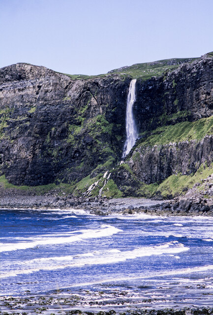
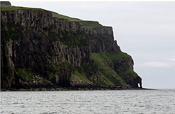
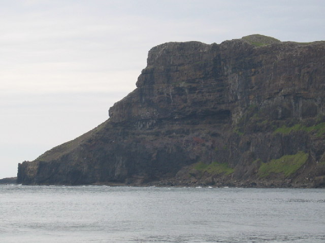
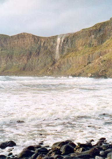
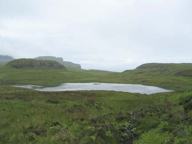
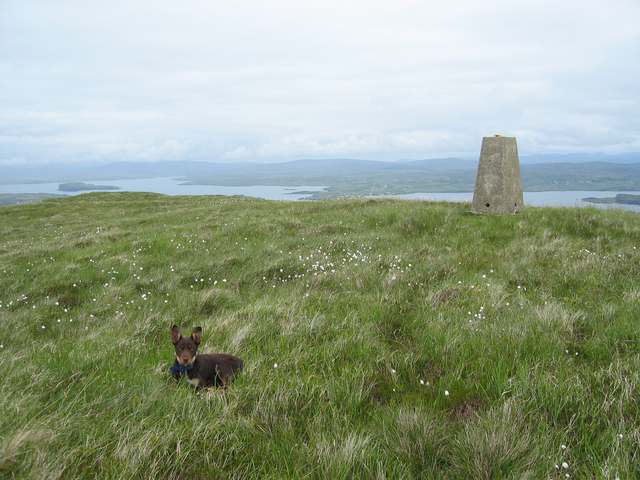
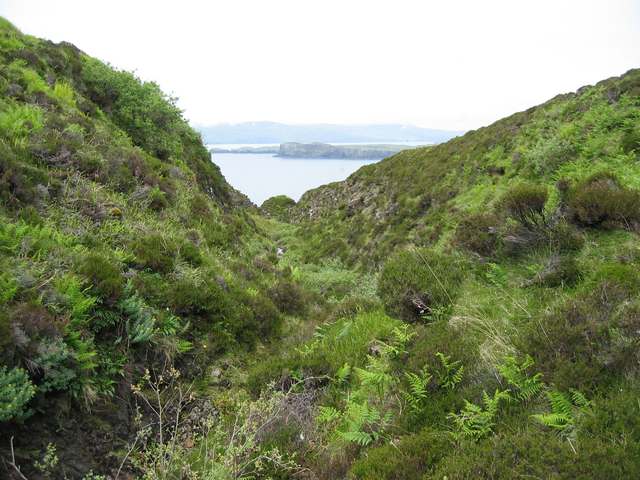
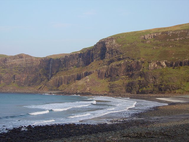
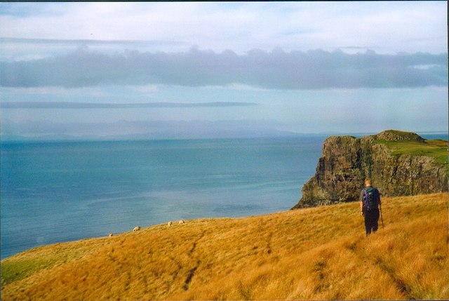
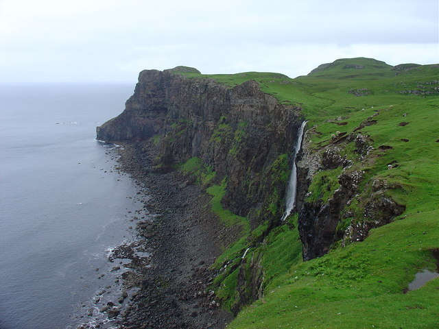
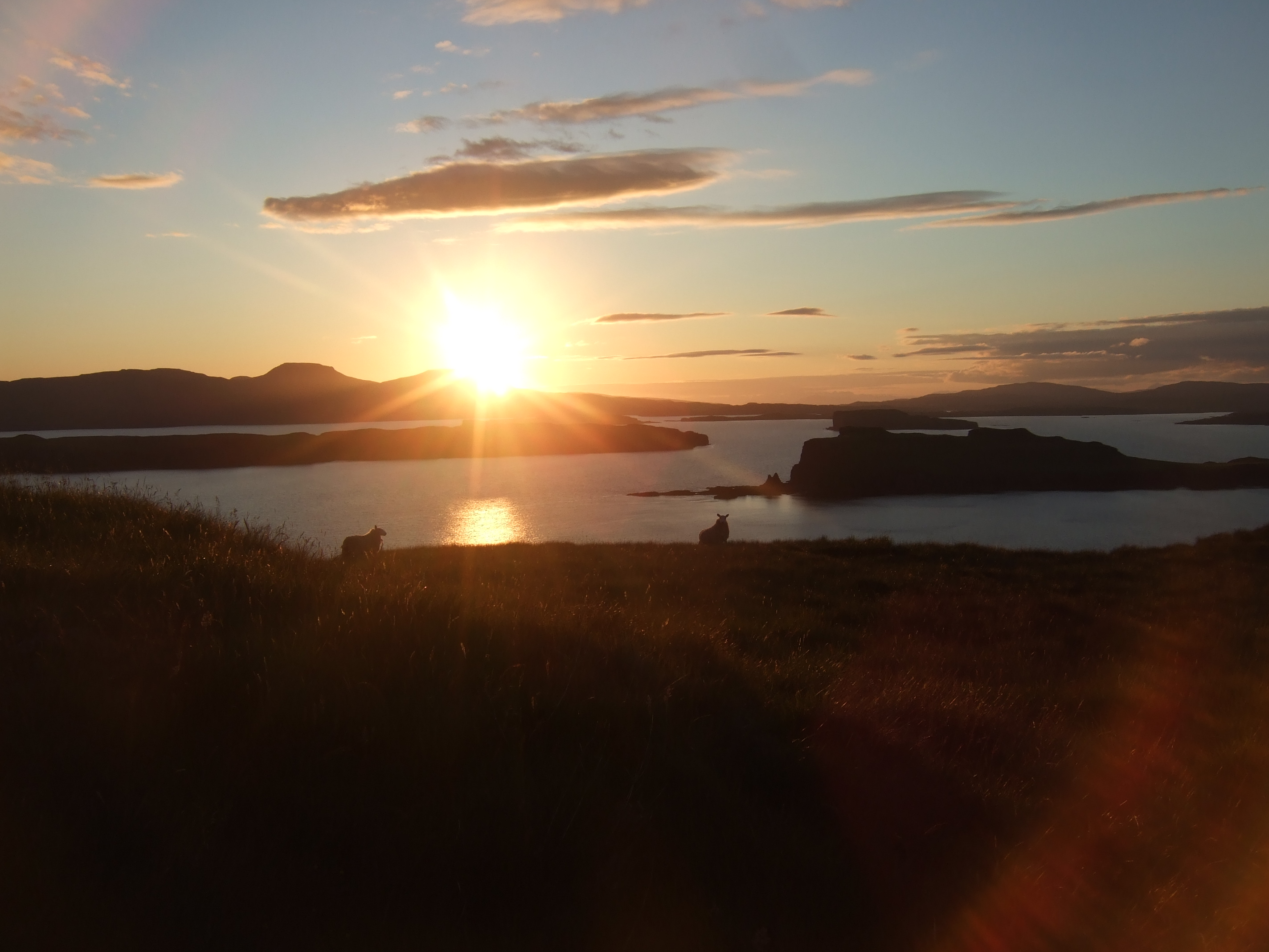
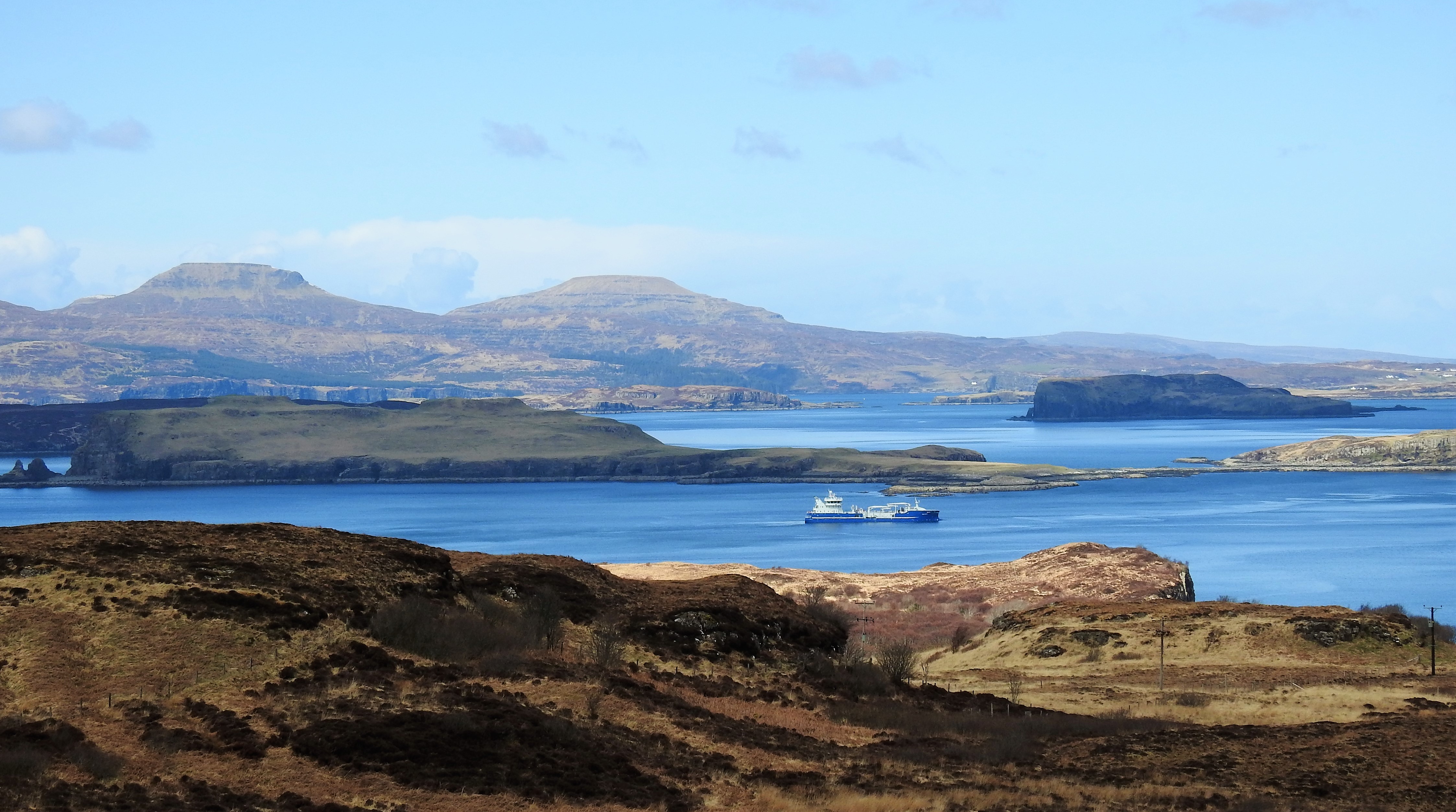
Rubha Dubh a' Ghrianain is a prominent coastal feature located in Inverness-shire, Scotland. Also known as the Black Headland, it is a rocky point that juts out into the Atlantic Ocean. Situated on the western coast of Scotland, Rubha Dubh a' Ghrianain offers breathtaking views of the surrounding landscape and the sea.

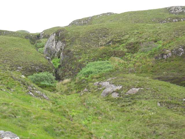
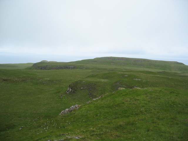
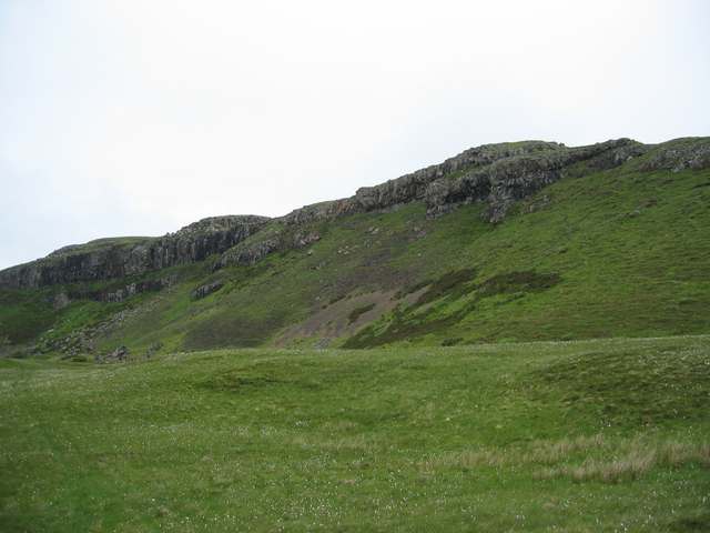
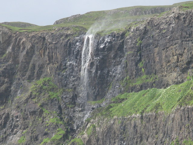
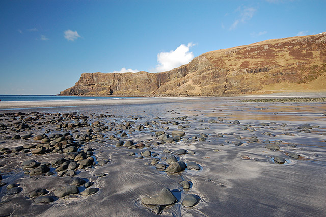
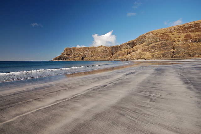
The headland is characterized by its rugged terrain, with steep cliffs that rise from the water. These cliffs are composed of black volcanic rock, which gives the headland its distinctive name. The dark color of the rock contrasts beautifully with the crashing waves and the greenery that covers the land.

Rubha Dubh a' Ghrianain is also home to a wide variety of wildlife, making it a popular spot for nature enthusiasts. Seabirds such as gulls, puffins, and guillemots can be seen nesting on the cliffs, while seals and dolphins are often spotted swimming in the nearby waters. The headland is also known for its diverse plant life, with heather, gorse, and wildflowers dotting the landscape.

The area surrounding Rubha Dubh a' Ghrianain is rich in history and has archaeological significance. There are remains of ancient settlements and burial sites, indicating that the headland has been inhabited for thousands of years. Visitors can explore these archaeological sites and immerse themselves in the history of the area.

Overall, Rubha Dubh a' Ghrianain is a stunning coastal feature that offers a unique blend of natural beauty and cultural heritage. Its dramatic cliffs, diverse wildlife, and rich history make it a must-visit destination for those exploring the Inverness-shire region of Scotland.

If you have any feedback on the listing, please let us know in the comments section below.

Rubha Dubh a' Ghrianain Images

Images are sourced within 2km of 57.298525/-6.4802155 or Grid Reference NG3031. Thanks to Geograph Open Source API. All images are credited.

Waterfall across Talisker Bay The Allt Mheididh which runs out of Loch an Sgùirr Mhòir dropping over the crag rim at the north side of Talisker Bay.
Waterfall across Talisker Bay
The Allt Mheididh which runs out of Loch an Sgùirr Mhòir dropping over the crag rim at the north side of Talisker Bay.
Leaving Loch Bracadale
Rubha Cruin Cliffs and point to north of Talisker Bay
Rubha Cruin
Cliffs and point to north of Talisker Bay
Talisker bay and waterfall A fine spot on the SW coast of Skye. On this visit a strong onshore wind was blowing the waterfall back over the clifftop.
Talisker bay and waterfall
A fine spot on the SW coast of Skye. On this visit a strong onshore wind was blowing the waterfall back over the clifftop.
Gorge of the Allt Geodh an Eich Bhric Not the Geodh after which the river is named. That is downstream of this gorge.
Gorge of the Allt Geodh an Eich Bhric
Not the Geodh after which the river is named. That is downstream of this gorge.
Sgurr Mor Sgurr Mor earns its name from the cliffs on the far side of it. This is a less spectacular view from inland.
Sgurr Mor
Sgurr Mor earns its name from the cliffs on the far side of it. This is a less spectacular view from inland.
Inland cliffs above Rubha nan Clach Typical of this area are tier after tier of cliffs - like these at the far north-west of Beinn nan Dubh-lochan.
Inland cliffs above Rubha nan Clach
Typical of this area are tier after tier of cliffs - like these at the far north-west of Beinn nan Dubh-lochan.
Loch an Sguirr Mhoir The burn exiting at the far side of the loch is the one that feeds the waterfall in <a href="https://www.geograph.org.uk/photo/124198">NG3130 : Talisker bay and waterfall</a>
Loch an Sguirr Mhoir
The burn exiting at the far side of the loch is the one that feeds the waterfall in NG3130 : Talisker bay and waterfall
Summit of Beinn nan Dubh-Lochan With Loch Bracadale beyond.
Summit of Beinn nan Dubh-Lochan
With Loch Bracadale beyond.
Geodh a' Mhadaidh The island beyond is Wiay, in Loch Bracadale.
Geodh a' Mhadaidh
The island beyond is Wiay, in Loch Bracadale.
Crags of Beinn nan Dubh-lochan On the southern side of the summit.
Crags of Beinn nan Dubh-lochan
On the southern side of the summit.
Talisker Bay
Talisker Bay
Clifftop path above Talisker Bay, Skye. Some fine views towards Rum, Eigg and Canna from this rather soggy clifftop path.
Clifftop path above Talisker Bay, Skye.
Some fine views towards Rum, Eigg and Canna from this rather soggy clifftop path.
Talisker Bay and Waterfall
Talisker Bay Waterfall On a windy day the water is completely blown away from the waterfall.
Talisker Bay Waterfall
On a windy day the water is completely blown away from the waterfall.
Waterfall at Talisker Bay, Skye
Talisker Bay The beach at Talisker at a low spring tide - a big contrast to the similar view at high tide in <a href="https://www.geograph.org.uk/photo/894148">NG3130 : Talisker Bay and Waterfall</a>.
Talisker Bay
The beach at Talisker at a low spring tide - a big contrast to the similar view at high tide in NG3130 : Talisker Bay and Waterfall.
Talisker Beach at low spring tide This section of the sand seldom sees daylight, and is marked in blue on the OS maps. The picture was taken close to the bottom of a very low tide.
Talisker Beach at low spring tide
This section of the sand seldom sees daylight, and is marked in blue on the OS maps. The picture was taken close to the bottom of a very low tide.
Show me another place!

Rubha Dubh a' Ghrianain is located at Grid Ref: NG3031 (Lat: 57.298525, Lng: -6.4802155)

Unitary Authority: Highland

Police Authority: Highlands and Islands

What 3 Words

///unsigned.limiting.stove. Near Carbost, Highland

Related Wikis

Talisker

Talisker (Scottish Gaelic: Talasgair) is a settlement on the Minginish peninsula in the Isle of Skye, Scotland. == History == Talisker was for centuries...

Fiskavaig

Fiskavaig or Fiscavaig (Scottish Gaelic: Fiosgabhaig) is a picturesque crofting settlement on the north-west shore of the Minginish peninsula, Isle of...

Loch Bracadale

Loch Bracadale (Scottish Gaelic: Loch Bhràcadail) is a sea loch on the west coast of Skye in Scotland. It separates the Minginish Peninsula in the south...

Oronsay, Loch Bracadale

Oronsay (Scottish Gaelic: Orasaigh) is an uninhabited tidal island in Loch Bracadale on the west coast of Skye, Scotland. It is c.1,000 metres (0.7miles...

Nearby Amenities

Located within 500m of 57.298525,-6.4802155
Created By: dmgroom_coastlines
Source: PGS
Lat/Long: 57.30139/-6.47955
Created By: dmgroom_coastlines
Source: PGS
Lat/Long: 57.30114/-6.47979
Created By: dmgroom_coastlines
Source: PGS
Lat/Long: 57.30127/-6.48073
Created By: dmgroom_coastlines
Source: PGS
Lat/Long: 57.30155/-6.48119
Created By: dmgroom_coastlines
Source: PGS
Lat/Long: 57.30169/-6.48165
Created By: dmgroom_coastlines
Source: PGS
Lat/Long: 57.30117/-6.48145
Created By: dmgroom_coastlines
Source: PGS
Lat/Long: 57.30015/-6.48152
Created By: dmgroom_coastlines
Source: PGS
Lat/Long: 57.29964/-6.48156
Created By: dmgroom_coastlines
Source: PGS
Lat/Long: 57.2995/-6.48133
Created By: dmgroom_coastlines
Source: PGS
Lat/Long: 57.29937/-6.4811
Created By: dmgroom_coastlines
Source: PGS
Lat/Long: 57.29911/-6.48088
Created By: dmgroom_coastlines
Source: PGS
Lat/Long: 57.29913/-6.48183
Created By: dmgroom_coastlines
Source: PGS
Lat/Long: 57.29887/-6.48161
Created By: dmgroom_coastlines
Source: PGS
Lat/Long: 57.29784/-6.48144
Created By: dmgroom_coastlines
Source: PGS
Lat/Long: 57.29769/-6.48051
Created By: dmgroom_coastlines
Source: PGS
Lat/Long: 57.29756/-6.48028
Created By: dmgroom_coastlines
Source: PGS
Lat/Long: 57.29704/-6.47984
Created By: dmgroom_coastlines
Source: PGS
Lat/Long: 57.29678/-6.47986
Created By: dmgroom_coastlines
Source: PGS
Lat/Long: 57.29653/-6.47988
Created By: dmgroom_coastlines
Source: PGS
Lat/Long: 57.2955/-6.47971
Created By: dmgroom_coastlines
Source: PGS
Lat/Long: 57.29552/-6.48066
Created By: dmgroom_coastlines
Source: PGS
Lat/Long: 57.295/-6.48046
Created By: dmgroom_coastlines
Source: PGS
Lat/Long: 57.29449/-6.48049
Created By: dmgroom_coastlines
Source: PGS
Lat/Long: 57.29425/-6.48098
The data included in this document is from www.openstreetmap.org. The data is made available under ODbL.

Have you been to Rubha Dubh a' Ghrianain?

Leave your review of Rubha Dubh a' Ghrianain below (or comments, questions and feedback).