Rubha Beul a' Chaolais

Coastal Feature, Headland, Point in Argyllshire

Scotland

Rubha Beul a' Chaolais

Tinkers Hole anchorage Erraid
Tinkers Hole anchorage Erraid Credit: sue middleton

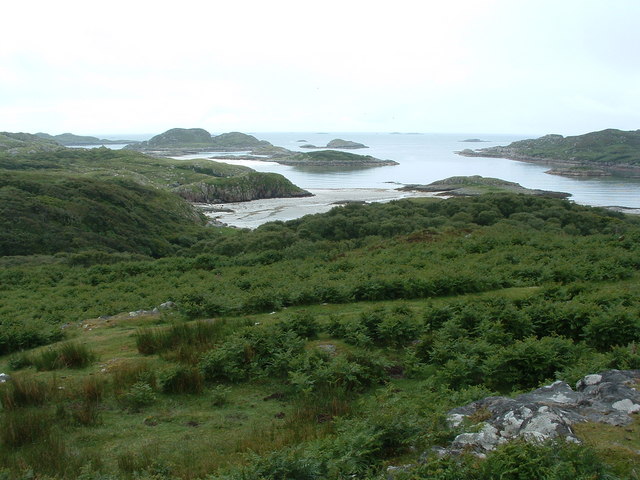
Rubha Beul a' Chaolais is a stunning coastal feature located in Argyllshire, Scotland. Situated on the west coast of the country, it is a headland or point that juts out into the Atlantic Ocean. The name Rubha Beul a' Chaolais translates to "Point of the Narrow Strait" in English, which accurately describes its geographical position.

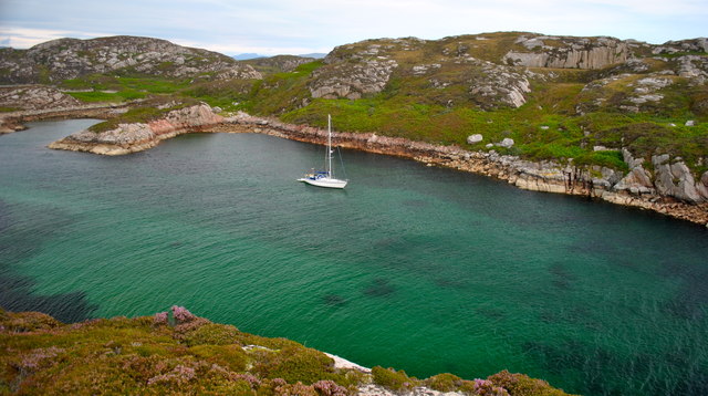
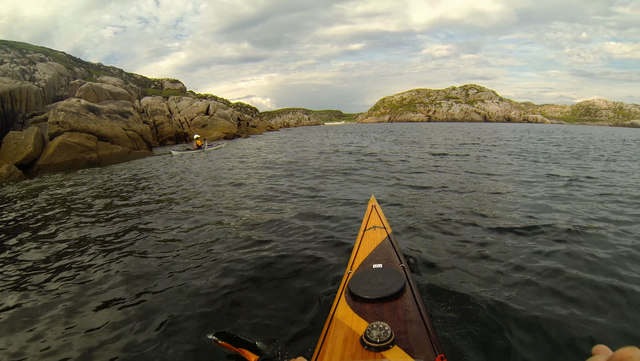
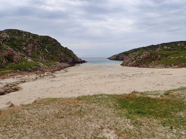
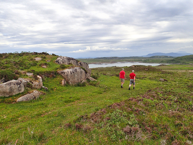
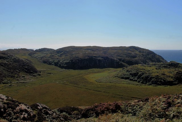
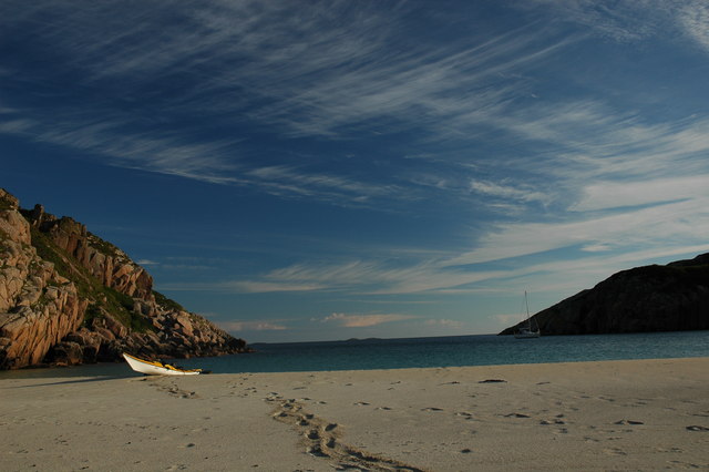
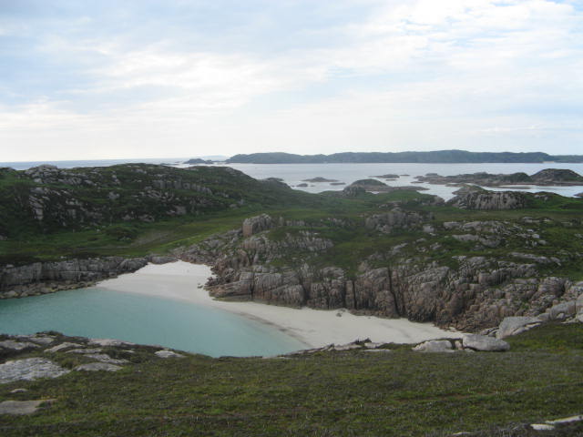
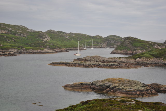
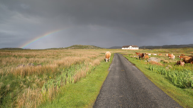
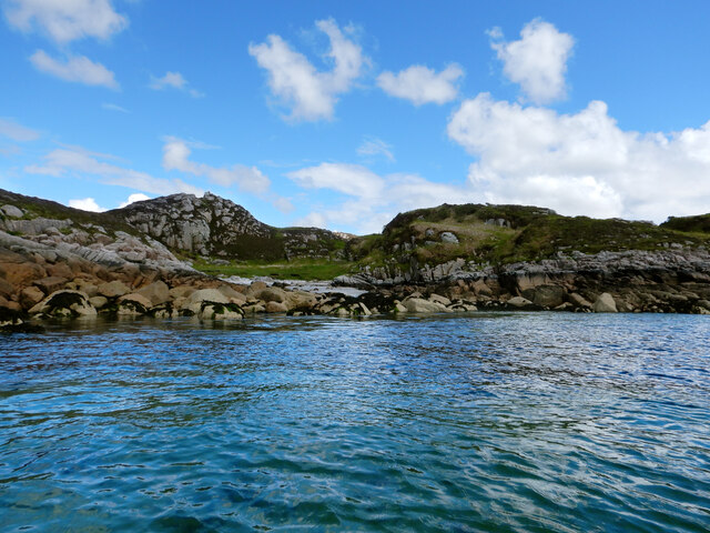
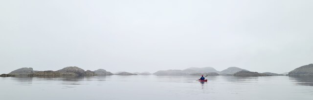
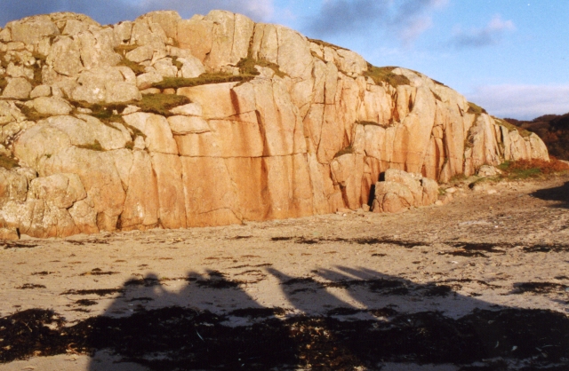
This headland is known for its dramatic and rugged landscape. The coastline is characterized by steep cliffs, rocky outcrops, and expansive views of the sea. It offers a perfect vantage point to admire the surrounding natural beauty, with breathtaking vistas stretching out to the horizon.

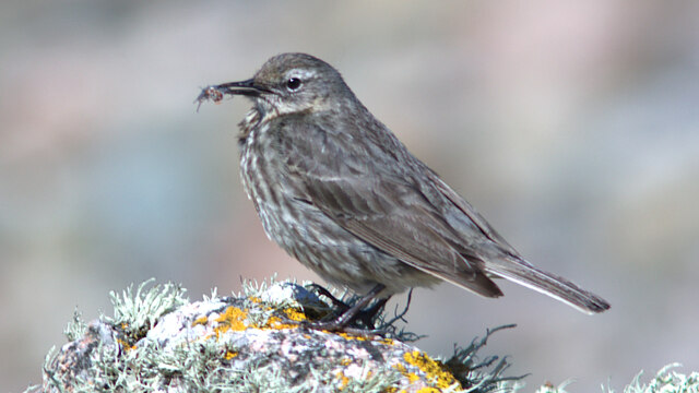
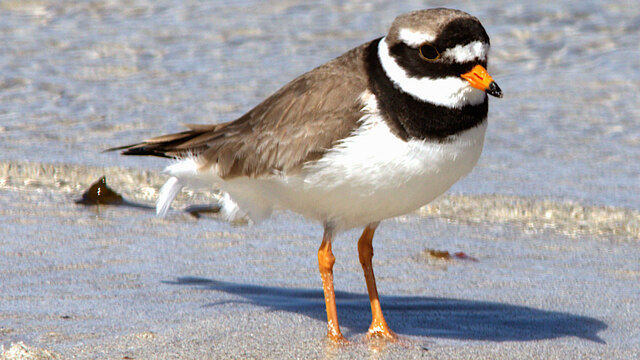
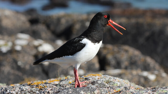
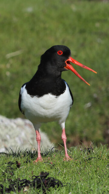
The area is rich in wildlife, making it a popular spot for nature enthusiasts. Visitors may spot various seabirds, such as gannets, puffins, and kittiwakes, nesting on the cliffs. Seals can often be seen basking on the rocks, and occasionally dolphins and porpoises can be spotted frolicking in the water.

Rubha Beul a' Chaolais is also significant from a historical perspective. It is believed that the site was once occupied by ancient settlements, as evidenced by the presence of standing stones and other archaeological remains. These remnants provide insights into the lives of the people who lived here in the distant past.

Overall, Rubha Beul a' Chaolais is a captivating coastal feature that offers a combination of stunning natural beauty and historical significance. Its rugged landscape, diverse wildlife, and historical remnants make it a must-visit destination for those exploring the Argyllshire region.

If you have any feedback on the listing, please let us know in the comments section below.

Rubha Beul a' Chaolais Images

Images are sourced within 2km of 56.305665/-6.3647434 or Grid Reference NM3021. Thanks to Geograph Open Source API. All images are credited.

Tinkers Hole anchorage Erraid
Heading for Traigh Gheal past Rubha Calachain Rounding the southern end of Erraid on an evening paddle, heading for Traigh Gheal - a fantastic beach with almost no plastic debris despite facing south into the weather. The jointed Ross of Mull granite, of Devonian age, intruded towards the end of the Caledonian orogeny, offers easy rock-hopping opportunities in the very minimal swell we experienced on this trip and weathers to a clean white sand in the shallower inlets like this one. Sea kayak is by far the best way to visit these isolated beaches, as crossing the island involves bog, midges and a certain amount of fighting with willow scrub, as we found when we tried to cross the area to the left of this photo to get to the top of an impressive geo we'd found from below.
Heading for Traigh Gheal past Rubha Calachain
Rounding the southern end of Erraid on an evening paddle, heading for Traigh Gheal - a fantastic beach with almost no plastic debris despite facing south into the weather. The jointed Ross of Mull granite, of Devonian age, intruded towards the end of the Caledonian orogeny, offers easy rock-hopping opportunities in the very minimal swell we experienced on this trip and weathers to a clean white sand in the shallower inlets like this one. Sea kayak is by far the best way to visit these isolated beaches, as crossing the island involves bog, midges and a certain amount of fighting with willow scrub, as we found when we tried to cross the area to the left of this photo to get to the top of an impressive geo we'd found from below.
Tràigh Gheal (Balfour's Bay) Following in the footsteps of David Balfour, the hero of Robert Louis Stevenson's Kidnapped, as he makes his way back to Edinburgh to confront his wicked uncle.

Stage 1, June 2016 from Erraid to Fishnish on the Isle of Mull.

See <span class="nowrap"><a title="http://www.stevensonway.org.uk" rel="nofollow ugc noopener" href="http://www.stevensonway.org.uk">Link</a><img style="margin-left:2px;" alt="External link" title="External link - shift click to open in new window" src="https://s1.geograph.org.uk/img/external.png" width="10" height="10"/></span>
Tràigh Gheal (Balfour's Bay)
Following in the footsteps of David Balfour, the hero of Robert Louis Stevenson's Kidnapped, as he makes his way back to Edinburgh to confront his wicked uncle. Stage 1, June 2016 from Erraid to Fishnish on the Isle of Mull. See LinkExternal link
Crossing Erraid Following in the footsteps of David Balfour, the hero of Robert Louis Stevenson's Kidnapped, as he makes his way back to Edinburgh to confront his wicked uncle.

Stage 1, June 2016 from Erraid to Fishnish on the Isle of Mull.

See <span class="nowrap"><a title="http://www.stevensonway.org.uk" rel="nofollow ugc noopener" href="http://www.stevensonway.org.uk">Link</a><img style="margin-left:2px;" alt="External link" title="External link - shift click to open in new window" src="https://s1.geograph.org.uk/img/external.png" width="10" height="10"/></span>
Crossing Erraid
Following in the footsteps of David Balfour, the hero of Robert Louis Stevenson's Kidnapped, as he makes his way back to Edinburgh to confront his wicked uncle. Stage 1, June 2016 from Erraid to Fishnish on the Isle of Mull. See LinkExternal link
Wet Plain on Erraid A boggy flat section between hills to the east of Balfour's Bay.
Wet Plain on Erraid
A boggy flat section between hills to the east of Balfour's Bay.
Traigh Gheal On Erraid Possibly the finest beach on the planet; pink granite, white sand and turquoise water.
Traigh Gheal On Erraid
Possibly the finest beach on the planet; pink granite, white sand and turquoise water.
Traigh Gheall Beautiful white beach on Erraid
Traigh Gheall
Beautiful white beach on Erraid
Yachts at anchor Tinkers Hole Mull
Cattle graze in clearing shower, road to Toba Bhreaca
NW coast of Erraid Erraid being a tidal island, one must get the timing right to visit its environs. Usually the tide is in when we would like to walk to it, and out when we would like to paddle the channel between it and the Ross of Mull, which is frustrating but mainly our own fault for not bothering to plan in advance. Today we are paddling the west side to get the square I keep missing. The gleaming white observatory forms a prominent landmark as long as you don't get too close to the shore so it hides behind the outcrops (it is just visible in this view).
NW coast of Erraid
Erraid being a tidal island, one must get the timing right to visit its environs. Usually the tide is in when we would like to walk to it, and out when we would like to paddle the channel between it and the Ross of Mull, which is frustrating but mainly our own fault for not bothering to plan in advance. Today we are paddling the west side to get the square I keep missing. The gleaming white observatory forms a prominent landmark as long as you don't get too close to the shore so it hides behind the outcrops (it is just visible in this view).
Rock Pipit with shrimp at Fidden
Ringed Plover feeding on the water's edge at Fidden
Oystercatcher distracting passers-by from nearby nest
Raucus Oystercatcher near shore at Fidden
Misty day in the Skerries east of Erraid Looking towards Eilean Ghomain from near Eilean Dubh on a calm but misty day
Misty day in the Skerries east of Erraid
Looking towards Eilean Ghomain from near Eilean Dubh on a calm but misty day
Knockvologan Low winter sunshine on an outcrop of typical pink granite by the beach opposite the Isle of Erraid. <a href="https://www.geograph.org.uk/photo/2984029">NM3019 : Ross of Mull Granite</a> is a more detailed view of part of the same outcrop.
Knockvologan
Low winter sunshine on an outcrop of typical pink granite by the beach opposite the Isle of Erraid. NM3019 : Ross of Mull Granite is a more detailed view of part of the same outcrop.
View from hill at Knockvologan The foreground is Mull, the sea inlet off to the right is the channel between Mull and Erraid.
View from hill at Knockvologan
The foreground is Mull, the sea inlet off to the right is the channel between Mull and Erraid.
Retired hay baling machine In a typical farming way, the old baling machine/contraption at Knockvologan farm is left to age rather ungracefully. It is also used as a storage point for old and new fencing material.
Retired hay baling machine
In a typical farming way, the old baling machine/contraption at Knockvologan farm is left to age rather ungracefully. It is also used as a storage point for old and new fencing material.
Show me another place!

Rubha Beul a' Chaolais is located at Grid Ref: NM3021 (Lat: 56.305665, Lng: -6.3647434)

Unitary Authority: Argyll and Bute

Police Authority: Argyll and West Dunbartonshire

What 3 Words

///splashes.obvious.mute. Near Fionnphort, Argyll & Bute

Nearby Locations

Rubha Beul a' Chaolais

Related Wikis

Erraid

Erraid (Scottish Gaelic: Eilean Earraid) is a tidal island approximately one mile (two kilometres) square located in the Inner Hebrides of Scotland. It...

Aridhglas

Aridhglas is a village on the Ross of Mull, Isle of Mull in Argyll and Bute, Scotland. == References ==

Fionnphort

Fionnphort (English: , Scottish Gaelic: [ˈfjun̪ˠafɔrˠt̪]) is the principal port of the Ross of Mull, and the second largest settlement in the area (its...

Sound of Iona

The Sound of Iona is a sound between the Inner Hebridean islands of Mull and Iona in western Scotland. It forms part of the Atlantic Ocean. The tidal...

Nearby Amenities

Located within 500m of 56.305665,-6.3647434
Source: PGS
Lat/Long: 56.3044799/-6.3571739
Source: PGS
Lat/Long: 56.3036615/-6.3593443
Source: PGS
Lat/Long: 56.3031401/-6.3593625
Source: PGS
Lat/Long: 56.3037038/-6.3609751
Source: PGS
Lat/Long: 56.3032878/-6.3621868
Created By: dmgroom_coastlines
Source: PGS
Lat/Long: 56.30354/-6.36573
Source: PGS
Lat/Long: 56.303932/-6.3657154
Source: PGS
Lat/Long: 56.3044058/-6.3666749
Source: PGS
Lat/Long: 56.3043848/-6.3669904
Source: PGS
Lat/Long: 56.3043229/-6.3674638
Created By: dmgroom_coastlines
Source: PGS
Lat/Long: 56.3045/-6.36843
Created By: dmgroom_coastlines
Source: PGS
Lat/Long: 56.30467/-6.37073
Created By: dmgroom_coastlines
Source: PGS
Lat/Long: 56.30482/-6.37164
Created By: dmgroom_coastlines
Source: PGS
Lat/Long: 56.30559/-6.37181
Source: PGS
Lat/Long: 56.3056678/-6.3714661
Created By: dmgroom_coastlines
Source: PGS
Lat/Long: 56.30571/-6.37111
Source: PGS
Lat/Long: 56.305588/-6.3710606
Created By: dmgroom_coastlines
Source: PGS
Lat/Long: 56.3067/-6.36966
Source: PGS
Lat/Long: 56.3067696/-6.3708397
Source: PGS
Lat/Long: 56.3071244/-6.3709416
Created By: dmgroom_coastlines
Source: PGS
Lat/Long: 56.30687/-6.37173
Created By: dmgroom_coastlines
Source: PGS
Lat/Long: 56.30739/-6.37192
Created By: dmgroom_coastlines
Source: PGS
Lat/Long: 56.30751/-6.37145
Source: PGS
Lat/Long: 56.3071541/-6.3709095
Source: PGS
Lat/Long: 56.3072154/-6.3702126
Source: PGS
Lat/Long: 56.3095939/-6.367804
Fidden Farm
Tourism: camp_site
Lat/Long: 56.307934/-6.3631104
Source: PGS
Lat/Long: 56.3043011/-6.3678234
Source: PGS
Lat/Long: 56.30313/-6.364407
Power: pole
Lat/Long: 56.3083952/-6.3613227
Generator Method: wind_turbine
Generator Source: wind
Generator Type: horizontal_axis
Power: generator
Lat/Long: 56.3090401/-6.3608855
Source: PGS
Lat/Long: 56.3039169/-6.3580365
An Caolas
Natural: bay
Lat/Long: 56.3022296/-6.3665557
The data included in this document is from www.openstreetmap.org. The data is made available under ODbL.

Have you been to Rubha Beul a' Chaolais?

Leave your review of Rubha Beul a' Chaolais below (or comments, questions and feedback).