Meall Challaboist

Coastal Feature, Headland, Point in Inverness-shire

Scotland

Meall Challaboist

Approaching Eilean Glas lighthouse A good path provides access from Ceann a Bhàigh to Eilean Glas.
The original lighthouse here, built 1789, was the first in the Hebrides, and its base still survives today,
(see <a href="https://www.geograph.org.uk/photo/4730643">NG2494 : The original Scalpay lighthouse</a>). 
The current tower was built 1824.
Approaching Eilean Glas lighthouse Credit: Richard Dorrell

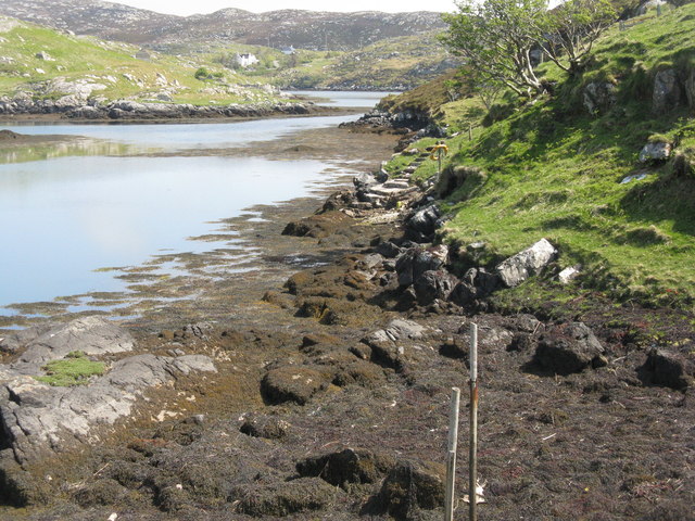
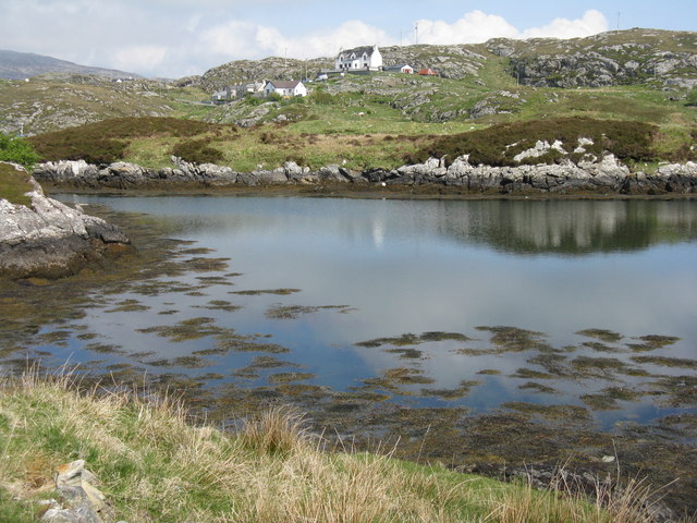
Meall Challaboist is a prominent coastal feature located in Inverness-shire, Scotland. Situated along the western coast, it is specifically found in the area known as the Inner Hebrides. Meall Challaboist is classified as a headland, also commonly referred to as a point due to its distinctive shape and geographical characteristics.

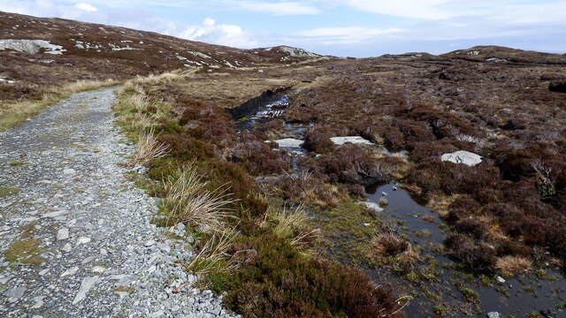
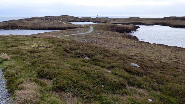
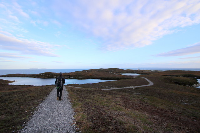
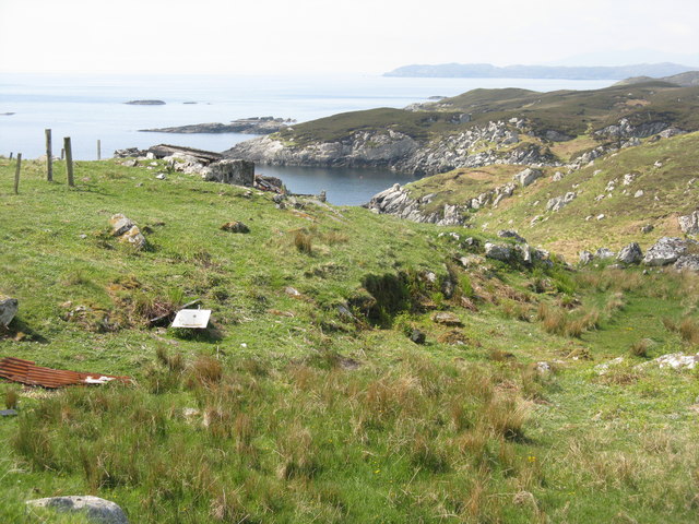
Rising to an elevation of approximately 100 meters (330 feet) above sea level, Meall Challaboist offers stunning panoramic views of the surrounding coastal landscape. The headland is characterized by its rugged and rocky terrain, with steep cliffs that drop dramatically into the sea below. These cliffs are often battered by the relentless waves of the Atlantic Ocean, creating a mesmerizing display of power and natural beauty.

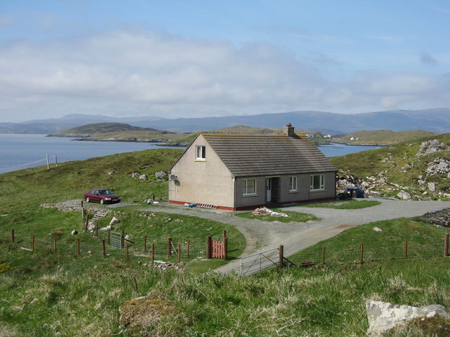
The headland is a popular destination for nature enthusiasts and outdoor adventurers alike. Hikers and climbers are attracted to the challenging terrain and the opportunity to explore the diverse flora and fauna that inhabit the area. Birdwatchers are particularly drawn to Meall Challaboist, as it serves as a nesting ground for various seabird species, including gannets, puffins, and cormorants.

Additionally, Meall Challaboist is a significant landmark for maritime navigation. Its distinct shape and prominent position make it a recognizable reference point for sailors and fishermen. The headland's strategic location has also led to the construction of a lighthouse, which aids in guiding ships safely through the surrounding coastal waters.

Overall, Meall Challaboist is a captivating coastal feature that showcases the raw power of nature and offers a range of recreational opportunities for visitors to Inverness-shire.

If you have any feedback on the listing, please let us know in the comments section below.

Meall Challaboist Images

Images are sourced within 2km of 57.850727/-6.6706997 or Grid Reference NG2294. Thanks to Geograph Open Source API. All images are credited.

Approaching Eilean Glas lighthouse A good path provides access from Ceann a Bhàigh to Eilean Glas.
The original lighthouse here, built 1789, was the first in the Hebrides, and its base still survives today,
(see <a href="https://www.geograph.org.uk/photo/4730643">NG2494 : The original Scalpay lighthouse</a>). 
The current tower was built 1824.
Approaching Eilean Glas lighthouse
A good path provides access from Ceann a Bhàigh to Eilean Glas. The original lighthouse here, built 1789, was the first in the Hebrides, and its base still survives today, (see NG2494 : The original Scalpay lighthouse). The current tower was built 1824.
Old Peat Cuttings
Old Peat Cuttings
Track to Eilean Glas Lighthouse There is some small-scale peat cutting immediately next to the track.
Track to Eilean Glas Lighthouse
There is some small-scale peat cutting immediately next to the track.
Eilean Glas Lighthouse <span class="nowrap"><a title="https://www.nlb.org.uk/lighthouses/eilean-glas/" rel="nofollow ugc noopener" href="https://www.nlb.org.uk/lighthouses/eilean-glas/">Link</a><img style="margin-left:2px;" alt="External link" title="External link - shift click to open in new window" src="https://s1.geograph.org.uk/img/external.png" width="10" height="10"/></span>
Eilean Glas Lighthouse
Footpath to Eilean Glas Lighthouse The path is in good condition and a pleasure to walk on.
Footpath to Eilean Glas Lighthouse
The path is in good condition and a pleasure to walk on.
The lighthouse on Scalpay Island This lighthouse was manned till 1979 when it became fully automated. The last keeper here was Leonard Fraser who was on duty at the Scalpay light from 1972. This light differed from the majority of other lights in that it was a "half hour wind" whereas the norm was "hour winds". This refers to how often the mechanism of the light was wound by the keeper.
The lighthouse on Scalpay Island
This lighthouse was manned till 1979 when it became fully automated. The last keeper here was Leonard Fraser who was on duty at the Scalpay light from 1972. This light differed from the majority of other lights in that it was a "half hour wind" whereas the norm was "hour winds". This refers to how often the mechanism of the light was wound by the keeper.
A lochan on the Heritage Trail to Scalpay Lighthouse The trail is spongy underfoot but well maintained. On the horizon left of centre you can see the Shiant Islands and that's Scalpay Lighthouse lying off the cliffs to the right.
A lochan on the Heritage Trail to Scalpay Lighthouse
The trail is spongy underfoot but well maintained. On the horizon left of centre you can see the Shiant Islands and that's Scalpay Lighthouse lying off the cliffs to the right.
The original Scalpay lighthouse This is one of the first four lighthouses to be built in Scotland circa 1789. Today's lighthouse replaced this original one in 1824.
<a href="https://www.geograph.org.uk/photo/4730659">NG2494 : Oh what tales this house could tell!</a>
The original Scalpay lighthouse
This is one of the first four lighthouses to be built in Scotland circa 1789. Today's lighthouse replaced this original one in 1824. NG2494 : Oh what tales this house could tell!
Looking skyward from the old lighthouse at Scalpay Built in 1789 much credit can be given to the masonry and carpentry employed in its construction.
Looking skyward from the old lighthouse at Scalpay
Built in 1789 much credit can be given to the masonry and carpentry employed in its construction.
The foghorn at Scalpay lighthouse
Old and not so old side by side The original light to the left was built in 1789 and its colourful replacement to the right in 1824. Some people only consider the usefulness of a lighthouse in darkness but the distinctive colours of the latter offer navigation references during hours of daylight too.
<a href="https://www.geograph.org.uk/photo/4730659">NG2494 : Oh what tales this house could tell!</a>
Old and not so old side by side
The original light to the left was built in 1789 and its colourful replacement to the right in 1824. Some people only consider the usefulness of a lighthouse in darkness but the distinctive colours of the latter offer navigation references during hours of daylight too. NG2494 : Oh what tales this house could tell!
Oh what tales this house could tell!
House on Scalpay/Scalpaigh In need of some restoration.
House on Scalpay/Scalpaigh
In need of some restoration.
Coast at Ãird Adhanais At the end of Sraid Falkland, looking out to Bagh Ceann na Muice.
Coast at Ãird Adhanais
At the end of Sraid Falkland, looking out to Bagh Ceann na Muice.
Tidal island in Bagh Ceann na Muice Sea surrounds the island at high tide, and separates it from the two houses in the distance.
Tidal island in Bagh Ceann na Muice
Sea surrounds the island at high tide, and separates it from the two houses in the distance.
Bàgh Ceann na Muice Or Bagh Ceann na Muise [OS spelling varies from scale to scale]. Looking across rocky grasslend from the road to Ceann a Bhàigh.
Bàgh Ceann na Muice
Or Bagh Ceann na Muise [OS spelling varies from scale to scale]. Looking across rocky grasslend from the road to Ceann a Bhàigh.
House on Straid Falkland Overlooking An Acairseid a Deas near Ceann a Bhàigh.
House on Straid Falkland
Overlooking An Acairseid a Deas near Ceann a Bhàigh.
Coast at Ceann a Bhàigh The end of the road at the southern end of Scalpay/Scalpaigh, over looking Loch an Tairbeairt.
Coast at Ceann a Bhàigh
The end of the road at the southern end of Scalpay/Scalpaigh, over looking Loch an Tairbeairt.
Show me another place!

Meall Challaboist is located at Grid Ref: NG2294 (Lat: 57.850727, Lng: -6.6706997)

Unitary Authority: Na h-Eileanan an Iar

Police Authority: Highlands and Islands

What 3 Words

///hours.boat.overpaid. Near Tarbert, Na h-Eileanan Siar

Related Wikis

Scalpay, Outer Hebrides

Scalpay (; Scottish Gaelic: Sgalpaigh or Sgalpaigh na Hearadh; i.e. "Scalpay of Harris" to distinguish it from Scalpay off Skye) is an island in the Outer...

Eilean Glas, Scalpay

Eilean Glas is a peninsula of Scalpay in the Outer Hebrides, Scotland. Eilean Glas is home to a historic lighthouse. Eilean Glas means Grey/Green Island...

Eilean Glas Lighthouse

Eilean Glas Lighthouse is situated on the east coast of the island of Scalpay in the Outer Hebrides of Scotland. It was one of the original four lights...

East Loch Tarbert

East Loch Tarbert (Scottish Gaelic: Loch an Tairbeairt) is a sea loch that lies to the east of Harris in the Outer Hebrides of Scotland. The loch contains...

Sgeotasaigh

Scotasay (Scottish Gaelic: Sgeotasaigh) is small island in the Outer Hebrides of Scotland. It lies 1 kilometre (0.6 miles) off the east coast of Harris...

Rèinigeadal

Rèinigeadal (or Rhenigidale) is a small settlement in Harris, in the Western Isles in Scotland. It is situated on the east coast of Harris 8 kilometres...

Harris distillery

Harris distillery is a Scotch whisky and Gin distillery in Tarbert on the Isle of Harris, Scotland. The distillery was the first legal distillery ever...

Tarbert, Harris

Tarbert (Scottish Gaelic: An Tairbeart [ən̪ˠ ˈt̪ɛrʲɛbərˠʃt̪]) is the main community on Harris in the Western Isles of Scotland. The name means "isthmus...

Have you been to Meall Challaboist?

Leave your review of Meall Challaboist below (or comments, questions and feedback).