Àird Mhànais

Coastal Feature, Headland, Point in Inverness-shire

Scotland

Àird Mhànais

View over Ob Leasaid Looking south east from beside a cairn on the hillside just east of Manish.
View over Ob Leasaid Credit: Richard Dorrell

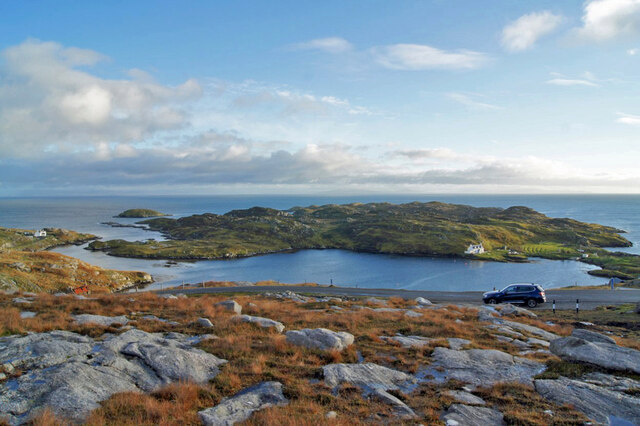
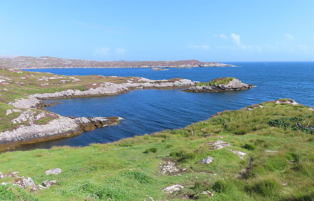
Àird Mhànais is a prominent coastal feature located in Inverness-shire, Scotland. Situated on the western coast of the Scottish Highlands, this headland or point marks the northernmost tip of the Ardnamurchan Peninsula.

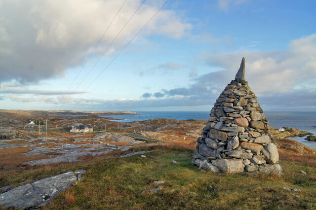
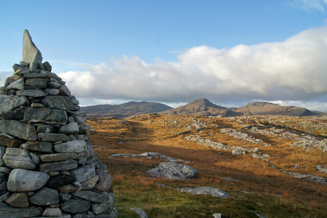
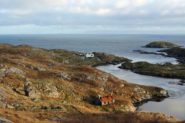
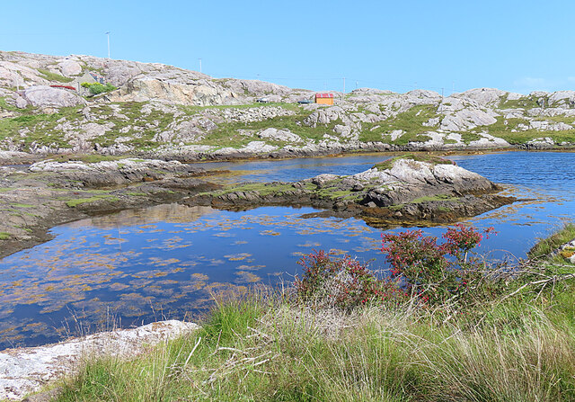
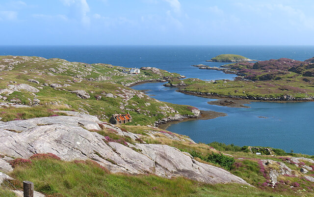
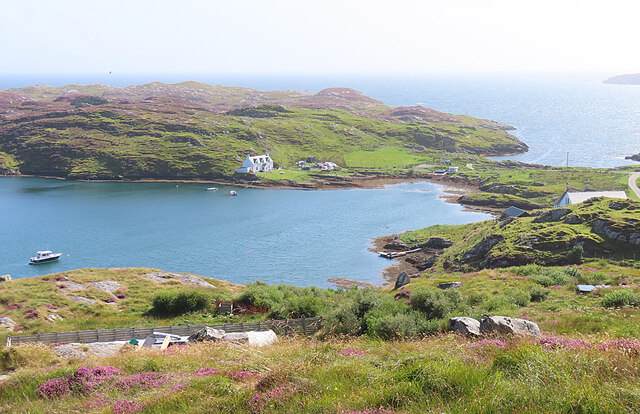
Rising to an elevation of approximately 150 meters (500 feet), Àird Mhànais offers breathtaking views of the surrounding rugged landscape, with the vast Atlantic Ocean stretching out to the west. The headland is characterized by steep cliffs, which have been shaped by the relentless force of the sea over thousands of years. These cliffs provide a nesting habitat for seabirds such as fulmars, kittiwakes, and guillemots, making it an ideal spot for birdwatching enthusiasts.

The area surrounding Àird Mhànais boasts a diverse range of flora and fauna, with a notable presence of heather, gorse, and grasses. The headland is also home to a variety of wildlife, including red deer and occasional sightings of otters and seals.

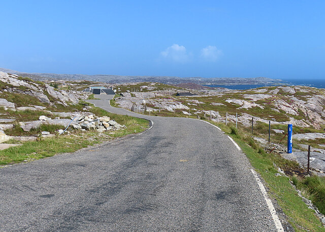
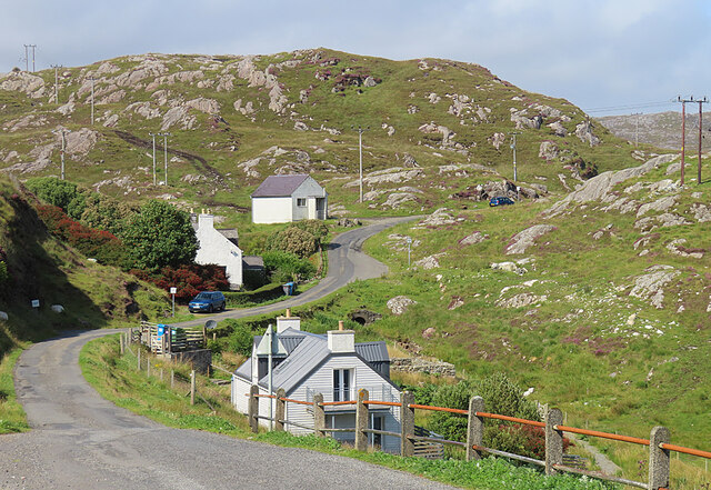
Access to Àird Mhànais is possible via a narrow road that winds its way through the stunning Ardnamurchan Peninsula. The headland can be explored on foot, with several walking trails leading to its summit, providing opportunities for hikers to immerse themselves in the unspoiled natural beauty of the area.

With its dramatic cliffs, panoramic views, and abundant wildlife, Àird Mhànais is a must-visit destination for nature lovers and photography enthusiasts alike, offering a unique and unforgettable experience of Scotland's coastal splendor.

If you have any feedback on the listing, please let us know in the comments section below.

Àird Mhànais Images

Images are sourced within 2km of 57.793948/-6.8631908 or Grid Reference NG1188. Thanks to Geograph Open Source API. All images are credited.

View over Ob Leasaid Looking south east from beside a cairn on the hillside just east of Manish.
View over Ob Leasaid
Looking south east from beside a cairn on the hillside just east of Manish.
Cairn and view, Manish Looking east past a neatly built cairn on the hillside just east of Manish.
Cairn and view, Manish
Looking east past a neatly built cairn on the hillside just east of Manish.
North past the cairn A view to the north past a cairn on the hillside just east of Manish.
North past the cairn
A view to the north past a cairn on the hillside just east of Manish.
Ruins and a house, Ardslave A view to the south east over the eastern coast of Harris.
Ruins and a house, Ardslave
A view to the south east over the eastern coast of Harris.
Solitary White house Geocaching is a type of global treasure hunt of people looking for caches, or hidden stashes of objects. Geocaching may also be described as a series of hide-and-seek games, where hiders provide online clues for seekers. Seekers use global positioning system (GPS) devices to find hidden caches
Solitary White house
Geocaching is a type of global treasure hunt of people looking for caches, or hidden stashes of objects. Geocaching may also be described as a series of hide-and-seek games, where hiders provide online clues for seekers. Seekers use global positioning system (GPS) devices to find hidden caches
Flodabay postbox Geocaching is a type of global treasure hunt of people looking for caches, or hidden stashes of objects. Geocaching may also be described as a series of hide-and-seek games, where hiders provide online clues for seekers. Seekers use global positioning system (GPS) devices to find hidden caches
Flodabay postbox
Geocaching is a type of global treasure hunt of people looking for caches, or hidden stashes of objects. Geocaching may also be described as a series of hide-and-seek games, where hiders provide online clues for seekers. Seekers use global positioning system (GPS) devices to find hidden caches
Inlet near Manais Another place where an arm of the sea penetrates well into the land.
Inlet near Manais
Another place where an arm of the sea penetrates well into the land.
Ob Leasaid Ob means an enclosed bay and this one is an excellent example, with a narrow channel from the sea widening to form a wide sea loch.
Ob Leasaid
Ob means an enclosed bay and this one is an excellent example, with a narrow channel from the sea widening to form a wide sea loch.
Manais One of the scattered settlements in eastern Harris, on the isthmus that separates Ob Leasaid from the open sea.
Manais
One of the scattered settlements in eastern Harris, on the isthmus that separates Ob Leasaid from the open sea.
The Winding Road The Bays road of eastern Harris twists and turns its way through the Lewisian gneiss landscape.
The Winding Road
The Bays road of eastern Harris twists and turns its way through the Lewisian gneiss landscape.
Loch Gheocrab One of the larger sea lochs on the east coast of Harris.
Loch Gheocrab
One of the larger sea lochs on the east coast of Harris.
Beachrabhaic Only a handful of houses make up the hamlet of Beacravik.
Beachrabhaic
Only a handful of houses make up the hamlet of Beacravik.
Church welcome sign A stone "noticeboard" on the side of the main road through Manish, inviting you to the Church of Scotland
Church welcome sign
A stone "noticeboard" on the side of the main road through Manish, inviting you to the Church of Scotland
Inlet of Loch Gheocrab
Turning for Aird Shleibhe
Unnamed Lochan on Flodabay Point Should have put my boots on for this one! Very wet underfoot
Unnamed Lochan on Flodabay Point
Should have put my boots on for this one! Very wet underfoot
House around Ob Leasaid near Manais Old and new houses around Ob Leasaid - a typical inlet in the Bays area of South Harris
House around Ob Leasaid near Manais
Old and new houses around Ob Leasaid - a typical inlet in the Bays area of South Harris
Old school at Manais
Show me another place!

Àird Mhànais is located at Grid Ref: NG1188 (Lat: 57.793948, Lng: -6.8631908)

Unitary Authority: Na h-Eileanan an Iar

Police Authority: Highlands and Islands

What 3 Words

///simple.intrigues.siblings. Near Leverburgh, Na h-Eileanan Siar

Related Wikis

Stockinish Island

Stockinish Island (Scottish Gaelic: Eilean Stocainis) is an uninhabited island off Harris, in the Outer Hebrides. == Geography and geology == Stockinish...

Borsham

Borsham (Scottish Gaelic: Boirseam) is a village in the 'Bays' area of Harris in the Outer Hebrides, Scotland. Borsham is within the parish of Harris....

Lingarabay

Lingarabay (also Lingerabay or Lingerbay; Scottish Gaelic: Lingreabhagh) is a small coastal settlement on Harris, in the Outer Hebrides of Scotland. It...

Harris Superquarry

The Harris Super Quarry was a super quarry at Lingerbay, Harris, Scotland proposed by Redland Aggregates in 1991. The plan was to surface mine aggregate...

Roineabhal

Roineabhal is a hill in Harris, in the Western Isles of Scotland. The granite on the summit plateau of the mountain is anorthosite, and is similar in composition...

St Clement's Church, Rodel

St Clement's Church (Scottish Gaelic: Tùr Chliamhainn, meaning Clement's Tower) is a late fifteenth-century or early sixteenth-century church in Rodel...

Rodel

Rodel (Scottish Gaelic: Roghadal) is a village on the south-eastern coast of Harris, an island in the Scottish Outer Hebrides. Rodel is situated in the...

Borve, Harris

Borve (Scottish Gaelic: Na Buirgh) is a village in Harris in the Outer Hebrides, Scotland. Borve is also within the parish of Harris, and is on the A859...

Nearby Amenities

Located within 500m of 57.793948,-6.8631908
Turning Circle
Lat/Long: 57.7967837/-6.8694669
Material: wood
Power: pole
Lat/Long: 57.7967999/-6.8696158
Material: wood
Power: pole
Lat/Long: 57.7968707/-6.869117
Ob Scalla
Natural: bay
Lat/Long: 57.7935331/-6.8633462
Sruth Ob Scalla
Natural: bay
Lat/Long: 57.7933273/-6.870792
Aird Mhor
Place: locality
Lat/Long: 57.7911886/-6.8621016
Aird Mhanais
Place: locality
Lat/Long: 57.7955001/-6.8655778
The data included in this document is from www.openstreetmap.org. The data is made available under ODbL.

Have you been to Àird Mhànais?

Leave your review of Àird Mhànais below (or comments, questions and feedback).