Ob Scalla

Bay in Inverness-shire

Scotland

Ob Scalla

Solitary White house Geocaching is a type of global treasure hunt of people looking for caches, or hidden stashes of objects. Geocaching may also be described as a series of hide-and-seek games, where hiders provide online clues for seekers. Seekers use global positioning system (GPS) devices to find hidden caches
Solitary White house Credit: Ralph Greig

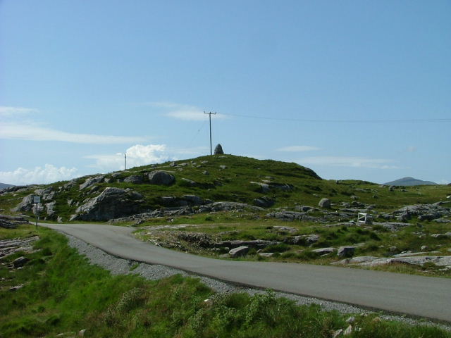
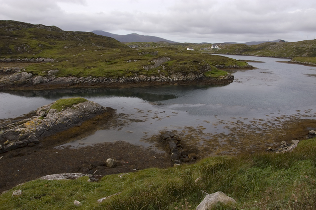
Ob Scalla, located in Inverness-shire, Scotland, is a picturesque bay that attracts visitors with its stunning natural beauty and rich historical significance. Situated on the eastern coast of the Scottish Highlands, the bay offers breathtaking views of the North Sea and the surrounding rugged landscapes.

The name "Ob Scalla" is derived from the Gaelic words "Ob," meaning bay, and "Scalla," referring to the rocky headland that juts out into the water. This prominent feature defines the bay and provides a unique backdrop for visitors.

The bay is known for its diverse wildlife, making it a popular destination for nature enthusiasts. Seals and dolphins are often spotted swimming in the clear blue waters, and a variety of bird species, such as puffins and gannets, can be observed along the coastline.

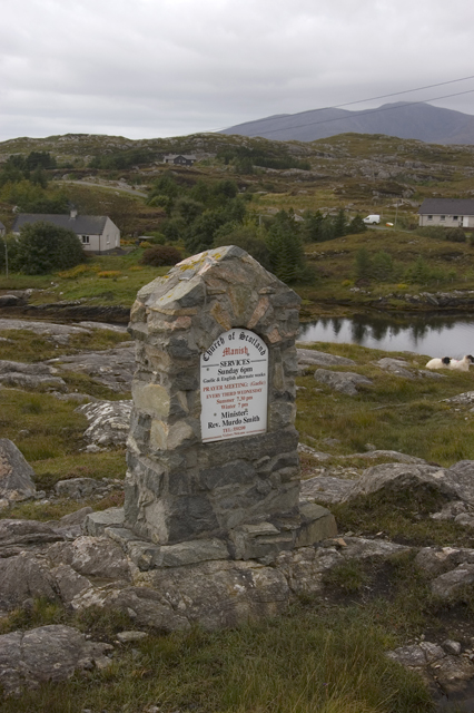
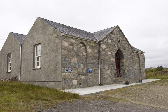
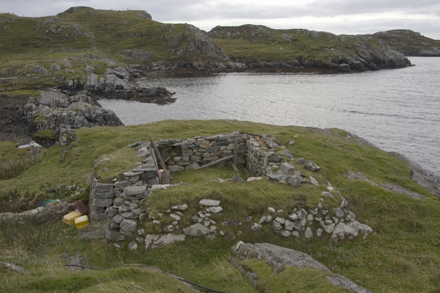
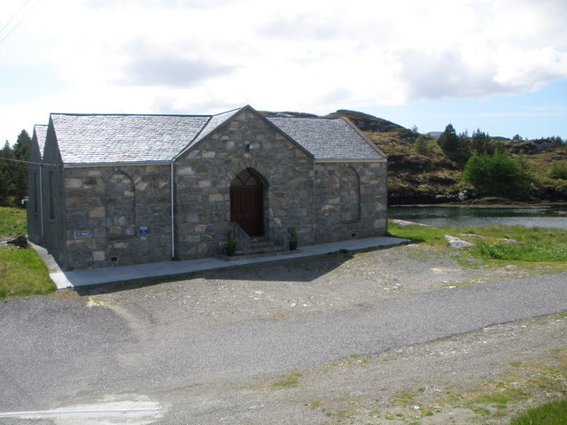
Ob Scalla is also historically significant, with archaeological remains dating back to the Neolithic period. The area has seen human habitation for thousands of years, and ancient artifacts and structures have been discovered in the vicinity. Visitors can explore the ruins of old settlements and learn about the region's fascinating past.

In addition to its natural beauty and historical sites, Ob Scalla offers recreational activities for outdoor enthusiasts. The bay is a great spot for hiking, with several trails that offer panoramic views of the surrounding countryside. Fishing is also popular in the area, with a variety of fish species inhabiting the waters.

Overall, Ob Scalla is a charming bay that combines natural splendor, rich history, and outdoor activities, making it a must-visit destination for those exploring Inverness-shire and the Scottish Highlands.

If you have any feedback on the listing, please let us know in the comments section below.

Ob Scalla Images

Images are sourced within 2km of 57.793509/-6.8565782 or Grid Reference NG1188. Thanks to Geograph Open Source API. All images are credited.

Solitary White house Geocaching is a type of global treasure hunt of people looking for caches, or hidden stashes of objects. Geocaching may also be described as a series of hide-and-seek games, where hiders provide online clues for seekers. Seekers use global positioning system (GPS) devices to find hidden caches
Solitary White house
Geocaching is a type of global treasure hunt of people looking for caches, or hidden stashes of objects. Geocaching may also be described as a series of hide-and-seek games, where hiders provide online clues for seekers. Seekers use global positioning system (GPS) devices to find hidden caches
Flodabay postbox Geocaching is a type of global treasure hunt of people looking for caches, or hidden stashes of objects. Geocaching may also be described as a series of hide-and-seek games, where hiders provide online clues for seekers. Seekers use global positioning system (GPS) devices to find hidden caches
Flodabay postbox
Geocaching is a type of global treasure hunt of people looking for caches, or hidden stashes of objects. Geocaching may also be described as a series of hide-and-seek games, where hiders provide online clues for seekers. Seekers use global positioning system (GPS) devices to find hidden caches
Church welcome sign A stone "noticeboard" on the side of the main road through Manish, inviting you to the Church of Scotland
Church welcome sign
A stone "noticeboard" on the side of the main road through Manish, inviting you to the Church of Scotland
Inlet of Loch Gheocrab
Turning for Aird Shleibhe
Unnamed Lochan on Flodabay Point Should have put my boots on for this one! Very wet underfoot
Unnamed Lochan on Flodabay Point
Should have put my boots on for this one! Very wet underfoot
House around Ob Leasaid near Manais Old and new houses around Ob Leasaid - a typical inlet in the Bays area of South Harris
House around Ob Leasaid near Manais
Old and new houses around Ob Leasaid - a typical inlet in the Bays area of South Harris
Old school at Manais
Shed at Manais The wood carving looks to be a copy of one of the Lewis Chessmen. The sign to the right of the carving has been taken? borrowed? nicked? from the Roghadal Hotel.
Shed at Manais
The wood carving looks to be a copy of one of the Lewis Chessmen. The sign to the right of the carving has been taken? borrowed? nicked? from the Roghadal Hotel.
Part of the Golden Road at Manais
Old school and Telephone box at Manais
Ob Leasaid At Manais
Ob Leasaid
At Manais
Cairn above Manais
Cairn above Manais
Manais Church sign
Manais Church sign
Church of Scotland, Manais
Ruins at Manais
Ruins at Manais
Ob Leasaid from Aird Shleibhe road
Church of Scotland Manais
Show me another place!

Ob Scalla is located at Grid Ref: NG1188 (Lat: 57.793509, Lng: -6.8565782)

Unitary Authority: Na h-Eileanan an Iar

Police Authority: Highlands and Islands

What 3 Words

///gashes.stub.steered. Near Leverburgh, Na h-Eileanan Siar

Related Wikis

Stockinish Island

Stockinish Island (Scottish Gaelic: Eilean Stocainis) is an uninhabited island off Harris, in the Outer Hebrides. == Geography and geology == Stockinish...

Borsham

Borsham (Scottish Gaelic: Boirseam) is a village in the 'Bays' area of Harris in the Outer Hebrides, Scotland. Borsham is within the parish of Harris....

Lingarabay

Lingarabay (also Lingerabay or Lingerbay; Scottish Gaelic: Lingreabhagh) is a small coastal settlement on Harris, in the Outer Hebrides of Scotland. It...

Harris Superquarry

The Harris Super Quarry was a super quarry at Lingerbay, Harris, Scotland proposed by Redland Aggregates in 1991. The plan was to surface mine aggregate...

Nearby Amenities

Located within 500m of 57.793509,-6.8565782
Ob Scalla
Natural: bay
Lat/Long: 57.7935331/-6.8633462
Aird Mhor
Place: locality
Lat/Long: 57.7911886/-6.8621016
Aird Bheag
Place: locality
Lat/Long: 57.7904566/-6.8567372
Geo an Fhithich
Natural: bay
Lat/Long: 57.7893694/-6.8589964
The data included in this document is from www.openstreetmap.org. The data is made available under ODbL.

Have you been to Ob Scalla?

Leave your review of Ob Scalla below (or comments, questions and feedback).