Rubha Rongaistean

Coastal Feature, Headland, Point in Ross-shire

Scotland

Rubha Rongaistean
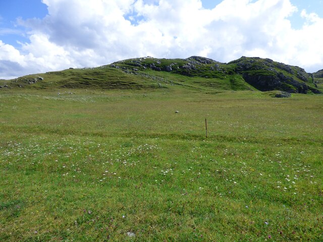
Lazy Beds at Tràigh na Beirigh Ridges formed by hand digging of fields.  These one are unusual in that some of the ridges are lined with small stones.
Lazy Beds at Tràigh na Beirigh Credit: Sandy Gerrard

Rubha Rongaistean is a prominent headland located in Ross-shire, Scotland. Situated on the coast, it juts out into the North Atlantic Ocean, offering breathtaking views and unique geological features. The headland is characterized by its rugged cliffs, which rise dramatically from the sea, adding to its grandeur and appeal.

The headland is formed mainly of ancient rocks, primarily composed of sandstone and shale. These rocks have been shaped and sculpted over millions of years by the powerful forces of erosion from the crashing waves and strong winds. This has resulted in the creation of fascinating geological formations, including sea arches, stacks, and caves, which can be explored by adventurous visitors.

The area surrounding Rubha Rongaistean is rich in biodiversity, with a diverse range of flora and fauna. Seabirds such as kittiwakes, guillemots, and puffins nest on the cliffs, providing a spectacular display for birdwatchers. The headland is also home to various marine species, including seals and dolphins, which can often be spotted in the surrounding waters.

For outdoor enthusiasts, Rubha Rongaistean offers excellent opportunities for coastal walks and exploration. The headland is accessible via a network of footpaths, allowing visitors to admire the stunning coastal scenery and observe the abundant wildlife. The area is particularly popular with photographers, who are drawn to its picturesque landscapes and dramatic seascapes.

Overall, Rubha Rongaistean is a captivating coastal feature that showcases the raw beauty of Scotland's coastline. Whether it's for its geological wonders, diverse wildlife, or simply its awe-inspiring views, this headland is a must-visit destination for nature lovers and adventure seekers alike.

If you have any feedback on the listing, please let us know in the comments section below.

Rubha Rongaistean Images

Images are sourced within 2km of 58.203626/-6.9229401 or Grid Reference NB1034. Thanks to Geograph Open Source API. All images are credited.

Lazy Beds at Tràigh na Beirigh Ridges formed by hand digging of fields.  These one are unusual in that some of the ridges are lined with small stones.
Lazy Beds at Tràigh na Beirigh
Ridges formed by hand digging of fields. These one are unusual in that some of the ridges are lined with small stones.
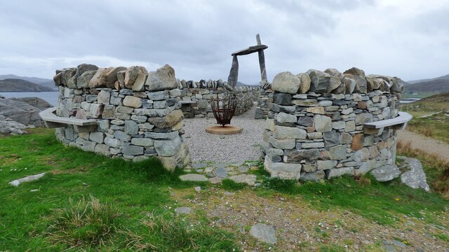
An Sùileachan Monument A monument to the Lewis land clearances <span class="nowrap"><a title="https://bhaltostrust.co.uk/suileachan-project/" rel="nofollow ugc noopener" href="https://bhaltostrust.co.uk/suileachan-project/">Link</a><img style="margin-left:2px;" alt="External link" title="External link - shift click to open in new window" src="https://s1.geograph.org.uk/img/external.png" width="10" height="10"/></span>
An Sùileachan Monument
A monument to the Lewis land clearances LinkExternal link
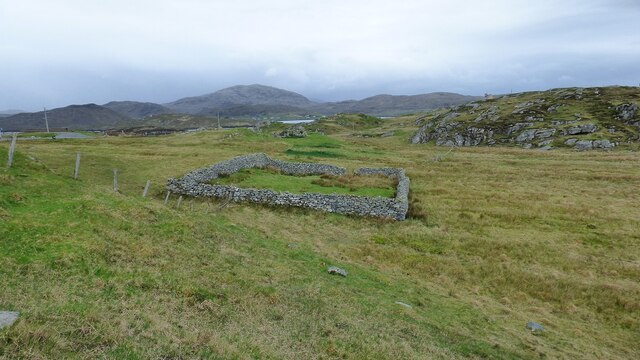
Sheepfold at Riof
Sheepfold at Riof
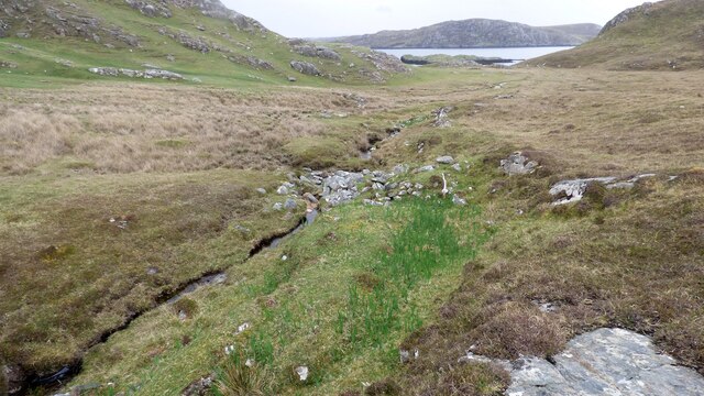
Norse Mill on burn leading from Loch Lionais The mill is very ruinous and survives as a spread of rubble overlying the lower courses of the building.  The leat serving the mill is represented by the bright green stripe.
Norse Mill on burn leading from Loch Lionais
The mill is very ruinous and survives as a spread of rubble overlying the lower courses of the building. The leat serving the mill is represented by the bright green stripe.
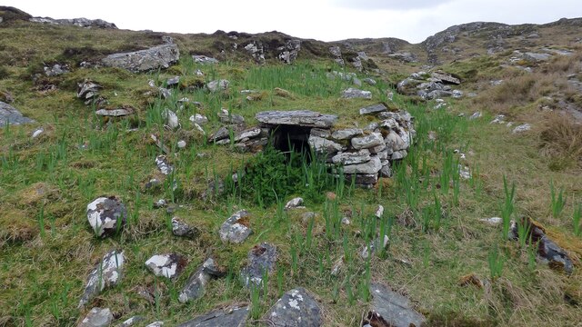
Norse Mill on burn leading from Loch Lionais The lower mill is rather better preserved with the tail race opening still intact.
Norse Mill on burn leading from Loch Lionais
The lower mill is rather better preserved with the tail race opening still intact.
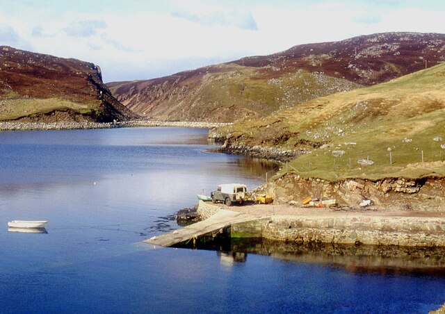
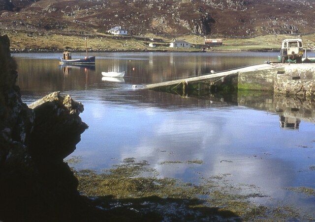
A slipway in Loch Miabhaig
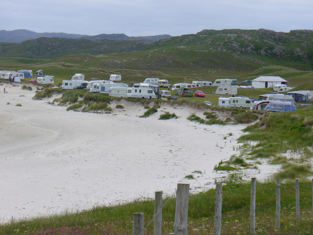
Berie Sands Caravan Park Busy site at Traigh na Beirigh with many caravans parked on the machair above the extensive sands.
Berie Sands Caravan Park
Busy site at Traigh na Beirigh with many caravans parked on the machair above the extensive sands.
A' Bheirigh from Suaineabhal
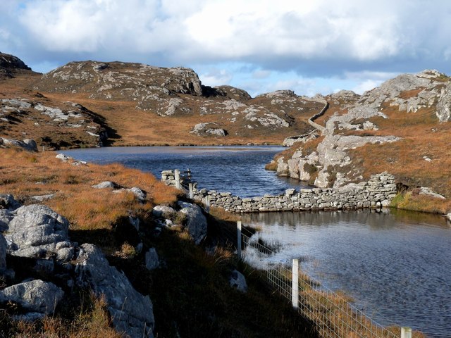
Lochan at Cragavig An old boundary wall snakes across the moorland
Lochan at Cragavig
An old boundary wall snakes across the moorland
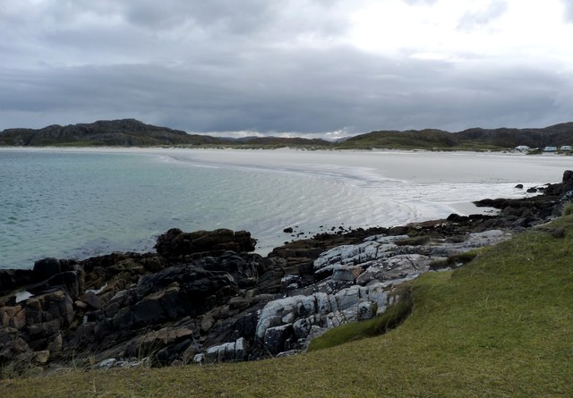
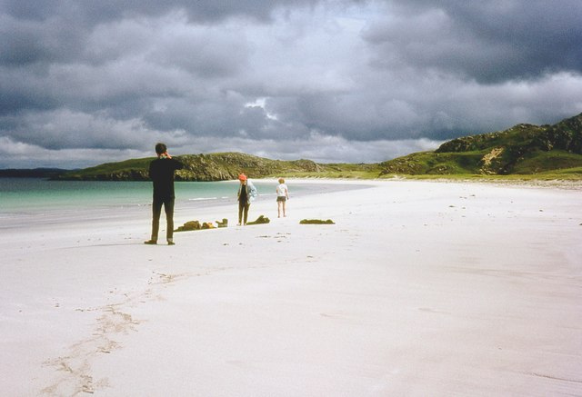
Tràigh na Beirigh In the 1960's this was a deserted beach.  Now it has to be shared with caravanners.
Tràigh na Beirigh
In the 1960's this was a deserted beach. Now it has to be shared with caravanners.
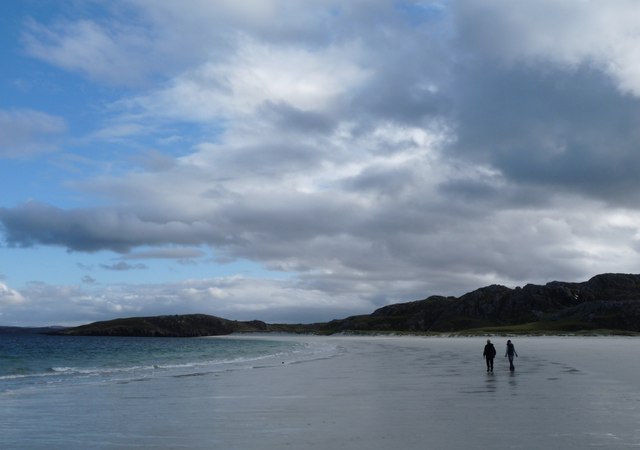
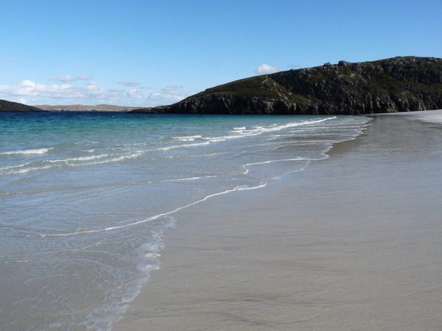
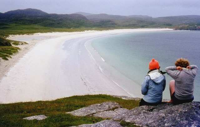
Tràigh na Beirigh A perfect crescent beach
Tràigh na Beirigh
A perfect crescent beach
A rocky buttress contains Tràigh na Beirigh
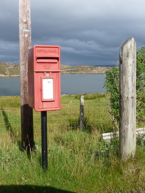
Cerishader: postbox № HS2 158 A small postbox on the B8011, with its back to Loch Ròg. It is emptied at 9 o'clock each morning, except Sunday.
Cerishader: postbox № HS2 158
A small postbox on the B8011, with its back to Loch Ròg. It is emptied at 9 o'clock each morning, except Sunday.
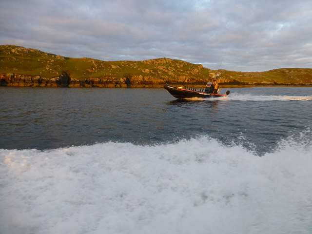
Morning RIB Commute Seatrek worker on morning commute to work at Miabhaig on a RIB. Photo taken from the MV Lochlann.
Morning RIB Commute
Seatrek worker on morning commute to work at Miabhaig on a RIB. Photo taken from the MV Lochlann.
Traigh na Berie
Traigh na Berie
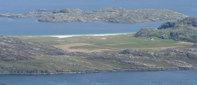
Tràigh na Beirigh from the east
Show me another place!

Rubha Rongaistean is located at Grid Ref: NB1034 (Lat: 58.203626, Lng: -6.9229401)

Unitary Authority: Na h-Eileanan an Iar

Police Authority: Highlands and Islands

What 3 Words

///occur.blaze.flamed. Near Carloway, Na h-Eileanan Siar

Related Wikis

Loch na Berie

Loch Na Berie is a broch in the Outer Hebrides of Scotland, located approximately 400 yards from the shore, and is thought to have been located on an island...

Flodaigh, Lewis

Flodaigh is a small island in Loch Roag on the west coast of Lewis in the Outer Hebrides of Scotland. It is about 33 hectares (82 acres) in extent and...

Fuaigh Beag

Fuaigh Beag or Vuia Be(a)g is an island in the Outer Hebrides. It is off the west coast of Lewis near Great Bernera in Loch Roag. Its name means "little...

Loch Ròg

Loch Ròg or Loch Roag is a large sea loch on the west coast of Lewis, Outer Hebrides. It is broadly divided into East Loch Roag and West Loch Roag with...

Fuaigh Mòr

Fuaigh Mòr (sometimes anglicised as Vuia Mor) is an island in the Outer Hebrides of Scotland. It is off the west coast of Lewis near Great Bernera in...

Kneep

Kneep (Scottish Gaelic: Cnìp) is a village on the Isle of Lewis, in the Outer Hebrides, Scotland. Kneep is within the parish of Uig.Various archaeological...

Vacsay

Vacsay (Scottish Gaelic: Bhacsaigh from Old Norse "bakkiey" meaning "peat bank island") is one of the Outer Hebrides. It is off the west coast of Lewis...

Cliff, Lewis

Cliff (Scottish Gaelic: Cliobh) is a small settlement on the Isle of Lewis, in the Outer Hebrides, Scotland. Cliff is within the parish of Uig. The settlement...

Nearby Amenities

Located within 500m of 58.203626,-6.9229401
Passing Place
Lat/Long: 58.2071806/-6.9240605
Passing Place
Lat/Long: 58.205463/-6.9235721
Passing Place
Lat/Long: 58.2051236/-6.9288927
Riof
Name En: Reef
Name Gd: Riof
Place: village
Lat/Long: 58.2047427/-6.9245971
Bus Stop
Reef
Naptan AtcoCode: 6010731786
Naptan Bearing: S
Naptan CommonName: Reef
Naptan Indicator: Reef
Naptan NaptanCode: 94723925
Naptan Street: Reef
Naptan Verified: no
Source: naptan_import
Lat/Long: 58.2044652/-6.9242118
Post Box
Collection Times: Mo-Fr 10:00; Sa 10:00
Old Ref: LH159
Operator: Royal Mail
Post Box Type: lamp
Ref: HS2 159
Royal Cypher: scottish_crown
Source: survey
Lat/Long: 58.2044145/-6.9243582
Barrier: cattle_grid
Lat/Long: 58.2049553/-6.9155746
Passing Place
Lat/Long: 58.2055396/-6.9176238
Turning Circle
Lat/Long: 58.2047532/-6.9148933
Passing Place
Lat/Long: 58.2048179/-6.9269692
Passing Place
Lat/Long: 58.2044143/-6.9251901
Barrier: cattle_grid
Lat/Long: 58.2048718/-6.9264905
Barrier: cattle_grid
Lat/Long: 58.2047523/-6.9272254
Power: pole
Lat/Long: 58.2056513/-6.9304119
Power: pole
Lat/Long: 58.2055307/-6.9291136
Power: pole
Lat/Long: 58.2053571/-6.9280528
Power: pole
Lat/Long: 58.2051371/-6.9266669
Power: pole
Lat/Long: 58.2049456/-6.9254526
Power: pole
Lat/Long: 58.2047506/-6.9242338
Power: pole
Lat/Long: 58.2049218/-6.9229044
Power: pole
Lat/Long: 58.2050408/-6.9220083
Power: pole
Lat/Long: 58.2052536/-6.9211913
Power: pole
Lat/Long: 58.2054855/-6.9203426
Power: pole
Lat/Long: 58.2057281/-6.9190087
Power: pole
Lat/Long: 58.2055925/-6.9182097
Power: pole
Lat/Long: 58.2054522/-6.9174017
Power: pole
Lat/Long: 58.2053071/-6.9165733
Power: pole
Lat/Long: 58.2051775/-6.9158059
Power: pole
Lat/Long: 58.2059101/-6.9200673
Power: pole
Lat/Long: 58.2047078/-6.9213199
Power: pole
Lat/Long: 58.2046091/-6.9224078
Power: pole
Lat/Long: 58.2044354/-6.9243038
Power: pole
Lat/Long: 58.2047661/-6.9271815
Power: pole
Lat/Long: 58.2050336/-6.9289759
Power: pole
Lat/Long: 58.2052596/-6.9286622
Power: pole
Lat/Long: 58.2050431/-6.9280054
Power: pole
Lat/Long: 58.2048862/-6.9283643
Power: pole
Lat/Long: 58.205652/-6.9298652
Power: pole
Lat/Long: 58.2055509/-6.929714
Power: pole
Lat/Long: 58.2057222/-6.9297591
Power: pole
Lat/Long: 58.2057959/-6.9298697
Barrier: cattle_grid
Lat/Long: 58.2045506/-6.9244502
The data included in this document is from www.openstreetmap.org. The data is made available under ODbL.

Have you been to Rubha Rongaistean?

Leave your review of Rubha Rongaistean below (or comments, questions and feedback).