Sròn a' Ghobhann
Coastal Feature, Headland, Point in Ross-shire
Scotland
Sròn a' Ghobhann

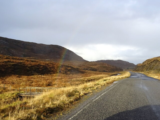
Sròn a' Ghobhann, located in Ross-shire, Scotland, is a prominent coastal feature that stands as a majestic headland jutting out into the North Atlantic Ocean. This point, also known as the Point of the Smith, showcases the raw beauty of the Scottish coastline and offers stunning panoramic views for visitors.
The geography of Sròn a' Ghobhann is characterized by its rugged and rocky terrain, with cliffs that tower over the crashing waves below. The headland stretches out into the ocean, forming a natural barrier against the powerful tides that constantly shape and mold the coastline. The rocky outcrops provide a habitat for various seabirds, including puffins, guillemots, and razorbills, making it an ideal spot for birdwatching enthusiasts.
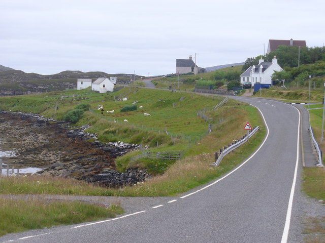
The area surrounding Sròn a' Ghobhann is rich in history and culture. The headland was historically known as a landing place for fishing boats and a site for local blacksmiths, which gave rise to its alternative name, the Point of the Smith. The remnants of these historic activities can still be seen in the form of old fishing huts and ruins of blacksmith workshops.
Visitors to Sròn a' Ghobhann can enjoy leisurely walks along the cliffside paths, taking in the breathtaking scenery and the invigorating sea air. It is a popular spot for photographers and nature lovers looking to capture the dramatic beauty of the Scottish coastline. The headland also offers opportunities for outdoor activities such as hiking, fishing, and wildlife spotting.
Overall, Sròn a' Ghobhann is a captivating coastal feature that combines natural beauty, historical significance, and recreational opportunities, making it a must-visit destination for anyone exploring the stunning landscapes of Ross-shire, Scotland.
If you have any feedback on the listing, please let us know in the comments section below.
Sròn a' Ghobhann Images
Images are sourced within 2km of 58.189954/-6.9219308 or Grid Reference NB1032. Thanks to Geograph Open Source API. All images are credited.


Sròn a' Ghobhann is located at Grid Ref: NB1032 (Lat: 58.189954, Lng: -6.9219308)
Unitary Authority: Na h-Eileanan an Iar
Police Authority: Highlands and Islands
What 3 Words
///possibly.ourselves.stunts. Near Carloway, Na h-Eileanan Siar
Related Wikis

Flodaigh, Lewis
Flodaigh is a small island in Loch Roag on the west coast of Lewis in the Outer Hebrides of Scotland. It is about 33 hectares (82 acres) in extent and...
Fuaigh Beag
Fuaigh Beag or Vuia Be(a)g is an island in the Outer Hebrides. It is off the west coast of Lewis near Great Bernera in Loch Roag. Its name means "little...
Loch Ròg
Loch Ròg or Loch Roag is a large sea loch on the west coast of Lewis, Outer Hebrides. It is broadly divided into East Loch Roag and West Loch Roag with...

Loch na Berie
Loch Na Berie is a broch in the Outer Hebrides of Scotland, located approximately 400 yards from the shore, and is thought to have been located on an island...
Fuaigh Mòr
Fuaigh Mòr (sometimes anglicised as Vuia Mor) is an island in the Outer Hebrides of Scotland. It is off the west coast of Lewis near Great Bernera in...

Kneep
Kneep (Scottish Gaelic: Cnìp) is a village on the Isle of Lewis, in the Outer Hebrides, Scotland. Kneep is within the parish of Uig.Various archaeological...

Cliff, Lewis
Cliff (Scottish Gaelic: Cliobh) is a small settlement on the Isle of Lewis, in the Outer Hebrides, Scotland. Cliff is within the parish of Uig. The settlement...

Vacsay
Vacsay (Scottish Gaelic: Bhacsaigh from Old Norse "bakkiey" meaning "peat bank island") is one of the Outer Hebrides. It is off the west coast of Lewis...
Have you been to Sròn a' Ghobhann?
Leave your review of Sròn a' Ghobhann below (or comments, questions and feedback).