Àird an Laoigh

Coastal Feature, Headland, Point in Inverness-shire

Scotland

Àird an Laoigh

Siolaigh Remote island off the coast of Harris. The hill to the left is a separate island Siolaigh Bheag, separated by a narrow channel.
Siolaigh Credit: Oliver Dixon

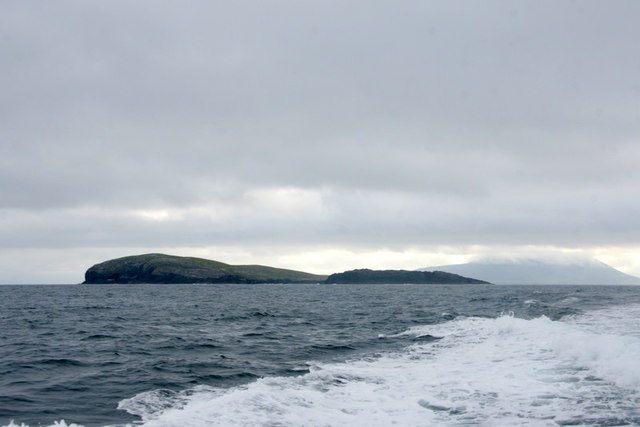
Àird an Laoigh is a prominent headland located in Inverness-shire, Scotland. Situated on the west coast of the country, it is positioned between the towns of Gairloch and Ullapool, overlooking the North Atlantic Ocean. With its breathtaking natural beauty and rugged cliffs, Àird an Laoigh is a popular destination for tourists and nature enthusiasts.

The headland stretches out into the sea, forming a distinct point that offers stunning panoramic views of the surrounding landscape. Its name, which translates to "Point of the Calves" in English, is derived from the presence of a nearby farm where young cattle were once reared.

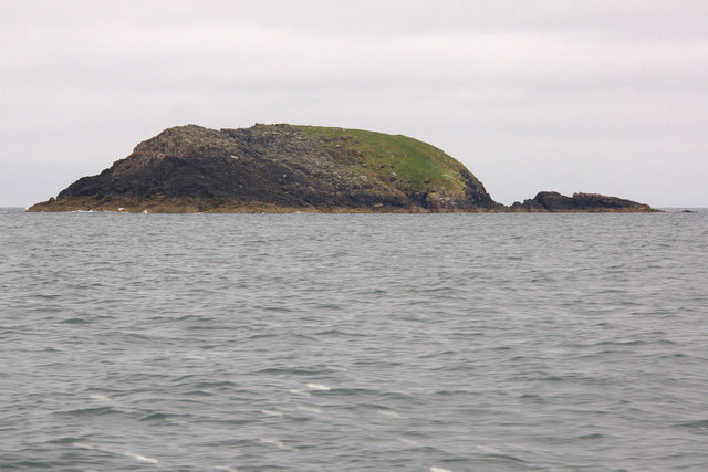
The area is characterized by its dramatic coastal features, including towering cliffs that provide nesting grounds for various seabirds, such as puffins, gannets, and razorbills. The diverse marine ecosystem also supports a rich array of aquatic life, making it a haven for fishing enthusiasts.

In addition to its natural wonders, Àird an Laoigh boasts a rugged coastal path that offers hikers and walkers the opportunity to explore the scenic surroundings. The path winds along the cliff edges, providing breathtaking views of the turquoise waters below and the distant mountain ranges.

Visitors can also enjoy the tranquility of the sandy beaches and rocky coves that dot the coastline, making it an ideal spot for picnics or a peaceful day by the sea. The headland is easily accessible by road, with car parking facilities available nearby.

All in all, Àird an Laoigh is a captivating coastal feature that showcases the raw beauty of Scotland's west coast. Its stunning cliffs, diverse wildlife, and picturesque views make it a must-visit destination for those seeking a true Scottish coastal experience.

If you have any feedback on the listing, please let us know in the comments section below.

Àird an Laoigh Images

Images are sourced within 2km of 57.799345/-7.2559257 or Grid Reference NF8790. Thanks to Geograph Open Source API. All images are credited.

Siolaigh Remote island off the coast of Harris. The hill to the left is a separate island Siolaigh Bheag, separated by a narrow channel.
Siolaigh
Remote island off the coast of Harris. The hill to the left is a separate island Siolaigh Bheag, separated by a narrow channel.
Siolaigh Bheag, north of Pabbay (Pabaigh) Small island south of Sioliagh (Shillay), which is to the right in the photo, as seen from a boat on the way to St Kilda.
Siolaigh Bheag, north of Pabbay (Pabaigh)
Small island south of Sioliagh (Shillay), which is to the right in the photo, as seen from a boat on the way to St Kilda.
Siolaigh (Shillay) from the west Taken from a boat en route to St Kilda.
Siolaigh (Shillay) from the west
Taken from a boat en route to St Kilda.
Siolaigh Bheag, north of Pabbay (Pabaigh) Taken from the south-east.
Siolaigh Bheag, north of Pabbay (Pabaigh)
Taken from the south-east.
Siolaigh (Shillay) from the south The grassy southern peninsula, covered in sheep, and the highest point of the island, at 79 m.
Siolaigh (Shillay) from the south
The grassy southern peninsula, covered in sheep, and the highest point of the island, at 79 m.
Northwest end of Siolaigh With the 79m high point of the island.
Northwest end of Siolaigh
With the 79m high point of the island.
Eastern end of Siolaigh The low lying east end of the island at the entrance to the Sound of Harris.
Eastern end of Siolaigh
The low lying east end of the island at the entrance to the Sound of Harris.
Show me another place!

Àird an Laoigh is located at Grid Ref: NF8790 (Lat: 57.799345, Lng: -7.2559257)

Unitary Authority: Na h-Eileanan an Iar

Police Authority: Highlands and Islands

What 3 Words

///repeating.rave.marmalade. Near Leverburgh, Na h-Eileanan Siar

Related Wikis

Shillay

Shillay (Scottish Gaelic: Siolaigh) is an uninhabited island which lies 2 km north of Pabbay in the Outer Hebrides of Scotland. The name is derived from...

Pabbay, Harris

Pabbay (Scottish Gaelic: Pabaigh) is an uninhabited island in the Outer Hebrides of Scotland which lies in the Sound of Harris between Harris and North...

Boreray, North Uist

Boreray (Scottish Gaelic: Boraraigh) is an island with a single croft, lying 2 kilometres (1.2 mi) north of North Uist in the Outer Hebrides of Scotland...

Berneray (North Uist)

Berneray (Scottish Gaelic: Beàrnaraigh na Hearadh) is an island and community in the Sound of Harris, Scotland. It is one of fifteen inhabited islands...

Nearby Amenities

Located within 500m of 57.799345,-7.2559257
Source: PGS
Lat/Long: 57.7970956/-7.2565396
Source: PGS
Lat/Long: 57.7968984/-7.2573414
Source: PGS
Lat/Long: 57.7970653/-7.2581583
Source: PGS
Lat/Long: 57.7972854/-7.2584002
Source: PGS
Lat/Long: 57.7974154/-7.2586302
Source: PGS
Lat/Long: 57.7976754/-7.2588602
Source: PGS
Lat/Long: 57.7976654/-7.2579002
Source: PGS
Lat/Long: 57.7981754/-7.2581202
Source: PGS
Lat/Long: 57.7986854/-7.2580802
Source: PGS
Lat/Long: 57.8005257/-7.2584164
Source: PGS
Lat/Long: 57.8010312/-7.2581812
Source: PGS
Lat/Long: 57.8011254/-7.2586902
Source: PGS
Lat/Long: 57.8012654/-7.2589302
Source: PGS
Lat/Long: 57.8013954/-7.2591602
Source: PGS
Lat/Long: 57.8015254/-7.2593902
Source: PGS
Lat/Long: 57.8022513/-7.260687
Source: PGS
Lat/Long: 57.8028155/-7.2602902
Source: PGS
Lat/Long: 57.8032981/-7.2522817
Source: PGS
Lat/Long: 57.8004754/-7.2481702
Source: PGS
Lat/Long: 57.8004954/-7.2496102
Source: PGS
Lat/Long: 57.8004954/-7.2500902
Source: PGS
Lat/Long: 57.8005054/-7.2505702
Source: PGS
Lat/Long: 57.8002554/-7.2520202
Source: PGS
Lat/Long: 57.8001554/-7.2530002
Source: PGS
Lat/Long: 57.7993854/-7.2530202
Source: PGS
Lat/Long: 57.7992754/-7.2539902
Source: PGS
Lat/Long: 57.7991454/-7.2542302
Source: PGS
Lat/Long: 57.7986454/-7.2547502
Source: PGS
Lat/Long: 57.7981354/-7.2552402
Source: PGS
Lat/Long: 57.7980154/-7.2554902
Source: PGS
Lat/Long: 57.7978854/-7.2557302
Source: PGS
Lat/Long: 57.7977654/-7.2559802
Source: PGS
Lat/Long: 57.7976354/-7.2562302
Source: PGS
Lat/Long: 57.7975154/-7.2564702
Source: PGS
Lat/Long: 57.7973854/-7.2567202
Source: PGS
Lat/Long: 57.7969612/-7.2630056
Source: PGS
Lat/Long: 57.7966382/-7.2616729
Source: PGS
Lat/Long: 57.7963782/-7.2614529
Source: PGS
Lat/Long: 57.7958582/-7.2609929
The data included in this document is from www.openstreetmap.org. The data is made available under ODbL.

Have you been to Àird an Laoigh?

Leave your review of Àird an Laoigh below (or comments, questions and feedback).