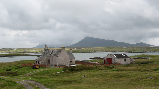
Rubh' a' Bhàigh Mhòir

Coastal Feature, Headland, Point in Inverness-shire

Scotland

Rubh' a' Bhàigh Mhòir
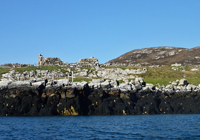
Ruined buildings at Buaile-mhòr
Ruined buildings at Buaile-mhòr Credit: Toby Speight

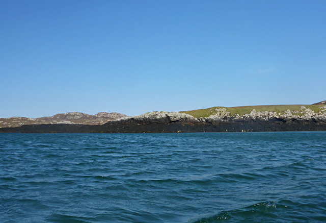
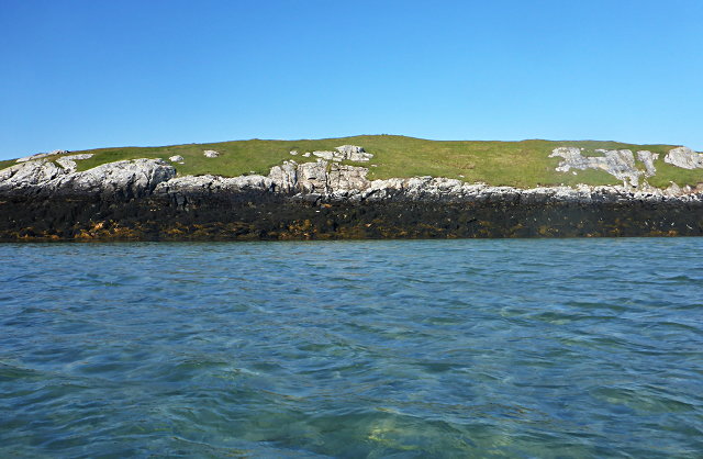
Rubh' a' Bhàigh Mhòir is a stunning coastal feature located in Inverness-shire, Scotland. This headland, also known as the Point of the Great Bay, juts out into the Atlantic Ocean and offers breathtaking views of the surrounding landscape.

Situated on the western coast of Scotland, Rubh' a' Bhàigh Mhòir is characterized by its rugged cliffs and rocky terrain. The headland is made up of layers of ancient rocks, showcasing the fascinating geological history of the area. From atop the cliffs, visitors can witness the sheer power of the ocean as waves crash against the shore, creating a dramatic and awe-inspiring spectacle.

The headland is also home to a diverse range of flora and fauna. The coastal grasslands are dotted with wildflowers, providing a colorful backdrop to the rugged scenery. The area is a haven for birdwatchers, as various seabirds such as gannets, fulmars, and guillemots can be spotted nesting on the cliffs. It is not uncommon to see seals bobbing in the water below, adding to the natural beauty of the location.

For those seeking outdoor activities, Rubh' a' Bhàigh Mhòir offers a multitude of options. Hikers can explore the headland and take in the panoramic views, while climbers can test their skills on the challenging cliffs. The headland is also a popular spot for fishing, with anglers casting their lines into the depths of the ocean in search of a prized catch.

Overall, Rubh' a' Bhàigh Mhòir is a captivating coastal feature in Inverness-shire, offering visitors a chance to immerse themselves in the beauty of Scotland's rugged coastline.

If you have any feedback on the listing, please let us know in the comments section below.

Rubh' a' Bhàigh Mhòir Images

Images are sourced within 2km of 57.489066/-7.2189859 or Grid Reference NF8756. Thanks to Geograph Open Source API. All images are credited.

Ruined buildings at Buaile-mhòr
Rubh' an t-Sagairt
Rubh' an t-Sagairt
Eilean na Hoe
Eilean na Hoe
Gearraidh Dubh Looking over the shore near Gearraidh Dubh towards Eabhal.
Gearraidh Dubh
Looking over the shore near Gearraidh Dubh towards Eabhal.
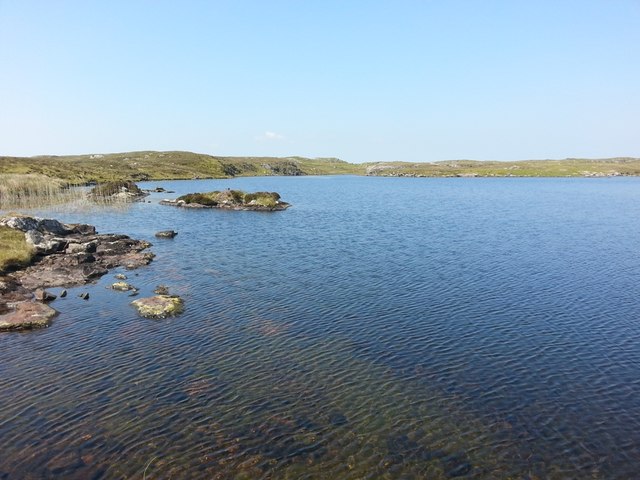
Loch na Faoileag on Grimsay One of many small islets on Loch na Faoileag on the Isle of Grimsay
Loch na Faoileag on Grimsay
One of many small islets on Loch na Faoileag on the Isle of Grimsay
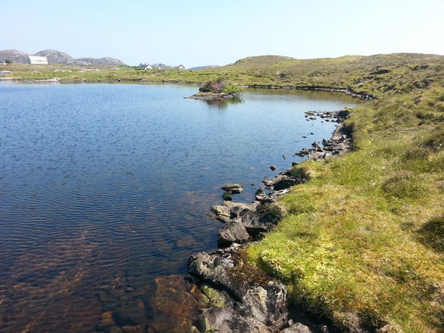
Loch na Faoileag Shoreline A view along the shoreline to north west finger on Loch na Faoileag (Isle of Grimsay) .Taken on the opposite bank from the roadside.
Loch na Faoileag Shoreline
A view along the shoreline to north west finger on Loch na Faoileag (Isle of Grimsay) .Taken on the opposite bank from the roadside.
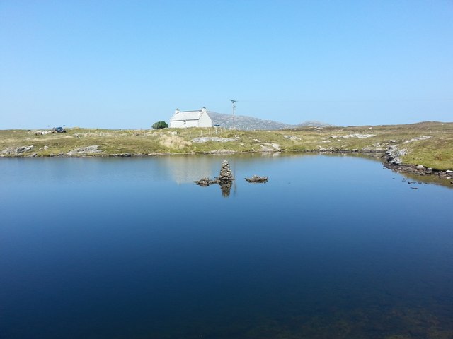
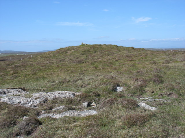
Loch na Faoileag Cairn A small cairn situated at the south-eastern end of Loch na Faoileag.
Loch na Faoileag Cairn
A small cairn situated at the south-eastern end of Loch na Faoileag.
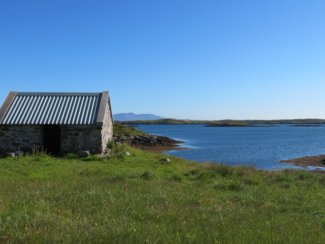
Bagh Sgotbheinn Not all Hebridean buildings fall into disrepair. I note that Dave Fergusson's 2007 photograph includes this small building, but now, twelve years later it has a new roof and is looking well cared for.
Bagh Sgotbheinn
Not all Hebridean buildings fall into disrepair. I note that Dave Fergusson's 2007 photograph includes this small building, but now, twelve years later it has a new roof and is looking well cared for.
Kallin Harbour, Grimsay
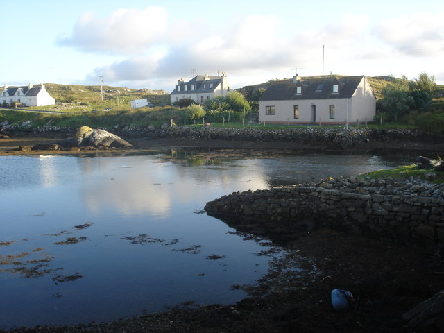
Old harbour, Grimsay A crofthouse sitting on a reclaimed piece of land at Baymore (Bagh mor) which was the main harbour on the island before the Kallin (Ceallan) development.  The harbour is littered with lots of old creels and other flotsam and there are many old stone piers.
Old harbour, Grimsay
A crofthouse sitting on a reclaimed piece of land at Baymore (Bagh mor) which was the main harbour on the island before the Kallin (Ceallan) development. The harbour is littered with lots of old creels and other flotsam and there are many old stone piers.
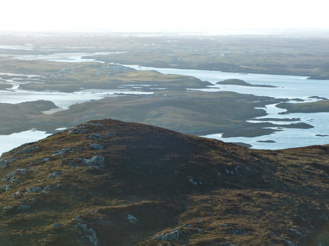
The summit region of Grimsay Grimsay is a low island between North Uist and Benbecula. It is difficult to be certain of its highest point, but this eminence, 25m or so above Mean Sea Level, is a good contender.
The summit region of Grimsay
Grimsay is a low island between North Uist and Benbecula. It is difficult to be certain of its highest point, but this eminence, 25m or so above Mean Sea Level, is a good contender.
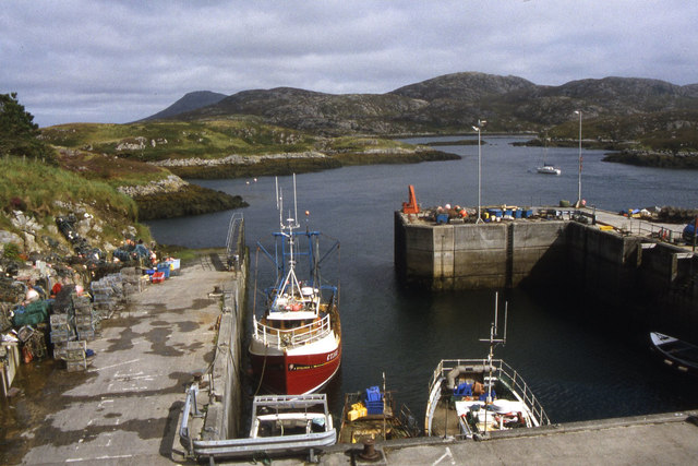
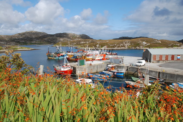
Kallin Harbour The smaller vessels in the harbour are inshore lobster boats which use creels to trap crabs and lobsters.  The larger vessels are offshore prawn boats which use trawl nets to catch the shellfish.
Kallin Harbour
The smaller vessels in the harbour are inshore lobster boats which use creels to trap crabs and lobsters. The larger vessels are offshore prawn boats which use trawl nets to catch the shellfish.
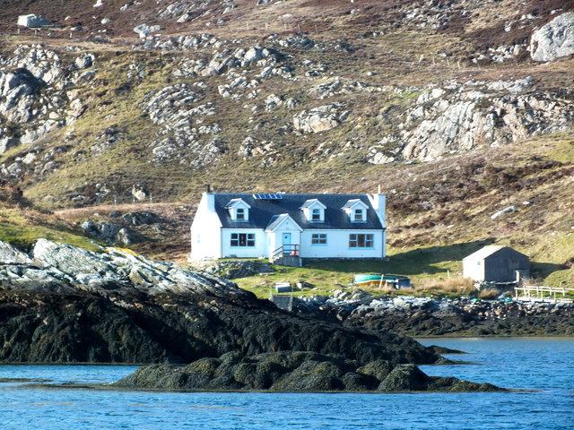
Cottage on Ronay Ronay
Cottage on Ronay
Ronay
Isle of Ronay View towards North Uist
Isle of Ronay
View towards North Uist
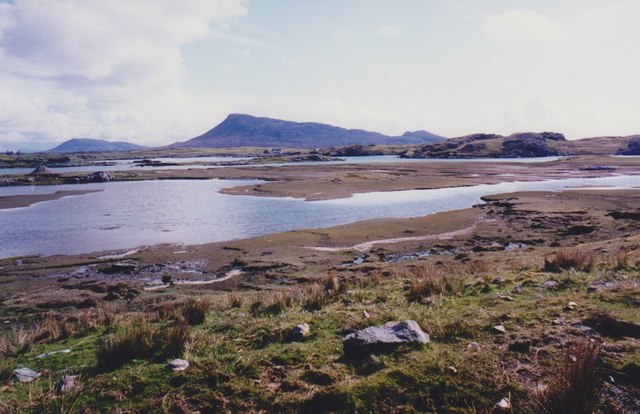
Sandy inlet on the coast of Grimsay One of a maze of inlets and channels around Grimsay. This view is interesting as there are remains of old field walls [possibly iron age/centre picture] visible in the sand, indicating a lower sea level at some time. Cloud capped Eabhal rises in the distance.
Sandy inlet on the coast of Grimsay
One of a maze of inlets and channels around Grimsay. This view is interesting as there are remains of old field walls [possibly iron age/centre picture] visible in the sand, indicating a lower sea level at some time. Cloud capped Eabhal rises in the distance.
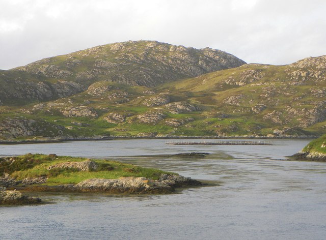
Vallastrome, Kallin The view along the Vallastrome channel towards the biggest hill on the island of Ronaigh. The trig point at 115m can just be seen.
Vallastrome, Kallin
The view along the Vallastrome channel towards the biggest hill on the island of Ronaigh. The trig point at 115m can just be seen.
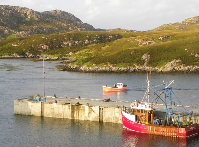
Coming in to harbour Small fishing boat entering Kallin harbour on a summer evening. This little boat has a 'FY' registration for Fowey in Cornwall, but arrived at Kallin on the back of a lorry. The 'Stelimar'is a local boat based here.
Coming in to harbour
Small fishing boat entering Kallin harbour on a summer evening. This little boat has a 'FY' registration for Fowey in Cornwall, but arrived at Kallin on the back of a lorry. The 'Stelimar'is a local boat based here.
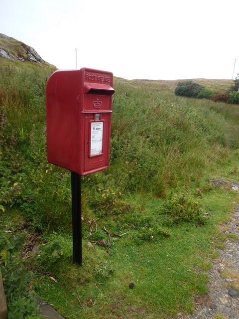
Baymore: postbox № HS6 15 One of four postboxes on the island of Grimsay. Apart from the one on the main road close to the post office, they are emptied at 11:45am on weekdays and at 9:30am on Saturdays.
Baymore: postbox № HS6 15
One of four postboxes on the island of Grimsay. Apart from the one on the main road close to the post office, they are emptied at 11:45am on weekdays and at 9:30am on Saturdays.
Show me another place!

Rubh' a' Bhàigh Mhòir is located at Grid Ref: NF8756 (Lat: 57.489066, Lng: -7.2189859)

Unitary Authority: Na h-Eileanan an Iar

Police Authority: Highlands and Islands

What 3 Words

///smarter.horseshoe.securing. Near Balivanich, Na h-Eileanan Siar

Related Wikis

Grimsay

Grimsay (Scottish Gaelic: Griomasaigh) is a tidal island in the Outer Hebrides of Scotland. == Geography == Grimsay is the largest of the low-lying stepping...

Ronay

Ronay (Scottish Gaelic: Rònaigh) is an island in the Outer Hebrides of Scotland, which lies a short distance off the east coast of Grimsay. == Geography... ==

Fraoch-Eilean

Fraoch-eilean is a small island with an uncertain population north of Benbecula in the Outer Hebrides of Scotland. It is about 55 hectares (140 acres...

Flodaigh

Flodaigh is a tidal island lying to the north of Benbecula and south of Grimsay in the Outer Hebrides, Scotland. It is connected to Benbecula by a causeway...

Nearby Amenities

Located within 500m of 57.489066,-7.2189859
Bus Stop
Grimsay Island
Local Ref: MORE
Naptan AtcoCode: 6010731675
Naptan Bearing: N
Naptan CommonName: Grimsay Island
Naptan Indicator: Baymore
Naptan Landmark: Baymore
Naptan NaptanCode: 94723529
Naptan Street: Baymore
Naptan Verified: no
Source: naptan_import
Lat/Long: 57.4881997/-7.221983
Passing Place
Lat/Long: 57.4875942/-7.2207528
Barrier: cattle_grid
Lat/Long: 57.4866526/-7.2196289
Am Bàgh Mòr
Alt Name: Bagh More
Name En: Baymore
Name Gd: Am Bàgh Mòr
Place: village
Lat/Long: 57.4879179/-7.2209063
Na Ceallan
Alt Name: Kallin
Direction: NW
Traffic Sign: city_limit
Lat/Long: 57.4862715/-7.2185782
Am Bàgh Mòr
Alt Name: Baymore
Direction: SE
Traffic Sign: city_limit
Lat/Long: 57.4862657/-7.2185661
Post Box
Collection Times: Mo-Fr 11:45; Sa 09:30
Drive Through: yes
Operator: Royal Mail
Post Box Mounting: pole
Post Box Type: lamp
Ref: HS6 15
Royal Cypher: scottish_crown
Lat/Long: 57.4882242/-7.2218035
Bàgh Mòr
Natural: bay
Lat/Long: 57.4880044/-7.2192514
Rubh a' Bhàigh Mhòir
Natural: cape
Lat/Long: 57.489019/-7.2173028
Power: pole
Lat/Long: 57.4871014/-7.2218326
Power: pole
Lat/Long: 57.4867544/-7.2208628
Power: pole
Lat/Long: 57.4864093/-7.2199083
Power: pole
Lat/Long: 57.4860089/-7.21887
Power: pole
Lat/Long: 57.4855333/-7.2176168
Power: pole
Lat/Long: 57.4852266/-7.2168053
Power: pole
Lat/Long: 57.4849639/-7.2161155
Power: pole
Lat/Long: 57.4859566/-7.2180192
Power: pole
Lat/Long: 57.4861674/-7.218537
Power: pole
Lat/Long: 57.4864276/-7.2191454
Power: pole
Lat/Long: 57.4866065/-7.219575
Power: pole
Lat/Long: 57.4892319/-7.2233945
Power: pole
Lat/Long: 57.4899026/-7.2239583
Power: pole
Lat/Long: 57.4905262/-7.2244524
Power: pole
Lat/Long: 57.4911278/-7.224969
Passing Place
Lat/Long: 57.4885825/-7.222077
Passing Place
Lat/Long: 57.4881599/-7.2216171
Barrier: cattle_grid
Lat/Long: 57.4862488/-7.2184072
Passing Place
Lat/Long: 57.4914182/-7.2246721
Passing Place
Lat/Long: 57.4850909/-7.2153155
Passing Place
Lat/Long: 57.4852293/-7.2156833
Power: pole
Lat/Long: 57.4872868/-7.2212134
Power: pole
Lat/Long: 57.486948/-7.220394
The data included in this document is from www.openstreetmap.org. The data is made available under ODbL.

Have you been to Rubh' a' Bhàigh Mhòir?

Leave your review of Rubh' a' Bhàigh Mhòir below (or comments, questions and feedback).