Rubha Laimhrig nan Capull

Coastal Feature, Headland, Point in Inverness-shire

Scotland

Rubha Laimhrig nan Capull

Eilean na Hoe
Eilean na Hoe Credit: Toby Speight

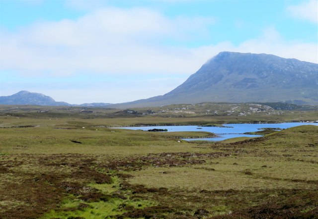
Rubha Laimhrig nan Capull is a prominent coastal feature located in Inverness-shire, a county in the Scottish Highlands. Also known as the "Point of the Horses' Leap," it is a stunning headland that juts out into the North Sea, offering breathtaking views of the surrounding landscape.

Situated on the east coast of Scotland, Rubha Laimhrig nan Capull boasts a rugged and dramatic terrain. The headland is characterized by steep cliffs that plummet down to the crashing waves below. These cliffs are composed of various rock formations, including sandstone and shale, which display a range of colors from deep red to gray.

The point is named after an ancient legend that tells of horses leaping from the cliffs into the sea, attempting to escape the pursuing enemy. This folklore adds an air of mystique to the already captivating landscape.

The headland is also home to a diverse array of flora and fauna. Seabird colonies, such as kittiwakes and guillemots, nest on the cliffs, while occasional sightings of dolphins and seals can be enjoyed from the shoreline. The surrounding waters are known for their rich marine life, making it a popular spot for fishing and diving enthusiasts.

Rubha Laimhrig nan Capull is a popular destination for outdoor enthusiasts, offering various activities such as hiking, birdwatching, and photography. The headland's remote location and untouched beauty make it a haven for those seeking tranquility and natural beauty.

If you have any feedback on the listing, please let us know in the comments section below.

Rubha Laimhrig nan Capull Images

Images are sourced within 2km of 57.504873/-7.2404898 or Grid Reference NF8658. Thanks to Geograph Open Source API. All images are credited.

Eilean na Hoe
Eilean na Hoe
Eilean Buidhe
Eilean Buidhe
Ocean on the west side of the causeway to North Uist
NCN780 on Grimsay Looking east, Loch an Fhaing on the left and Eaval, North Uist, in the distance.
NCN780 on Grimsay
Looking east, Loch an Fhaing on the left and Eaval, North Uist, in the distance.
Signpost on Grimsay The house beyond the end of Loch an Fhaing is marked as a Post Office on the map, but the may not be up to date information.
Signpost on Grimsay
The house beyond the end of Loch an Fhaing is marked as a Post Office on the map, but the may not be up to date information.
Bus stop and post box on Grimsay At the road-end of a loop that leaves the main road [A865].
Bus stop and post box on Grimsay
At the road-end of a loop that leaves the main road [A865].
Gearraidh Dubh Looking over the shore near Gearraidh Dubh towards Eabhal.
Gearraidh Dubh
Looking over the shore near Gearraidh Dubh towards Eabhal.
Loch na Faoileag on Grimsay One of many small islets on Loch na Faoileag on the Isle of Grimsay
Loch na Faoileag on Grimsay
One of many small islets on Loch na Faoileag on the Isle of Grimsay
Loch na Faoileag Shoreline A view along the shoreline to north west finger on Loch na Faoileag (Isle of Grimsay) .Taken on the opposite bank from the roadside.
Loch na Faoileag Shoreline
A view along the shoreline to north west finger on Loch na Faoileag (Isle of Grimsay) .Taken on the opposite bank from the roadside.
Loch na Faoileag Cairn A small cairn situated at the south-eastern end of Loch na Faoileag.
Loch na Faoileag Cairn
A small cairn situated at the south-eastern end of Loch na Faoileag.
Near Gearraidh Dubh
Near Gearraidh Dubh
Gairbh-eilean
Gairbh-eilean
Barp Hacklett Cairn One cannot be absolutely sure if this is the cairn as the OS map doesn't give a detailed site, but as it is the only pile of stones on a green protuberance on an otherwise rather squelchy moor, then one would suggest that this is it.
Barp Hacklett Cairn
One cannot be absolutely sure if this is the cairn as the OS map doesn't give a detailed site, but as it is the only pile of stones on a green protuberance on an otherwise rather squelchy moor, then one would suggest that this is it.
Eilean an t-Seagail Seating located at a parking spot just off the A865 near Baile Glas on Benbecula.
Eilean an t-Seagail
Seating located at a parking spot just off the A865 near Baile Glas on Benbecula.
View towards Loch nan Garbh Chlachan Peat and heather moorland stretch away towards the shores of Loch nan Garbh Chlachan where a line of stepping stones are visible, beyond which in an adjoining square is Dun Ban on an islet. Magnifying the image brings up what looks like some remains of walls at the dun. In the distance is the familiar outline of Eabhal.
View towards Loch nan Garbh Chlachan
Peat and heather moorland stretch away towards the shores of Loch nan Garbh Chlachan where a line of stepping stones are visible, beyond which in an adjoining square is Dun Ban on an islet. Magnifying the image brings up what looks like some remains of walls at the dun. In the distance is the familiar outline of Eabhal.
Thatch at Cladach Chairinis
The summit region of Grimsay Grimsay is a low island between North Uist and Benbecula. It is difficult to be certain of its highest point, but this eminence, 25m or so above Mean Sea Level, is a good contender.
The summit region of Grimsay
Grimsay is a low island between North Uist and Benbecula. It is difficult to be certain of its highest point, but this eminence, 25m or so above Mean Sea Level, is a good contender.
Baile Glas, Grimsay Hamlet on the causewayed road between Benbecula and North Uist.
<span class="nowrap"><a title="http://www.isle-of-benbecula.co.uk/" rel="nofollow ugc noopener" href="http://www.isle-of-benbecula.co.uk/">Link</a><img style="margin-left:2px;" alt="External link" title="External link - shift click to open in new window" src="https://s1.geograph.org.uk/img/external.png" width="10" height="10"/></span>
Baile Glas, Grimsay
Hamlet on the causewayed road between Benbecula and North Uist. LinkExternal link
Show me another place!

Rubha Laimhrig nan Capull is located at Grid Ref: NF8658 (Lat: 57.504873, Lng: -7.2404898)

Unitary Authority: Na h-Eileanan an Iar

Police Authority: Highlands and Islands

What 3 Words

///pocketed.covertly.incoming. Near Balivanich, Na h-Eileanan Siar

Related Wikis

Fraoch-Eilean

Fraoch-eilean is a small island with an uncertain population north of Benbecula in the Outer Hebrides of Scotland. It is about 55 hectares (140 acres...

Grimsay

Grimsay (Scottish Gaelic: Griomasaigh) is a tidal island in the Outer Hebrides of Scotland. == Geography == Grimsay is the largest of the low-lying stepping...

Baile Glas

Baile Glas or Ballaglasa (Scottish Gaelic: Am Baile Glas) is a settlement on Grimsay in the Outer Hebrides, Scotland. Ballaglasa is within the parish of...

Flodaigh

Flodaigh is a tidal island lying to the north of Benbecula and south of Grimsay in the Outer Hebrides, Scotland. It is connected to Benbecula by a causeway...

Nearby Amenities

Located within 500m of 57.504873,-7.2404898
Seana Bhaile
Name En: Seanabaily
Name Gd: Seana Bhaile
Place: hamlet
Population: 10
Lat/Long: 57.5045439/-7.242031
Barrier: cattle_grid
Lat/Long: 57.5023282/-7.2454972
Passing Place
Lat/Long: 57.5013509/-7.2440048
Power: pole
Lat/Long: 57.5072796/-7.2472483
Power: pole
Lat/Long: 57.5058127/-7.2467119
Power: pole
Lat/Long: 57.5073026/-7.2470498
Power: pole
Lat/Long: 57.5058228/-7.2465
Power: pole
Lat/Long: 57.5053207/-7.2463229
Power: pole
Lat/Long: 57.5048876/-7.246162
Power: pole
Lat/Long: 57.5049755/-7.2464315
Power: pole
Lat/Long: 57.5040591/-7.2460561
Power: pole
Lat/Long: 57.5036887/-7.2462773
Power: pole
Lat/Long: 57.5029026/-7.2467065
Power: pole
Lat/Long: 57.5040158/-7.2458401
Power: pole
Lat/Long: 57.5035367/-7.2461311
Power: pole
Lat/Long: 57.50276/-7.2465871
Power: pole
Lat/Long: 57.5023688/-7.2468486
Power: pole
Lat/Long: 57.503462/-7.24033
Power: pole
Lat/Long: 57.5033503/-7.2416799
Power: pole
Lat/Long: 57.5032169/-7.2430764
Power: pole
Lat/Long: 57.503041/-7.2451252
Barrier: cattle_grid
Lat/Long: 57.5028524/-7.2367816
Height: 6
Man Made: tower
Tower Construction: mast
Tower Type: communication
Lat/Long: 57.5032255/-7.2446317
The data included in this document is from www.openstreetmap.org. The data is made available under ODbL.

Have you been to Rubha Laimhrig nan Capull?

Leave your review of Rubha Laimhrig nan Capull below (or comments, questions and feedback).