Tigh na h-Acairseid

Coastal Feature, Headland, Point in Inverness-shire

Scotland

Tigh na h-Acairseid

Fish farming near Eilean Ornais
Fish farming near Eilean Ornais Credit: Toby Speight

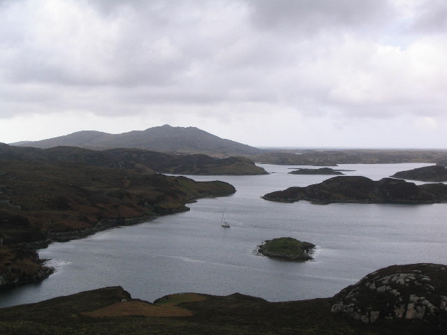
Tigh na h-Acairseid, located in Inverness-shire, Scotland, is a stunning coastal feature that stands as a prominent headland and point. With its breathtaking natural beauty and rich history, this picturesque location attracts visitors from all over the world.

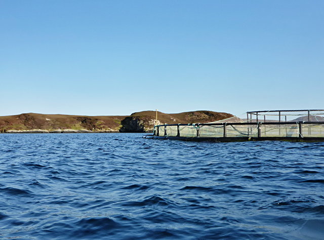
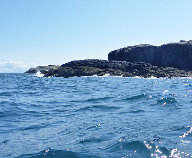
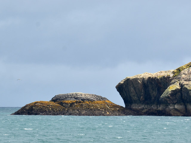
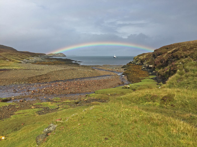
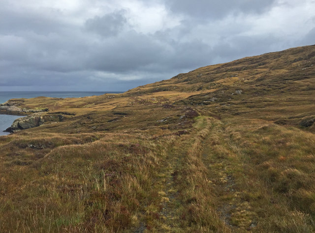
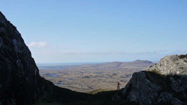
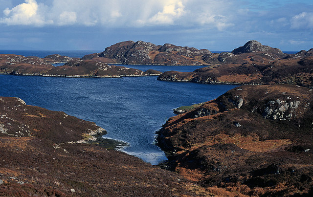
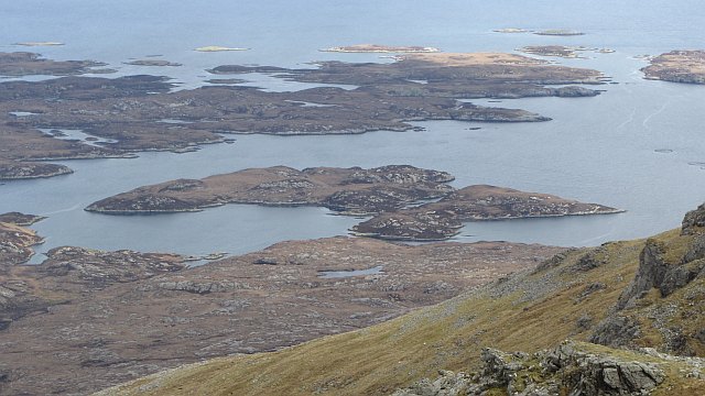
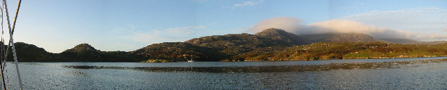
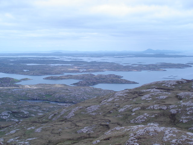
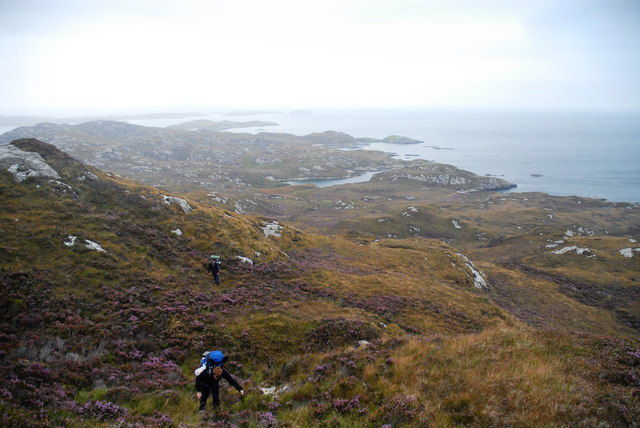
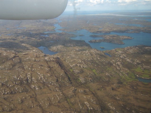
The headland of Tigh na h-Acairseid is formed by rugged cliffs that rise dramatically from the North Sea. These cliffs offer magnificent panoramic views of the surrounding landscape, including the sparkling blue waters below and the rolling hills in the distance. The headland is characterized by its rocky terrain, adorned with lush green vegetation, wildflowers, and occasional wildlife sightings.

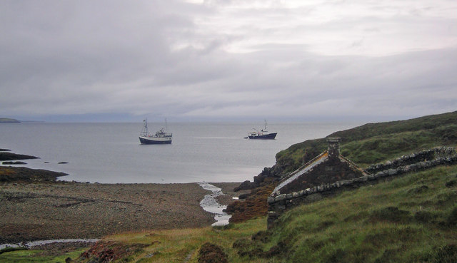
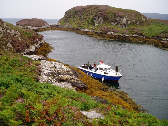
Tigh na h-Acairseid has played a significant role in the area's history, serving as a strategic lookout point and a navigational landmark for sailors. The headland's name translates to "house of the anchor" in Gaelic, referring to the anchorage that protected ships during storms. This historical significance adds to the charm and allure of the location.

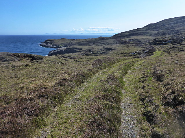
Visitors to Tigh na h-Acairseid can explore the headland on foot, following well-maintained trails that wind along the cliffs. These paths provide opportunities for hiking, birdwatching, and photography enthusiasts to immerse themselves in the natural splendor and capture breathtaking vistas.

In addition to its natural beauty, Tigh na h-Acairseid offers visitors access to nearby attractions such as sandy beaches, charming coastal villages, and historic sites. This makes it an ideal destination for those looking to experience the beauty of the Scottish coastline and immerse themselves in its rich cultural heritage.

If you have any feedback on the listing, please let us know in the comments section below.

Tigh na h-Acairseid Images

Images are sourced within 2km of 57.315023/-7.2258298 or Grid Reference NF8537. Thanks to Geograph Open Source API. All images are credited.

Fish farming near Eilean Ornais
Uisinis Lighthouse track When the Uisinis lighthouse was constructed for the Commissioners of Northern Lights in 1857, the designers, David and Thomas Stevenson, foolishly neglected to also invent helicopters.  Thus, generations of lighthouse keepers, and their supplies, arrived by sea.

The landing in the bay of Mol a Tuath is much more sheltered than the rocky coast at the lighthouse, and the gently-graded track provides an easier approach than steep steps to the shoreline as built at other locations.

The track has seen much less use since the introduction of helicopters, and especially since full automation of the light in 1970.
Uisinis Lighthouse track
When the Uisinis lighthouse was constructed for the Commissioners of Northern Lights in 1857, the designers, David and Thomas Stevenson, foolishly neglected to also invent helicopters. Thus, generations of lighthouse keepers, and their supplies, arrived by sea. The landing in the bay of Mol a Tuath is much more sheltered than the rocky coast at the lighthouse, and the gently-graded track provides an easier approach than steep steps to the shoreline as built at other locations. The track has seen much less use since the introduction of helicopters, and especially since full automation of the light in 1970.
Northern limit of Uisinis
Northernmost point of Uisinis The left side of the rocks shown is the only land in this square.
Northernmost point of Uisinis
The left side of the rocks shown is the only land in this square.
Mouth of the Abhainn Mol a' Tuath A rainbow curves over a ship at anchor in Mol a' Tuath bay.
Mouth of the Abhainn Mol a' Tuath
A rainbow curves over a ship at anchor in Mol a' Tuath bay.
Track to the Uisinis Lighthouse Apparently used only by pedestrian traffic now, the track connects the landing place at Mol a' Tuath Bay to the lighthouse, which is now unmanned and serviced by helicopter.
Track to the Uisinis Lighthouse
Apparently used only by pedestrian traffic now, the track connects the landing place at Mol a' Tuath Bay to the lighthouse, which is now unmanned and serviced by helicopter.
Climbing to the ridge at Maol Martaig
Caolas Mòr Caolas Mòr - The great anchorage.  As impressive a location from the land as from a boat at anchor. <a href="https://www.geograph.org.uk/photo/334015">NF8438 : At anchor in Caolas Mòr - the great anchorage</a> and <a href="https://www.geograph.org.uk/photo/599470">NF8438 : Caolas Mòr - the great anchorage</a>.
Caolas Mòr
Caolas Mòr - The great anchorage. As impressive a location from the land as from a boat at anchor. NF8438 : At anchor in Caolas Mòr - the great anchorage and NF8438 : Caolas Mòr - the great anchorage.
Siolaigh Mòr Island off South Uist, seen from Hecla.
Siolaigh Mòr
Island off South Uist, seen from Hecla.
Storehouse for Uisinish Lighthouse A view of Uisinish Bay. In the foreground is the storehouse above the derelict jetty once used to land supplies for the lighthouse.
Storehouse for Uisinish Lighthouse
A view of Uisinish Bay. In the foreground is the storehouse above the derelict jetty once used to land supplies for the lighthouse.
Natural harbour, Acarsaid Falaich The boat belongs to the owners of the local big house, who had landed on this remote part of the east coast of South Uist for a picnic!
Natural harbour, Acarsaid Falaich
The boat belongs to the owners of the local big house, who had landed on this remote part of the east coast of South Uist for a picnic!
Wizard Pool, Loch Skipport panorama of the anchorage of Wizard Pool. The mountain in the distance, partially in cloud, is Hecla (606m)
Wizard Pool, Loch Skipport
panorama of the anchorage of Wizard Pool. The mountain in the distance, partially in cloud, is Hecla (606m)
Wizard Pool, Loch Skiport
Beinn na h-Aire The Lewisian landscape of Uist and Benbecula, from the top of
Beinn na h-Aire, on the northwest ridge of Hecla, South Uist
Beinn na h-Aire
The Lewisian landscape of Uist and Benbecula, from the top of Beinn na h-Aire, on the northwest ridge of Hecla, South Uist
At anchor in Caolas Mòr - the great anchorage Caolas Mòr is a very well protected anchorage at the entrance to Loch Skiport.  The entrance to the anchorage is to the northwest - the direction of sunset in midsummer. The yacht is the 14.7 m long Ismana built in 1951.  See <span class="nowrap"><a title="http://www.sandemanyachtcompany.co.uk/yacht/272/laurent-giles-47-ft-yawl-1951" rel="nofollow ugc noopener" href="http://www.sandemanyachtcompany.co.uk/yacht/272/laurent-giles-47-ft-yawl-1951">Link</a><img style="margin-left:2px;" alt="External link" title="External link - shift click to open in new window" src="https://s1.geograph.org.uk/img/external.png" width="10" height="10"/></span>.  The yacht provided an excellent base for exploring the Hebrides.
At anchor in Caolas Mòr - the great anchorage
Caolas Mòr is a very well protected anchorage at the entrance to Loch Skiport. The entrance to the anchorage is to the northwest - the direction of sunset in midsummer. The yacht is the 14.7 m long Ismana built in 1951. See LinkExternal link. The yacht provided an excellent base for exploring the Hebrides.
Caolas Mòr - the great anchorage No houses are visible from this favoured anchorage for yachts in South Uist. The yacht is the 14 m Ismana built in 1951.  See <span class="nowrap"><a title="http://www.sandemanyachtcompany.co.uk/yacht/272/laurent-giles-47-ft-yawl-1951" rel="nofollow ugc noopener" href="http://www.sandemanyachtcompany.co.uk/yacht/272/laurent-giles-47-ft-yawl-1951">Link</a><img style="margin-left:2px;" alt="External link" title="External link - shift click to open in new window" src="https://s1.geograph.org.uk/img/external.png" width="10" height="10"/></span>.  The yacht provided a home for a week's cruising of the Western Isles.
Caolas Mòr - the great anchorage
No houses are visible from this favoured anchorage for yachts in South Uist. The yacht is the 14 m Ismana built in 1951. See LinkExternal link. The yacht provided a home for a week's cruising of the Western Isles.
The slog to Uisinish Bay Slogging through the trackless heather on a wild corner of South Uist.
The slog to Uisinish Bay
Slogging through the trackless heather on a wild corner of South Uist.
Loch Bein and Loch Sgiopoirt Loch Bein is on the left; the island to the right is Siolagh Mor in Loch Sgiopoirt.
Loch Bein and Loch Sgiopoirt
Loch Bein is on the left; the island to the right is Siolagh Mor in Loch Sgiopoirt.
Show me another place!

Tigh na h-Acairseid is located at Grid Ref: NF8537 (Lat: 57.315023, Lng: -7.2258298)

Unitary Authority: Na h-Eileanan an Iar

Police Authority: Highlands and Islands

What 3 Words

///cassettes.receiving.courage. Near Lochboisdale, Na h-Eileanan Siar

Related Wikis

Ushenish Lighthouse

The Ushenish Lighthouse is an active lighthouse located in South Uist, Outer Hebrides, Scotland. == History == Ushenish Lighthouse was designed by engineers...

Hecla (South Uist)

Hecla or Thacla is a mountain on the island of South Uist in the Outer Hebrides of Scotland. With a height of 606 metres (1,988 ft), it is the second-highest...

Loch Druidibeg

Loch Druidibeag is a freshwater loch situated on the island of South Uist, in the Outer Hebrides of Scotland. The loch is near the northern end of the...

South Uist Machair and Lochs

The South Uist Machair and Lochs is a protected wetland area on the west coast of South Uist in the Outer Hebrides of Scotland. A total of 5,019 hectares...

Have you been to Tigh na h-Acairseid?

Leave your review of Tigh na h-Acairseid below (or comments, questions and feedback).