Sgoth

Coastal Feature, Headland, Point in Inverness-shire

Scotland

Sgoth

Geo south of Rubha na Brataich One of a number of geos to navigate on the coast of South Uist heading for Rubha Bholium
Geo south of Rubha na Brataich Credit: Pete Lynn

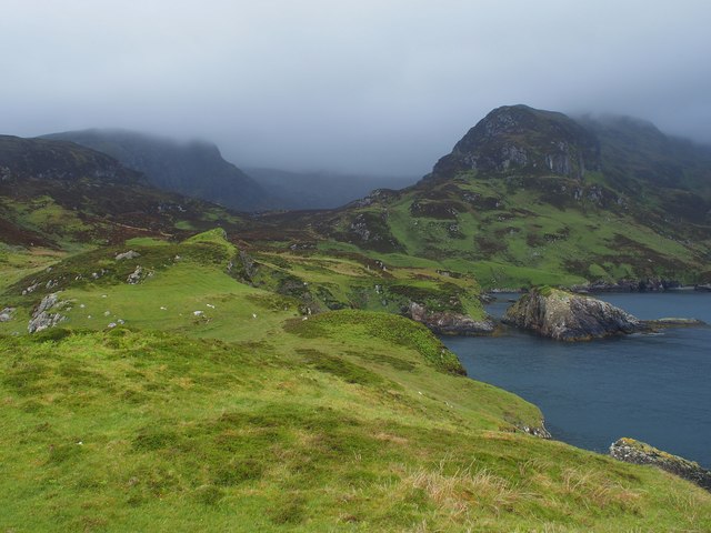
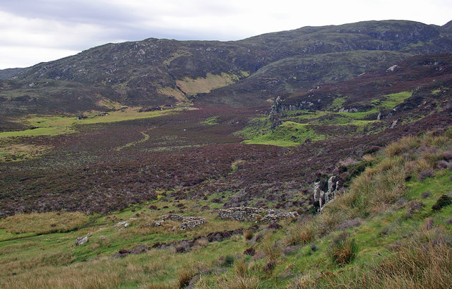
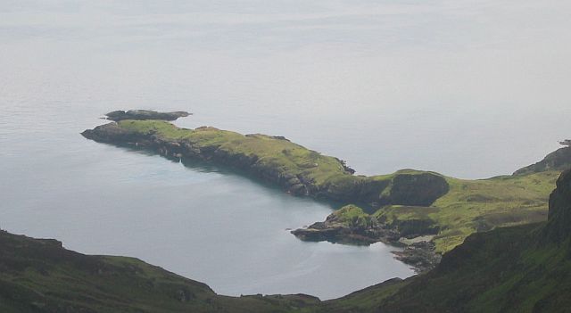
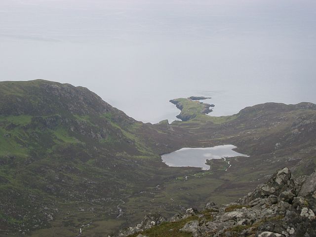
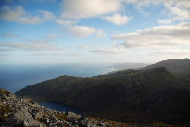
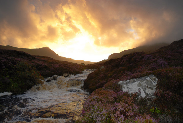
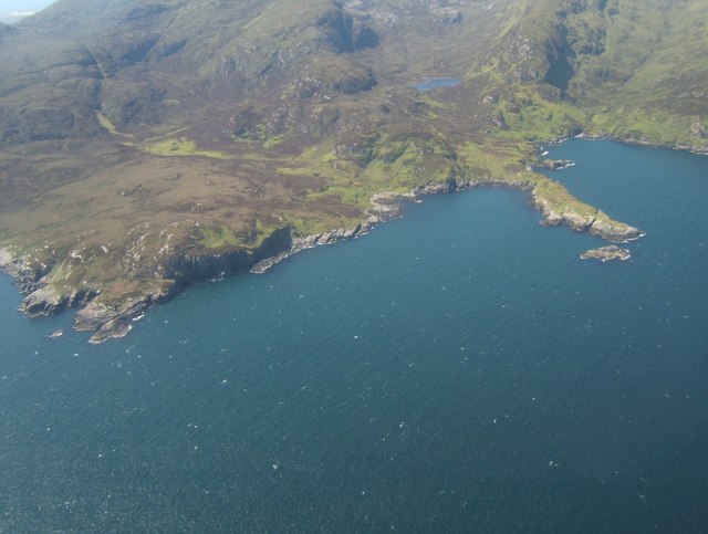
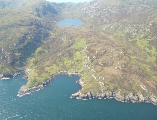
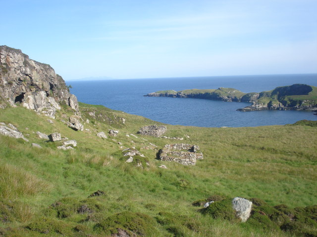
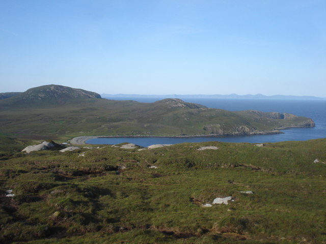
Sgoth is a prominent coastal feature located in Inverness-shire, Scotland. It is a headland or point that juts out into the North Atlantic Ocean, offering breathtaking views of the surrounding landscape and ocean.

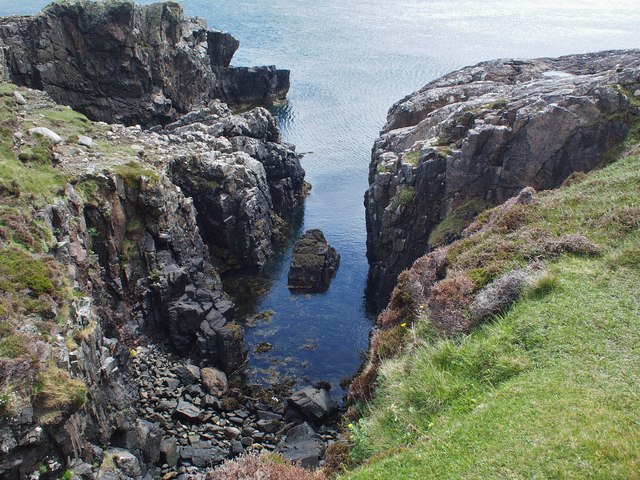
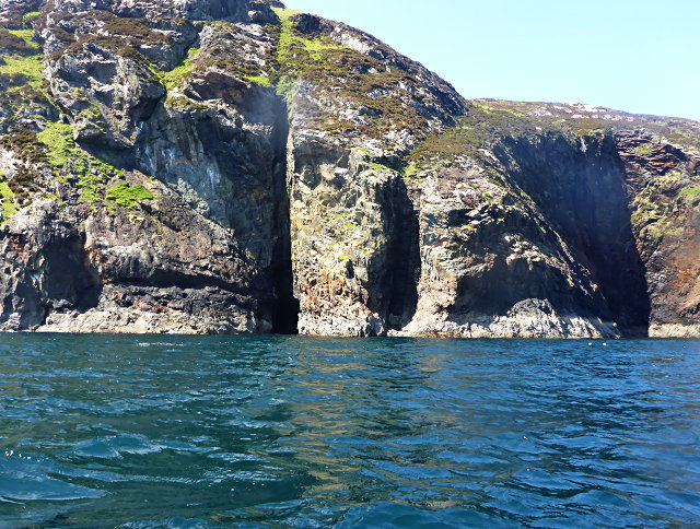
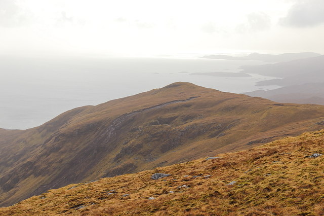
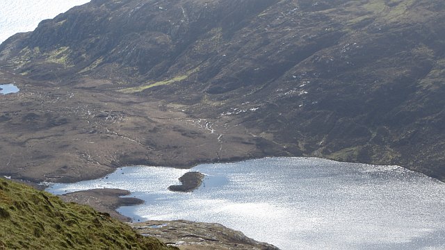
Situated on the western coast of Scotland, Sgoth is known for its rugged cliffs and rocky terrain. The headland is characterized by its steep and jagged cliffs, which rise dramatically from the sea, creating a stunning and dramatic natural spectacle. The cliffs are composed of ancient rock formations, displaying layers of sedimentary rock that have been shaped and eroded by the relentless power of the ocean waves.

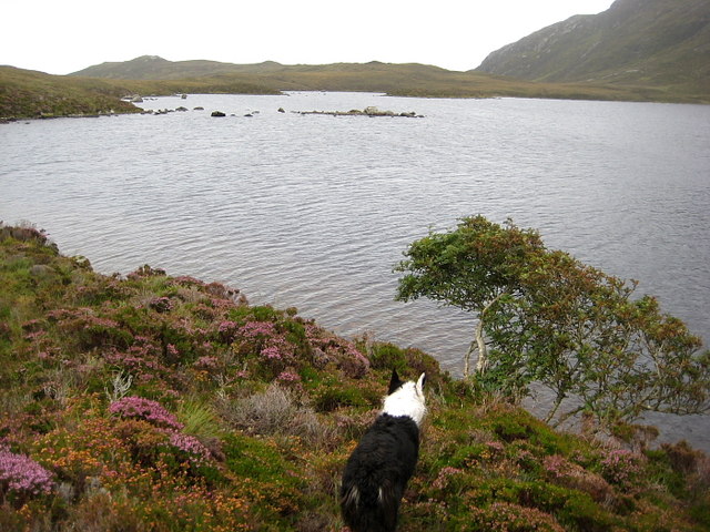
The area surrounding Sgoth is rich in biodiversity, with a variety of plant and animal species calling this coastal region their home. Seabirds such as gannets, puffins, and guillemots can often be spotted nesting on the cliffs, while seals and dolphins can be seen swimming in the waters below.

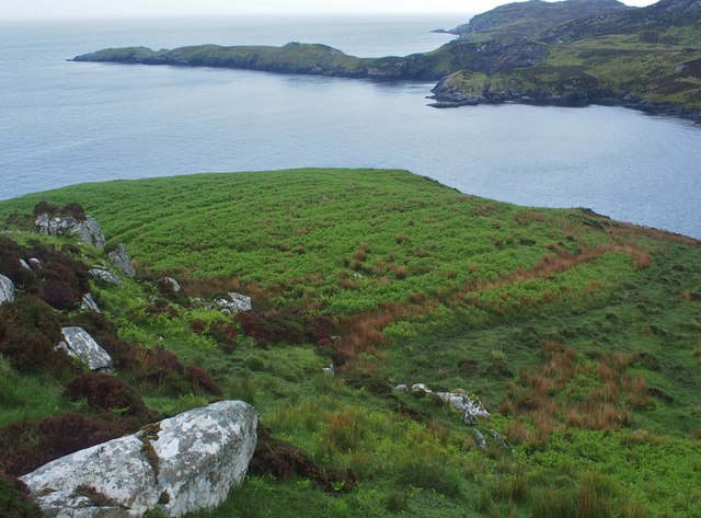
Sgoth is a popular destination for hikers and nature enthusiasts, offering numerous walking trails and viewpoints that provide incredible vistas of the coastline and the vast expanse of the sea. The headland is also a favored spot for photographers, who come to capture the beauty and drama of the landscape.

Overall, Sgoth in Inverness-shire is a remarkable coastal feature, offering visitors a chance to experience the wild and untamed beauty of the Scottish coast.

If you have any feedback on the listing, please let us know in the comments section below.

Sgoth Images

Images are sourced within 2km of 57.262565/-7.2485869 or Grid Reference NF8331. Thanks to Geograph Open Source API. All images are credited.

Geo south of Rubha na Brataich One of a number of geos to navigate on the coast of South Uist heading for Rubha Bholium
Geo south of Rubha na Brataich
One of a number of geos to navigate on the coast of South Uist heading for Rubha Bholium
Fissured coastline
Fissured coastline
Rubha Heileasdail
Rubha Heileasdail
Loch Heileasdail A shallow corner of one of the remotest lochs on South Uist.
It's a long walk to catch no trout...
Loch Heileasdail
A shallow corner of one of the remotest lochs on South Uist. It's a long walk to catch no trout...
Old lazy beds at Uamh a' Phrionnsa Lines in the bracken show location of old lazy beds. Rubha Healeasdail behind.
Old lazy beds at Uamh a' Phrionnsa
Lines in the bracken show location of old lazy beds. Rubha Healeasdail behind.
Rubha Heileasdail and Glen Heileasdail Rabbit cropped turf on Rubha Heileasdail and Glen Heileasdail beyond. Beinn Mhor on left and Ben Corodale on right.
Rubha Heileasdail and Glen Heileasdail
Rabbit cropped turf on Rubha Heileasdail and Glen Heileasdail beyond. Beinn Mhor on left and Ben Corodale on right.
South Ridge, Ben Corrodale
Loch Coradail View into Gleann Uisinis from Hecla.
Loch Coradail
View into Gleann Uisinis from Hecla.
Loch Coradail
Loch Coradail
Gleann Liadail The ruins of an abandoned settlement at the mouth of Gleann Liadail.
Gleann Liadail
The ruins of an abandoned settlement at the mouth of Gleann Liadail.
Rubha Heileasdail A distinctive peninsula beneath Beinn Mhòr, seen from Beinn Choradail.
Rubha Heileasdail
A distinctive peninsula beneath Beinn Mhòr, seen from Beinn Choradail.
Gleann Heileasdail From Beinn Mhòr. Gleann Heileasdail and Loch Heileasdail. The long flat peninsula of Rubha Heileasdail beyond.
Gleann Heileasdail
From Beinn Mhòr. Gleann Heileasdail and Loch Heileasdail. The long flat peninsula of Rubha Heileasdail beyond.
East Ridge of Beinn Corradail Taken from the summit of Hecla
East Ridge of Beinn Corradail
Taken from the summit of Hecla
The burn flowing down Gleann Uisinis The burn flowing down lower Gleann Uisinis towards Uisinish Bay.
The burn flowing down Gleann Uisinis
The burn flowing down lower Gleann Uisinis towards Uisinish Bay.
Rhuba Sheileasdail View westward from the air.  Compare with <a href="https://www.geograph.org.uk/photo/935772">NF8330 : Rubha Heileasdail</a>, which gives a view easterly from the land.
Rhuba Sheileasdail
View westward from the air. Compare with NF8330 : Rubha Heileasdail, which gives a view easterly from the land.
Bagh Lamasaigh The point to the left is Ruhba Lamasaigh, and beyond the bay Loch Coradail lies within Gleann Uisinis.
Bagh Lamasaigh
The point to the left is Ruhba Lamasaigh, and beyond the bay Loch Coradail lies within Gleann Uisinis.
Uamh a' Phrionnsa Old crofts with small cave to the left
Uamh a' Phrionnsa
Old crofts with small cave to the left
Rocky cove Looking towards Bagh uisinis with bothy on the left
Rocky cove
Looking towards Bagh uisinis with bothy on the left
Show me another place!

Sgoth is located at Grid Ref: NF8331 (Lat: 57.262565, Lng: -7.2485869)

Unitary Authority: Na h-Eileanan an Iar

Police Authority: Highlands and Islands

What 3 Words

///beak.warbler.indicate. Near Lochboisdale, Na h-Eileanan Siar

Nearby Locations

Sgoth

Related Wikis

Beinn Mhòr (South Uist)

Beinn Mhòr is a mountain on the island of South Uist in the Outer Hebrides of Scotland. With a height of 620 metres (2,034 ft), it is the highest point...

Hecla (South Uist)

Hecla or Thacla is a mountain on the island of South Uist in the Outer Hebrides of Scotland. With a height of 606 metres (1,988 ft), it is the second-highest...

South Uist

South Uist (Scottish Gaelic: Uibhist a Deas, [ˈɯ.ɪʃtʲ ə ˈtʲes̪] ; Scots: Sooth Uist) is the second-largest island of the Outer Hebrides in Scotland. At...

Ushenish Lighthouse

The Ushenish Lighthouse is an active lighthouse located in South Uist, Outer Hebrides, Scotland. == History == Ushenish Lighthouse was designed by engineers...

Have you been to Sgoth?

Leave your review of Sgoth below (or comments, questions and feedback).