Rubha Bhuailte

Coastal Feature, Headland, Point in Inverness-shire

Scotland

Rubha Bhuailte

Junction on the path to Aird Horragaigh, South Uist From the end of the tarred road, an excellent grass track heads south. Although it deteriorates a little, it still makes a great afternoon walk.
Junction on the path to Aird Horragaigh, South Uist Credit: AlastairG

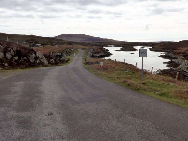
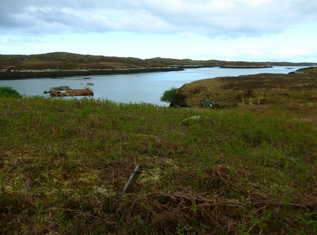
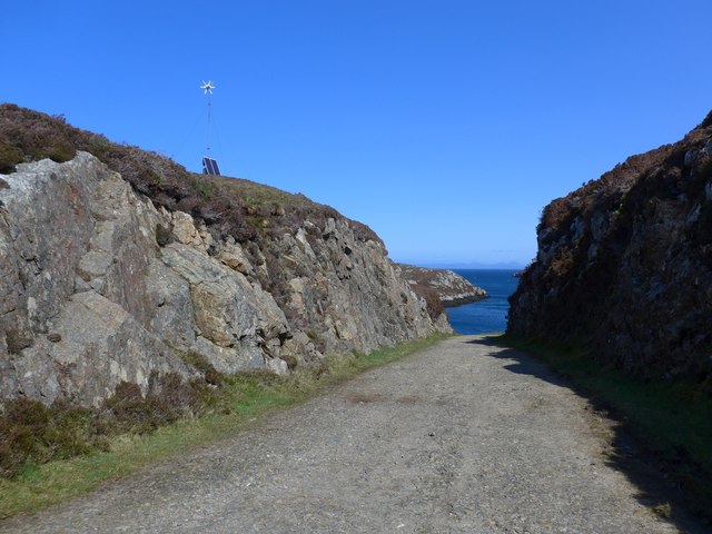
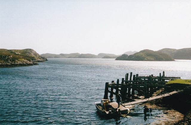
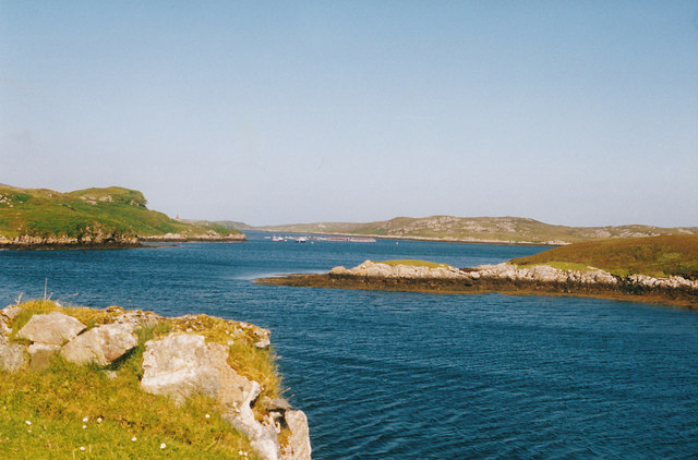
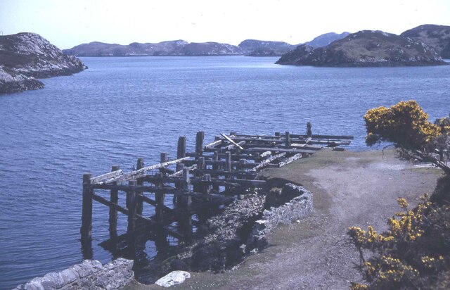
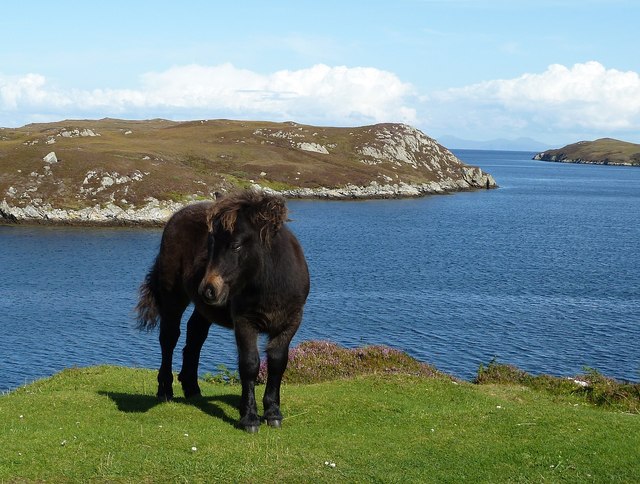
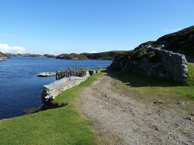
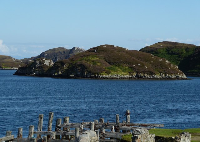
Rubha Bhuailte is a picturesque headland located in Inverness-shire, Scotland. Situated on the west coast of Scotland, this coastal feature offers stunning views of the surrounding landscape and the North Atlantic Ocean.

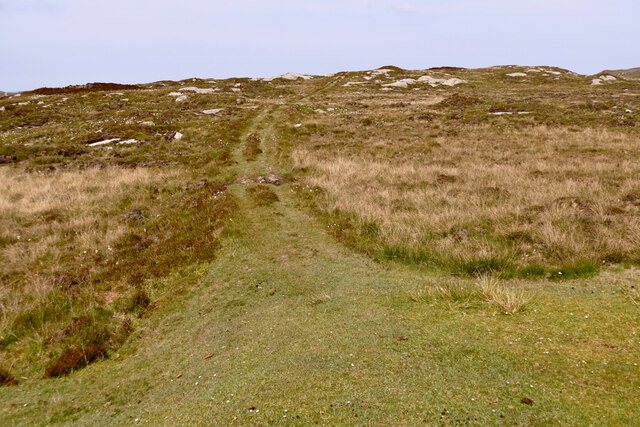
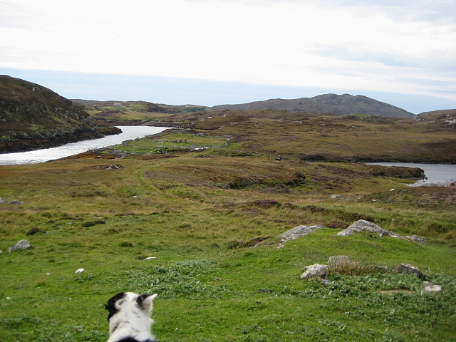
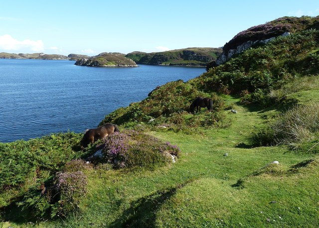
The headland is characterized by its rugged and rocky terrain, with cliffs that drop dramatically into the sea. Its prominent position jutting out into the water makes it an excellent vantage point for observing marine life, such as seals, dolphins, and various seabirds. The crashing waves against the rocks provide a mesmerizing and soothing soundtrack to visitors.

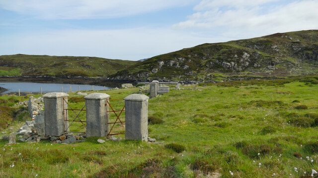
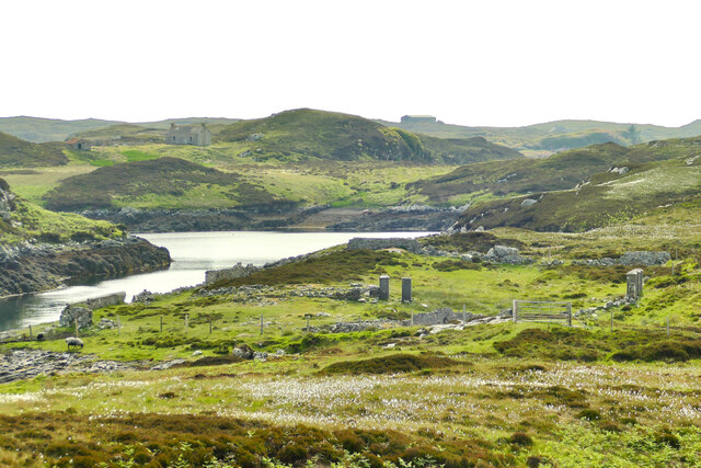
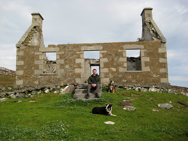
Rubha Bhuailte is also known for its rich historical and cultural significance. The area was inhabited by early settlers, and evidence of their presence can be found in the form of ancient ruins and standing stones. These remnants serve as a reminder of the region's past and add an air of mystery and intrigue to the landscape.

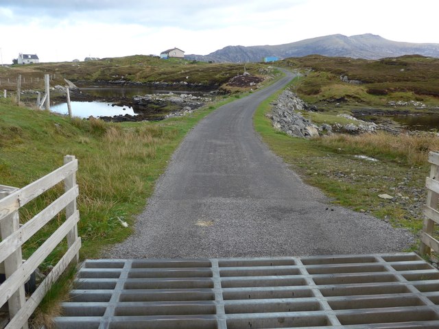
For outdoor enthusiasts, Rubha Bhuailte offers several hiking trails that wind their way along the headland, providing breathtaking panoramic views of the surrounding area. The trails are well-maintained and suitable for both casual walkers and experienced hikers.

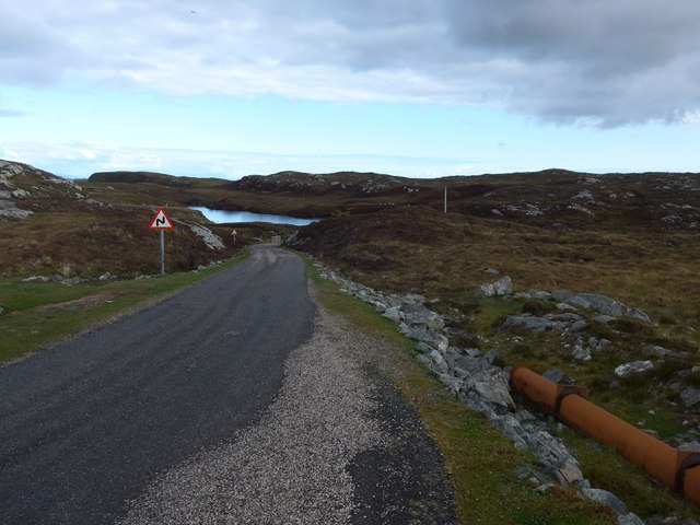
Access to Rubha Bhuailte is relatively easy, with a car park and a well-marked path leading visitors to the headland. The nearby town of Inverness offers various amenities, including accommodations, restaurants, and shops, making it a convenient base for exploring the area.

In summary, Rubha Bhuailte is a captivating headland in Inverness-shire that combines natural beauty, wildlife, and historical intrigue. Its stunning views, rugged terrain, and cultural significance make it a must-visit destination for nature lovers and history enthusiasts alike.

If you have any feedback on the listing, please let us know in the comments section below.

Rubha Bhuailte Images

Images are sourced within 2km of 57.344077/-7.2614078 or Grid Reference NF8340. Thanks to Geograph Open Source API. All images are credited.

Junction on the path to Aird Horragaigh, South Uist From the end of the tarred road, an excellent grass track heads south. Although it deteriorates a little, it still makes a great afternoon walk.
Junction on the path to Aird Horragaigh, South Uist
From the end of the tarred road, an excellent grass track heads south. Although it deteriorates a little, it still makes a great afternoon walk.
19th century East Gerinish school at Aird Horragaigh The school gates at East Gerinish. Why two gates? One for the girls and one for the boys. Amazing, especially as many would have walked miles to school in mixed groups.
19th century East Gerinish school at Aird Horragaigh
The school gates at East Gerinish. Why two gates? One for the girls and one for the boys. Amazing, especially as many would have walked miles to school in mixed groups.
Schoolmaster's house, East Gerinish Standing on the hillside near a ruined croft, the schoolmaster's house would have had a commanding view over the school below.  <a href="https://www.geograph.org.uk/photo/7514077">NF8339 : View of East Gerinish school from the schoolmaster's house</a>
Schoolmaster's house, East Gerinish
Standing on the hillside near a ruined croft, the schoolmaster's house would have had a commanding view over the school below. NF8339 : View of East Gerinish school from the schoolmaster's house
View of East Gerinish school from the schoolmaster's house The schoolmaster would have missed nothing from this viewpoint.  <a href="https://www.geograph.org.uk/photo/7514071">NF8339 : Schoolmaster's house, East Gerinish</a> The three pillars on the right on the school 'enclosure' frame the girls' and boys' gates.  <a href="https://www.geograph.org.uk/photo/7514055">NF8339 : 19th century East Gerinish school at Aird Horragaigh</a>
View of East Gerinish school from the schoolmaster's house
The schoolmaster would have missed nothing from this viewpoint. NF8339 : Schoolmaster's house, East Gerinish The three pillars on the right on the school 'enclosure' frame the girls' and boys' gates. NF8339 : 19th century East Gerinish school at Aird Horragaigh
On the road to Caolas Liubharsaigh
On the road to Caolas Liubharsaigh That's salt water on the right (always difficult to be certain in the Uists!).
On the road to Caolas Liubharsaigh
That's salt water on the right (always difficult to be certain in the Uists!).
Loch Sheileabhaig A salt-water sea loch.
Loch Sheileabhaig
A salt-water sea loch.
Cattle grid on the road to Caolas Liubharsaigh
The road to Loch Sgioport With the sea loch itself visible ahead.
The road to Loch Sgioport
With the sea loch itself visible ahead.
An old pier The pier is still in use but the gare timbers did look rather precarious to me as a non sailor.
An old pier
The pier is still in use but the gare timbers did look rather precarious to me as a non sailor.
What a wonderful view Looking in the other direction from the pier at Loch Sgioport. I notice in more recent submissions that the pier is in an even more decayed condition.
What a wonderful view
Looking in the other direction from the pier at Loch Sgioport. I notice in more recent submissions that the pier is in an even more decayed condition.
Old pier at the end of the B890, Loch Sgiopoirt
Pony at Rubha Mòr Rubha Mòr is at the end of the B890 as it reaches Loch Sgiopoirt (alternative names: Scioport, Skipport etc.) on the eastern coast of South Uist.
This little pony was very friendly and posed nicely for me when requested !
Pony at Rubha Mòr
Rubha Mòr is at the end of the B890 as it reaches Loch Sgiopoirt (alternative names: Scioport, Skipport etc.) on the eastern coast of South Uist. This little pony was very friendly and posed nicely for me when requested !
Disused pier, Rubha Mòr The B890 peters out as it reaches Loch Sgioport, but a track continues winding down to this old abandoned pier. The sea loch stretches ahead on this beautiful eastern coast of South Uist.
Disused pier, Rubha Mòr
The B890 peters out as it reaches Loch Sgioport, but a track continues winding down to this old abandoned pier. The sea loch stretches ahead on this beautiful eastern coast of South Uist.
Bagh a Mhanaich Bagh a Mhanaich and the site of the old school house (in the middle distance along side the water).
Bagh a Mhanaich
Bagh a Mhanaich and the site of the old school house (in the middle distance along side the water).
Ruined Croft House Overlooking the site of the school house. There are several older ruins just to the north.
Ruined Croft House
Overlooking the site of the school house. There are several older ruins just to the north.
Ponies graze above Loch Sgiopoirt Loch Sgiopoirt is a deeply indented sea loch on the east coast of South Uist. Several ponies were grazing contentedly on this headland. The islet in the background is Eilean Haey.
Ponies graze above Loch Sgiopoirt
Loch Sgiopoirt is a deeply indented sea loch on the east coast of South Uist. Several ponies were grazing contentedly on this headland. The islet in the background is Eilean Haey.
Eilean Haey from Rubha Mòr Eilean Haey is a little island in the mouth of the sea loch Sgiopoirt. This view is taken over the remains of the old pier at Rubha Mòr.
Eilean Haey from Rubha Mòr
Eilean Haey is a little island in the mouth of the sea loch Sgiopoirt. This view is taken over the remains of the old pier at Rubha Mòr.
Show me another place!

Rubha Bhuailte is located at Grid Ref: NF8340 (Lat: 57.344077, Lng: -7.2614078)

Unitary Authority: Na h-Eileanan an Iar

Police Authority: Highlands and Islands

What 3 Words

///armed.manifests.title. Near Balivanich, Na h-Eileanan Siar

Related Wikis

Loch Druidibeg

Loch Druidibeag is a freshwater loch situated on the island of South Uist, in the Outer Hebrides of Scotland. The loch is near the northern end of the...

Eilean na Cille

Eilean na Cille, south east of Benbecula is an island of the Outer Hebrides connected to Grimsay (South) by a causeway which carries the B891. The road...

Carnan (townland)

Carnan is a townland in County Tyrone, Northern Ireland. It is situated in the historic barony of Dungannon Upper and the civil parish of Arboe and covers...

Our Lady of the Isles

Our Lady of the Isles (Gaelic: Moire ro Naomh nan Eilean or Bana Thighearna nan Eilean) is a sculpture of the Madonna and Child, on South Uist in the Outer...

Nearby Amenities

Located within 500m of 57.344077,-7.2614078
Turning Circle
Lat/Long: 57.3419473/-7.2636396
Caolas Liubharsaigh
Name En: East Gerinish
Name Gd: Caolas Liubharsaigh
Place: hamlet
Lat/Long: 57.3440089/-7.268353
Power: pole
Lat/Long: 57.3451396/-7.2693107
Power: pole
Lat/Long: 57.3445997/-7.2682083
Power: pole
Lat/Long: 57.3440802/-7.2678221
Power: pole
Lat/Long: 57.3435389/-7.2674385
Power: pole
Lat/Long: 57.3432103/-7.2667599
Power: pole
Lat/Long: 57.3427978/-7.2659338
Power: pole
Lat/Long: 57.342313/-7.2647939
Power: pole
Lat/Long: 57.3419613/-7.2641823
Barrier: cattle_grid
Lat/Long: 57.3421055/-7.2650675
The data included in this document is from www.openstreetmap.org. The data is made available under ODbL.

Have you been to Rubha Bhuailte?

Leave your review of Rubha Bhuailte below (or comments, questions and feedback).