Fyfield
Settlement in Wiltshire
England
Fyfield
Fyfield is a picturesque village located in the county of Wiltshire, England. Situated approximately 10 miles northeast of the town of Marlborough, Fyfield is nestled within the tranquil countryside, offering residents and visitors a peaceful retreat from the hustle and bustle of city life.
The village is characterized by its charming thatched-roof cottages, many of which date back several centuries, showcasing the area's rich history. Fyfield is also home to a 13th-century church, St. Nicholas, which stands as a testament to the village's long-standing heritage.
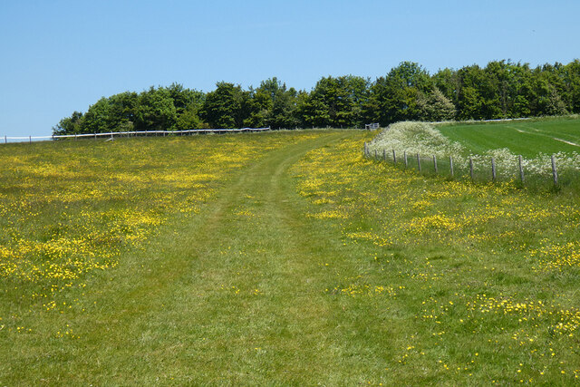
The surrounding countryside provides ample opportunities for outdoor activities, with rolling hills and scenic walking trails attracting nature enthusiasts and hikers. Fyfield is also in close proximity to the picturesque River Kennet, providing opportunities for fishing and boating.
Although Fyfield is a small village, it offers a close-knit community atmosphere. The village boasts a local pub, The Horseshoe Inn, where locals and visitors can enjoy a traditional pub meal or a refreshing drink.
The village's location provides easy access to nearby towns and cities, with Marlborough offering a range of amenities including shops, restaurants, and schools. Fyfield is also within reach of larger cities such as Swindon and Reading, making it an ideal location for those seeking a peaceful rural lifestyle while still being in close proximity to urban centers.
Overall, Fyfield's idyllic setting, rich history, and strong sense of community make it an attractive place to live or visit for those seeking a tranquil retreat in the heart of the Wiltshire countryside.
If you have any feedback on the listing, please let us know in the comments section below.
Fyfield Images
Images are sourced within 2km of 51.417406/-1.7892526 or Grid Reference SU1468. Thanks to Geograph Open Source API. All images are credited.
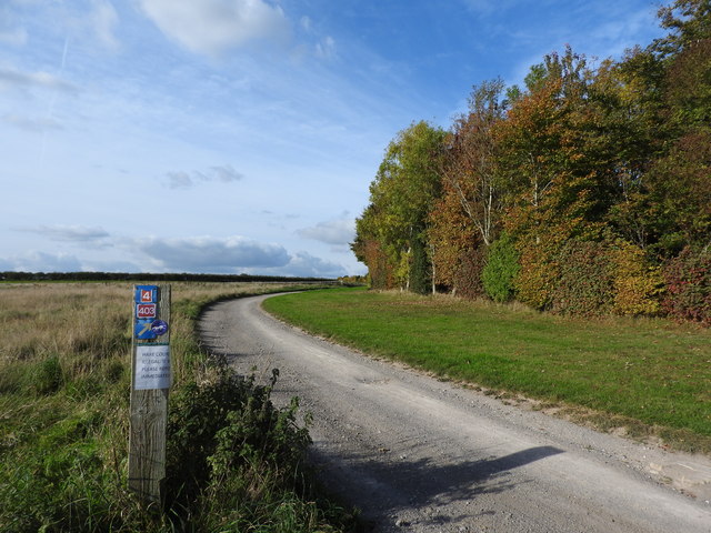

![From East Kennet to Overton Down and return [59] Seen from the footpath is this view looking south along the horse gallops. West Wood is seen on the skyline.
From East Kennett the walk passes The Sanctuary and, after crossing the A4 road, follows The Ridgeway to Overton Down. A right turn onto Herepath leads to Fyfield Down then footpaths and a bridleway lead back to West Overton village and a minor road runs back to the start. Just over 5½ miles.](https://s3.geograph.org.uk/geophotos/06/55/74/6557443_5c285463.jpg)
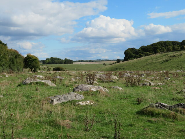
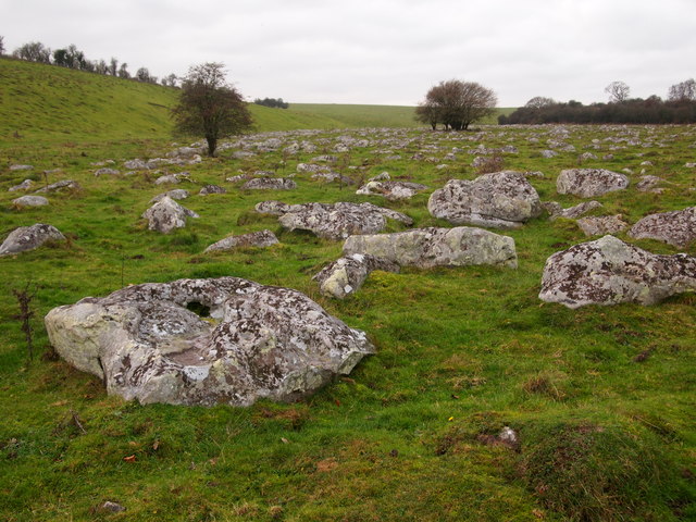
![From East Kennet to Overton Down and return [60] This view of part of Fyfield Down is seen from the footpath as it leads from the horse gallops to the corner of the field on the right. Fyfield Down has a great array of sarsen stones - large boulders of hard, silicified sandstone. The down is a National Nature Reserve consisting of 800 acres of undulating, hilly land, underlain by chalk and so supporting a diverse range of wildflowers.
From East Kennett the walk passes The Sanctuary and, after crossing the A4 road, follows The Ridgeway to Overton Down. A right turn onto Herepath leads to Fyfield Down then footpaths and a bridleway lead back to West Overton village and a minor road runs back to the start. Just over 5½ miles.](https://s2.geograph.org.uk/geophotos/06/55/74/6557474_ce87c1f0.jpg)
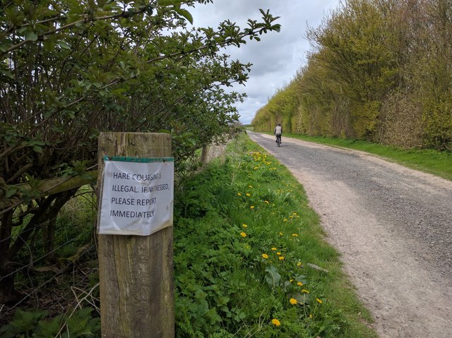
![From East Kennet to Overton Down and return [61] At this point the footpath crosses a bridleway. This is the bridleway heading towards the southern end of the horse gallops and Down Barn.
From East Kennett the walk passes The Sanctuary and, after crossing the A4 road, follows The Ridgeway to Overton Down. A right turn onto Herepath leads to Fyfield Down then footpaths and a bridleway lead back to West Overton village and a minor road runs back to the start. Just over 5½ miles.](https://s1.geograph.org.uk/geophotos/06/55/74/6557489_6efc9c70.jpg)
![From East Kennet to Overton Down and return [64] The wooden fence to the right is the bottom end of the horse gallops seen at <a href="https://www.geograph.org.uk/photo/6557443">SU1370 : From East Kennet to Overton Down and return [59]</a>. The bridleway continues through the gate towards Down Barn.
From East Kennett the walk passes The Sanctuary and, after crossing the A4 road, follows The Ridgeway to Overton Down. A right turn onto Herepath leads to Fyfield Down then footpaths and a bridleway lead back to West Overton village and a minor road runs back to the start. Just over 5½ miles.](https://s1.geograph.org.uk/geophotos/06/55/86/6558677_1eda856b.jpg)
![From East Kennet to Overton Down and return [65] Seen from the bridleway are the horse gallops. The reverse view is seen at <a href="https://www.geograph.org.uk/photo/6557443">SU1370 : From East Kennet to Overton Down and return [59]</a>.
From East Kennett the walk passes The Sanctuary and, after crossing the A4 road, follows The Ridgeway to Overton Down. A right turn onto Herepath leads to Fyfield Down then footpaths and a bridleway lead back to West Overton village and a minor road runs back to the start. Just over 5½ miles.](https://s1.geograph.org.uk/geophotos/06/55/86/6558681_fda8f55d.jpg)
![From East Kennet to Overton Down and return [66] The bridleway follows the field edge towards Down Barn which is hidden from view in the dip. Harestone Down and All Cannings Down are in the far distance.
From East Kennett the walk passes The Sanctuary and, after crossing the A4 road, follows The Ridgeway to Overton Down. A right turn onto Herepath leads to Fyfield Down then footpaths and a bridleway lead back to West Overton village and a minor road runs back to the start. Just over 5½ miles.](https://s0.geograph.org.uk/geophotos/06/55/86/6558684_879f4f9f.jpg)


Fyfield is located at Grid Ref: SU1468 (Lat: 51.417406, Lng: -1.7892526)
Unitary Authority: Wiltshire
Police Authority: Wiltshire
What 3 Words
///dweller.dusters.clockwork. Near Fyfield, Wiltshire
Nearby Locations
Related Wikis

Fyfield (near Marlborough)
Fyfield is a village and civil parish in the English county of Wiltshire, in the Kennet Valley about 2.5 miles (4.0 km) west of Marlborough. The village...
Piggledene
Piggledene (grid reference SU141689) is a 4.7 hectare biological and geological Site of Special Scientific Interest in Wiltshire, notified in 1965. Since...

Lockeridge
Lockeridge is a village in Wiltshire, England. It lies at the edge of the West Woods in the Kennet Valley, 2.9 miles (4.7 km) west of Marlborough, 3.1...

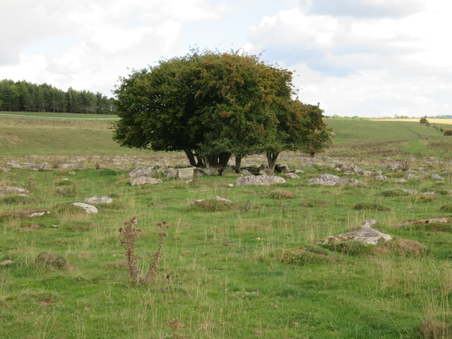
The Devil's Den
The Devil's Den or Devil's Den is a dolmen burial chamber on Fyfield Hill near Marlborough, Wiltshire, England. The chamber is part of a neolithic passage...
Nearby Amenities
Located within 500m of 51.417406,-1.7892526Have you been to Fyfield?
Leave your review of Fyfield below (or comments, questions and feedback).