Rubha Àirigh an Sgadain

Coastal Feature, Headland, Point in Inverness-shire

Scotland

Rubha Àirigh an Sgadain

Catabatic Cloud Formation on Beinn Mhor Dense cloud tumbling down the slopes of the "Big Mountain" on South Uist - seen from the ferry entering Lochboisdale.
Catabatic Cloud Formation on Beinn Mhor Credit: Colin Smith

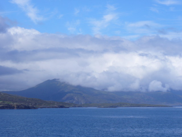
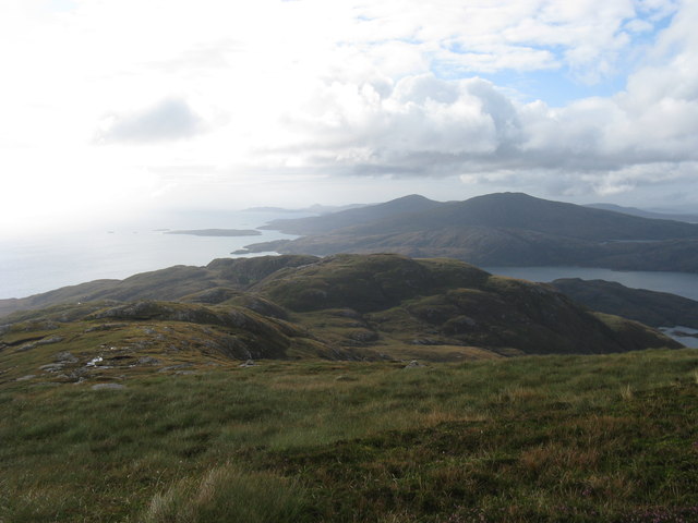
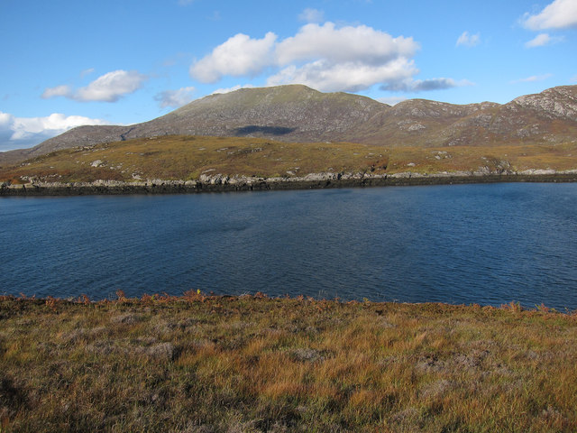
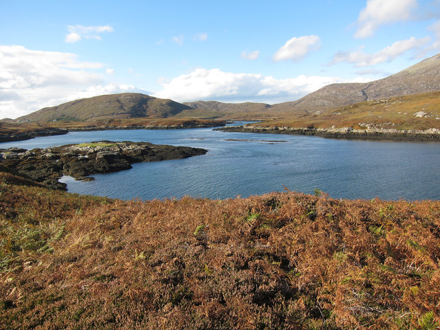
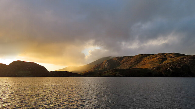
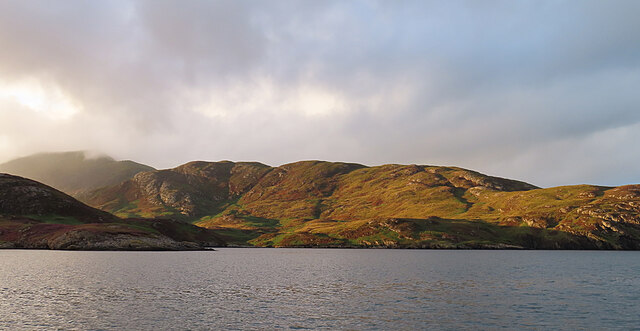
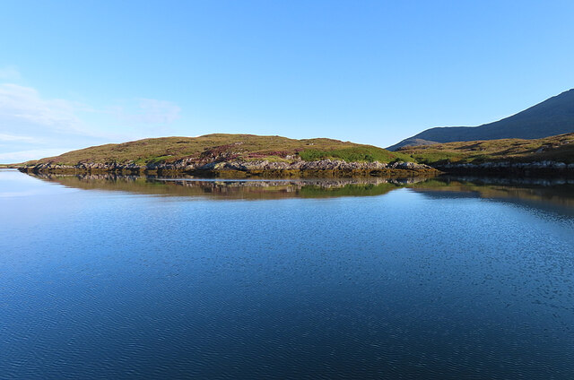
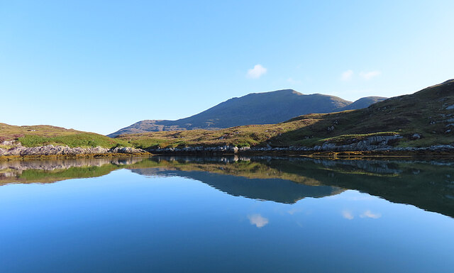
Rubha Àirigh an Sgadain, located in Inverness-shire, Scotland, is a prominent coastal feature known for its beautiful headland and point. Situated on the western coast of Scotland, this picturesque location offers breathtaking views of the surrounding landscape and the nearby sea.

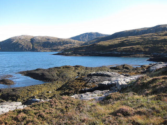
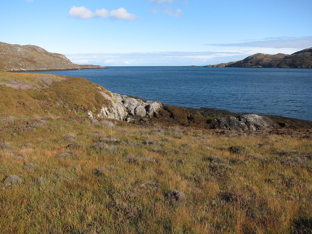
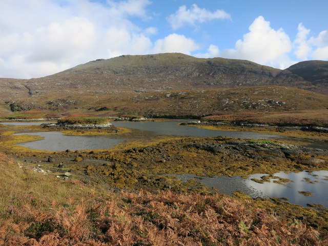
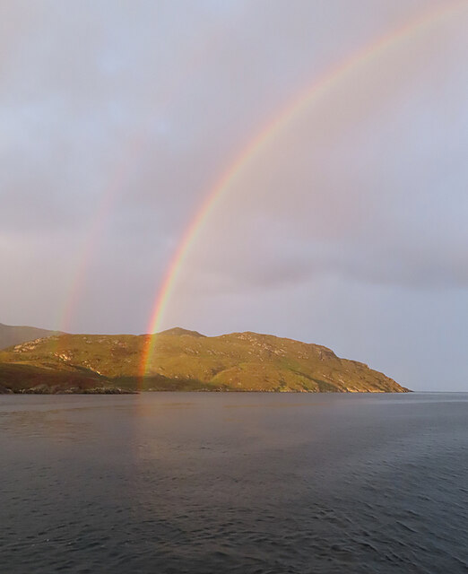
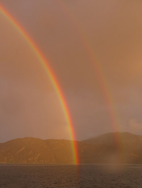
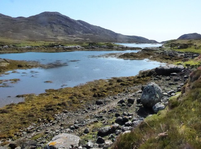
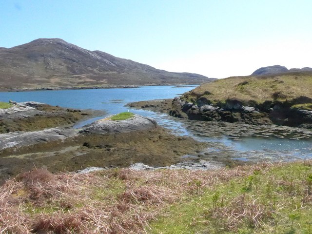
The headland of Rubha Àirigh an Sgadain juts out into the Atlantic Ocean, creating a distinct point that is a popular destination for nature enthusiasts and photographers alike. Its rugged cliffs, softened by lush vegetation, provide a dramatic backdrop against the shimmering blue waters of the sea.

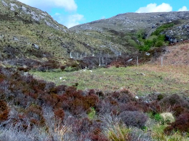
The area is known for its diverse wildlife, making it a haven for birdwatchers. Seabirds such as puffins and gannets can be spotted nesting on the cliffs, while dolphins and seals are often seen swimming in the waters below. The heather-covered hills surrounding the headland are also home to various species of wildflowers, creating a colorful and vibrant landscape in the summer months.

Visitors to Rubha Àirigh an Sgadain can enjoy peaceful walks along the coastal path, taking in the fresh sea air and enjoying the tranquility of the surroundings. The headland also offers opportunities for fishing and boating, allowing visitors to fully immerse themselves in the coastal experience.

Overall, Rubha Àirigh an Sgadain is a captivating coastal feature that showcases the natural beauty of the Scottish Highlands. Its stunning cliffs, diverse wildlife, and picturesque views make it a must-visit location for those seeking an authentic Scottish coastal experience.

If you have any feedback on the listing, please let us know in the comments section below.

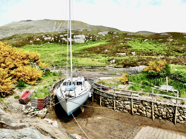
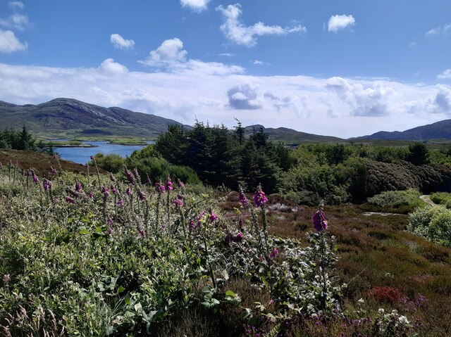
Rubha Àirigh an Sgadain Images

Images are sourced within 2km of 57.232711/-7.2995907 or Grid Reference NF8028. Thanks to Geograph Open Source API. All images are credited.

Catabatic Cloud Formation on Beinn Mhor Dense cloud tumbling down the slopes of the "Big Mountain" on South Uist - seen from the ferry entering Lochboisdale.
Catabatic Cloud Formation on Beinn Mhor
Dense cloud tumbling down the slopes of the "Big Mountain" on South Uist - seen from the ferry entering Lochboisdale.
Beinn nan Caorach View looking down the south ridge of Beinn nan Caorach, which is a small summit on the southern ridge of Beinn Mhor, and across Loch Aineort.
Beinn nan Caorach
View looking down the south ridge of Beinn nan Caorach, which is a small summit on the southern ridge of Beinn Mhor, and across Loch Aineort.
Mouth of Loch Eynort East coast of South Uist.
Mouth of Loch Eynort
East coast of South Uist.
Rubha Laileum Near the mouth of Loch Aineort.
Rubha Laileum
Near the mouth of Loch Aineort.
Rubha nan Sruthan Looking over Sruthan Beag.
Rubha nan Sruthan
Looking over Sruthan Beag.
Loch Eynort Narrow stretch near the eastern end.
Loch Eynort
Narrow stretch near the eastern end.
Sloc Dubh Looking towards Beinn Mhor.
Sloc Dubh
Looking towards Beinn Mhor.
Evening Sunshine After some gloomy weather, the setting sun broke through the clouds for a short fine spell.
Evening Sunshine
After some gloomy weather, the setting sun broke through the clouds for a short fine spell.
Meall Mòr Evening light on the north side of Loch Aineort.
Meall Mòr
Evening light on the north side of Loch Aineort.
Evening Rainbow A double rainbow making landfall on the north side of Loch Aineort.
Evening Rainbow
A double rainbow making landfall on the north side of Loch Aineort.
Double Rainbow Fuelled by a very heavy shower, this is one of the most magnificent rainbows I've ever seen.
Double Rainbow
Fuelled by a very heavy shower, this is one of the most magnificent rainbows I've ever seen.
Rubha nan Sruthan The peninsula on the north side of the narrowest part of Loch Aineort.
Rubha nan Sruthan
The peninsula on the north side of the narrowest part of Loch Aineort.
Loch Aineort An inlet east of Rubha nan Sruthan. The hill in the background is Beinn Mhòr.
Loch Aineort
An inlet east of Rubha nan Sruthan. The hill in the background is Beinn Mhòr.
Loch Aineort Looking to Eilean an Easbuig.
Loch Aineort
Looking to Eilean an Easbuig.
Estate boundary fence Just inshore from Loch Aineort.
Estate boundary fence
Just inshore from Loch Aineort.
Loch Aineort
Loch Aineort
Loch Aineort's hidden harbour This tiny harbour on Loch Aineort, South Uist, is not much wider than a single car garage. Maybe this is why it escaped the OS cartographers! I haven't been able to find it on any map including all the scales available on MAGIC.  It does, however, show up clearly on Google Earth.
Loch Aineort's hidden harbour
This tiny harbour on Loch Aineort, South Uist, is not much wider than a single car garage. Maybe this is why it escaped the OS cartographers! I haven't been able to find it on any map including all the scales available on MAGIC. It does, however, show up clearly on Google Earth.
Small woodland above Loch Aineort
Show me another place!

Rubha Àirigh an Sgadain is located at Grid Ref: NF8028 (Lat: 57.232711, Lng: -7.2995907)

Unitary Authority: Na h-Eileanan an Iar

Police Authority: Highlands and Islands

What 3 Words

///squabbles.arts.emerge. Near Lochboisdale, Na h-Eileanan Siar

Related Wikis

Beinn Mhòr (South Uist)

Beinn Mhòr is a mountain on the island of South Uist in the Outer Hebrides of Scotland. With a height of 620 metres (2,034 ft), it is the highest point...

South Uist

South Uist (Scottish Gaelic: Uibhist a Deas, [ˈɯ.ɪʃtʲ ə ˈtʲes̪] ; Scots: Sooth Uist) is the second-largest island of the Outer Hebrides in Scotland. At...

Stuley

Stuley is an island lying to the east of South Uist in the Outer Hebrides, Scotland. It lies off the section of coastline between Loch Eynort and Loch...

Milton (South Uist)

Milton (Scottish Gaelic: Geàrraidh Bhailteas) is the name of a tack or tenant farm on the island of South Uist in the Outer Hebrides, Scotland. It was...

Nearby Amenities

Located within 500m of 57.232711,-7.2995907
Rubh' Àirigh an Sgadain
Natural: cape
Lat/Long: 57.2329447/-7.2998553
Sloc Dubh
Natural: bay
Lat/Long: 57.2327937/-7.2951346
The data included in this document is from www.openstreetmap.org. The data is made available under ODbL.

Have you been to Rubha Àirigh an Sgadain?

Leave your review of Rubha Àirigh an Sgadain below (or comments, questions and feedback).