Creag Mhòr

Coastal Feature, Headland, Point in Inverness-shire

Scotland

Creag Mhòr

Na Stacan Dubha and Cal Mac Ferry View from Pollachar.
Na Stacan Dubha and Cal Mac Ferry Credit: Sandy Gerrard

The requested URL returned error: 429 Too Many Requests

If you have any feedback on the listing, please let us know in the comments section below.
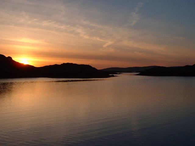
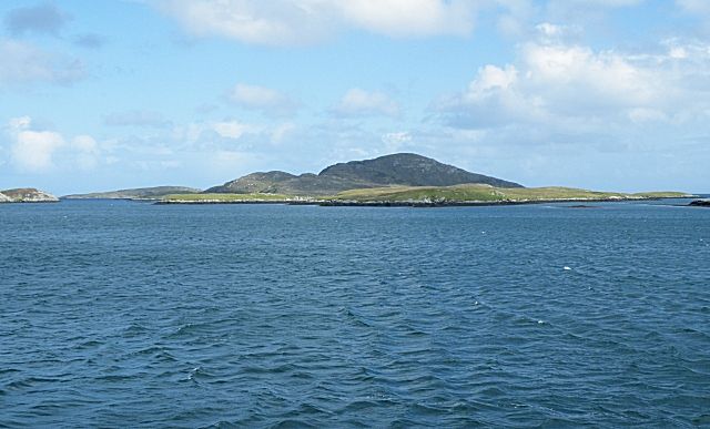
Creag Mhòr Images

Images are sourced within 2km of 57.042996/-7.302154 or Grid Reference NF7807. Thanks to Geograph Open Source API. All images are credited.

Na Stacan Dubha and Cal Mac Ferry View from Pollachar.
Na Stacan Dubha and Cal Mac Ferry
View from Pollachar.
Southwest coast of Eriskay Eileanan Dubha in the background.
Southwest coast of Eriskay
Eileanan Dubha in the background.
Rubha Meall nan Caorach A rocky coastline and quite awkward going being quite easy to get stuck below cliff lines.
Rubha Meall nan Caorach
A rocky coastline and quite awkward going being quite easy to get stuck below cliff lines.
Na Stacan Dubha On the highest point, on the right, are the remains of Caisteal an Reubadair, named on older maps as Weaver's Castle. Also known by various other names, it was the seat of a MacNeill who was famed for piracy.
Na Stacan Dubha
On the highest point, on the right, are the remains of Caisteal an Reubadair, named on older maps as Weaver's Castle. Also known by various other names, it was the seat of a MacNeill who was famed for piracy.
Eilean a' Gheòidh
Eilean a' Gheòidh
Paddling towards Rubha Meall nan Caorach The rocky and interesting eastern coastline of Eriskay.
Paddling towards Rubha Meall nan Caorach
The rocky and interesting eastern coastline of Eriskay.
Eilean Leathan A small rocky island to the south of Eriskay.
Eilean Leathan
A small rocky island to the south of Eriskay.
Caisteal An Reubadair The ruins of Reiver's Castle - often corrupted as Weaver's Castle - on Eilean Leathan.
Caisteal An Reubadair
The ruins of Reiver's Castle - often corrupted as Weaver's Castle - on Eilean Leathan.
 An outlier of Na Stacan Dubha A small skerry south of Eriskay, and about 700m east of the main rocks of the stacan.
An outlier of Na Stacan Dubha
A small skerry south of Eriskay, and about 700m east of the main rocks of the stacan.
Southern Eriskay from the air Leac na Banaraich, at the bottom of the picture is the southernmost point of the island.
Southern Eriskay from the air
Leac na Banaraich, at the bottom of the picture is the southernmost point of the island.
Show me another place!

Creag Mhòr is located at Grid Ref: NF7807 (Lat: 57.042996, Lng: -7.302154)

Unitary Authority: Na h-Eileanan an Iar

Police Authority: Highlands and Islands

What 3 Words

///prime.foresight.newsstand. Near Lochboisdale, Na h-Eileanan Siar

Related Wikis

Ceann a' Ghàraidh

Ceann a' Ghàraidh is the location of the ferry terminal on the south-western side of the island of Eriskay in the Outer Hebrides of Scotland. It provides...

Eriskay

Eriskay (Scottish Gaelic: Èirisgeigh), from the Old Norse for "Eric's Isle", is an island and community council area of the Outer Hebrides in northern...

Gighay

Gighay (Scottish Gaelic Gioghaigh) an uninhabited island off the northeast coast of Barra. It is one of ten islands in the Sound of Barra, a Site of Community...

Sound of Barra

The Sound of Barra is a large ocean inlet or sound situated to the north of the isle of Barra and to the south of South Uist in the Outer Hebrides in Scotland...

Nearby Amenities

Located within 500m of 57.042996,-7.302154
Caolas an Iarainn
Natural: strait
Lat/Long: 57.0469758/-7.3008864
Caolas an Eilein
Natural: bay
Lat/Long: 57.0434834/-7.3028433
Caisteal a' Bhreabadair
Historic: archaeological_site
Lat/Long: 57.0431986/-7.3014958
An Stac Àrd
Place: locality
Lat/Long: 57.0429371/-7.3003328
Leathain
Natural: bay
Lat/Long: 57.0437519/-7.2984466
The data included in this document is from www.openstreetmap.org. The data is made available under ODbL.

Have you been to Creag Mhòr?

Leave your review of Creag Mhòr below (or comments, questions and feedback).