Giumachsgor

Coastal Feature, Headland, Point in Inverness-shire

Scotland

Giumachsgor

Dùn from Ruabhal A classic view of Dùn.  I had a memorable day on Dùn not helped by falling into the sea when being landed.  It is lucky my camera survived to take these images later.
Dùn from Ruabhal Credit: Julian Paren

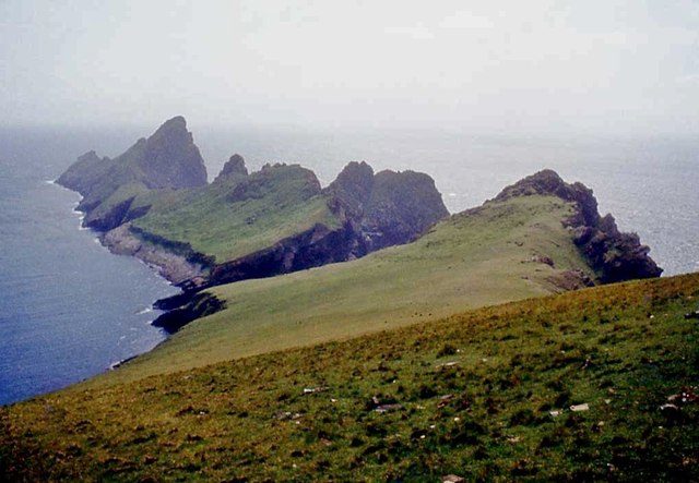
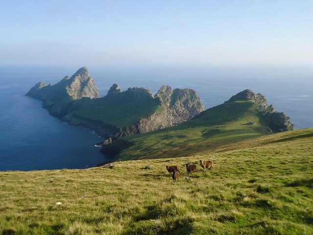
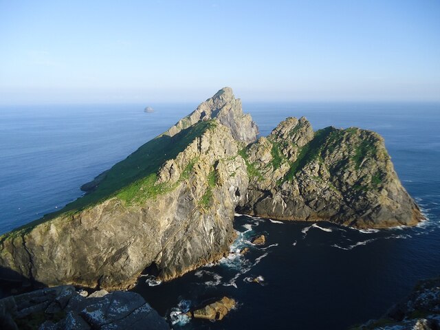
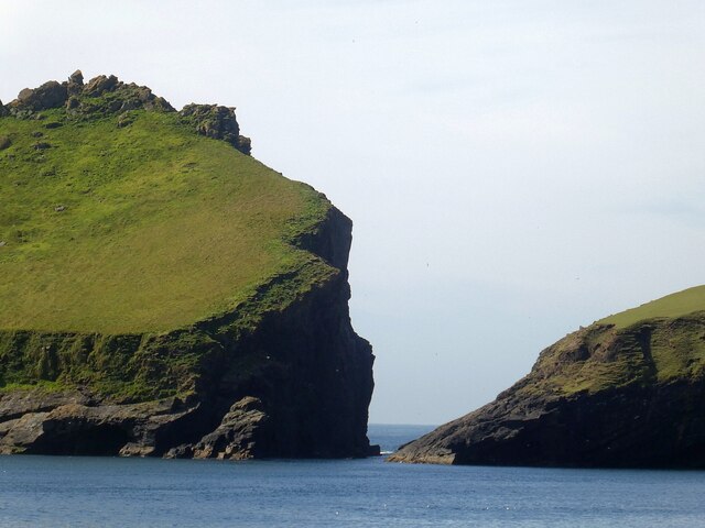
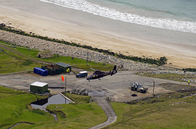
Giumachsgor is a prominent coastal feature located in Inverness-shire, Scotland. It is classified as a headland, also referred to as a point, due to its distinct protrusion into the sea. Situated along the western coast of the Scottish Highlands, Giumachsgor offers breathtaking views of the surrounding landscape, making it a popular destination for nature lovers and photographers.

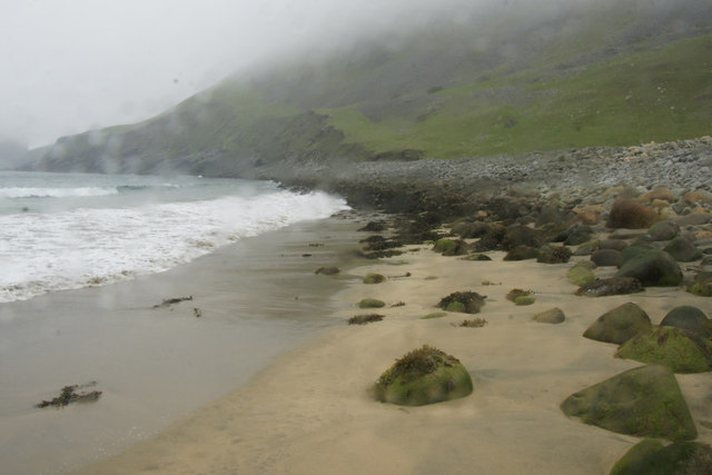
The headland is characterized by rugged cliffs that stretch out into the North Atlantic Ocean. These cliffs, composed of various rock formations, create a dramatic backdrop against the crashing waves below. Giumachsgor is known for its steep and jagged terrain, which adds to its allure and provides a sense of grandeur.

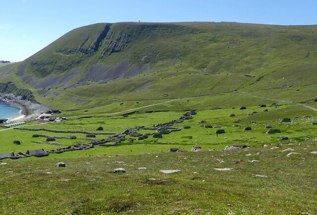
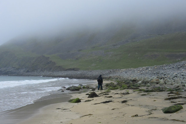
Visitors to Giumachsgor can enjoy a variety of outdoor activities. The headland offers excellent opportunities for hiking and walking along its coastal trails, allowing visitors to explore the stunning scenery and observe the diverse wildlife that inhabits the area. Birdwatchers, in particular, will be delighted by the chance to spot various seabirds soaring above the cliffs, including gulls, puffins, and fulmars.

At low tide, Giumachsgor reveals hidden rock pools teeming with marine life, providing a fascinating opportunity for both children and adults to explore and learn about the local ecosystem. The headland also boasts a small sandy beach, which can be accessed during certain tide conditions, offering a serene spot for relaxation and picnicking.

Overall, Giumachsgor is a captivating coastal feature in Inverness-shire, offering a unique blend of natural beauty, outdoor activities, and wildlife encounters. Its remarkable cliffs and breathtaking views make it a must-visit destination for those exploring the Scottish Highlands.

If you have any feedback on the listing, please let us know in the comments section below.

Giumachsgor Images

Images are sourced within 2km of 57.794145/-8.5577827 or Grid Reference NF1097. Thanks to Geograph Open Source API. All images are credited.

Dùn from Ruabhal A classic view of Dùn.  I had a memorable day on Dùn not helped by falling into the sea when being landed.  It is lucky my camera survived to take these images later.
Dùn from Ruabhal
A classic view of Dùn. I had a memorable day on Dùn not helped by falling into the sea when being landed. It is lucky my camera survived to take these images later.
Village Bay from the side of Ruabhal, Hirta The military encampment is noticeable and this image was taken when the North Uist Rocket Range was extensively used by NATO.
Village Bay from the side of Ruabhal, Hirta
The military encampment is noticeable and this image was taken when the North Uist Rocket Range was extensively used by NATO.
Below The Mistress Stone, St Kilda This stone shared with The Lovers Stone a role in proving fidelity in courtship. Village Bay, Hirta is in the background.
Below The Mistress Stone, St Kilda
This stone shared with The Lovers Stone a role in proving fidelity in courtship. Village Bay, Hirta is in the background.
Radar Tracking Station on Mullach Sgar This radar station, located on Mullach Sgar, is one of two stations on the island which serve the South Uist rocket range. They contain equipment which allows them to track test firings on the range by radar, and to record images of missiles in flight. The second radar station on Hirta is located further north, on the summit of Mullach Mòr.
Radar Tracking Station on Mullach Sgar
This radar station, located on Mullach Sgar, is one of two stations on the island which serve the South Uist rocket range. They contain equipment which allows them to track test firings on the range by radar, and to record images of missiles in flight. The second radar station on Hirta is located further north, on the summit of Mullach Mòr.
Dùn and Hirta A view along the coast of Dùn towards Ruabhal, on the island of Hirta, and the narrow strait (Caolas an Dùin) which separates the two islands. View taken from Bhàga a’ Bhaile (Village Bay).
Dùn and Hirta
A view along the coast of Dùn towards Ruabhal, on the island of Hirta, and the narrow strait (Caolas an Dùin) which separates the two islands. View taken from Bhàga a’ Bhaile (Village Bay).
Dùn from Ruabhal
Dùn from Ruabhal
Radar dome overlooking Dun
Ruabhal and Dun
Ruabhal and Dun
The island of Dun Seen from about the most southerly point of Hirta. In the distance the skerry called Leibhinis <a href="https://www.geograph.org.uk/gridref/NF1396">NF1396</a> can be seen.
The island of Dun
Seen from about the most southerly point of Hirta. In the distance the skerry called Leibhinis NF1396 can be seen.
St Kilda - Caolas an Dùin (the straits of Dùn) The island of Dùn is almost joined to Hirta at Ruiaval, however the two islands are separated by Caolas an Dùin (the straits of Dùn) which can be seen here with Dùn on the left. This small separation meant (and means) that the Soay sheep that roam freely on Hirta do not live on Dùn.
A short but useful Wikipedia entry on Dùn here <span class="nowrap"><a title="https://en.wikipedia.org/wiki/D%C3%B9n" rel="nofollow ugc noopener" href="https://en.wikipedia.org/wiki/D%C3%B9n">Link</a><img style="margin-left:2px;" alt="External link" title="External link - shift click to open in new window" src="https://s1.geograph.org.uk/img/external.png" width="10" height="10"/></span>
St Kilda - Caolas an Dùin (the straits of Dùn)
The island of Dùn is almost joined to Hirta at Ruiaval, however the two islands are separated by Caolas an Dùin (the straits of Dùn) which can be seen here with Dùn on the left. This small separation meant (and means) that the Soay sheep that roam freely on Hirta do not live on Dùn. A short but useful Wikipedia entry on Dùn here LinkExternal link
St Kilda - looking across the village to Clash na Bearnaich A view from above the ruined village of St Kilda on the island of Hirta over to the hill on its western side with the notable gash in it called 'Clash na Bearnaich'
St Kilda - looking across the village to Clash na Bearnaich
A view from above the ruined village of St Kilda on the island of Hirta over to the hill on its western side with the notable gash in it called 'Clash na Bearnaich'
Yachts in Village Bay, St Kilda With Ruabhal as the backdrop.
Yachts in Village Bay, St Kilda
With Ruabhal as the backdrop.
Clash na Bearnaich, St Kilda Steep scree slopes, as seen from a boat in Village Bay.
Clash na Bearnaich, St Kilda
Steep scree slopes, as seen from a boat in Village Bay.
Rubhal from the pier at Village Bay, St Kilda In the foreground is the boat that brought us across, Orca II operated by kildacruises.co.uk.
Rubhal from the pier at Village Bay, St Kilda
In the foreground is the boat that brought us across, Orca II operated by kildacruises.co.uk.
Sandy beach, Village Bay, St Kilda Yes, it was that wet!
Sandy beach, Village Bay, St Kilda
Yes, it was that wet!
Sandy beach, Village Bay, St Kilda
Giasgeir and Caolas an Duin, St Kilda There are the remains of cultivation on Dun from when it was still connected to Hirta, and early visitors to St Kilda describe how it was possible to skip across the rocks at low tide, but this not advisable these days.
Giasgeir and Caolas an Duin, St Kilda
There are the remains of cultivation on Dun from when it was still connected to Hirta, and early visitors to St Kilda describe how it was possible to skip across the rocks at low tide, but this not advisable these days.
St Kilda Helipad A 1984 Aerospatiale SA365N helicopter G-PDGN registered to PLM Dollar Group Ltd of Inverness, departs from the helipad at Village Bay, St Kilda.
St Kilda Helipad
A 1984 Aerospatiale SA365N helicopter G-PDGN registered to PLM Dollar Group Ltd of Inverness, departs from the helipad at Village Bay, St Kilda.
Show me another place!

Giumachsgor is located at Grid Ref: NF1097 (Lat: 57.794145, Lng: -8.5577827)

Unitary Authority: Na h-Eileanan an Iar

Police Authority: Highlands and Islands

What 3 Words

///sobered.lawns.pocketed. Near Balivanich, Na h-Eileanan Siar

Related Wikis

Dùn

Dùn is an island in St Kilda, Scotland. It is nearly 1 mile (1.6 kilometres) long. Its name simply means "fort" in Scottish Gaelic (for more information...

Hirta

Hirta (Scottish Gaelic: Hiort) is the largest island in the St Kilda archipelago, on the western edge of Scotland. The names Hiort (in Scottish Gaelic...

Stac Levenish

Stac Levenish or Stac Leibhinis (sometimes simply called Levenish/Leibhinis) is a sea stack in the St Kilda archipelago in Scotland. Lying 2.5 kilometres...

St Kilda, Scotland

St Kilda (Scottish Gaelic: Hiort) is an isolated archipelago situated 64 kilometres (40 mi) west-northwest of North Uist in the North Atlantic Ocean. It...

Nearby Amenities

Located within 500m of 57.794145,-8.5577827
Bioda Mòr
Corbett: no
Ele: 178
Graham: no
Marilyn: yes
Munro: no
Natural: peak
Prominence: 178
Lat/Long: 57.7952342/-8.5604821
Natural: rock
Seamark Type: rock
Lat/Long: 57.797154/-8.5632533
Natural: rock
Seamark Type: rock
Lat/Long: 57.796998/-8.5629931
The data included in this document is from www.openstreetmap.org. The data is made available under ODbL.

Have you been to Giumachsgor?

Leave your review of Giumachsgor below (or comments, questions and feedback).