Frostenden Bottom

Wood, Forest in Suffolk East Suffolk

England

Frostenden Bottom

Field south-east of Wrentham
Field south-east of Wrentham Credit: Christopher Hilton

Frostenden Bottom is a charming woodland located in the county of Suffolk, England. Situated near the village of Frostenden, this picturesque area covers an expanse of approximately 50 acres. The woodland is often referred to as a "bottom," a term commonly used in Suffolk to describe a small valley or depression.

The wood is predominantly composed of native deciduous trees, including oak, beech, and birch, creating a diverse and vibrant ecosystem. The dense foliage provides a sanctuary for various wildlife species, such as deer, foxes, and a wide variety of bird species. Birdwatchers and nature enthusiasts are often drawn to the area to observe the diverse avian population.

Frostenden Bottom is crisscrossed by a network of footpaths, allowing visitors to explore and immerse themselves in the natural beauty of the woodland. These paths lead visitors through enchanting glades, over babbling brooks, and past tranquil ponds, providing a truly immersive experience.

The woodland is managed by the local forestry commission, ensuring the preservation of its natural beauty and biodiversity. As a result, Frostenden Bottom serves as an important habitat for many rare and protected species of flora and fauna.

The beauty and tranquility of Frostenden Bottom make it a popular destination for walkers, hikers, and nature lovers looking to escape the hustle and bustle of everyday life. Its close proximity to the village of Frostenden also makes it easily accessible for both locals and tourists alike, providing an opportunity to enjoy the stunning natural landscapes that Suffolk has to offer.

If you have any feedback on the listing, please let us know in the comments section below.

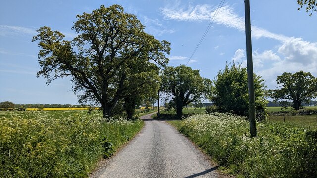
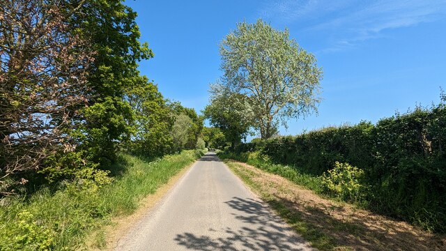
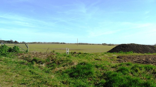
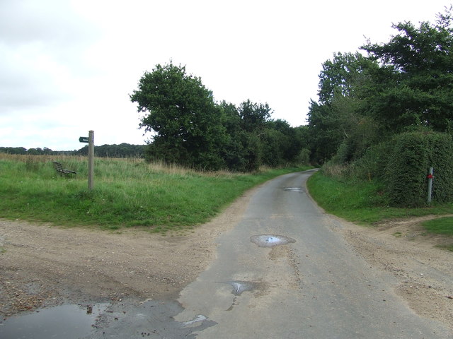
Frostenden Bottom Images

Images are sourced within 2km of 52.374773/1.6608287 or Grid Reference TM4981. Thanks to Geograph Open Source API. All images are credited.

Field south-east of Wrentham
Road leading to Middle Buildings
Suffolk Coast Path Coastal erosion means that the path is often inland and here follows the main road into Covehithe.
Suffolk Coast Path
Coastal erosion means that the path is often inland and here follows the main road into Covehithe.
Fields and fertiliser near Covehithe, Suffolk
Church of All Saints, Frostenden <span class="nowrap"><a title="https://historicengland.org.uk/listing/the-list/list-entry/1032170?section=official-list-entry" rel="nofollow ugc noopener" href="https://historicengland.org.uk/listing/the-list/list-entry/1032170?section=official-list-entry">Link</a><img style="margin-left:2px;" alt="External link" title="External link - shift click to open in new window" src="https://s1.geograph.org.uk/img/external.png" width="10" height="10"/></span>
Church of All Saints, Frostenden
Waiting for Life to Emerge Large field near Frostenden Hall.
Waiting for Life to Emerge
Large field near Frostenden Hall.
Church of St. Nicholas, Wrentham <span class="nowrap"><a title="https://historicengland.org.uk/listing/the-list/list-entry/1284532?section=official-list-entry" rel="nofollow ugc noopener" href="https://historicengland.org.uk/listing/the-list/list-entry/1284532?section=official-list-entry">Link</a><img style="margin-left:2px;" alt="External link" title="External link - shift click to open in new window" src="https://s1.geograph.org.uk/img/external.png" width="10" height="10"/></span>
Church of St. Nicholas, Wrentham
Wrentham War Memorial <span class="nowrap"><a title="https://historicengland.org.uk/listing/the-list/list-entry/1458655?section=official-list-entry" rel="nofollow ugc noopener" href="https://historicengland.org.uk/listing/the-list/list-entry/1458655?section=official-list-entry">Link</a><img style="margin-left:2px;" alt="External link" title="External link - shift click to open in new window" src="https://s1.geograph.org.uk/img/external.png" width="10" height="10"/></span>
Wrentham War Memorial
Gate And Field Metal gate and field near to South Cove, Suffolk.
Gate And Field
Metal gate and field near to South Cove, Suffolk.
Minor Road Minor road looking west near to South Cove, Suffolk.
Minor Road
Minor road looking west near to South Cove, Suffolk.
Footpath Off Minor Road Footpath off minor road near to Covehithe, Suffolk.
Footpath Off Minor Road
Footpath off minor road near to Covehithe, Suffolk.
Green Lane Marked on the O.S. 1:25:000 map as Green Lane near to Covehithe, Suffolk.
Green Lane
Marked on the O.S. 1:25:000 map as Green Lane near to Covehithe, Suffolk.
Road Junction Road junction on Mill Lane near to Wrentham, Suffolk.
Road Junction
Road junction on Mill Lane near to Wrentham, Suffolk.
Field Boundary Field boundary near to South Cove, Suffolk.
Field Boundary
Field boundary near to South Cove, Suffolk.
Entrance To Park Farm Entrance to Park Farm near to Wrentham, Suffolk.
Entrance To Park Farm
Entrance to Park Farm near to Wrentham, Suffolk.
Minor Road Minor road looking east near to Wrentham, Suffolk.
Minor Road
Minor road looking east near to Wrentham, Suffolk.
St Lawrence, South Cove: churchyard
St Lawrence, South Cove: porch
Show me another place!

Frostenden Bottom is located at Grid Ref: TM4981 (Lat: 52.374773, Lng: 1.6608287)

Administrative County: Suffolk

District: East Suffolk

Police Authority: Suffolk

What 3 Words

///stir.acoustics.raced. Near Southwold, Suffolk

Related Wikis

South Cove, Suffolk

South Cove is a civil parish in the east of the English county of Suffolk. It is 3 miles (4.8 km) north of the coastal town of Southwold and 1 mile (1...

Frostenden

Frostenden is a village and civil parish in the East Suffolk district of the English county of Suffolk. It is around 8 miles (13 km) south-west of Lowestoft...

Wrentham, Suffolk

Wrentham is a village and civil parish in the East Suffolk district, in the north-east of the English county of Suffolk. It is located about 2 miles (3...

Old Town Hall, Wrentham

The Old Town Hall is a former municipal building in the High Street in Wrentham, Suffolk, England. The building, which was the meeting place of Wrentham...

Nearby Amenities

Located within 500m of 52.374773,1.6608287
Barrier: stile
Bicycle: no
Foot: yes
Material: wood
Stile: stepover
Lat/Long: 52.3710237/1.6586774
Barrier: stile
Bicycle: no
Foot: yes
Material: wood
Stile: stepover
Lat/Long: 52.3731391/1.6590235
Power: pole
Lat/Long: 52.3769779/1.6554098
Power: pole
Lat/Long: 52.3759758/1.6551845
Power: pole
Lat/Long: 52.3746552/1.655674
Power: pole
Lat/Long: 52.3736285/1.6560455
Power: pole
Lat/Long: 52.3737718/1.6548143
Power: pole
Lat/Long: 52.372483/1.6564465
Power: pole
Lat/Long: 52.3718575/1.6553186
The data included in this document is from www.openstreetmap.org. The data is made available under ODbL.

Have you been to Frostenden Bottom?

Leave your review of Frostenden Bottom below (or comments, questions and feedback).