Filby Wood

Wood, Forest in Norfolk Great Yarmouth

England

Filby Wood

Scratby village sign, repainted Scratby and California share a sign featuring a lifebelt, the Royal Albert lifeboat, an oar and some ruins with a glazed window, probably representing Scratby church which was demolished in 1548. On the right is what I believe to be a lifeboat shed and perhaps a beacon.
Scratby village sign, repainted Credit: Jane Rackham

Filby Wood is a picturesque forest located in the county of Norfolk, England. Covering an area of approximately 70 hectares, this woodland is a popular destination for nature enthusiasts and outdoor enthusiasts alike.

The wood is predominantly composed of deciduous trees, including oak, birch, and beech, which create a vibrant and diverse ecosystem. The canopy of the forest provides a sheltered habitat for a wide variety of bird species, including woodpeckers, tits, and warblers. The forest floor is rich in flora, with bluebells, wild garlic, and wood anemones carpeting the ground during the spring months, creating a breathtaking display of color.

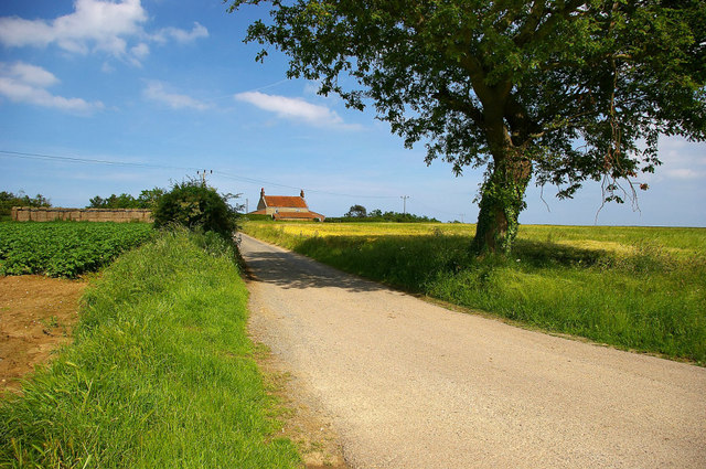
Filby Wood is crisscrossed by a network of well-maintained footpaths, enabling visitors to explore the forest at their own pace. These paths lead to secluded clearings, where visitors can sit and enjoy the tranquil surroundings or have a picnic amidst the natural beauty. The woods are also home to a small pond, attracting a range of amphibians and serving as a watering hole for local wildlife.

Conservation efforts have been made to preserve the natural integrity of Filby Wood, ensuring that it remains a haven for wildlife and a peaceful retreat for visitors. The forest is managed by the local council, who work to maintain the woodlands and protect its delicate ecosystem.

Overall, Filby Wood offers a serene and enchanting experience for those seeking a connection with nature. Its diverse flora and fauna, coupled with its well-maintained trails, make it an ideal destination for walking, birdwatching, or simply immersing oneself in the beauty of the natural world.

If you have any feedback on the listing, please let us know in the comments section below.
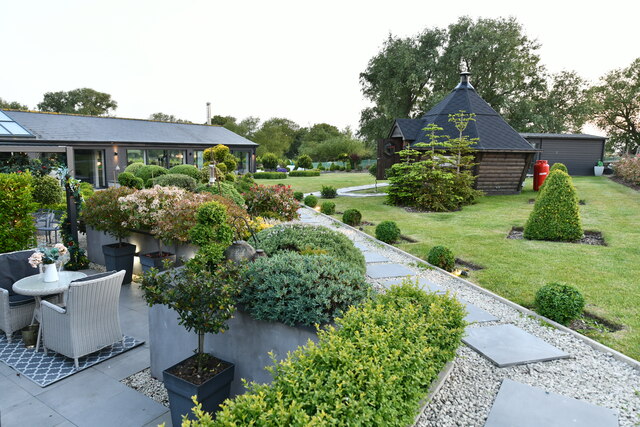
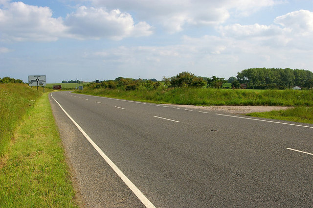
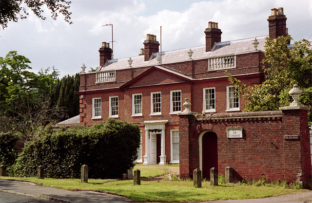
Filby Wood Images

Images are sourced within 2km of 52.670073/1.6855946 or Grid Reference TG4914. Thanks to Geograph Open Source API. All images are credited.

Scratby village sign, repainted Scratby and California share a sign featuring a lifebelt, the Royal Albert lifeboat, an oar and some ruins with a glazed window, probably representing Scratby church which was demolished in 1548. On the right is what I believe to be a lifeboat shed and perhaps a beacon.
Scratby village sign, repainted
Scratby and California share a sign featuring a lifebelt, the Royal Albert lifeboat, an oar and some ruins with a glazed window, probably representing Scratby church which was demolished in 1548. On the right is what I believe to be a lifeboat shed and perhaps a beacon.
Filby: Black Barn Garden
Station Road going in the direction of California Station Road, and to the right is Flint Cottage. At the extent to which the road can be seen in the picture, but out of view, is the B1159 and crossroad. The road straight over at the crossroad leads to California.
Station Road going in the direction of California
Station Road, and to the right is Flint Cottage. At the extent to which the road can be seen in the picture, but out of view, is the B1159 and crossroad. The road straight over at the crossroad leads to California.
Scratby Road in the direction of Hemsby Scratby Road, seen here running through farmland as it heads out of Scratby and towards Hemsby village.
Scratby Road in the direction of Hemsby
Scratby Road, seen here running through farmland as it heads out of Scratby and towards Hemsby village.
A149 Bypass looking in the direction of West Caister A149 Bypass completed in the mid 1990’s. A half kilometre stretch cuts the southwest corner of this grid square. The southern section of the bypass replaced the old Nova Scotia Road.
A149 Bypass looking in the direction of West Caister
A149 Bypass completed in the mid 1990’s. A half kilometre stretch cuts the southwest corner of this grid square. The southern section of the bypass replaced the old Nova Scotia Road.
Rural Scene off the A149 Bypass A rural scene photographed from the A149 bypass. The lane flanked on either side by farmland leads to Nova Scotia Cottages and continues on to Nova Scotia Farm.
Rural Scene off the A149 Bypass
A rural scene photographed from the A149 bypass. The lane flanked on either side by farmland leads to Nova Scotia Cottages and continues on to Nova Scotia Farm.
Scratby Road and Thoroughfare Lane junction The car is emerging onto Scratby Road from Thoroughfare Lane. Scratby Hall is behind the clump of trees to the right of the picture; in the years 1948-1986 it was a school for boys, named Duncan Hall School – See <span class="nowrap"><a title="www.home.earthlink.net/~duncanhallschool" rel="nofollow ugc noopener" href="http://www.home.earthlink.net/~duncanhallschool">Link</a><img style="margin-left:2px;" alt="External link" title="External link - shift click to open in new window" src="https://s1.geograph.org.uk/img/external.png" width="10" height="10"/></span>
Scratby Road and Thoroughfare Lane junction
The car is emerging onto Scratby Road from Thoroughfare Lane. Scratby Hall is behind the clump of trees to the right of the picture; in the years 1948-1986 it was a school for boys, named Duncan Hall School – See LinkExternal link
Beach Road - Scratby A well looked after and scenic area of Beach Road. Following this road all the way to the coast and then bearing right will take you to California.
Beach Road - Scratby
A well looked after and scenic area of Beach Road. Following this road all the way to the coast and then bearing right will take you to California.
B1159 Scratby Road & Beach Road Junction B1159 Scratby Road and Beach Road junction, not an easy junction to get out of, Scratby Road is quite a busy road this time of the year.
B1159 Scratby Road & Beach Road Junction
B1159 Scratby Road and Beach Road junction, not an easy junction to get out of, Scratby Road is quite a busy road this time of the year.
Dabs 'n' Crabs fish shop The Dabs 'n' Crabs wet fish shop on the main road at Scratby.
Dabs 'n' Crabs fish shop
The Dabs 'n' Crabs wet fish shop on the main road at Scratby.
To North Walsham 21 Old milepost on what was the A.149 at California, Norfolk. For close up view see <a title="https://www.geograph.org.uk/photo/1737448" href="https://www.geograph.org.uk/photo/1737448">Link</a> For more info on the post see <span class="nowrap"><a title="http://milestones.megalithia.com/sites/tg512143.htm" rel="nofollow ugc noopener" href="http://milestones.megalithia.com/sites/tg512143.htm">Link</a><img style="margin-left:2px;" alt="External link" title="External link - shift click to open in new window" src="https://s1.geograph.org.uk/img/external.png" width="10" height="10"/></span> do have a look at their home page.
To North Walsham 21
Old milepost on what was the A.149 at California, Norfolk. For close up view see Link For more info on the post see LinkExternal link do have a look at their home page.
Old Milepost Old milepost on what was the A.149 at California, Norfolk. For overall view see <a title="https://www.geograph.org.uk/photo/1737432" href="https://www.geograph.org.uk/photo/1737432">Link</a> For more info on the post see <span class="nowrap"><a title="http://milestones.megalithia.com/sites/tg512143.htm" rel="nofollow ugc noopener" href="http://milestones.megalithia.com/sites/tg512143.htm">Link</a><img style="margin-left:2px;" alt="External link" title="External link - shift click to open in new window" src="https://s1.geograph.org.uk/img/external.png" width="10" height="10"/></span> do have a look at their home page.
Old Milepost
Old milepost on what was the A.149 at California, Norfolk. For overall view see Link For more info on the post see LinkExternal link do have a look at their home page.
Going to California That's California, Norfolk. This is the road junction of Scratby Road (roughly north south) with Station Road (to the west).
Going to California
That's California, Norfolk. This is the road junction of Scratby Road (roughly north south) with Station Road (to the west).
Ormesby Old Hall, Ormesby St Margaret An attractive front of 1735, its parapet lined with urns. As so often it is a Georgian refronting of an older house, on this occasion for Cotton Symonds. Not visible from the photo but unusually the bricks are laid in header bond. Grade II* listed.
By the road is a contemporary wall, also topped by urns, as well as a cornice. Grade II listed.
Ormesby Old Hall, Ormesby St Margaret
An attractive front of 1735, its parapet lined with urns. As so often it is a Georgian refronting of an older house, on this occasion for Cotton Symonds. Not visible from the photo but unusually the bricks are laid in header bond. Grade II* listed. By the road is a contemporary wall, also topped by urns, as well as a cornice. Grade II listed.
Old Methodist chapel, Scratby It now appears to be converted to a dwelling.
Old Methodist chapel, Scratby
It now appears to be converted to a dwelling.
Large house, Ormesby St Margaret
Station Road, Ormesby St Margaret Looking east.
Station Road, Ormesby St Margaret
Looking east.
Field south of Station Road, Ormesby St Margaret
Show me another place!

Filby Wood is located at Grid Ref: TG4914 (Lat: 52.670073, Lng: 1.6855946)

Administrative County: Norfolk

District: Great Yarmouth

Police Authority: Norfolk

What 3 Words

///stalemate.fuels.feathers. Near Ormesby St Margaret, Norfolk

Related Wikis

Great Ormesby railway station

Great Ormesby railway station was a station in Ormesby St Margaret, Norfolk. It was opened in 1877 and later became part of the Midland and Great Northern...

Ormesby St Margaret with Scratby

Ormesby St Margaret with Scratby is a civil parish in the English county of Norfolk. It is made up of the inland village of Ormesby St Margaret and the...

Duncan Hall School

Duncan Hall School was a boys’ prep school at Scratby Hall in Ormesby St Margaret with Scratby, Norfolk from 1949 to 1986, with girls admitted from 1979...

Scratby Halt railway station

Scratby Halt was a railway station on the Midland and Great Northern Joint Railway which served the Norfolk village of Scratby, England. == History... ==

Ormesby St Michael

Ormesby St Michael is a small village and civil parish in the English county of Norfolk. It is situated some 12 km (7.5 mi) north-west of the town of Great...

California Halt railway station

California Halt was a railway station on the Midland and Great Northern Joint Railway which served the Norfolk village of California, England. == History... ==

Blitz and Pieces

Blitz and Pieces is a museum in Scratby in Great Yarmouth, England, owned and operated by Darren Stride. Based on the British Home Front during World...

Mautby

Mautby is a village and civil parish in the English county of Norfolk, in the East Flegg Hundred. The parish comprises a largely rural area along the north...

Nearby Amenities

Located within 500m of 52.670073,1.6855946
Royal Oak, opp
Naptan AtcoCode: 2900O0114
Naptan Bearing: NW
Naptan BusStopType: CUS
Naptan CommonName: Royal Oak
Naptan Indicator: opp
Naptan Landmark: Royal Oak
Naptan Locality: Ormesby
Naptan NaptanCode: nfodmtmd
Naptan PlusbusZoneRef: YARMTH
Naptan Street: Cromer Road
Naptan Verified: no
Source: naptan_import
Lat/Long: 52.6730142/1.6887748
Bus Stop
Royal Oak, adj
Naptan AtcoCode: 2900O013
Naptan Bearing: SE
Naptan CommonName: Royal Oak
Naptan Indicator: adj
Naptan Landmark: Royal Oak
Naptan Locality: Ormesby
Naptan NaptanCode: nfodmtwm
Naptan PlusbusZoneRef: YARMTH
Naptan Street: Cromer Road
Naptan Verified: no
Source: naptan_import
Lat/Long: 52.6731182/1.688902
Traffic Calming: island
Lat/Long: 52.670287/1.6833844
Post Office
Source: OS_OpenData_StreetView
Lat/Long: 52.6737865/1.685475
Pharmacy
Co-operative
Lat/Long: 52.6734926/1.6866837
Restaurant
Cuisine: indian
Lat/Long: 52.6733235/1.6864906
War Memorial
Historic: memorial
Inscription: To the Glory of God and in Memory of those Sailors & Soldiers of Ormesby S. Margaret, Ormesby St Michael, Scratby & California Who Gave Their Lives for Their Country in the Great War 1914-1918
Inscription 2: (35 mens names listed). For 1939-1945 WW2 (14 mens names listed)
Website: http://www.roll-of-honour.com/Norfolk/Ormesby.html
Lat/Long: 52.6729482/1.6903924
Saint Peter
Abandoned Amenity: place_of_worship
Denomination: anglican
Historic: church
Listed Status: no
Material: ground
Religion: christian
Tower: round
Website: http://www.heritage.norfolk.gov.uk/record-details?MNF8648
Lat/Long: 52.6724495/1.683071
Give Way
Lat/Long: 52.6732363/1.6903677
Give Way
Lat/Long: 52.6732129/1.6902726
Ormesby St·Margaret
Alt Name: Ormesby St Margaret
Man Made: village_sign
Material: metal
Website: https://ormesbypc.norfolkparishes.gov.uk/
Lat/Long: 52.6729806/1.6900814
Give Way
Lat/Long: 52.6728505/1.6906336
Waste Basket
Lat/Long: 52.6731262/1.6901538
Description: Pink marble slab set on the ground in the Memorial Green. Lettering is hard to read.
Historic: memorial
Inscription: Here lie the remains of some sixty or more of our Anglo Saxon forebears whose graves were disturbed during the contruction of the bypass.
Inscription 2: At the request of the Ormesby parish council they were reinterred in the summer of 2001 by the rector of this parish the reverend Andrew Sangster. May they rest in peace. This memorial was the gift of Arthur Jary & Sons.
Lat/Long: 52.6729652/1.6901685
Man Made: flagpole
Lat/Long: 52.6729643/1.6903315
Bench
Backrest: yes
Material: wood
Seats: 3
Lat/Long: 52.6729961/1.6899593
Bench
Backrest: yes
Material: wood
Seats: 3
Lat/Long: 52.6730249/1.6901484
Power: pole
Lat/Long: 52.6708313/1.6790079
Power: pole
Lat/Long: 52.6700359/1.6797549
Power: pole
Lat/Long: 52.6692275/1.6805112
Power: pole
Lat/Long: 52.6683557/1.6813561
Power: pole
Lat/Long: 52.6677555/1.6825765
Power: pole
Lat/Long: 52.6672057/1.6836333
Power: pole
Lat/Long: 52.6666519/1.6847089
Power: pole
Lat/Long: 52.66588/1.6860151
The data included in this document is from www.openstreetmap.org. The data is made available under ODbL.

Have you been to Filby Wood?

Leave your review of Filby Wood below (or comments, questions and feedback).