Fullwell Cross

Settlement in Essex

England

Fullwell Cross

Typically Chigwell Say no more .. (but see also <a href="https://www.geograph.org.uk/gridref/TQ4392">TQ4392</a>)
Typically Chigwell Credit: John Davies

Fullwell Cross is a suburban area located in the London Borough of Redbridge, Essex, England. Situated approximately 12 miles northeast of central London, it forms part of the larger district of Barkingside. Fullwell Cross is primarily a residential area, known for its tranquil atmosphere and leafy surroundings.

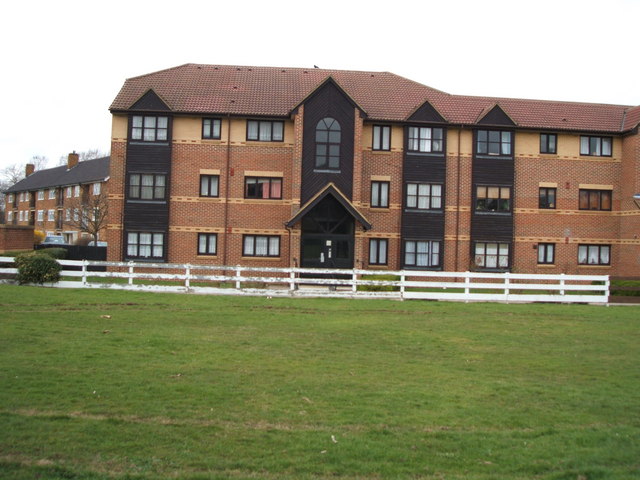
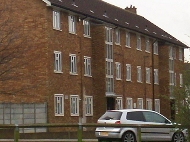
The area is characterized by a mix of housing types, including Victorian and Edwardian terraced houses, semi-detached properties, and modern developments. The streets are well-maintained, and the area boasts a strong community spirit with a range of local amenities and services.

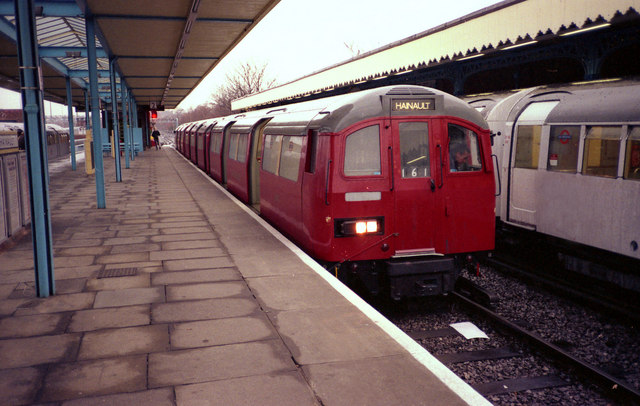
Fullwell Cross benefits from excellent transport links, with multiple bus routes connecting it to nearby towns and the city center. The nearest London Underground station is Fairlop, situated on the Central Line, providing easy access to the rest of London. Additionally, Fullwell Cross is well-connected by road, with the A12 and A406 North Circular Road in close proximity.

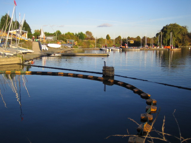
Residents of Fullwell Cross enjoy a variety of amenities, including several parks and green spaces. Hainault Forest Country Park, located nearby, offers beautiful woodlands, nature trails, and recreational facilities. There are also a number of schools, healthcare facilities, and shopping options in the area, ensuring residents have access to essential services.

Overall, Fullwell Cross is a peaceful and well-connected residential area, offering a high quality of life for its residents while maintaining close proximity to the bustling city of London.

If you have any feedback on the listing, please let us know in the comments section below.

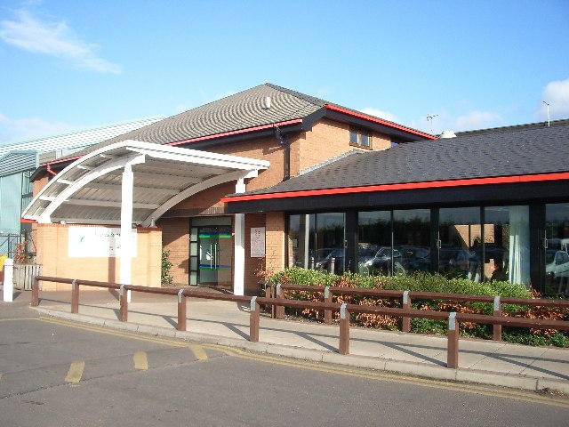
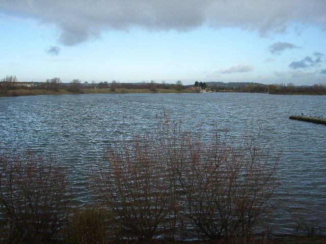
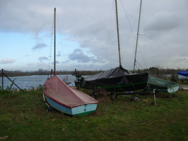
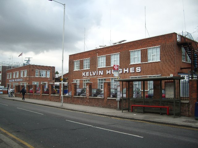
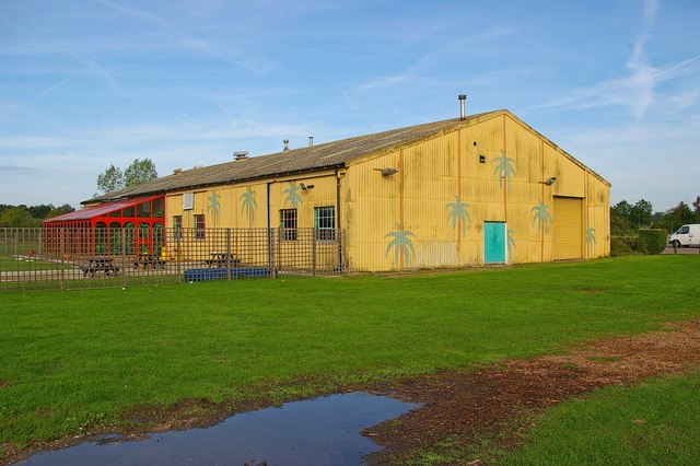
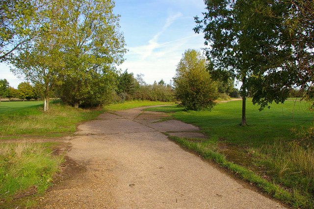
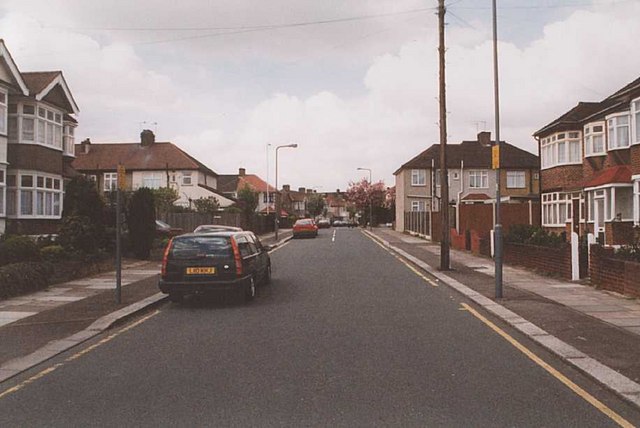
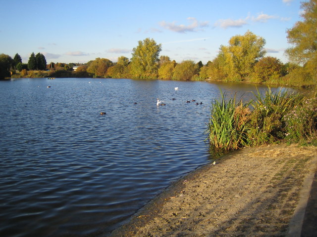
Fullwell Cross Images

Images are sourced within 2km of 51.593802/0.08445 or Grid Reference TQ4490. Thanks to Geograph Open Source API. All images are credited.

Typically Chigwell Say no more .. (but see also <a href="https://www.geograph.org.uk/gridref/TQ4392">TQ4392</a>)
Typically Chigwell
Say no more .. (but see also TQ4392)
Redbridge Sports and Leisure Centre Why do such places have huge car parks ? You would have thought .. Oh, never mind.
Redbridge Sports and Leisure Centre
Why do such places have huge car parks ? You would have thought .. Oh, never mind.
Fairlop Waters Country Park The former sand and gravel extraction area of Fairlop Plain is now a popular sailing and canoeing venue (in the summer, not when the January rain clouds are gathering, as here).
Fairlop Waters Country Park
The former sand and gravel extraction area of Fairlop Plain is now a popular sailing and canoeing venue (in the summer, not when the January rain clouds are gathering, as here).
Fairlop Waters Country Park Beached for the winter
Fairlop Waters Country Park
Beached for the winter
Hainault Allotments Well-tended and productive allotments in New North Road, Hainault
Hainault Allotments
Well-tended and productive allotments in New North Road, Hainault
Kelvin Hughes Head Office Kelvin Hughes, part of Smiths Marine Systems provides 'total marine navigation solutions'.  The head office, in New North Road, Hainault, has radar scanners revolving on the roof.
Kelvin Hughes Head Office
Kelvin Hughes, part of Smiths Marine Systems provides 'total marine navigation solutions'. The head office, in New North Road, Hainault, has radar scanners revolving on the roof.
Wedmore Avenue This grid square is a largely residential area within the London Borough of Redbridge. There is parkland adjacent to these houses in Wedmore Avenue, just behind the photographer.
Wedmore Avenue
This grid square is a largely residential area within the London Borough of Redbridge. There is parkland adjacent to these houses in Wedmore Avenue, just behind the photographer.
RAF Fairlop Survivor? This asbestos building is on <a href="https://www.geograph.org.uk/photo/111606">TQ4590 : Fairlop Waters Country Park</a> this was built on the site of RAF Fairlop. The airfield opened as RFC Hainault Farm to counter the treat of Zeppelin raids in WW1, the base closed in 1919. The City of London Corporation bought the site before WW2 intending it to be London Airport but the site was requisitioned by the air ministry and a military base constructed. Operations began in November 1941 the base was used by Spitfires, Hurricane (fighter bomber version) and Typhoons it closed in 1946. I may be a tad romantic thinking this is a wartime survivor it is more likely to be associated with the gravel extraction that destroyed almost all vestiges of the aerodrome and created the lakes, however there are some concrete paths that look suspiciously like <a href="https://www.geograph.org.uk/photo/255652">TQ4590 : Fairlop Peri?</a>. To go to the next field in an alphabetical tour of Essex WW2 airfields click on <a href="https://www.geograph.org.uk/photo/221155">TL7830 : Gosfield Airfield</a>. Much information was gleaned from Graham Smith’s book “Essex Airfields In The Second World War”. <span class="nowrap"><a title="https://books.google.co.uk/books/about/Essex_Airfields_in_the_Second_World_War.html?id=u3atAAAACAAJ&redir_esc=y" rel="nofollow ugc noopener" href="https://books.google.co.uk/books/about/Essex_Airfields_in_the_Second_World_War.html?id=u3atAAAACAAJ&redir_esc=y">Link</a><img style="margin-left:2px;" alt="External link" title="External link - shift click to open in new window" src="https://s1.geograph.org.uk/img/external.png" width="10" height="10"/></span>
RAF Fairlop Survivor?
This asbestos building is on TQ4590 : Fairlop Waters Country Park this was built on the site of RAF Fairlop. The airfield opened as RFC Hainault Farm to counter the treat of Zeppelin raids in WW1, the base closed in 1919. The City of London Corporation bought the site before WW2 intending it to be London Airport but the site was requisitioned by the air ministry and a military base constructed. Operations began in November 1941 the base was used by Spitfires, Hurricane (fighter bomber version) and Typhoons it closed in 1946. I may be a tad romantic thinking this is a wartime survivor it is more likely to be associated with the gravel extraction that destroyed almost all vestiges of the aerodrome and created the lakes, however there are some concrete paths that look suspiciously like TQ4590 : Fairlop Peri?. To go to the next field in an alphabetical tour of Essex WW2 airfields click on TL7830 : Gosfield Airfield. Much information was gleaned from Graham Smith’s book “Essex Airfields In The Second World War”. LinkExternal link
Fairlop Peri? This is a concrete path that encircles much of <a href="https://www.geograph.org.uk/photo/111601">TQ4590 : Fairlop Waters Country Park</a> which is strong circumstantial evidence that this is the remains of the perimeter track of RAF Fairlop that formerly occupied the site see 
<a href="https://www.geograph.org.uk/photo/255648">TQ4590 : RAF Fairlop Survivor?</a>.
Fairlop Peri?
This is a concrete path that encircles much of TQ4590 : Fairlop Waters Country Park which is strong circumstantial evidence that this is the remains of the perimeter track of RAF Fairlop that formerly occupied the site see TQ4590 : RAF Fairlop Survivor?.
Virginia Gardens Virginia Gardens, Barkingside from its junction with Starch House Lane, looking towards the junction with Craven Gardens.
Virginia Gardens
Virginia Gardens, Barkingside from its junction with Starch House Lane, looking towards the junction with Craven Gardens.
Fairlop Waters A former gravel pit, this is the eastern end of the approximate fifteen hectare or thirty-eight acre lake, now used for sailing and windsurfing.
Fairlop Waters
A former gravel pit, this is the eastern end of the approximate fifteen hectare or thirty-eight acre lake, now used for sailing and windsurfing.
Fairlop Waters This is the lake's sailing centre. The site's website is here <span class="nowrap"><a title="http://www.fairlopwaters.info/index.asp" rel="nofollow ugc noopener" href="http://www.fairlopwaters.info/index.asp">Link</a><img style="margin-left:2px;" alt="External link" title="External link - shift click to open in new window" src="https://s1.geograph.org.uk/img/external.png" width="10" height="10"/></span>  The booms in the foreground are in place to trap debris and pollutants from entering the lake from the stream that feeds it.
Fairlop Waters
This is the lake's sailing centre. The site's website is here LinkExternal link The booms in the foreground are in place to trap debris and pollutants from entering the lake from the stream that feeds it.
Fairlop Waters: Cycle circuit Tucked away in the north-east corner of the Fairlop Waters country park is this rather neglected and badly rutted cycle circuit.

Update July 2010:
A correspondent writes that "The cycle track is no longer in existence, having been built over and is now a car park. New cycling facilities are available 2 kilometres away at Redbridge Cycling Centre".
Fairlop Waters: Cycle circuit
Tucked away in the north-east corner of the Fairlop Waters country park is this rather neglected and badly rutted cycle circuit. Update July 2010: A correspondent writes that "The cycle track is no longer in existence, having been built over and is now a car park. New cycling facilities are available 2 kilometres away at Redbridge Cycling Centre".
Hainault station With red tube train which was operating on the Hainault - Woodford shuttle
Hainault station
With red tube train which was operating on the Hainault - Woodford shuttle
Heathcote Avenue
Heathcote Avenue
Local area house A nice house in the middle of the field between Caterham High School and the local bus stop. 
Taken by George, Luke and Jack.
Local area house
A nice house in the middle of the field between Caterham High School and the local bus stop. Taken by George, Luke and Jack.
Rows of flats This picture is outside Caterham High School. It is a lovely block of flats with no graffiti on it.
Rows of flats
This picture is outside Caterham High School. It is a lovely block of flats with no graffiti on it.
Health Centre A health centre on Heathcote Avenue. It is a beautiful health centre that serves the public well.
Health Centre
A health centre on Heathcote Avenue. It is a beautiful health centre that serves the public well.
Show me another place!

Fullwell Cross is located at Grid Ref: TQ4490 (Lat: 51.593802, Lng: 0.08445)

Unitary Authority: Redbridge

Police Authority: Metropolitan

What 3 Words

///quiz.lands.friday. Near Grange Hill, Essex

Nearby Locations

Fairlop Fullwell Cross

Related Wikis

Ilford North (UK Parliament constituency)

Ilford North is a constituency created in 1945 and represented in the House of Commons of the UK Parliament since 2015 by Wes Streeting of the Labour Party...

King Solomon High School

King Solomon High School is a Modern Orthodox Judaism comprehensive school located in Barkingside, Greater London, England. It was opened in 1993 by its...

Fairlop tube station

Fairlop is a London Underground station in Fairlop in east London, England, which is on the Central line of the London Underground. It has been in Travelcard...

Ilford County High School

Ilford County High School (often abbreviated to ICHS) is a selective secondary grammar school for boys located in the town of Barkingside of the London...

Fairlop

Fairlop is an area of Ilford, in the London Borough of Redbridge in east London. As well as residential areas, the district includes farmland, woodland...

Dr Barnardo's Memorial

The Memorial to Dr Barnardo by George Frampton, at Barkingside in the London Borough of Redbridge, commemorates the founder of the Barnardo's children...

Barkingside

Barkingside is an area in Ilford, in the London Borough of Redbridge. It includes the major road junction of Fullwell Cross which also gives its name to...

Redbridge F.C.

Redbridge Football Club is an English association football club based in Barkingside in the London Borough of Redbridge. Prior to July 2004 the club was...

Nearby Amenities

Located within 500m of 51.593802,0.08445
Give Way
Direction: forward
Lat/Long: 51.5935264/0.0848797
Mini Roundabout
Lat/Long: 51.5949803/0.0842879
Mini Roundabout
Lat/Long: 51.589503/0.0836213
Turning Circle
Lat/Long: 51.591171/0.0866655
Ref GB Tflcid: RWG170133
Traffic Calming: hump
Lat/Long: 51.5920393/0.0805623
Direction: forward
Ref GB Tflcid: RWG170132
Traffic Calming: hump
Lat/Long: 51.5921504/0.0808585
Turning Circle
Lat/Long: 51.5949596/0.083137
Noexit: yes
Lat/Long: 51.5956799/0.0779948
Turning Circle
Lat/Long: 51.5970969/0.0804154
Noexit: yes
Lat/Long: 51.5955608/0.0780479
Noexit: yes
Lat/Long: 51.5952822/0.078696
Entrance: main
Lat/Long: 51.5931485/0.0849114
Entrance: yes
Lat/Long: 51.5929915/0.0850956
Noexit: yes
Lat/Long: 51.5926165/0.0833911
Noexit: yes
Lat/Long: 51.590929/0.0810294
Noexit: yes
Lat/Long: 51.592828/0.0814036
Noexit: yes
Lat/Long: 51.5936212/0.0804357
Noexit: yes
Lat/Long: 51.5934702/0.0806646
Post Box
Created By: Potlatch 0.10f
Ref: IG6 3
Lat/Long: 51.594491/0.084829
Bus Stop
Barkingside High Street
Bus: yes
Local Ref: H
Naptan AtcoCode: 490003612H
Naptan Bearing: W
Naptan CommonName: Barkingside High Street
Naptan Indicator: Stop H
Naptan Verified: no
Public Transport: platform
Ref: 74976
Source Ref: naptan
Lat/Long: 51.5902603/0.0812186
Bus Stop
Barkingside High Street
Bus: yes
Local Ref: P
Naptan AtcoCode: 490003612P
Naptan Bearing: E
Naptan CommonName: Barkingside High Street
Naptan Indicator: Stop P
Naptan Verified: no
Public Transport: platform
Ref: 53942
Source Ref: naptan
Lat/Long: 51.5904008/0.081194
Bus Stop
Aintree Crescent
Bus: yes
Local Ref: F
Naptan AtcoCode: 490003127E
Naptan Bearing: E
Naptan CommonName: Aintree Crescent
Naptan Indicator: Stop F
Naptan Street: FULLWELL AVENUE
Naptan Verified: no
Public Transport: platform
Ref: 49591
Lat/Long: 51.5940472/0.0830204
Bus Stop
Aintree Crescent
Bus: yes
Local Ref: E
Naptan AtcoCode: 490003127W
Naptan Bearing: W
Naptan CommonName: Aintree Crescent
Naptan Indicator: Stop E
Naptan Street: FULLWELL AVENUE
Naptan Verified: no
Public Transport: platform
Ref: 73597
Lat/Long: 51.5941995/0.0815537
Bus Stop
Fencepiece Road
Bus: yes
Local Ref: M
Naptan AtcoCode: 490006790N
Naptan Bearing: N
Naptan CommonName: Fencepiece Road
Naptan Indicator: Stop M
Naptan Street: TOMSWOOD HILL
Naptan Verified: no
Public Transport: platform
Ref: 58438
Source Ref: naptan
Lat/Long: 51.5955036/0.0831368
Bus Stop
Fencepiece Road
Bus: yes
Local Ref: L
Naptan AtcoCode: 490006790S
Naptan Bearing: S
Naptan CommonName: Fencepiece Road
Naptan Indicator: Stop L
Naptan Street: TOMSWOOD HILL
Naptan Verified: no
Public Transport: platform
Ref: 76303
Source Ref: naptan
Lat/Long: 51.5951319/0.0838289
Bus Stop
Fremantle Road
Bench: yes
Bus: yes
Local Ref: J
Naptan AtcoCode: 490007012J
Naptan Bearing: N
Naptan CommonName: Fremantle Road
Naptan Indicator: Stop J
Naptan Street: BARKINGSIDE HIGH STREET
Naptan Verified: no
Public Transport: platform
Ref: 59002
Shelter: yes
Lat/Long: 51.5897676/0.0816256
Bus Stop
Fullwell Cross
Bus: yes
Local Ref: A
Naptan AtcoCode: 490007059A
Naptan Bearing: N
Naptan CommonName: Barkingside Fullwell Cross
Naptan Indicator: Stop A
Naptan Street: BARKINGSIDE HIGH STREET
Naptan Verified: no
Public Transport: platform
Ref: 48391
Shelter: yes
Lat/Long: 51.5930165/0.084354
Bus Stop
Fullwell Cross
Bus: yes
Local Ref: D
Naptan AtcoCode: 490007059D
Naptan Bearing: S
Naptan CommonName: Barkingside Fullwell Cross
Naptan Indicator: Stop D
Naptan Street: BARKINGSIDE HIGH STREET
Naptan Verified: no
Public Transport: platform
Ref: 59321
Shelter: yes
Lat/Long: 51.592591/0.0842322
Bus Stop
Neville Road
Bus: yes
Local Ref: Q
Naptan AtcoCode: 490010189N
Naptan Bearing: N
Naptan CommonName: Neville Road
Naptan Indicator: Stop Q
Naptan Street: FENCEPIECE ROAD
Naptan Verified: no
Public Transport: platform
Ref: 74244
Source Ref: naptan
Lat/Long: 51.5976666/0.0846293
Bus Stop
Neville Road
Bus: yes
Local Ref: X
Naptan AtcoCode: 490010189S
Naptan Bearing: S
Naptan CommonName: Neville Road
Naptan Indicator: Stop X
Naptan Street: FENCEPIECE ROAD
Naptan Verified: no
Public Transport: platform
Ref: 56507
Source Ref: naptan
Lat/Long: 51.5978748/0.0848514
Bus Stop
Tomswood Hill
Bus: yes
Local Ref: P
Naptan AtcoCode: 490013704N
Naptan Bearing: N
Naptan CommonName: Tomswood Hill
Naptan Indicator: Stop P
Naptan Street: FENCEPIECE ROAD
Naptan Verified: no
Public Transport: platform
Ref: 56437
Source Ref: naptan
Lat/Long: 51.5958071/0.0843044
Bus Stop
Tomswood Hill
Bus: yes
Local Ref: K
Naptan AtcoCode: 490013704S
Naptan Bearing: S
Naptan CommonName: Tomswood Hill
Naptan Indicator: Stop K
Naptan Street: FENCEPIECE ROAD
Naptan Verified: no
Public Transport: platform
Ref: 52825
Source Ref: naptan
Lat/Long: 51.5957858/0.0844744
Bus Stop
Waverley Gardens
Bus: yes
Local Ref: G
Naptan AtcoCode: 490014316G
Naptan Bearing: S
Naptan CommonName: Waverley Gardens
Naptan Indicator: Stop G
Naptan Street: BARKINGSIDE HIGH STREET
Naptan Verified: no
Public Transport: platform
Ref: 75001
Lat/Long: 51.5910182/0.0828892
Bus Stop
Mossford Lane
Bus: yes
Local Ref: H
Naptan AtcoCode: 490015391E
Naptan Bearing: E
Naptan CommonName: Mossford Lane Fullwell Av
Naptan Indicator: Stop H
Naptan Street: FULLWELL AVENUE
Naptan Verified: no
Public Transport: platform
Ref: 77746
Lat/Long: 51.5948994/0.0785499
Bus Stop
Mossford Lane
Bus: yes
Local Ref: G
Naptan AtcoCode: 490015391W
Naptan Bearing: W
Naptan CommonName: Mossford Lane Fullwell Av
Naptan Indicator: Stop G
Naptan Street: FULLWELL AVENUE
Naptan Verified: no
Public Transport: platform
Ref: 72530
Lat/Long: 51.5948629/0.0775821
Noexit: yes
Lat/Long: 51.5955431/0.0785701
Noexit: yes
Lat/Long: 51.5964098/0.0838096
Noexit: yes
Lat/Long: 51.5952987/0.0827879
Railway: subway_entrance
Lat/Long: 51.5957006/0.0908842
Bicycle Parking
Bicycle Parking: stands
Capacity: 48
Covered: yes
Note: half covered and half uncovered
Lat/Long: 51.595569/0.0907633
Ref GB Tflcid: RWG169115
Traffic Calming: hump
Lat/Long: 51.5956389/0.0908303
Post Box
Post Box Type: pillar
Royal Cypher: EIIR
Royal Cypher Wikidata: Q33102113
Lat/Long: 51.5955048/0.0909162
Crossing
Crossing: unmarked
Crossing Island: yes
Crossing Markings: no
Tactile Paving: yes
Lat/Long: 51.5909587/0.0860354
Herb China
Addr City: Ilford
Addr Housenumber: 47
Addr Postcode: IG6 2AD
Addr Street: High Street
Phone: +44 20 8551 2888
Lat/Long: 51.5897173/0.0814798
Waste Basket
Material: plastic
Source: local knowledge;streetlevel imagery
Waste: trash
Lat/Long: 51.5896677/0.0815936
Charlie's Sweet Emporium
Addr City: Ilford
Addr Country: GB
Addr Housenumber: 58
Addr Postcode: IG6 2DQ
Addr Street: High Street
Addr Suburb: Barkingside
Email: barkingside@charliessweets.co.uk
Facebook: https://www.facebook.com/CharliesSweetEmporiumBarkingside
Opening Hours: Mo-Fr 09:30-17:30; Sa 09:30-18:00; Su 11:00-17:00
Phone: +44 20 8550 7988
Shop: confectionery
Website: www.charliessweets.co.uk
Lat/Long: 51.5898524/0.0819332
Fast Food
Domino's
Addr City: Ilford
Addr Country: GB
Addr Housenumber: 52
Addr Postcode: IG6 2DQ
Addr Street: High Street
Addr Suburb: Barkingside
Brand: Domino's
Brand Wikidata: Q839466
Brand Wikipedia: en:Domino's Pizza
Contact Website: https://www.dominos.co.uk/pizza-near-me/ilford/52-high-street
Cuisine: pizza
Fhrs Id: 443818
Source Addr: FHRS Open Data
Takeaway: yes
Lat/Long: 51.5897185/0.0818448
Gadget Exchange
Addr Street: High Street
Lat/Long: 51.5897992/0.0819005
Haart of Barkingside
Addr Street: High Street
Lat/Long: 51.5897563/0.0818709
Bank
Halifax
Addr Street: High Street
Brand: Halifax
Brand Wikidata: Q3310164
Lat/Long: 51.5899339/0.0819898
Cafe
Maison Fraise
Addr City: Ilford
Addr Country: GB
Addr Housenumber: 50
Addr Postcode: IG6 2DQ
Addr Street: High Street
Addr Suburb: Barkingside
Contact Phone: +44 20 8551 3726
Fhrs Id: 443693
Fhrs Local Authority Id: 165482
Phone: +44 20 8551 3726
Source Addr: FHRS Open Data
Lat/Long: 51.5896705/0.0818117
Fast Food
Subway
Addr City: Ilford
Addr Country: GB
Addr Housenumber: 48
Addr Postcode: IG6 2DQ
Addr Street: High Street
Addr Suburb: Barkingside
Brand: Subway
Brand Wikidata: Q244457
Contact Website: https://restaurants.subway.com/united-kingdom/en/london/48-high-street
Cuisine: sandwich
Fhrs Id: 443557
Fhrs Local Authority Id: 164782
Source Addr: FHRS Open Data
Takeaway: yes
Lat/Long: 51.5896273/0.0817818
Fulwell Cross Swimming Pool
Leisure: swimming_pool
Sport: swimming
Lat/Long: 51.5923849/0.0845065
Bicycle Parking
Bicycle Parking: stands
Lat/Long: 51.593513/0.0847636
Bicycle Parking
Bicycle Parking: rack
Lat/Long: 51.5931746/0.0859182
Bus Stop
Kantor Campus
Bus: yes
Local Ref: T
Naptan AtcoCode: 490000380Z
Public Transport: platform
Ref: 92114
Source Ref: naptan
Lat/Long: 51.5940307/0.086522
Crossing
Crossing: uncontrolled
Crossing Island: yes
Crossing Ref: zebra
Source: bing
Lat/Long: 51.5940708/0.0853391
Crossing
Crossing: uncontrolled
Crossing Island: yes
Crossing Ref: zebra
Source: bing
Lat/Long: 51.593837/0.0845991
Crossing
Crossing: uncontrolled
Crossing Island: yes
Crossing Ref: zebra
Source: bing
Lat/Long: 51.5938573/0.0858592
Crossing
Crossing: uncontrolled
Crossing Island: yes
Crossing Ref: zebra
Source: bing
Lat/Long: 51.5932453/0.0857274
Noexit: yes
Lat/Long: 51.5934052/0.0831522
Traffic Signals
Lat/Long: 51.5932074/0.0845853
Traffic Signals
Lat/Long: 51.5932624/0.0847678
Crossing
Crossing: traffic_signals
Crossing Ref: puffin
Lat/Long: 51.5932232/0.0845983
Crossing
Crossing: traffic_signals
Crossing Ref: puffin
Lat/Long: 51.5932467/0.0847498
Traffic Signals
Traffic Signals Direction: backward
Lat/Long: 51.5902407/0.0821066
Crossing
Crossing: traffic_signals
Crossing Island: yes
Crossing Markings: dots
Crossing Ref: pelican
Lat/Long: 51.5900441/0.0819436
Crossing
Crossing: traffic_signals
Crossing Island: yes
Crossing Markings: dots
Crossing Ref: pelican
Lat/Long: 51.5902091/0.0820804
Crossing
Crossing: traffic_signals
Crossing Island: yes
Crossing Markings: dots
Crossing Ref: pelican
Lat/Long: 51.5901702/0.0818648
Traffic Signals
Traffic Signals Direction: forward
Lat/Long: 51.5900108/0.081916
Crossing
Crossing: traffic_signals
Crossing Island: yes
Crossing Markings: dots
Crossing Ref: pelican
Lat/Long: 51.5900486/0.0821221
Crossing
Crossing: unmarked
Crossing Island: yes
Crossing Markings: no
Lat/Long: 51.5895394/0.0834678
Traffic Signals
Traffic Signals Direction: forward
Lat/Long: 51.5901853/0.0818202
Traffic Signals
Traffic Signals Direction: forward
Lat/Long: 51.590034/0.0821645
Noexit: yes
Lat/Long: 51.5943676/0.0838021
Noexit: yes
Lat/Long: 51.5955674/0.0823215
Crossing
Crossing: unmarked
Crossing Island: yes
Crossing Markings: no
Tactile Paving: yes
Lat/Long: 51.5948851/0.0842831
Crossing
Crossing: unmarked
Crossing Island: yes
Crossing Markings: no
Tactile Paving: yes
Lat/Long: 51.5949808/0.0841157
Give Way
Direction: forward
Lat/Long: 51.59494/0.0839627
Give Way
Direction: backward
Lat/Long: 51.5949806/0.0841643
Give Way
Direction: forward
Lat/Long: 51.5978216/0.0846951
Noexit: yes
Lat/Long: 51.5938576/0.080353
Noexit: yes
Lat/Long: 51.5954699/0.0824593
Crossing
Button Operated: yes
Crossing: traffic_signals
Crossing Island: yes
Crossing Markings: dots
Tactile Paving: yes
Traffic Signals Vibration: no
Lat/Long: 51.5948358/0.0788353
Noexit: yes
Lat/Long: 51.5928475/0.0794044
Noexit: yes
Lat/Long: 51.5933406/0.0823477
Direction: forward
Ref GB Tflcid: RWG170126
Traffic Calming: cushion
Lat/Long: 51.5894004/0.0837538
Direction: forward
Ref GB Tflcid: RWG166709
Traffic Calming: hump
Lat/Long: 51.5913704/0.0787802
Direction: both
Ref GB Tflcid: RWG170134
Traffic Calming: hump
Lat/Long: 51.5914795/0.0811978
Direction: forward
Ref GB Tflcid: RWG166711
Traffic Calming: hump
Lat/Long: 51.5917105/0.0796862
Direction: both
Ref GB Tflcid: RWG170135
Traffic Calming: hump
Lat/Long: 51.5910949/0.0819341
Bicycle Parking
Bicycle Parking: stands
Capacity: 4
Ref GB Tflcid: RWG157051
Lat/Long: 51.5921566/0.08421
Bicycle Parking
Bicycle Parking: stands
Capacity: 6
Ref GB Tflcid: RWG157053
Lat/Long: 51.5929956/0.0849503
Bicycle Parking
Bicycle Parking: stands
Capacity: 12
Ref GB Tflcid: RWG157052
Lat/Long: 51.5927463/0.0844406
Bicycle Parking
Bicycle Parking: stands
Capacity: 6
Ref GB Tflcid: RWG157054
Lat/Long: 51.5909703/0.0824672
Gambling
Gala Bingo
Lat/Long: 51.5934592/0.0837154
Crossing
Crossing: traffic_signals
Lat/Long: 51.5919765/0.083562
Crossing
Crossing: unmarked
Crossing Island: yes
Crossing Markings: no
Tactile Paving: yes
Lat/Long: 51.5920461/0.0859156
Crossing
Crossing: unmarked
Crossing Island: yes
Crossing Markings: no
Tactile Paving: yes
Lat/Long: 51.5917733/0.0859498
Crossing
Crossing: unmarked
Crossing Island: yes
Crossing Markings: no
Tactile Paving: yes
Lat/Long: 51.5912847/0.085999
Crossing
Crossing: unmarked
Crossing Island: yes
Crossing Markings: no
Tactile Paving: yes
Lat/Long: 51.5902604/0.0861111
Post Box
Operator: Royal Mail
Operator Wikidata: Q638098
Post Box Type: pillar
Source: bing
Lat/Long: 51.5899054/0.0862232
Telephone
Booth: KX100
Covered: booth
Lat/Long: 51.5921187/0.0835573
Crossing
Crossing: unmarked
Crossing Island: yes
Crossing Markings: no
Tactile Paving: yes
Lat/Long: 51.5924698/0.0840071
Telephone
Booth: KX100
Covered: booth
Lat/Long: 51.5931883/0.0845028
Bench
Lat/Long: 51.5932751/0.084502
Bench
Lat/Long: 51.5932531/0.0844859
Communication Mobile Phone: yes
Fixme: Lacking mast information
Man Made: mast
Tower Type: communication
Lat/Long: 51.5934526/0.0839601
Give Way
Direction: forward
Lat/Long: 51.5895649/0.0835605
Traffic Signals
Traffic Signals Direction: forward
Lat/Long: 51.5900968/0.0821648
Traffic Calming: cushion
Lat/Long: 51.5896219/0.0834282
Give Way
Direction: forward
Lat/Long: 51.5894411/0.0836716
Crossing
Crossing: unmarked
Crossing Island: yes
Crossing Markings: no
Lat/Long: 51.5895831/0.0835181
Crossing
Crossing: traffic_signals
Crossing Island: yes
Crossing Markings: dots
Crossing Ref: pelican
Lat/Long: 51.5900849/0.0822037
Waste Basket
Material: plastic
Source: local knowledge;streetlevel imagery
Waste: trash
Lat/Long: 51.5897709/0.081861
Waste Basket
Material: plastic
Source: local knowledge;streetlevel imagery
Waste: trash
Lat/Long: 51.5901344/0.0817473
Advertising: board
Direction: 290
Lit: no
Source: local knowledge
Lat/Long: 51.5902902/0.0818381
Information: guidepost
Tourism: information
Lat/Long: 51.5902866/0.0820269
Waste Basket
Material: plastic
Source: local knowledge;streetlevel imagery
Waste: trash
Lat/Long: 51.5902429/0.0822241
Waste Basket
Material: plastic
Source: local knowledge;streetlevel imagery
Waste: trash
Lat/Long: 51.5904265/0.0821574
Bench
Backrest: yes
Material: steel
Source: local knowledge;streetlevel imagery
Lat/Long: 51.5903756/0.08211
Bench
Backrest: yes
Material: steel
Source: local knowledge;streetlevel imagery
Lat/Long: 51.5903144/0.0822787
Vending Machine
Vending: parking_tickets
Lat/Long: 51.5906422/0.0823387
Waste Basket
Material: plastic
Source: local knowledge;streetlevel imagery
Waste: trash
Lat/Long: 51.5908033/0.0824749
Waste Basket
Material: plastic
Source: local knowledge;streetlevel imagery
Waste: trash
Lat/Long: 51.5907255/0.08261
Waste Basket
Material: plastic
Source: local knowledge;streetlevel imagery
Waste: trash
Lat/Long: 51.5908375/0.0827244
Waste Basket
Material: plastic
Source: local knowledge;streetlevel imagery
Waste: trash
Lat/Long: 51.59113/0.082747
Waste Basket
Material: plastic
Source: local knowledge;streetlevel imagery
Waste: trash
Lat/Long: 51.5913485/0.0831502
Waste Basket
Material: plastic
Source: local knowledge;streetlevel imagery
Waste: trash
Lat/Long: 51.5916083/0.083145
Waste Basket
Material: plastic
Source: local knowledge;streetlevel imagery
Waste: trash
Lat/Long: 51.5915786/0.0833213
Waste Basket
Material: plastic
Source: local knowledge;streetlevel imagery
Waste: trash
Lat/Long: 51.5917052/0.0832326
Bench
Backrest: yes
Material: steel
Source: local knowledge;streetlevel imagery
Lat/Long: 51.591734/0.0832453
Bench
Backrest: yes
Material: wood
Source: local knowledge;streetlevel imagery
Lat/Long: 51.5918253/0.0835404
Waste Basket
Material: plastic
Source: local knowledge;streetlevel imagery
Waste: trash
Lat/Long: 51.5919929/0.0837074
Bench
Backrest: yes
Material: wood
Source: local knowledge;streetlevel imagery
Lat/Long: 51.5920087/0.08372
Waste Basket
Material: plastic
Source: local knowledge;streetlevel imagery
Waste: trash
Lat/Long: 51.5922783/0.0837207
Waste Basket
Material: metal
Source: local knowledge;streetlevel imagery
Waste: trash
Lat/Long: 51.59216/0.0841814
Bench
Backrest: yes
Material: wood
Source: local knowledge;streetlevel imagery
Lat/Long: 51.5921445/0.0842474
Bench
Backrest: yes
Material: wood
Source: local knowledge;streetlevel imagery
Lat/Long: 51.5921382/0.084286
Waste Basket
Material: metal
Source: local knowledge;streetlevel imagery
Waste: trash
Lat/Long: 51.5921268/0.0843792
Vending Machine
Vending: parking_tickets
Lat/Long: 51.5921189/0.0844061
Crossing
Crossing: unmarked
Crossing Island: no
Crossing Markings: no
Source: local knowledge
Tactile Paving: yes
Traffic Calming: table
Lat/Long: 51.5921406/0.0838274
Waste Basket
Material: plastic
Source: local knowledge;streetlevel imagery
Waste: trash
Lat/Long: 51.5925441/0.0841947
Waste Basket
Material: plastic
Source: local knowledge;streetlevel imagery
Waste: trash
Lat/Long: 51.5927284/0.0841115
Waste Basket
Material: plastic
Source: local knowledge;streetlevel imagery
Waste: trash
Lat/Long: 51.5927016/0.0843266
Waste Basket
Material: plastic
Source: local knowledge;streetlevel imagery
Waste: trash
Lat/Long: 51.5928699/0.0844763
Waste Basket
Material: plastic
Source: local knowledge;streetlevel imagery
Waste: trash
Lat/Long: 51.592935/0.0842875
Waste Basket
Material: plastic
Source: local knowledge;streetlevel imagery
Waste: trash
Lat/Long: 51.5929961/0.0845811
Waste Basket
Material: plastic
Source: local knowledge;streetlevel imagery
Waste: trash
Lat/Long: 51.5904044/0.0811719
Waste Basket
Material: plastic
Source: local knowledge;streetlevel imagery
Waste: trash
Lat/Long: 51.5902535/0.0812769
Bicycle Parking
Access: yes
Covered: no
Fee: no
Source: local knowledge;streetlevel imagery
Lat/Long: 51.5901333/0.0823322
Barkingside Food Store
Addr City: Ilford
Addr Country: GB
Addr Housenumber: 64
Addr Postcode: IG6 2DJ
Addr Street: High Street
Addr Suburb: Barkingside
Organic: only
Shop: greengrocer
Source: local knowledge;streetlevel imagery
Lat/Long: 51.5901456/0.0824015
Love Nails
Addr City: Ilford
Addr Country: GB
Addr Housenumber: 66
Addr Postcode: IG6 2DJ
Addr Street: High Street
Addr Suburb: Barkingside
Beauty: nails
Email: lovenailsbarkingside@yahoo.com
Opening Hours: Mo-Su 09:00-19:00
Phone: +44 20 8551 0050
Shop: beauty
Source: local knowledge;survey
Lat/Long: 51.5901919/0.0824273
SixtySix Salon
Addr City: Ilford
Addr Country: GB
Addr Housenumber: 66
Addr Postcode: IG6 2DJ
Addr Street: High Street
Addr Suburb: Barkingside
Email: info@sixtysixsalon.com
Phone: +44 20 8550 5661
Shop: hairdresser
Source: local knowledge;survey
Unisex: yes
Website: https://sixtysixsalon.com/
Lat/Long: 51.590216/0.0824475
Bank
Leeds Building Society
Addr City: Ilford
Addr Country: GB
Addr Housenumber: 84
Addr Postcode: IG6 2DJ
Addr Street: High Street
Addr Suburb: Barkingside
Atm: no
Brand: Leeds Building Society
Brand Wikidata: Q6515848
Drive Through: no
Website: https://www.leedsbuildingsociety.co.uk
Lat/Long: 51.5906564/0.0827039
Thanalaksme Jewelers Limited
Addr City: Ilford
Addr Country: GB
Addr Housenumber: 82
Addr Postcode: IG6 2DJ
Addr Street: High Street
Addr Suburb: Barkingside
Opening Hours: Mo-Fr 10:00-19:00; Sa 11:00-18:00; Su 11:00-17:00
Phone: +44 20 8551 1153
Shop: jewelry
Source: local knowledge;survey;streetlevel imagery
Lat/Long: 51.5906088/0.0826648
Card Factory
Addr City: Ilford
Addr Country: GB
Addr Housenumber: 73
Addr Postcode: IG6 2AF
Addr Street: High Street
Addr Suburb: Barkingside
Brand: Card Factory
Brand Wikidata: Q5038192
Opening Hours: Mo-Sa 09:00-17:30; Su 10:00-16:00
Phone: +44 20 8551 7761
Shop: gift
Website: https://www.cardfactory.co.uk
Lat/Long: 51.5905624/0.0821234
Bank
Barclays
Addr City: Ilford
Addr Country: GB
Addr Housenumber: 83-85
Addr Postcode: IG6 2AQ
Addr Street: High Street
Addr Suburb: Barkingside
Atm: yes
Brand: Barclays
Brand Wikidata: Q245343
Drive Through: no
Opening Hours: Mo-Tu,Th-Fr 09:30-16:00; We 10:00-16:00; Sa-Su off
Phone: +44 345 734 5345
Wheelchair: yes
Lat/Long: 51.5908565/0.0822135
Crossing
Crossing: unmarked
Crossing Island: no
Crossing Markings: no
Source: local knowledge
Tactile Paving: yes
Traffic Calming: table
Lat/Long: 51.5908865/0.0825194
Crossing
Crossing: unmarked
Crossing Island: no
Crossing Markings: no
Source: local knowledge
Tactile Paving: yes
Traffic Calming: table
Lat/Long: 51.590776/0.0826813
Crossing
Crossing: unmarked
Crossing Island: no
Crossing Markings: no
Source: local knowledge
Tactile Paving: yes
Traffic Calming: table
Lat/Long: 51.5914604/0.08324
Crossing
Crossing: unmarked
Crossing Island: no
Crossing Markings: no
Source: local knowledge
Tactile Paving: yes
Traffic Calming: table
Lat/Long: 51.5916712/0.0831661
Crossing
Crossing: unmarked
Crossing Island: no
Crossing Markings: no
Source: local knowledge
Tactile Paving: yes
Traffic Calming: table
Lat/Long: 51.5933063/0.0845902
Bench
Backrest: yes
Material: steel
Source: local knowledge;streetlevel imagery
Lat/Long: 51.5928083/0.0845327
Bench
Backrest: yes
Material: steel
Source: local knowledge;streetlevel imagery
Lat/Long: 51.5928925/0.0846153
Bench
Backrest: yes
Material: steel
Source: local knowledge;streetlevel imagery
Lat/Long: 51.5929726/0.084694
Barrier: lift_gate
Lift Gate Type: single
Locked: no
Lat/Long: 51.5929713/0.0856705
Advertising: billboard
Website: https://ukbillboards.com
Lat/Long: 51.5907758/0.0829244
Arbon Miller
Addr City: Ilford
Addr Postcode: IG6 2DS
Addr Street: Waverley Gardens
Addr Village: Barkingside
Office: estate_agent
Source: local knowledge;survey
Lat/Long: 51.5907582/0.0830721
Cafe
Bella's coffee
Addr City: Ilford
Addr Housenumber: 86
Addr Postcode: IG6 2DR
Addr Street: High Street
Addr Village: Barkingside
Cuisine: coffee_shop
Source: local knowledge;survey
Lat/Long: 51.5908173/0.0829013
Furniture Fleet
Addr City: Ilford
Addr Housenumber: 88
Addr Postcode: IG6 2DR
Addr Street: High Street
Addr Village: Barkingside
Phone: +44 20 8617 8840
Shop: furniture
Source: local knowledge;survey
Website: http://furniturefleet.co.uk
Lat/Long: 51.5908421/0.0830122
Boots Opticians
Addr City: Ilford
Addr Housenumber: 90
Addr Postcode: IG6 2DR
Addr Street: High Street
Addr Village: Barkingside
Branch: Barkingside High Street Opticians
Brand: Boots Opticians
Brand Wikidata: Q4944037
Operator: Boots UK Limited
Shop: optician
Short Name: Boots
Source: local knowledge;survey
Lat/Long: 51.5908875/0.0830508
Nainas Beauty Box & Aesthetics
Addr City: Ilford
Addr Housenumber: 92
Addr Postcode: IG6 2DR
Addr Street: High Street
Addr Village: Barkingside
Beauty: spa;hair_removal;skin_care;nails
Branch: Nainas Beauty Box Barkingside
Opening Hours: Mo-Sa 10:00-19:00; Su 10:00-17:00
Phone: +44 20 8550 3332
Shop: beauty
Source: local knowledge;survey
Website: https://nainasbeautybox.co.uk/
Lat/Long: 51.5909331/0.0830882
Vodafone
Addr City: Ilford
Addr Housenumber: 94
Addr Postcode: IG6 2DR
Addr Street: High Street
Addr Village: Barkingside
Brand: Vodafone
Brand Wikidata: Q122141
Shop: mobile_phone
Source: local knowledge;survey
Lat/Long: 51.5909758/0.0831287
H&T Pawnbrokers
Addr City: Ilford
Addr Housenumber: 96
Addr Postcode: IG6 2DR
Addr Street: High Street
Addr Village: Barkingside
Brand: H&T Pawnbrokers
Brand Wikidata: Q105672451
Opening Hours: Mo-Sa 09:00-17:30; Su closed
Phone: +44 20 8551 0745
Shop: pawnbroker
Source: local knowledge;survey
Website: https://handt.co.uk
Lat/Long: 51.5910227/0.0831583
Spirit Outlet
Addr City: Ilford
Addr Housenumber: 98
Addr Postcode: IG6 2DR
Addr Street: High Street
Addr Village: Barkingside
Shop: clothes
Source: local knowledge;survey
Lat/Long: 51.5910665/0.0832019
Acasa Delicatessen Limited
Addr City: Ilford
Addr Housenumber: 102
Addr Postcode: IG6 2DR
Addr Street: High Street
Addr Village: Barkingside
Organic: only
Shop: supermarket
Source: local knowledge
Lat/Long: 51.591158/0.0832789
Gates DIY Store
Addr City: Ilford
Addr Housenumber: 104
Addr Postcode: IG6 2DR
Addr Street: High Street
Addr Village: Barkingside
Shop: doityourself
Source: local knowledge
Lat/Long: 51.5912033/0.0833145
Sense
Addr City: Ilford
Addr Housenumber: 106
Addr Postcode: IG6 2DR
Addr Street: High Street
Addr Village: Barkingside
Brand: Sense
Brand Wikidata: Q92552497
Email: Barkingside@sense.org.uk
Opening Hours: Mo-Sa 10:00-17:00; Su closed
Phone: +44 20 8551 3513
Shop: charity
Source: local knowledge;survey
Website: https://www.sense.org.uk
Lat/Long: 51.591249/0.0833511
Cafe
Danny's Pie & Mash
Addr City: Ilford
Addr Housenumber: 100
Addr Postcode: IG6 2DR
Addr Street: High Street
Addr Village: Barkingside
Delivery: yes
Internet Access: no
Outdoor Seating: no
Phone: +44 20 8220 0510
Source: local knowledge;survey
Takeaway: yes
Website: https://dannyspieandmashilford.cafecityguide.website
Lat/Long: 51.5911133/0.0832387
Bank
Nationwide
Addr City: Ilford
Addr Housenumber: 108
Addr Postcode: IG6 2DR
Addr Street: High Street
Addr Village: Barkingside
Atm: yes
Branch: Nationwide Barkingside
Brand: Nationwide
Brand Wikidata: Q846735
Drive Through: no
Opening Hours: Mo-Tu 09:00-16:30; We 10:00-16:30; Th 09:00-16:30; Sa 09:00-12:00
Phone: +44 345 266 0233
Source: local knowledge;survey
Website: https://www.nationwide.co.uk
Wheelchair: yes
Lat/Long: 51.5912921/0.0834103
Barkingside Tyres & Brakes
Addr City: Ilford
Addr Housenumber: 132
Addr Postcode: IG6 2DU
Addr Street: High Street
Addr Village: Barkingside
Shop: tyres
Lat/Long: 51.5919959/0.0839201
Restaurant
SWEET.
Addr City: Ilford
Addr Housenumber: 128-130
Addr Postcode: IG6 2DU
Addr Street: High Street
Addr Village: Barkingside
Branch: SWEET. Barkingside
Cuisine: dessert
Lat/Long: 51.5919282/0.0838386
Patricija
Addr City: Ilford
Addr Housenumber: 126
Addr Postcode: IG6 2DU
Addr Street: High Street
Addr Village: Barkingside
Shop: convenience
Lat/Long: 51.5918683/0.0837433
Group Of Good Deeds
Addr City: Ilford
Addr Housenumber: 124
Addr Postcode: IG6 2DU
Addr Street: High Street
Addr Village: Barkingside
Phone: +44 1708 540032
Shop: charity
Website: https://www.ggd-charity.org
Lat/Long: 51.5918241/0.0837058
Fast Food
German Doner Kebab
Addr City: Ilford
Addr Housenumber: 122
Addr Postcode: IG6 2DU
Addr Street: High Street
Addr Village: Barkingside
Branch: German Doner Kebab Barkingside
Brand: German Doner Kebab
Brand Wikidata: Q112913418
Cuisine: kebab
Delivery: yes
Opening Hours: Mo-Th 11:00-22:00; Fr-Sa 11:00-23:00; Su 11:00-22:00;
Takeaway: yes
Website: https://www.germandonerkebab.com/
Lat/Long: 51.5917798/0.0836679
Studio 120
Addr City: Ilford
Addr Housenumber: 120
Addr Postcode: IG6 2DU
Addr Street: High Street
Addr Village: Barkingside
Shop: hairdresser
Unisex: yes
Lat/Long: 51.5917372/0.0836313
Amabillia
Addr City: Ilford
Addr Housenumber: 118
Addr Postcode: IG6 2DU
Addr Street: High Street
Addr Village: Barkingside
Beauty: tanning
Shop: beauty
Lat/Long: 51.5916926/0.0835928
NEON Estates
Addr City: Ilford
Addr Housenumber: 116
Addr Postcode: IG6 2DU
Addr Street: High Street
Addr Village: Barkingside
Email: info@neonestates.com
Office: estate_agent
Opening Hours: Mo-Fr 09:00-18:00; Sa 09:00-16:00; Su closed
Phone: +44 20 8550 0088
Website: https://neonestates.com
Lat/Long: 51.5916471/0.0835534
Arabella House of Beauty and Hair
Addr City: Ilford
Addr Housenumber: 114
Addr Postcode: IG6 2DU
Addr Street: High Street
Addr Village: Barkingside
Shop: hairdresser
Lat/Long: 51.5915881/0.0835502
Rūta
Addr City: Ilford
Addr Housenumber: 112
Addr Postcode: IG6 2DU
Addr Street: High Street
Addr Village: Barkingside
Drive Through: no
Shop: alcohol
Lat/Long: 51.5915566/0.0834739
JenningsBet
Addr City: Ilford
Addr Housenumber: 110
Addr Postcode: IG6 2DU
Addr Street: High Street
Addr Village: Barkingside
Brand: JenningsBet
Brand Wikidata: Q112925339
Shop: bookmaker
Lat/Long: 51.5914786/0.0834938
Pound Plus World Limited
Addr City: Ilford
Addr Housenumber: 111
Addr Postcode: IG6 2AH
Addr Street: High Street
Addr Village: Barkingside
Shop: variety_store
Source: survey
Lat/Long: 51.5915737/0.0828747
Restaurant
Best BBQ Turkish Cuisine
Addr City: Ilford
Addr Housenumber: 109
Addr Postcode: IG6 2AH
Addr Street: High Street
Addr Village: Barkingside
Cuisine: turkish
Source: survey
Lat/Long: 51.5915346/0.0828163
Fast Food
HI-TIDE
Addr City: Ilford
Addr Housenumber: 107
Addr Postcode: IG6 2AH
Addr Street: High Street
Addr Village: Barkingside
Cuisine: fish_and_chips
Phone: +44 20 8550 5722
Source: survey
Lat/Long: 51.5914973/0.0827696
Headstrong Hair Salon
Addr City: Ilford
Addr Housenumber: 113A
Addr Postcode: IG6 2AH
Addr Street: High Street
Addr Village: Barkingside
Shop: hairdresser
Source: survey
Unisex: yes
Lat/Long: 51.5915782/0.0829746
Cafe
Costa
Addr City: Ilford
Addr Housenumber: 113
Addr Postcode: IG6 2AH
Addr Street: High Street
Addr Village: Barkingside
Branch: Costa Barkingside
Brand: Costa
Brand Wikidata: Q608845
Cuisine: coffee_shop
Fhrs Id: 443903
Internet Access: wlan
Internet Access Fee: customers
Opening Hours: Mo-Fr 06:30-19:00; Sa 07:00-19:00; Su 08:30-17:00;
Outdoor Seating: yes
Source: local knowledge;survey
Takeaway: yes
Toilets: yes
Toilets Wheelchair: yes
Website: https://www.costa.co.uk
Wheelchair: yes
Lat/Long: 51.5916622/0.082853
Restaurant
Spice
Addr City: Ilford
Addr Housenumber: 103
Addr Postcode: IG6 2AH
Addr Street: High Street
Addr Village: Barkingside
Air Conditioning: yes
Branch: Spice Barkingside
Source: survey
Lat/Long: 51.5914078/0.0826811
Deluxe Nails Spa
Addr City: Ilford
Addr Housenumber: 101
Addr Postcode: IG6 2AH
Addr Street: High Street
Addr Village: Barkingside
Beauty: nails
Phone: +44 20 8551 4222
Shop: beauty
Source: survey
Lat/Long: 51.5913324/0.0827464
James Shoe Care
Addr City: Ilford
Addr Housenumber: 97
Addr Postcode: IG6 2AH
Addr Street: High Street
Addr Village: Barkingside
Shop: shoe_repair
Source: survey
Website: https://www.jscbarkingside.co.uk
Lat/Long: 51.5912296/0.0825218
Bank
Santander
Addr City: Ilford
Addr Housenumber: 99
Addr Postcode: IG6 2AH
Addr Street: High Street
Addr Village: Barkingside
Air Conditioning: yes
Atm: yes
Brand: Santander
Brand Wikidata: Q7420065
Drive Through: no
Internet Access: wlan
Internet Access Fee: no
Not Brand Wikidata: Q7420065
Opening Hours: Mo-Fr 09:30-15:00; Sa 09:30-12:30; Su closed;
Operator: Santander UK
Source: local knowledge;survey
Website: https://www.santander.co.uk
Wheelchair: yes
Lat/Long: 51.5913005/0.0825812
Superdrug
Addr City: Ilford
Addr Housenumber: 93-95
Addr Postcode: IG6 2AH
Addr Street: High Street
Addr Village: Barkingside
Brand: Superdrug
Brand Wikidata: Q7643261
Shop: chemist
Source: survey
Lat/Long: 51.5911767/0.0824941
Cash Concepts
Addr City: Ilford
Addr Housenumber: 91
Addr Postcode: IG6 2AH
Addr Street: High Street
Addr Village: Barkingside
Shop: bookmaker
Source: survey
Lat/Long: 51.5911345/0.082454
Smokers Paradise
Addr City: Ilford
Addr Housenumber: 89
Addr Postcode: IG6 2AH
Addr Street: High Street
Addr Village: Barkingside
Shop: tobacco
Source: survey
Lat/Long: 51.5910563/0.0825136
Pharmacy
Fairlop Pharmacy
Addr City: Ilford
Addr Country: GB
Addr Housenumber: 87
Addr Postcode: IG6 2AH
Addr Street: High Street
Addr Suburb: Barkingside
Healthcare: pharmacy
Source: survey
Lat/Long: 51.5910129/0.082476
Ice Cream
Sweet Summer
Addr City: Ilford
Addr Housenumber: 175
Addr Postcode: IG6 2AJ
Addr Street: High Street
Addr Village: Barkingside
Lat/Long: 51.5930874/0.0842044
Freeda Hair Beauty Aesthetics
Addr City: Ilford
Addr Housenumber: 173
Addr Postcode: IG6 2AJ
Addr Street: High Street
Addr Village: Barkingsideq
Shop: beauty
Lat/Long: 51.5930485/0.0841422
Betfred
Addr City: Ilford
Addr Housenumber: 171
Addr Postcode: IG6 2AJ
Addr Street: High Street
Addr Village: Barkingside
Brand: Betfred
Brand Wikidata: Q4897425
Shop: bookmaker
Lat/Long: 51.5929879/0.084089
Baylis Food and Wine
Addr City: Ilford
Addr Housenumber: 161
Addr Postcode: IG6 2AJ
Addr Street: High Street
Addr Village: Barkingside
Organic: only
Shop: supermarket
Lat/Long: 51.5928872/0.0840838
Catwalk
Addr City: Ilford
Addr Housenumber: 159
Addr Postcode: IG6 2AJ
Addr Street: High Street
Addr Village: Barkingside
Shop: pet
Lat/Long: 51.5928274/0.0840331
Fast Food
KFC
Addr City: Ilford
Addr Housenumber: 155,157
Addr Postcode: IG6 2AJ
Addr Street: High Street
Addr Village: Barkingside
Alt Name: Kentucky Fried Chicken
Brand: KFC
Brand Wikidata: Q524757
Cuisine: chicken
Delivery: yes
Fhrs Id: 444110
Source: local knowledge;streetlevel imagery
Takeaway: yes
Website: https://www.kfc.co.uk/kfc-near-me/barkingside-high-street
Lat/Long: 51.5927541/0.083926
Ice Cream
Cookies and Creams
Addr City: Ilford
Addr Housenumber: 153
Addr Postcode: IG6 2AJ
Addr Street: High Street
Addr Village: Barkingside
Delivery: yes
Outdoor Seating: no
Source: local knowledge;streetlevel imagery
Takeaway: yes
Website: http://cookiesandcream.net
Lat/Long: 51.5926906/0.0838662
Scope
Addr City: Ilford
Addr Housenumber: 151
Addr Postcode: IG6 2AJ
Addr Street: High Street
Addr Village: Barkingside
Branch: Scope Barkingside
Brand: Scope
Brand Wikidata: Q7434435
Shop: charity
Source: local knowledge;streetlevel imagery
Lat/Long: 51.5926693/0.0837591
Bieluch Limited
Addr City: Ilford
Addr Housenumber: 149
Addr Postcode: IG6 2AJ
Addr Street: High Street
Addr Village: Barkingside
Shop: deli
Source: local knowledge;streetlevel imagery
Lat/Long: 51.5925994/0.0837894
La Boucherie Kosher Limited
Addr City: Ilford
Addr Housenumber: 145
Addr Postcode: IG6 2AJ
Addr Street: High Street
Addr Village: Barkingside
Phone: +44 20 8551 9215
Shop: butcher
Source: local knowledge;streetlevel imagery
Lat/Long: 51.5925406/0.0836068
Pepperman's Deli
Addr City: Ilford
Addr Housenumber: 143
Addr Postcode: IG6 2AJ
Addr Street: High Street
Addr Village: Barkingside
Shop: deli
Source: local knowledge;streetlevel imagery
Lat/Long: 51.5924465/0.0836946
Unistat Limited
Addr City: Ilford
Addr Housenumber: 141
Addr Postcode: IG6 2AJ
Addr Street: High Street
Addr Village: Barkingside
Shop: tailor
Source: local knowledge;streetlevel imagery
Lat/Long: 51.5924104/0.0836235
Fast Food
Onur BBQ
Addr City: Ilford
Addr Housenumber: 139
Addr Postcode: IG6 2AJ
Addr Street: High Street
Addr Village: Barkingside
Cuisine: kebab
Source: local knowledge;streetlevel imagery
Lat/Long: 51.5923955/0.0835045
Ali Barbers
Addr City: Ilford
Addr Housenumber: 137
Addr Postcode: IG6 2AJ
Addr Street: High Street
Addr Village: Barkingside
Branch: Ali Barbers Barkingside
Male: yes
Opening Hours: Mo-Sa 08:00-19:00; Su 09:00-16:00
Phone: +44 20 8550 4443
Shop: hairdresser
Source: local knowledge;streetlevel imagery
Website: https://www.alibarbers.com
Lat/Long: 51.5923528/0.0834688
Restaurant
Rowans
Addr Village: Barkingside
Source: local knowledge;streetlevel imagery
Lat/Long: 51.5923063/0.0834294
Saint Francis Hospice Limited
Addr City: Ilford
Addr Housenumber: 127-131
Addr Postcode: IG6 2AJ
Addr Street: High Street
Addr Village: Barkingside
Shop: charity
Source: local knowledge;streetlevel imagery
Lat/Long: 51.5920703/0.0833429
Bank
NatWest
Addr City: Ilford
Addr Housenumber: 133
Addr Postcode: IG6 2AJ
Addr Street: High Street
Addr Village: Barkingside
Atm: yes
Brand: NatWest
Brand Wikidata: Q2740021
Drive Through: no
Opening Hours: Mo-Tu 09:30-16:30; We 10:00-16:30; Th-Fr 09:30-16:30; Sa-Su closed;
Source: local knowledge;streetlevel imagery
Website: https://www.natwest.com/search-results/locator/branch.html?sortcode=600138&name=Barkingside
Wheelchair: yes
Lat/Long: 51.5922027/0.0834171
Pharmacy
Well Pharmacy
Addr City: Ilford
Addr Housenumber: 125
Addr Postcode: IG6 2AJ
Addr Street: High Street
Addr Village: Barkingside
Brand: Well Pharmacy
Brand Wikidata: Q7726524
Drive Through: no
Healthcare: pharmacy
Not Brand Wikidata: Q7726524
Source: local knowledge;streetlevel imagery
Wikipedia: en:Well Pharmacy
Lat/Long: 51.5920296/0.0831992
Quidsaver
Addr City: Ilford
Addr Housenumber: 115-123
Addr Postcode: IG6 2AJ
Addr Street: High Street
Addr Village: Barkingside
Shop: variety_store
Source: local knowledge;streetlevel imagery
Lat/Long: 51.591937/0.0831358
Post Depot
Post Office
Addr City: Ilford
Addr Housenumber: 115-123
Addr Postcode: IG6 2AJ
Addr Street: High Street
Addr Village: Barkingside
Check Date: 2022‑05‑27
Check Date Opening Hours: 2022‑05‑27
Opening Hours: Mo-Sa 09:00-17:30; Su 10:00-16:00;
Operator: Royal Mail
Operator Type: private
Operator Wikidata: Q638098
Ref Pol Id: 128099
Source: local knowledge;streetlevel imagery
Website: https://www.postoffice.co.uk
Wheelchair: limited
Lat/Long: 51.5918869/0.0829586
Ice Cream
Rossi Bros
Addr City: Ilford
Addr Housenumber: 115-123
Addr Postcode: IG6 2AJ
Addr Street: High Street
Addr Village: Barkingside
Outdoor Seating: no
Source: local knowledge;streetlevel imagery
Lat/Long: 51.5918078/0.0830781
Bus: yes
Direction: backward
Public Transport: stop_position
Lat/Long: 51.5929123/0.0843904
Bus: yes
Direction: forward
Public Transport: stop_position
Lat/Long: 51.5928136/0.0843049
Bus: yes
Direction: forward
Public Transport: stop_position
Lat/Long: 51.5903603/0.0810669
Bus: yes
Direction: backward
Public Transport: stop_position
Lat/Long: 51.5903055/0.0813397
Give Way
Direction: forward
Lat/Long: 51.59087/0.0825704
Give Way
Direction: backward
Lat/Long: 51.5920145/0.0805872
Direction: both
Traffic Calming: hump
Lat/Long: 51.5919573/0.0806444
Give Way
Direction: backward
Lat/Long: 51.5922306/0.080976
Give Way
Direction: backward
Lat/Long: 51.5916612/0.0831983
Give Way
Direction: forward
Lat/Long: 51.5932982/0.0846144
Give Way
Direction: forward
Lat/Long: 51.5911365/0.0859434
Give Way
Direction: backward
Lat/Long: 51.5911433/0.0860857
Give Way
Direction: forward
Lat/Long: 51.5919081/0.0858616
Give Way
Direction: backward
Lat/Long: 51.5919143/0.0860024
Give Way
Direction: backward
Lat/Long: 51.5914754/0.0831988
Give Way
Direction: backward
Lat/Long: 51.5921499/0.0837984
Noexit: yes
Lat/Long: 51.5923969/0.0865252
Give Way
Direction: backward
Lat/Long: 51.5907865/0.0826451
Give Way
Direction: backward
Lat/Long: 51.5904694/0.0842956
Give Way
Direction: forward
Lat/Long: 51.5903511/0.0860293
Give Way
Direction: backward
Lat/Long: 51.5904417/0.0861593
Dentist
Dental Practice Barkingside
Addr City: Ilford
Addr Housenumber: 6
Addr Postcode: IG6 2AZ
Addr Street: Fremantle Road
Addr Village: Barkingside
Healthcare: dentist
Phone: +44 20 8550 7668
Source: aerial imagery
Lat/Long: 51.5905211/0.0813042
Give Way
Direction: forward
Lat/Long: 51.5895598/0.0836814
Give Way
Direction: backward
Lat/Long: 51.5894485/0.0835641
Beauti Spa
Addr City: Ilford
Addr Housenumber: 47
Addr Postcode: IG6 2AD
Addr Street: High Street
Beauty: nails
Shop: beauty
Website: https://www.beautispa.co.uk/
Lat/Long: 51.5897449/0.0813835
Dentist
Barkingside Dental Care
Addr City: Ilford
Addr Housenumber: 47a
Addr Postcode: IG6 2AD
Addr Street: High Street
Addr Village: Barkingside
Healthcare: dentist
Lat/Long: 51.5897524/0.0815002
Gilderson & Sons
Addr City: Ilford
Addr Housenumber: 49
Addr Postcode: IG6 2AD
Addr Street: High Street
Addr Village: Barkingside
Shop: funeral_directors
Lat/Long: 51.5898155/0.0813902
Buy Labels For Less
Addr City: Ilford
Addr Housenumber: 51a
Addr Postcode: IG6 2AD
Addr Street: High Street
Phone: +44 20 8550 5108
Shop: clothes
Lat/Long: 51.5898668/0.0814336
Pharmacy
Savers
Addr City: Ilford
Addr Housenumber: 53a
Addr Postcode: IG6 2AD
Addr Street: High Street
Addr Village: Barkingside
Brand: Savers
Brand Wikidata: Q7428189
Dispensing: no
Fhrs Id: 443030
Fhrs Local Authority Id: 137642
Official Name: Savers Health & Beauty
Shop: chemist
Lat/Long: 51.5899278/0.0814568
Restaurant
Barkingside Kebabish
Addr City: Ilford
Addr Housenumber: 55a
Addr Postcode: IG6 2AD
Addr Street: High Street
Addr Village: Barkingside
Cuisine: indian
Phone: +44 20 8550 1818
Lat/Long: 51.5899833/0.0814899
Kevin & Co
Addr City: Ilford
Addr Housenumber: 57
Addr Postcode: IG6 2AD
Addr Street: High Street
Addr Village: Barkingside
Office: estate_agent
Lat/Long: 51.5900161/0.0816267
Cakes & Bakes
Addr City: Ilford
Addr Housenumber: 59a
Addr Postcode: IG6 2AD
Addr Street: High Street
Addr Village: Barkingside
Branch: 59 High Street, Barkingside
Fhrs Id: 570067
Fhrs Local Authority Id: 176085
Phone: +44 20 8551 2114
Shop: bakery
Website: https://cakesbakes.co.uk/
Lat/Long: 51.5900955/0.0815748
Douglas Allen
Addr City: Ilford
Addr Housenumber: 59b
Addr Postcode: IG6 2AD
Addr Street: High Street
Office: estate_agent
Lat/Long: 51.5901443/0.0815819
Waste Basket
Material: plastic
Source: local knowledge;streetlevel imagery
Waste: trash
Lat/Long: 51.5898033/0.0816735
Five Star Fishmongers
Addr City: Ilford
Addr Housenumber: 81
Addr Postcode: IG6 2AF
Addr Street: High Street
Addr Village: Barkingside
Shop: seafood
Lat/Long: 51.5908093/0.0821563
Veenas Cash & Carry
Addr City: Ilford
Addr Housenumber: 77-79
Addr Postcode: IG6 2AF
Addr Street: High Street
Addr Village: Barkingside
Shop: greengrocer
Lat/Long: 51.5907371/0.082095
Fast Food
Greggs
Addr City: Ilford
Addr Housenumber: 75
Addr Postcode: IG6 2AF
Addr Street: High Street
Addr Village: Barkingside
Brand: Greggs
Brand Wikidata: Q3403981
Cuisine: sandwich;bakery
Shop: bakery
Takeaway: yes
Lat/Long: 51.5906186/0.0821742
Fast Food
Sambal Express
Addr City: Ilford
Addr Housenumber: 71
Addr Postcode: IG6 2AF
Addr Street: High Street
Addr Village: Barkingside
Lat/Long: 51.5905236/0.082085
Veena's Fancy, Fashion, Household
Addr City: Ilford
Addr Housenumber: 69
Addr Postcode: IG6 2AF
Addr Street: High Street
Addr Village: Barkingside
Shop: fashion_accessories
Lat/Long: 51.5904839/0.0820511
Fast Food
Dixy Chicken
Addr City: Ilford
Addr Housenumber: 67
Addr Postcode: IG6 2AF
Addr Street: High Street
Addr Village: Barkingside
Brand: Dixy Chicken
Brand Wikidata: Q5285003
Cuisine: chicken
Diet Halal: yes
Takeaway: yes
Lat/Long: 51.5904446/0.082018
Holland & Barrett
Addr City: Ilford
Addr Housenumber: 65
Addr Postcode: IG6 2AF
Addr Street: High Street
Addr Village: Barkingside
Brand: Holland & Barrett
Brand Wikidata: Q5880870
Shop: health_food
Lat/Long: 51.590398/0.0819763
Veena's Green
Addr City: Ilford
Addr Housenumber: 61-63
Addr Postcode: IG6 2AF
Addr Street: High Street
Addr Village: Barkingside
Shop: greengrocer
Lat/Long: 51.590371/0.0818015
Styles Ahead
Addr City: Ilford
Addr Country: GB
Addr Housenumber: 78
Addr Postcode: IG6 2DJ
Addr Street: High Street
Addr Suburb: Barkingside
Shop: hairdresser
Lat/Long: 51.5905159/0.082587
Bank
HSBC UK
Addr City: Ilford
Addr Country: GB
Addr Housenumber: 72,74
Addr Postcode: IG6 2DJ
Addr Street: High Street
Addr Suburb: Barkingside
Brand: HSBC UK
Brand Wikidata: Q64767453
Lat/Long: 51.5904013/0.0824901
Altax
Addr City: Ilford
Addr Country: GB
Addr Housenumber: 70
Addr Postcode: IG6 2DJ
Addr Street: High Street
Addr Suburb: Barkingside
Office: accountant
Lat/Long: 51.5903233/0.0824447
Fashion Nails
Addr City: Ilford
Addr Country: GB
Addr Housenumber: 80
Addr Postcode: IG6 2DJ
Addr Street: High Street
Addr Suburb: Barkingside
Beauty: nails
Shop: beauty
Lat/Long: 51.5905616/0.0826254
Cycleway: asl
Direction: forward
Lat/Long: 51.5899787/0.0818958
Cycleway: asl
Direction: backward
Lat/Long: 51.590268/0.08213
Give Way
Direction: forward
Lat/Long: 51.5897803/0.0860903
Crossing
Crossing: unmarked
Crossing Island: no
Crossing Markings: no
Tactile Paving: yes
Lat/Long: 51.5894397/0.0835549
Crossing
Crossing: unmarked
Crossing Island: no
Crossing Markings: no
Tactile Paving: yes
Lat/Long: 51.5895688/0.0836909
Information: terminal
Operator: BT Group
Tourism: information
Lat/Long: 51.5930216/0.0846038
Advertising: poster_box
Lit: no
Lat/Long: 51.5931038/0.0843677
Bicycle Parking
Access: yes
Covered: no
Fee: no
Source: local knowledge;survey;streetlevel imagery
Lat/Long: 51.590312/0.0817901
Bicycle Parking
Access: yes
Covered: no
Fee: no
Source: local knowledge;streetlevel imagery
Lat/Long: 51.5897963/0.0818493
Noexit: yes
Lat/Long: 51.5927705/0.0851769
Noexit: yes
Lat/Long: 51.5926323/0.0851898
Noexit: yes
Lat/Long: 51.5924865/0.0852085
Noexit: yes
Lat/Long: 51.5940193/0.0841352
Bicycle Parking
Bicycle Parking: lockers
Covered: no
Lat/Long: 51.5930919/0.0858886
Waste Basket
Colour: black
Material: plastic
Waste: trash
Lat/Long: 51.5930816/0.0858467
Waste Basket
Colour: black
Material: plastic
Waste: trash
Lat/Long: 51.5935665/0.0863418
Grit Bin
Material: plastic
Lat/Long: 51.5931044/0.0858425
Crossing
Crossing: unmarked
Crossing Island: no
Crossing Markings: no
Tactile Paving: yes
Lat/Long: 51.5942391/0.0868325
Direction: both
Traffic Calming: cushion
Lat/Long: 51.5944729/0.0876499
Direction: both
Traffic Calming: cushion
Lat/Long: 51.5946616/0.08832
Direction: both
Traffic Calming: cushion
Lat/Long: 51.5949279/0.0892654
Give Way
Direction: forward
Lat/Long: 51.593907/0.0861403
Crossing
Crossing: unmarked
Crossing Island: no
Crossing Markings: no
Tactile Paving: yes
Lat/Long: 51.5938994/0.0861653
Crossing
Crossing: unmarked
Crossing Island: no
Crossing Markings: no
Tactile Paving: yes
Lat/Long: 51.5946276/0.0881992
Crossing
Crossing: unmarked
Crossing Island: no
Crossing Markings: no
Tactile Paving: yes
Lat/Long: 51.5950759/0.0897906
Noexit: yes
Lat/Long: 51.5944127/0.0892647
Noexit: yes
Lat/Long: 51.5943088/0.0890073
Noexit: yes
Lat/Long: 51.594062/0.0887379
Noexit: yes
Lat/Long: 51.591478/0.0794593
Bus: yes
Direction: forward
Public Transport: stop_position
Lat/Long: 51.5943873/0.0873461
Give Way
Direction: forward
Lat/Long: 51.5937967/0.0856873
Give Way
Direction: forward
Lat/Long: 51.5934461/0.0854592
Give Way
Direction: forward
Lat/Long: 51.5938295/0.0848259
Give Way
Direction: backward
Lat/Long: 51.5939904/0.0853284
Entrance: main
Lat/Long: 51.5915422/0.0798407
Noexit: yes
Lat/Long: 51.5924526/0.0829438
Noexit: yes
Lat/Long: 51.5924928/0.0830883
Barrier: swing_gate
Locked: yes
Lat/Long: 51.5920086/0.0852831
Entrance: yes
Lat/Long: 51.5925451/0.0847799
Entrance: main
Lat/Long: 51.5926008/0.0846093
Crossing
Crossing: unmarked
Crossing Island: no
Crossing Markings: no
Tactile Paving: yes
Lat/Long: 51.5897789/0.0860652
Crossing
Crossing: unmarked
Crossing Island: no
Crossing Markings: no
Tactile Paving: yes
Lat/Long: 51.5903513/0.085999
Crossing
Crossing: unmarked
Crossing Island: no
Crossing Markings: no
Tactile Paving: yes
Lat/Long: 51.5904428/0.0861862
Crossing
Crossing: unmarked
Crossing Island: no
Crossing Markings: no
Tactile Paving: yes
Lat/Long: 51.5911446/0.0861122
Crossing
Crossing: unmarked
Crossing Island: no
Crossing Markings: no
Tactile Paving: yes
Lat/Long: 51.5911354/0.0859214
Crossing
Crossing: unmarked
Crossing Island: no
Crossing Markings: no
Tactile Paving: yes
Lat/Long: 51.591907/0.0858392
Crossing
Crossing: unmarked
Crossing Island: no
Crossing Markings: no
Tactile Paving: yes
Lat/Long: 51.5919156/0.086034
Defibrillator
Access: yes
Emergency: defibrillator
Indoor: no
Lat/Long: 51.5930495/0.0849674
Direction: forward
Traffic Calming: hump
Lat/Long: 51.5918988/0.0801879
Noexit: yes
Lat/Long: 51.5923807/0.0852996
Noexit: yes
Lat/Long: 51.59285/0.0853229
Barrier: swing_gate
Material: metal
Lat/Long: 51.5931827/0.0833784
Crossing
Button Operated: yes
Crossing: traffic_signals
Crossing Island: yes
Crossing Markings: dots
Tactile Paving: yes
Traffic Signals Vibration: no
Lat/Long: 51.5947369/0.0790151
Crossing
Button Operated: yes
Crossing: traffic_signals
Crossing Island: yes
Crossing Markings: dots
Tactile Paving: yes
Traffic Signals Vibration: no
Lat/Long: 51.5947388/0.0793438
Give Way
Direction: backward
Lat/Long: 51.5964045/0.0813591
Noexit: yes
Lat/Long: 51.5955455/0.0820737
Give Way
Direction: backward
Lat/Long: 51.5941416/0.0825236
Give Way
Direction: forward
Lat/Long: 51.5939774/0.0829304
Give Way
Direction: backward
Lat/Long: 51.594125/0.0820022
Direction: both
Traffic Calming: cushion
Lat/Long: 51.5951226/0.0837758
Direction: both
Traffic Calming: cushion
Lat/Long: 51.595726/0.0830524
Direction: both
Traffic Calming: cushion
Lat/Long: 51.5962638/0.0824065
Crossing
Crossing: unmarked
Crossing Island: yes
Crossing Markings: no
Tactile Paving: yes
Lat/Long: 51.5951409/0.0843152
Crossing
Crossing: unmarked
Crossing Island: no
Crossing Markings: no
Tactile Paving: yes
Lat/Long: 51.5948546/0.0840661
Crossing
Button Operated: yes
Crossing: traffic_signals
Crossing Island: no
Crossing Markings: dots
Tactile Paving: yes
Lat/Long: 51.5948598/0.079127
Give Way
Direction: backward
Lat/Long: 51.5959165/0.0792707
Give Way
Direction: forward
Lat/Long: 51.5957458/0.0798511
Give Way
Direction: backward
Lat/Long: 51.5963979/0.0822997
Give Way
Direction: forward
Lat/Long: 51.5969378/0.084539
Give Way
Direction: backward
Lat/Long: 51.5970951/0.0814786
Direction: both
Traffic Calming: cushion
Lat/Long: 51.5968762/0.081671
Give Way
Direction: backward
Lat/Long: 51.5976644/0.0807998
Give Way
Direction: backward
Lat/Long: 51.5966637/0.0818695
Direction: both
Traffic Calming: cushion
Lat/Long: 51.5974893/0.0809348
Crossing
Crossing: unmarked
Crossing Island: no
Crossing Markings: no
Tactile Paving: yes
Lat/Long: 51.5978169/0.0846744
Crossing
Crossing: unmarked
Crossing Island: no
Crossing Markings: no
Tactile Paving: yes
Lat/Long: 51.5976752/0.080848
Crossing
Crossing: unmarked
Crossing Island: no
Crossing Markings: no
Tactile Paving: yes
Lat/Long: 51.5971076/0.081534
Crossing
Crossing: unmarked
Crossing Island: no
Crossing Markings: no
Tactile Paving: yes
Lat/Long: 51.5966448/0.0818281
Crossing
Crossing: unmarked
Crossing Island: no
Crossing Markings: no
Tactile Paving: yes
Lat/Long: 51.5964143/0.0823389
Crossing
Crossing: unmarked
Crossing Island: no
Crossing Markings: no
Tactile Paving: yes
Lat/Long: 51.5964401/0.0821947
Crossing
Crossing: unmarked
Crossing Island: no
Crossing Markings: no
Lat/Long: 51.5963929/0.0813662
Crossing
Crossing: unmarked
Crossing Island: no
Crossing Markings: no
Tactile Paving: yes
Lat/Long: 51.5957505/0.0798373
Give Way
Direction: backward
Lat/Long: 51.5964606/0.0807626
Crossing
Crossing: unmarked
Crossing Island: no
Crossing Markings: no
Lat/Long: 51.5964709/0.0807569
Crossing
Crossing: unmarked
Crossing Island: no
Crossing Markings: no
Tactile Paving: no
Lat/Long: 51.5967518/0.0834613
Crossing
Crossing: unmarked
Crossing Island: no
Crossing Markings: no
Lat/Long: 51.594156/0.0825284
Crossing
Crossing: unmarked
Crossing Island: no
Crossing Markings: no
Tactile Paving: yes
Lat/Long: 51.5942906/0.0811251
Crossing
Crossing: unmarked
Crossing Island: no
Crossing Markings: no
Lat/Long: 51.5941066/0.0819911
Crossing
Crossing: unmarked
Crossing Island: no
Crossing Markings: no
Tactile Paving: yes
Lat/Long: 51.5939666/0.0829255
Crossing
Crossing: unmarked
Crossing Island: no
Crossing Markings: no
Lat/Long: 51.5940313/0.0784429
Give Way
Direction: forward
Lat/Long: 51.5940395/0.0784303
Crossing
Crossing: unmarked
Crossing Island: no
Crossing Markings: no
Tactile Paving: yes
Lat/Long: 51.5945422/0.084412
The data included in this document is from www.openstreetmap.org. The data is made available under ODbL.

Have you been to Fullwell Cross?

Leave your review of Fullwell Cross below (or comments, questions and feedback).