Broom Covert
Wood, Forest in Suffolk East Suffolk
England
Broom Covert

Broom Covert is a picturesque woodland located in Suffolk, England. Situated near the village of Woodbridge, this forested area covers approximately 50 hectares of land and is a popular destination for nature enthusiasts and outdoor lovers.
The woodland is characterized by its dense growth of broom shrubs, from which it derives its name. Broom is a vibrant yellow flowering plant that blooms in abundance during the spring and summer months, creating a striking and colorful landscape. The shrubs provide a habitat for various wildlife species, including birds, butterflies, and small mammals.
Broom Covert offers a diverse range of landscapes, including ancient woodland, open glades, and meandering footpaths, making it an ideal location for leisurely walks and exploration. The forest is also home to a network of well-maintained trails that provide visitors with the opportunity to immerse themselves in the tranquility of nature.
As visitors venture deeper into the woodland, they will encounter a rich variety of flora and fauna. Ancient oak and beech trees tower above, creating a majestic canopy that filters sunlight and casts dappled shadows on the forest floor. Wildflowers such as bluebells and primroses carpet the ground during the spring, adding to the forest's natural beauty.
Broom Covert is managed by the local authorities to ensure the preservation of its unique ecosystem. The woodland serves as an important habitat for protected species, including the endangered dormouse. Efforts are made to maintain the delicate balance of the ecosystem, allowing visitors to enjoy the beauty of nature while respecting its fragility.
Overall, Broom Covert is a remarkable woodland that offers a peaceful retreat for individuals seeking to connect with nature. Its diverse landscapes, abundant wildlife, and vibrant flora make it a must-visit destination for nature enthusiasts and those seeking respite from the hustle and bustle of everyday life.
If you have any feedback on the listing, please let us know in the comments section below.
Broom Covert Images
Images are sourced within 2km of 52.093222/1.4621936 or Grid Reference TM3749. Thanks to Geograph Open Source API. All images are credited.


Broom Covert is located at Grid Ref: TM3749 (Lat: 52.093222, Lng: 1.4621936)
Administrative County: Suffolk
District: East Suffolk
Police Authority: Suffolk
What 3 Words
///copying.pavilions.pacifist. Near Rendlesham, Suffolk
Nearby Locations
Related Wikis

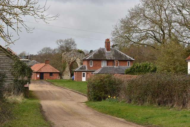
Butley Priory
Butley Priory, sometimes called Butley Abbey, was a religious house of Canons regular (Augustinians, Black canons) in Butley, Suffolk, dedicated to The...

Rendlesham Forest incident
The Rendlesham Forest incident was a series of reported sightings of unexplained lights near Rendlesham Forest in Suffolk, England, in December 1980, which...

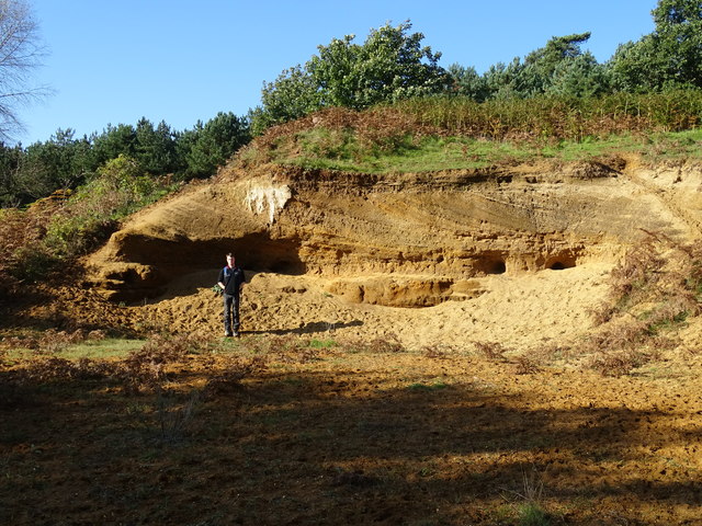
Neutral Farm Pit, Butley
Neutral Farm Pit, Butley is a 1.1-hectare (2.7-acre) geological Site of Special Scientific Interest in Butley, east of Woodbridge in Suffolk. It is a Geological...

Capel St Andrew
Capel St Andrew is a village and a civil parish in the East Suffolk district, in the county of Suffolk, England. It is near the larger settlement of Orford...

Butley, Suffolk
Butley is a village and civil parish in the English county of Suffolk. Butley lies 7+1⁄2 miles (12 km) east of the town of Woodbridge on the B1084 (Orford...

Staverton Park and The Thicks, Wantisden
Staverton Park and The Thicks, Wantisden is an 80.8-hectare (200-acre) biological Site of Special Scientific Interest west of Butley in Suffolk. It is...

Wantisden
Wantisden is a small village and civil parish in the East Suffolk district of Suffolk in eastern England. Largely consisting of a single farm and ancient...

Boyton, Suffolk
Boyton is a village and civil parish in the East Suffolk district of Suffolk, England, about eight miles east of Woodbridge, and close to Orford Ness....
Nearby Amenities
Located within 500m of 52.093222,1.4621936Have you been to Broom Covert?
Leave your review of Broom Covert below (or comments, questions and feedback).