Follyclose Wood

Wood, Forest in Kent Dover

England

Follyclose Wood
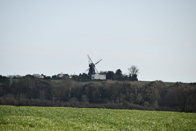
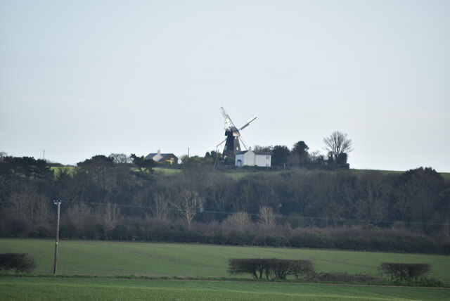
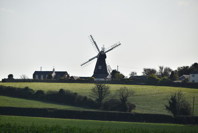
Ripple Mill Grade II listed.
Ripple Mill Credit: N Chadwick

Follyclose Wood is a picturesque woodland located in the county of Kent, England. Situated in the southeast of the country, this woodland covers an area of approximately 50 acres and is a popular destination for nature enthusiasts and walkers alike.

The wood is characterized by its dense canopy of mixed deciduous trees, including oak, beech, and ash. These towering trees create a tranquil and shady environment, providing a cool escape from the summer heat. The forest floor is covered in a thick carpet of moss and ferns, adding to the enchanting atmosphere of the wood.

Follyclose Wood is home to a diverse range of wildlife, making it a haven for animal lovers and birdwatchers. Visitors may spot deer, foxes, and squirrels, as well as a variety of bird species such as woodpeckers and owls. The wood is also known for its vibrant wildflowers, which bloom in abundance during the spring and summer months.

The wood is crisscrossed by a network of well-maintained walking trails, allowing visitors to explore its beauty at their own pace. These paths lead to a small clearing in the heart of the wood, where visitors can relax and enjoy a picnic amidst the tranquil surroundings.

Follyclose Wood is easily accessible, with a car park located nearby for convenience. It offers a peaceful retreat from the hustle and bustle of daily life, providing a place for locals and tourists alike to connect with nature and enjoy the serene beauty of the Kent countryside.

If you have any feedback on the listing, please let us know in the comments section below.

Follyclose Wood Images

Images are sourced within 2km of 51.17674/1.372598 or Grid Reference TR3547. Thanks to Geograph Open Source API. All images are credited.
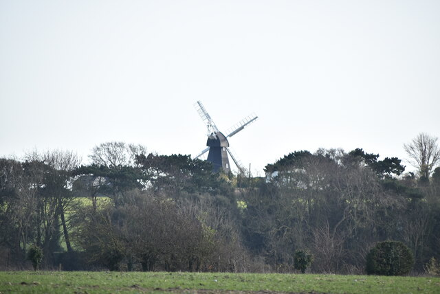
Ripple Mill Grade II listed.
Ripple Mill
Grade II listed.
Ripple Mill Grade II listed.
Ripple Mill
Grade II listed.
Ripple Mill There are three main types of windmill in Great Britain: post mills, smock mills and tower mills.

The smock mill is of a timber-framed construction with weatherboarded, steeply sloping external walls.  It was built on a brick base.  A pivoting wooden top with sails moved independently of the main structure so that the sails could be positioned towards the wind.  This was controlled by a tail fan.

Windmill article <a title="https://www.geograph.org.uk/article/Windmills" href="https://www.geograph.org.uk/article/Windmills">Link</a>
Ripple Mill
There are three main types of windmill in Great Britain: post mills, smock mills and tower mills. The smock mill is of a timber-framed construction with weatherboarded, steeply sloping external walls. It was built on a brick base. A pivoting wooden top with sails moved independently of the main structure so that the sails could be positioned towards the wind. This was controlled by a tail fan. Windmill article Link
Ripple Mill Ripple Windmill is a Grade II listed <span class="nowrap"><a title="https://historicengland.org.uk/listing/the-list/list-entry/1237017" rel="nofollow ugc noopener" href="https://historicengland.org.uk/listing/the-list/list-entry/1237017">Link</a><img style="margin-left:2px;" alt="External link" title="External link - shift click to open in new window" src="https://s1.geograph.org.uk/img/external.png" width="10" height="10"/></span>  smock mill in Ringwould, that was built in Drellingore and moved to Ringwould in the early nineteenth century. Having been stripped of machinery and used as a television mast, it is now under restoration as a working windmill.
Wikipedia: <span class="nowrap"><a title="https://en.wikipedia.org/wiki/Ripple_Mill,_Ringwould" rel="nofollow ugc noopener" href="https://en.wikipedia.org/wiki/Ripple_Mill,_Ringwould">Link</a><img style="margin-left:2px;" alt="External link" title="External link - shift click to open in new window" src="https://s1.geograph.org.uk/img/external.png" width="10" height="10"/></span>
Ripple Mill
Ripple Windmill is a Grade II listed LinkExternal link smock mill in Ringwould, that was built in Drellingore and moved to Ringwould in the early nineteenth century. Having been stripped of machinery and used as a television mast, it is now under restoration as a working windmill. Wikipedia: LinkExternal link
Upper Street, Kingsdown Taken looking downhill from near junction with Chalk Hill Road.
Upper Street, Kingsdown
Taken looking downhill from near junction with Chalk Hill Road.
Footpath through Otty Bottom south of Kingsdown
Footpath through sweetcorn near Kingsdown The footpath through the open downland landscape of Otty Bottom ends in this crop of sweetcorn just before it reaches Victoria Road in Kingsdown.
Footpath through sweetcorn near Kingsdown
The footpath through the open downland landscape of Otty Bottom ends in this crop of sweetcorn just before it reaches Victoria Road in Kingsdown.
Oilseed rape
Oilseed rape
A walk from St Margaret’s at Cliffe to Kingsdown and return [27] The bridleway leaves The Avenue and runs at the back of the houses in Victoria Road.
Starting from the Dover Patrol Monument, the walk follows the long distance Saxon Shore Way along the top of the cliffs before descending to the bay at Kingsdown.  Heading inland there is an ascent of Wood Hill before various rights of way run across fields to the wonderfully named Otty Bottom, then on to Free Down and a return to the starting point. A little more than 5 miles.
A walk from St Margaret’s at Cliffe to Kingsdown and return [27]
The bridleway leaves The Avenue and runs at the back of the houses in Victoria Road. Starting from the Dover Patrol Monument, the walk follows the long distance Saxon Shore Way along the top of the cliffs before descending to the bay at Kingsdown. Heading inland there is an ascent of Wood Hill before various rights of way run across fields to the wonderfully named Otty Bottom, then on to Free Down and a return to the starting point. A little more than 5 miles.
A walk from St Margaret’s at Cliffe to Kingsdown and return [28] Seen alongside the bridleway, this small electrical sub station is in danger of being swallowed by the greenery.
Starting from the Dover Patrol Monument, the walk follows the long distance Saxon Shore Way along the top of the cliffs before descending to the bay at Kingsdown.  Heading inland there is an ascent of Wood Hill before various rights of way run across fields to the wonderfully named Otty Bottom, then on to Free Down and a return to the starting point. A little more than 5 miles.
A walk from St Margaret’s at Cliffe to Kingsdown and return [28]
Seen alongside the bridleway, this small electrical sub station is in danger of being swallowed by the greenery. Starting from the Dover Patrol Monument, the walk follows the long distance Saxon Shore Way along the top of the cliffs before descending to the bay at Kingsdown. Heading inland there is an ascent of Wood Hill before various rights of way run across fields to the wonderfully named Otty Bottom, then on to Free Down and a return to the starting point. A little more than 5 miles.
A walk from St Margaret’s at Cliffe to Kingsdown and return [29] The bridleway runs at the back of the houses in Victoria Road.
Starting from the Dover Patrol Monument, the walk follows the long distance Saxon Shore Way along the top of the cliffs before descending to the bay at Kingsdown.  Heading inland there is an ascent of Wood Hill before various rights of way run across fields to the wonderfully named Otty Bottom, then on to Free Down and a return to the starting point. A little more than 5 miles.
A walk from St Margaret’s at Cliffe to Kingsdown and return [29]
The bridleway runs at the back of the houses in Victoria Road. Starting from the Dover Patrol Monument, the walk follows the long distance Saxon Shore Way along the top of the cliffs before descending to the bay at Kingsdown. Heading inland there is an ascent of Wood Hill before various rights of way run across fields to the wonderfully named Otty Bottom, then on to Free Down and a return to the starting point. A little more than 5 miles.
A walk from St Margaret’s at Cliffe to Kingsdown and return [30] The bridleway now crosses Victoria Road which is now no more than a track. This view is looking along Victoria Road which is used as a footpath but is not a right of way.
Starting from the Dover Patrol Monument, the walk follows the long distance Saxon Shore Way along the top of the cliffs before descending to the bay at Kingsdown.  Heading inland there is an ascent of Wood Hill before various rights of way run across fields to the wonderfully named Otty Bottom, then on to Free Down and a return to the starting point. A little more than 5 miles.
A walk from St Margaret’s at Cliffe to Kingsdown and return [30]
The bridleway now crosses Victoria Road which is now no more than a track. This view is looking along Victoria Road which is used as a footpath but is not a right of way. Starting from the Dover Patrol Monument, the walk follows the long distance Saxon Shore Way along the top of the cliffs before descending to the bay at Kingsdown. Heading inland there is an ascent of Wood Hill before various rights of way run across fields to the wonderfully named Otty Bottom, then on to Free Down and a return to the starting point. A little more than 5 miles.
A walk from St Margaret’s at Cliffe to Kingsdown and return [31] The bridleway cross Victoria Road, now no more than a track, and enters a field of maize.
Starting from the Dover Patrol Monument, the walk follows the long distance Saxon Shore Way along the top of the cliffs before descending to the bay at Kingsdown.  Heading inland there is an ascent of Wood Hill before various rights of way run across fields to the wonderfully named Otty Bottom, then on to Free Down and a return to the starting point. A little more than 5 miles.
A walk from St Margaret’s at Cliffe to Kingsdown and return [31]
The bridleway cross Victoria Road, now no more than a track, and enters a field of maize. Starting from the Dover Patrol Monument, the walk follows the long distance Saxon Shore Way along the top of the cliffs before descending to the bay at Kingsdown. Heading inland there is an ascent of Wood Hill before various rights of way run across fields to the wonderfully named Otty Bottom, then on to Free Down and a return to the starting point. A little more than 5 miles.
A walk from St Margaret’s at Cliffe to Kingsdown and return [32] The bridleway continues through the maize.
Starting from the Dover Patrol Monument, the walk follows the long distance Saxon Shore Way along the top of the cliffs before descending to the bay at Kingsdown.  Heading inland there is an ascent of Wood Hill before various rights of way run across fields to the wonderfully named Otty Bottom, then on to Free Down and a return to the starting point. A little more than 5 miles.
A walk from St Margaret’s at Cliffe to Kingsdown and return [32]
The bridleway continues through the maize. Starting from the Dover Patrol Monument, the walk follows the long distance Saxon Shore Way along the top of the cliffs before descending to the bay at Kingsdown. Heading inland there is an ascent of Wood Hill before various rights of way run across fields to the wonderfully named Otty Bottom, then on to Free Down and a return to the starting point. A little more than 5 miles.
A walk from St Margaret’s at Cliffe to Kingsdown and return [33] The bridleway continues to head south through the seemingly endless field of maize.
Starting from the Dover Patrol Monument, the walk follows the long distance Saxon Shore Way along the top of the cliffs before descending to the bay at Kingsdown.  Heading inland there is an ascent of Wood Hill before various rights of way run across fields to the wonderfully named Otty Bottom, then on to Free Down and a return to the starting point. A little more than 5 miles.
A walk from St Margaret’s at Cliffe to Kingsdown and return [33]
The bridleway continues to head south through the seemingly endless field of maize. Starting from the Dover Patrol Monument, the walk follows the long distance Saxon Shore Way along the top of the cliffs before descending to the bay at Kingsdown. Heading inland there is an ascent of Wood Hill before various rights of way run across fields to the wonderfully named Otty Bottom, then on to Free Down and a return to the starting point. A little more than 5 miles.
A walk from St Margaret’s at Cliffe to Kingsdown and return [34] Finally, the maize ends and the bridleway emerges.
Starting from the Dover Patrol Monument, the walk follows the long distance Saxon Shore Way along the top of the cliffs before descending to the bay at Kingsdown.  Heading inland there is an ascent of Wood Hill before various rights of way run across fields to the wonderfully named Otty Bottom, then on to Free Down and a return to the starting point. A little more than 5 miles.
A walk from St Margaret’s at Cliffe to Kingsdown and return [34]
Finally, the maize ends and the bridleway emerges. Starting from the Dover Patrol Monument, the walk follows the long distance Saxon Shore Way along the top of the cliffs before descending to the bay at Kingsdown. Heading inland there is an ascent of Wood Hill before various rights of way run across fields to the wonderfully named Otty Bottom, then on to Free Down and a return to the starting point. A little more than 5 miles.
A walk from St Margaret’s at Cliffe to Kingsdown and return [35] On this stretch of the bridleway there is maize on only one side.
Starting from the Dover Patrol Monument, the walk follows the long distance Saxon Shore Way along the top of the cliffs before descending to the bay at Kingsdown.  Heading inland there is an ascent of Wood Hill before various rights of way run across fields to the wonderfully named Otty Bottom, then on to Free Down and a return to the starting point. A little more than 5 miles.
A walk from St Margaret’s at Cliffe to Kingsdown and return [35]
On this stretch of the bridleway there is maize on only one side. Starting from the Dover Patrol Monument, the walk follows the long distance Saxon Shore Way along the top of the cliffs before descending to the bay at Kingsdown. Heading inland there is an ascent of Wood Hill before various rights of way run across fields to the wonderfully named Otty Bottom, then on to Free Down and a return to the starting point. A little more than 5 miles.
Show me another place!

Follyclose Wood is located at Grid Ref: TR3547 (Lat: 51.17674, Lng: 1.372598)

Administrative County: Kent

District: Dover

Police Authority: Kent

What 3 Words

///flashing.gives.insisting. Near Deal, Kent

Related Wikis

Ringwould

Ringwould is a village and electoral ward near Deal in Kent, England. The coastal confederation of Cinque Ports during its mediaeval period consisted...

St Nicholas Church, Ringwould

St Nicholas Church is the Church of England parish church of the village of Ringwould in east Kent. A Grade I listed building, it was constructed in the...

Ringwould with Kingsdown

Ringwould with Kingsdown is a coastal civil parish in the Dover District of Kent, England. The parish contains the villages of Ringwould and Kingsdown...

East Kent Sudbury School

East Kent Sudbury is a home education learning community in Deal, Kent in the United Kingdom. The community operates on Sudbury school principles, that...

Nearby Amenities

Located within 500m of 51.17674,1.372598
The Animal Inn
Shop: pet_grooming
Lat/Long: 51.1751188/1.3674524
The data included in this document is from www.openstreetmap.org. The data is made available under ODbL.

Have you been to Follyclose Wood?

Leave your review of Follyclose Wood below (or comments, questions and feedback).