Longclose Wood
Wood, Forest in Kent Dover
England
Longclose Wood

Longclose Wood is a picturesque woodland located in the county of Kent, England. Situated near the village of Sissinghurst, this woodland covers an area of approximately 50 acres. Longclose Wood is known for its dense and varied vegetation, making it a haven for wildlife and a popular destination for nature enthusiasts.
The woodland is characterized by a mix of deciduous and coniferous trees, including oak, beech, birch, and pine. The tall, ancient trees create a dense canopy that provides shade and shelter for a diverse range of flora and fauna. Bluebells, primroses, and wild garlic carpet the forest floor in the spring, creating a vibrant burst of color.
Longclose Wood is also home to a variety of animal species. Visitors may encounter deer, foxes, badgers, and a multitude of bird species, including woodpeckers, owls, and warblers. The woodland's tranquil atmosphere and the abundance of wildlife make it an ideal destination for birdwatching and photography.
The wood is crisscrossed with a network of well-maintained footpaths, allowing visitors to explore its natural beauty. The paths wind through the trees, leading to secluded clearings and hidden glades. There are also several benches strategically placed throughout the wood, offering visitors a place to rest and take in the tranquil surroundings.
Longclose Wood is managed by a local conservation group, ensuring the preservation of its natural beauty and protection of its wildlife. It is open to the public year-round and is a popular destination for nature lovers seeking a peaceful retreat in the heart of Kent's countryside.
If you have any feedback on the listing, please let us know in the comments section below.
Longclose Wood Images
Images are sourced within 2km of 51.174057/1.3661345 or Grid Reference TR3547. Thanks to Geograph Open Source API. All images are credited.

![A walk from St Margaretâs at Cliffe to Kingsdown and return [30] The bridleway now crosses Victoria Road which is now no more than a track. This view is looking along Victoria Road which is used as a footpath but is not a right of way.
Starting from the Dover Patrol Monument, the walk follows the long distance Saxon Shore Way along the top of the cliffs before descending to the bay at Kingsdown. Heading inland there is an ascent of Wood Hill before various rights of way run across fields to the wonderfully named Otty Bottom, then on to Free Down and a return to the starting point. A little more than 5 miles.](https://s3.geograph.org.uk/geophotos/07/08/56/7085667_58954979.jpg)
![A walk from St Margaretâs at Cliffe to Kingsdown and return [31] The bridleway cross Victoria Road, now no more than a track, and enters a field of maize.
Starting from the Dover Patrol Monument, the walk follows the long distance Saxon Shore Way along the top of the cliffs before descending to the bay at Kingsdown. Heading inland there is an ascent of Wood Hill before various rights of way run across fields to the wonderfully named Otty Bottom, then on to Free Down and a return to the starting point. A little more than 5 miles.](https://s0.geograph.org.uk/geophotos/07/08/56/7085668_178ddaeb.jpg)
![A walk from St Margaretâs at Cliffe to Kingsdown and return [32] The bridleway continues through the maize.
Starting from the Dover Patrol Monument, the walk follows the long distance Saxon Shore Way along the top of the cliffs before descending to the bay at Kingsdown. Heading inland there is an ascent of Wood Hill before various rights of way run across fields to the wonderfully named Otty Bottom, then on to Free Down and a return to the starting point. A little more than 5 miles.](https://s1.geograph.org.uk/geophotos/07/08/62/7086217_2b651e64.jpg)
![A walk from St Margaretâs at Cliffe to Kingsdown and return [33] The bridleway continues to head south through the seemingly endless field of maize.
Starting from the Dover Patrol Monument, the walk follows the long distance Saxon Shore Way along the top of the cliffs before descending to the bay at Kingsdown. Heading inland there is an ascent of Wood Hill before various rights of way run across fields to the wonderfully named Otty Bottom, then on to Free Down and a return to the starting point. A little more than 5 miles.](https://s2.geograph.org.uk/geophotos/07/08/62/7086218_64ceefa3.jpg)
![A walk from St Margaretâs at Cliffe to Kingsdown and return [34] Finally, the maize ends and the bridleway emerges.
Starting from the Dover Patrol Monument, the walk follows the long distance Saxon Shore Way along the top of the cliffs before descending to the bay at Kingsdown. Heading inland there is an ascent of Wood Hill before various rights of way run across fields to the wonderfully named Otty Bottom, then on to Free Down and a return to the starting point. A little more than 5 miles.](https://s3.geograph.org.uk/geophotos/07/08/62/7086219_27ed6ea0.jpg)
![A walk from St Margaretâs at Cliffe to Kingsdown and return [35] On this stretch of the bridleway there is maize on only one side.
Starting from the Dover Patrol Monument, the walk follows the long distance Saxon Shore Way along the top of the cliffs before descending to the bay at Kingsdown. Heading inland there is an ascent of Wood Hill before various rights of way run across fields to the wonderfully named Otty Bottom, then on to Free Down and a return to the starting point. A little more than 5 miles.](https://s0.geograph.org.uk/geophotos/07/08/62/7086220_4a32c956.jpg)
![A walk from St Margaretâs at Cliffe to Kingsdown and return [36] The bridleway emerges from the maize and now runs along the field edge.
Starting from the Dover Patrol Monument, the walk follows the long distance Saxon Shore Way along the top of the cliffs before descending to the bay at Kingsdown. Heading inland there is an ascent of Wood Hill before various rights of way run across fields to the wonderfully named Otty Bottom, then on to Free Down and a return to the starting point. A little more than 5 miles.](https://s1.geograph.org.uk/geophotos/07/08/62/7086221_bc7a8dde.jpg)
![A walk from St Margaretâs at Cliffe to Kingsdown and return [37] Following the field edge, the bridle way continues to descend toward Otty Bottom.
Starting from the Dover Patrol Monument, the walk follows the long distance Saxon Shore Way along the top of the cliffs before descending to the bay at Kingsdown. Heading inland there is an ascent of Wood Hill before various rights of way run across fields to the wonderfully named Otty Bottom, then on to Free Down and a return to the starting point. A little more than 5 miles.](https://s2.geograph.org.uk/geophotos/07/08/62/7086222_d0765ac2.jpg)
![A walk from St Margaretâs at Cliffe to Kingsdown and return [38] The bridleway follows the boundary between two fields.
Starting from the Dover Patrol Monument, the walk follows the long distance Saxon Shore Way along the top of the cliffs before descending to the bay at Kingsdown. Heading inland there is an ascent of Wood Hill before various rights of way run across fields to the wonderfully named Otty Bottom, then on to Free Down and a return to the starting point. A little more than 5 miles.](https://s3.geograph.org.uk/geophotos/07/08/62/7086223_93fe857e.jpg)
![A walk from St Margaretâs at Cliffe to Kingsdown and return [39] Looking towards the coast from the bridleway, the land rises to East Hill, home of the Walmer and Kingsdown Golf Club.
Starting from the Dover Patrol Monument, the walk follows the long distance Saxon Shore Way along the top of the cliffs before descending to the bay at Kingsdown. Heading inland there is an ascent of Wood Hill before various rights of way run across fields to the wonderfully named Otty Bottom, then on to Free Down and a return to the starting point. A little more than 5 miles.](https://s0.geograph.org.uk/geophotos/07/08/62/7086224_ebfa034e.jpg)
![A walk from St Margaretâs at Cliffe to Kingsdown and return [40] The bridleway now passes through a small area of woodland.
Starting from the Dover Patrol Monument, the walk follows the long distance Saxon Shore Way along the top of the cliffs before descending to the bay at Kingsdown. Heading inland there is an ascent of Wood Hill before various rights of way run across fields to the wonderfully named Otty Bottom, then on to Free Down and a return to the starting point. A little more than 5 miles.](https://s1.geograph.org.uk/geophotos/07/08/62/7086225_ce60758e.jpg)
![A walk from St Margaretâs at Cliffe to Kingsdown and return [41] From here the line of the bridleway runs straight across to the corner of this field. The line of the right of way has not been re-established after ploughing and an alternative route along the field edge is offered - see <a href="https://www.geograph.org.uk/photo/7086227">TR3646 : A walk from St Margaret&rsquo;s at Cliffe to Kingsdown and return [42]</a>. For the reverse view of this image see <a href="https://www.geograph.org.uk/photo/7086230">TR3646 : A walk from St Margaret&rsquo;s at Cliffe to Kingsdown and return [45]</a>.
Starting from the Dover Patrol Monument, the walk follows the long distance Saxon Shore Way along the top of the cliffs before descending to the bay at Kingsdown. Heading inland there is an ascent of Wood Hill before various rights of way run across fields to the wonderfully named Otty Bottom, then on to Free Down and a return to the starting point. A little more than 5 miles.](https://s2.geograph.org.uk/geophotos/07/08/62/7086226_fc2cdda3.jpg)
![A walk from St Margaretâs at Cliffe to Kingsdown and return [42] From the same viewpoint as <a href="https://www.geograph.org.uk/photo/7086226">TR3646 : A walk from St Margaret&rsquo;s at Cliffe to Kingsdown and return [41]</a> this is the alternative route along the field edge to the track between the hedges. The golf course on East Hill is in the distance.
Starting from the Dover Patrol Monument, the walk follows the long distance Saxon Shore Way along the top of the cliffs before descending to the bay at Kingsdown. Heading inland there is an ascent of Wood Hill before various rights of way run across fields to the wonderfully named Otty Bottom, then on to Free Down and a return to the starting point. A little more than 5 miles.](https://s3.geograph.org.uk/geophotos/07/08/62/7086227_cd12a75c.jpg)
![A walk from St Margaretâs at Cliffe to Kingsdown and return [43] The bridleway now follows the well surfaced track towards Upper Freedown.
Starting from the Dover Patrol Monument, the walk follows the long distance Saxon Shore Way along the top of the cliffs before descending to the bay at Kingsdown. Heading inland there is an ascent of Wood Hill before various rights of way run across fields to the wonderfully named Otty Bottom, then on to Free Down and a return to the starting point. A little more than 5 miles.](https://s0.geograph.org.uk/geophotos/07/08/62/7086228_6335abe3.jpg)
![A walk from St Margaretâs at Cliffe to Kingsdown and return [44] A view back along the track, a public bridleway, looking towards Kingsdown.
Starting from the Dover Patrol Monument, the walk follows the long distance Saxon Shore Way along the top of the cliffs before descending to the bay at Kingsdown. Heading inland there is an ascent of Wood Hill before various rights of way run across fields to the wonderfully named Otty Bottom, then on to Free Down and a return to the starting point. A little more than 5 miles.](https://s1.geograph.org.uk/geophotos/07/08/62/7086229_aca74dd5.jpg)
![A walk from St Margaretâs at Cliffe to Kingsdown and return [45] This is the reverse view of <a href="https://www.geograph.org.uk/photo/7086226">TR3646 : A walk from St Margaret&rsquo;s at Cliffe to Kingsdown and return [41]</a> and is where the right of way would meet the track. However, the bridleway has not been re-established after ploughing, and an alternative route has been used.
Starting from the Dover Patrol Monument, the walk follows the long distance Saxon Shore Way along the top of the cliffs before descending to the bay at Kingsdown. Heading inland there is an ascent of Wood Hill before various rights of way run across fields to the wonderfully named Otty Bottom, then on to Free Down and a return to the starting point. A little more than 5 miles.](https://s2.geograph.org.uk/geophotos/07/08/62/7086230_17cbc437.jpg)
Longclose Wood is located at Grid Ref: TR3547 (Lat: 51.174057, Lng: 1.3661345)
Administrative County: Kent
District: Dover
Police Authority: Kent
What 3 Words
///petal.archduke.dressings. Near Deal, Kent
Nearby Locations
Related Wikis

Martin Mill
Martin Mill is a village in east Kent, England. It takes its name from the nearby village of Martin. Martin Mill railway station is on the Dover to Deal...
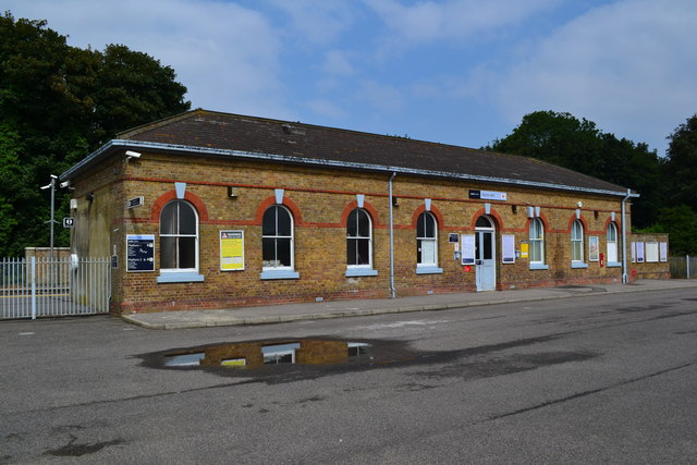
Martin Mill railway station
Martin Mill railway station serves the small village of Martin Mill in East Kent. The station and all trains serving it are operated by Southeastern. The...

Ringwould
Ringwould is a village and electoral ward near Deal in Kent, England. The coastal confederation of Cinque Ports during its mediaeval period consisted...

St Nicholas Church, Ringwould
St Nicholas Church is the Church of England parish church of the village of Ringwould in east Kent. A Grade I listed building, it was constructed in the...

Ringwould with Kingsdown
Ringwould with Kingsdown is a coastal civil parish in the Dover District of Kent, England. The parish contains the villages of Ringwould and Kingsdown...

East Kent Sudbury School
East Kent Sudbury is a home education learning community in Deal, Kent in the United Kingdom. The community operates on Sudbury school principles, that...
Martin, Kent
Martin is a hamlet north-east of Dover in the county of Kent in England. The nearby village of Martin Mill is situated on the railway between Dover and...

Ripple Mill, Ringwould
Ripple Windmill is a Grade II listed smock mill in Ringwould, Kent, England, that was built in Drellingore and moved to Ringwould in the early nineteenth...
Nearby Amenities
Located within 500m of 51.174057,1.3661345Have you been to Longclose Wood?
Leave your review of Longclose Wood below (or comments, questions and feedback).