Cornfield Wood

Wood, Forest in Kent Dover

England

Cornfield Wood

Rough grasses
Rough grasses Credit: N Chadwick

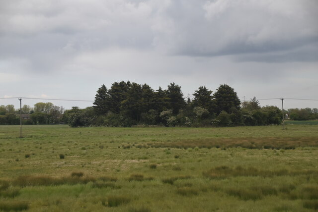
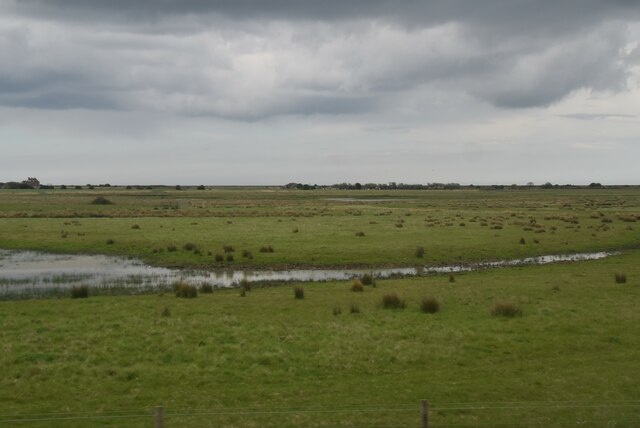
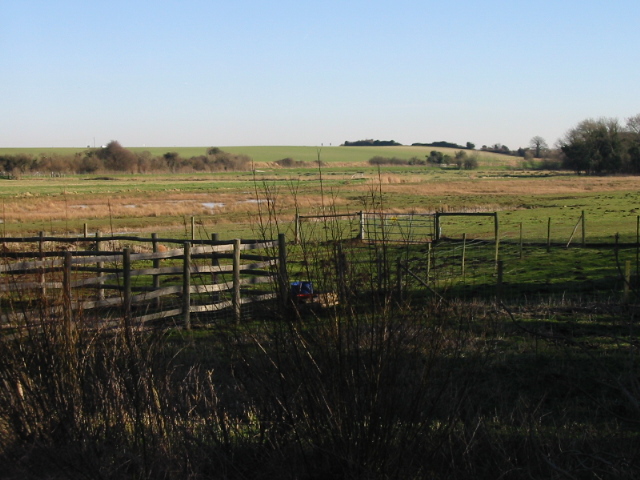
Cornfield Wood is a picturesque woodland located in Kent, England. Covering an area of approximately 50 acres, it is an enchanting mix of ancient woodland and newer plantations. Situated near the village of Cornfield, the wood is easily accessible and attracts both locals and tourists alike.

The woodland is characterized by a diverse range of tree species, including oak, beech, birch, and hazel. The well-established trees create a dense canopy, allowing only dappled sunlight to filter through, creating a mesmerizing play of light and shadow. This environment provides a haven for a variety of wildlife, such as deer, foxes, badgers, and a plethora of birds, including woodpeckers and owls.

Cornfield Wood is a popular destination for nature enthusiasts, walkers, and photographers. Several well-marked trails wind their way through the wood, offering visitors the opportunity to explore its beauty at their own pace. The peaceful atmosphere and the captivating sounds of nature make it an ideal spot for those seeking tranquility and an escape from the hustle and bustle of everyday life.

In addition to its natural beauty, Cornfield Wood also holds historical significance. The remains of an ancient Iron Age settlement have been discovered within its boundaries, adding an extra layer of intrigue to the area.

Overall, Cornfield Wood in Kent is a captivating woodland, offering a captivating mix of natural beauty, diverse wildlife, and a touch of history. It is a place to reconnect with nature and find solace in its peaceful surroundings.

If you have any feedback on the listing, please let us know in the comments section below.

Cornfield Wood Images

Images are sourced within 2km of 51.251706/1.3522556 or Grid Reference TR3455. Thanks to Geograph Open Source API. All images are credited.

Rough grasses
Rough grasses
Flat grasses
Flat grasses
Cattle grazing
Cattle grazing
Worth Parish Hall, The Street This was <a href="https://www.geograph.org.uk/photo/6640646">TR3356 : Worth Parish Hall, The Street</a> in September 2020. According to the hall’s website, the work of installing replacement windows was carried out during October 2020.
Worth Parish Hall, The Street
This was TR3356 : Worth Parish Hall, The Street in September 2020. According to the hall’s website, the work of installing replacement windows was carried out during October 2020.
Chilton Villa The Street Planning permission has been approved by Dover District Council under application number DOV/21/01471 for the “erection of first floor side extensions and installation of first floor cladding”.
Chilton Villa The Street
Planning permission has been approved by Dover District Council under application number DOV/21/01471 for the “erection of first floor side extensions and installation of first floor cladding”.
Building site, Jubilee Road A house is being constructed on land, where <a href="https://www.geograph.org.uk/photo/6041469">TR3356 : Derelict farm buildings, Jubilee Road</a> once stood.
Building site, Jubilee Road
A house is being constructed on land, where TR3356 : Derelict farm buildings, Jubilee Road once stood.
Worth County Primary School This was <a href="https://www.geograph.org.uk/photo/6639461">TR3356 : Worth County Primary School, The Street</a>, when a new extension was being built.
Worth County Primary School
This was TR3356 : Worth County Primary School, The Street, when a new extension was being built.
Carter House, The Street The house is grade II listed.
Carter House, The Street
The house is grade II listed.
Northbrook House, Minnis Way This was <a href="https://www.geograph.org.uk/photo/3286273">TR3356 : Northbrook House, Minnis Way</a>, during the time that work was being carried out to the house.
Northbrook House, Minnis Way
This was TR3356 : Northbrook House, Minnis Way, during the time that work was being carried out to the house.
Cattle
Cattle
Lydden valley
Lydden valley
North Stream
North Stream
Grassland
Grassland
The Delf
The Delf
Isolated house
Isolated house
Rough grasses
Rough grasses
North Stream
North Stream
Flat grassland
Flat grassland
Show me another place!

Cornfield Wood is located at Grid Ref: TR3455 (Lat: 51.251706, Lng: 1.3522556)

Administrative County: Kent

District: Dover

Police Authority: Kent

What 3 Words

///steamed.obviously.mixed. Near Sandwich, Kent

Related Wikis

Worth, Kent

Worth is a village and civil parish in the Dover District of Kent, England, situated near Sandwich. It has two public houses, a church, and a school. According...

Ham Fen

Ham Fen is a 41-hectare (100-acre) nature reserve south of Sandwich in Kent. It is one of Kent Wildlife Trust's nature reserves and is being extended...

Finglesham Anglo-Saxon cemetery

Finglesham Anglo-Saxon cemetery is a place of burial that was used from the sixth to the eighth centuries CE. It is located adjacent to the village of...

Ham, Kent

Ham is a village and former civil parish, now in the parish of Northbourne, in the Dover district, in the county of Kent, England. It is near the town...

Nearby Amenities

Located within 500m of 51.251706,1.3522556
Post Box
Brand: Royal Mail
Brand Wikidata: Q638098
Collection Times: Mo-Fr 16:15; Sa 11:45
Operator: Royal Mail
Operator Wikidata: Q638098
Post Box Mounting: telegraph_pole
Post Box Type: lamp
Postal Code: CT14
Ref: CT14 93
Royal Cypher: EIIR
Source: survey
Lat/Long: 51.2505897/1.3473582
Bus Stop
King George Villas
Bus: yes
Naptan AtcoCode: 2400A033560A
Naptan Bearing: N
Naptan CommonName: King George Villas
Naptan Indicator: adj
Naptan Landmark: King George Villas
Naptan NaptanCode: kntdjwpa
Naptan PlusbusZoneRef: DEAL
Naptan Street: Jubilee Road
Naptan Verified: no
Public Transport: platform
Ref: KNTDJWPA
Source: naptan_import
Lat/Long: 51.250607/1.3472436
Bus Stop
King George Villas
Flag: no
Naptan AtcoCode: 2400A033550A
Naptan Bearing: S
Naptan BusStopType: CUS
Naptan CommonName: King George Villas
Naptan Indicator: opp
Naptan Landmark: King George Villas
Naptan NaptanCode: kntdjwmw
Naptan PlusbusZoneRef: DEAL
Naptan Street: Jubilee Road
Naptan Verified: no
Public Transport: platform
Ref: KNTDJWMW
Source: naptan_import
Lat/Long: 51.2505186/1.3474262
Bus Stop
Church View
Bus: yes
Naptan AtcoCode: 2400A033570A
Naptan Bearing: S
Naptan CommonName: Church View
Naptan Indicator: opp
Naptan NaptanCode: kntdjwpd
Naptan PlusbusZoneRef: DEAL
Naptan Street: Jubilee Rd
Naptan Verified: no
Public Transport: platform
Ref: KNTDJWPD
Source: naptan_import
Lat/Long: 51.2551347/1.3481305
East Kent Trim Supplies Ltd.
Addr Postcode: CT14 0DT
Phone: +44 1304 611681
Shop: car_parts
Source Addr Postcode: http://www.classiccar-trim.com/
Website: https://www.classiccar-trim.com/
Lat/Long: 51.2509486/1.3472705
Power: pole
Lat/Long: 51.2530538/1.347918
Power: pole
Lat/Long: 51.2538999/1.3468746
Generator Method: photovoltaic
Generator Output Electricity: yes
Generator Source: solar
Generator Type: solar_photovoltaic_panel
Location: roof
Power: generator
Lat/Long: 51.2540743/1.3477483
Generator Method: photovoltaic
Generator Output Electricity: yes
Generator Source: solar
Generator Type: solar_photovoltaic_panel
Location: roof
Power: generator
Lat/Long: 51.2501501/1.3468686
Generator Method: photovoltaic
Generator Output Electricity: yes
Generator Source: solar
Generator Type: solar_photovoltaic_panel
Location: roof
Power: generator
Lat/Long: 51.2520422/1.3479227
The data included in this document is from www.openstreetmap.org. The data is made available under ODbL.

Have you been to Cornfield Wood?

Leave your review of Cornfield Wood below (or comments, questions and feedback).