Alder Carr

Wood, Forest in Suffolk East Suffolk

England

Alder Carr

Cartshed, past the best
Cartshed, past the best Credit: Adrian S Pye

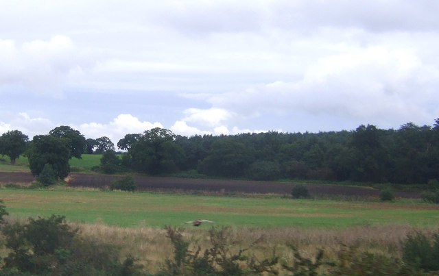
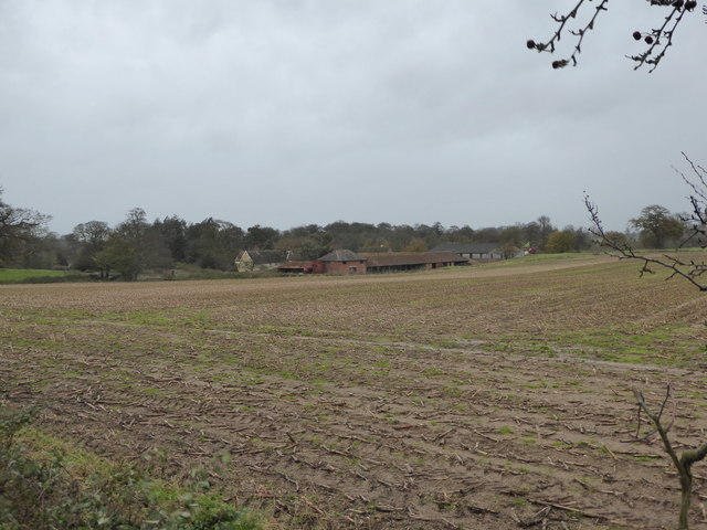
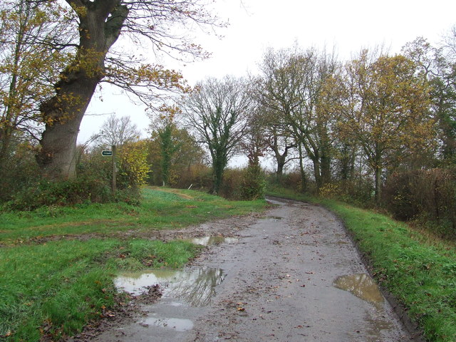
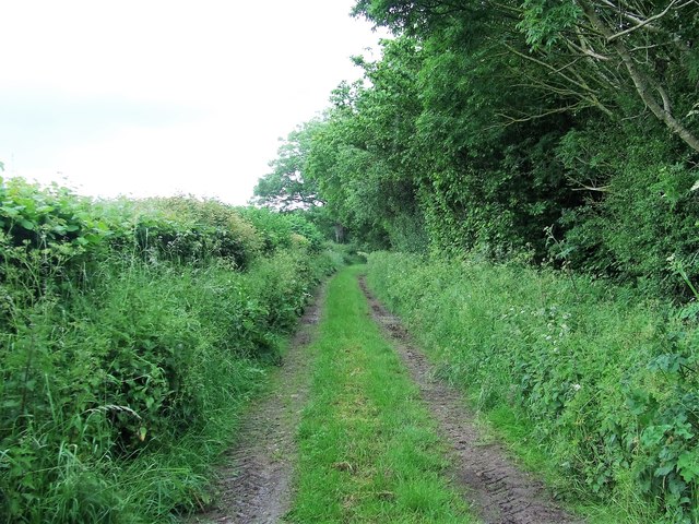
Alder Carr, Suffolk is a picturesque and thriving woodland area located in the eastern part of England. Known for its abundant alder trees, this forested region covers a vast expanse of approximately 50 hectares. Located near the village of Snape, Alder Carr is a popular destination for nature enthusiasts, hikers, and bird watchers.

The landscape of Alder Carr is characterized by its rich biodiversity. The woodland is home to a diverse range of plant and animal species, making it an important ecological site. The alder trees, after which the area is named, thrive in the damp and marshy conditions of the forest. These trees provide a habitat for various bird species, including the elusive kingfisher and the rare marsh harrier.

Visitors to Alder Carr can enjoy a variety of activities, such as walking along the well-marked trails, observing the wildlife, and even participating in organized bird-watching tours. The forest is also a popular spot for picnics and family outings, with designated areas providing facilities for barbecues and outdoor games.

Alder Carr is well-maintained and managed by local conservation organizations, with efforts in place to preserve its natural beauty and protect its delicate ecosystem. Guided walks and educational programs are regularly organized, allowing visitors to learn about the importance of woodland conservation and the unique flora and fauna found in Alder Carr.

Overall, Alder Carr, Suffolk is a must-visit destination for those seeking a tranquil escape into nature. Its stunning woodlands, diverse wildlife, and well-preserved environment make it a true gem in the Suffolk countryside.

If you have any feedback on the listing, please let us know in the comments section below.

Alder Carr Images

Images are sourced within 2km of 52.158896/1.4148788 or Grid Reference TM3356. Thanks to Geograph Open Source API. All images are credited.

Cartshed, past the best
Field Cottage Set in farmland near Jolly's Farm.
Field Cottage
Set in farmland near Jolly's Farm.
Farmland towards Allonsfield
Field, Campsea Ashe Looking towards the church.
Field, Campsea Ashe
Looking towards the church.
Farmland near Blaxhall Hall
The Blaxhall Stone A nearby information sign <a href="https://www.geograph.org.uk/photo/4297025">TM3556 : Information Sign</a> reads "Said to have been ploughed up in the 19th century when no bigger than two fists, thrown down by the ploughman where it now stands, it has been growing ever since". According to <span class="nowrap"><a title="http://www.megalithia.com/sites/tm351565.html" rel="nofollow ugc noopener" href="http://www.megalithia.com/sites/tm351565.html">Link</a><img style="margin-left:2px;" alt="External link" title="External link - shift click to open in new window" src="https://s1.geograph.org.uk/img/external.png" width="10" height="10"/></span> this glacial erratic weighs five tons and comes from a parent mass in Spilsby, Lincolnshire.
The Blaxhall Stone
A nearby information sign TM3556 : Information Sign reads "Said to have been ploughed up in the 19th century when no bigger than two fists, thrown down by the ploughman where it now stands, it has been growing ever since". According to LinkExternal link this glacial erratic weighs five tons and comes from a parent mass in Spilsby, Lincolnshire.
Blackstock Barn, Stone Farm, Blaxhall
View across the fields to Blaxhall Hall
Keepers Lane Footpath off Keepers Lane near to Little Glemham, Suffolk.
Keepers Lane
Footpath off Keepers Lane near to Little Glemham, Suffolk.
Interior of St John the Baptist's Church The 14th-century nave and chancel were rebuilt in 1792 and further restored in 1869.  The chancel arch and ceiling date from the 19th-century restoration.  The communion table of 1936 was designed by the noted Suffolk ecclesiologist Henry Munro Cautley.  The east window showing Christ in majesty <a href="https://www.geograph.org.uk/photo/2012442">TM3255 : Campsea Ashe, St John the Baptist: stained glass window (3)</a> is the work of Powell & Sons in 1912 as a memorial to William and Alice Lowther.  <span class="nowrap"><a title="http://www.suffolkchurches.co.uk/campsea.html" rel="nofollow ugc noopener" href="http://www.suffolkchurches.co.uk/campsea.html">Link</a><img style="margin-left:2px;" alt="External link" title="External link - shift click to open in new window" src="https://s1.geograph.org.uk/img/external.png" width="10" height="10"/></span>
Interior of St John the Baptist's Church
The 14th-century nave and chancel were rebuilt in 1792 and further restored in 1869. The chancel arch and ceiling date from the 19th-century restoration. The communion table of 1936 was designed by the noted Suffolk ecclesiologist Henry Munro Cautley. The east window showing Christ in majesty TM3255 : Campsea Ashe, St John the Baptist: stained glass window (3) is the work of Powell & Sons in 1912 as a memorial to William and Alice Lowther. LinkExternal link
Faith and Hope - two theological virtues Pre-Raphaelite stained glass of 1882 in St John the Baptist's Church, designed by Sir Henry Holiday for Powell Brothers as a memorial to John George Sheppard.  Faith is represented by the Cross, and Hope by an anchor.  In the vine-leaf panels above, doves symbolising the Holy Spirit are seen ascending at the left and descending on the right.  For a general view of the window see <a href="https://www.geograph.org.uk/photo/2012477">TM3255 : Campsea Ashe, St John the Baptist: stained glass window (5)</a>.
Faith and Hope - two theological virtues
Pre-Raphaelite stained glass of 1882 in St John the Baptist's Church, designed by Sir Henry Holiday for Powell Brothers as a memorial to John George Sheppard. Faith is represented by the Cross, and Hope by an anchor. In the vine-leaf panels above, doves symbolising the Holy Spirit are seen ascending at the left and descending on the right. For a general view of the window see TM3255 : Campsea Ashe, St John the Baptist: stained glass window (5).
Pelican in her Piety Stained glass of 1880 in St John the Baptist's Church; detail of a memorial window to Egidia, 5th Baroness Rendlesham.  The companion left-hand panel shows the Agnus Dei.  For the whole window see <a href="https://www.geograph.org.uk/photo/2012430">TM3255 : Campsea Ashe, St John the Baptist: stained glass window (1)</a>.
Pelican in her Piety
Stained glass of 1880 in St John the Baptist's Church; detail of a memorial window to Egidia, 5th Baroness Rendlesham. The companion left-hand panel shows the Agnus Dei. For the whole window see TM3255 : Campsea Ashe, St John the Baptist: stained glass window (1).
West doorway of St Peter's Church Pevsner, touring Suffolk in 1961, described this as "pretty": "Hook mould with fleurons, spandrels with an angel and a monster-head.  Quatrefoil frieze in flushwork over."
West doorway of St Peter's Church
Pevsner, touring Suffolk in 1961, described this as "pretty": "Hook mould with fleurons, spandrels with an angel and a monster-head. Quatrefoil frieze in flushwork over."
Footpath Footpath looking east near to Campsea Ashe, Suffolk.
Footpath
Footpath looking east near to Campsea Ashe, Suffolk.
Cut Mark Campsey Ashe Church Cut Mark Campsey Ashe St John the Baptist Church SE angle, SE face.
Cut Mark Campsey Ashe Church
Cut Mark Campsey Ashe St John the Baptist Church SE angle, SE face.
Marlesford Mill
Marlesford Mill
The old railway station at Marlesford Thanks to Adrian Pye for identifying the building. <a title="https://www.geograph.org.uk/photo/4409748" href="https://www.geograph.org.uk/photo/4409748">Link</a>
The old railway station at Marlesford
Thanks to Adrian Pye for identifying the building. Link
Little Glemham village
Show me another place!

Alder Carr is located at Grid Ref: TM3356 (Lat: 52.158896, Lng: 1.4148788)

Administrative County: Suffolk

District: East Suffolk

Police Authority: Suffolk

What 3 Words

///mediate.decking.hippy. Near Wickham Market, Suffolk

Related Wikis

Campsea Ashe

Campsea Ashe (sometimes spelt Campsey Ash) is a village in Suffolk, England located approximately 5 miles (8 km) north east of Woodbridge and 6 miles...

Plomesgate Rural District

Plomesgate Rural District was a rural district within the administrative county of East Suffolk between 1894 and 1934. == History == The district had...
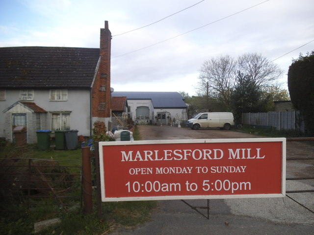
Marlesford

Marlesford is a village and civil parish in the East Suffolk district of Suffolk, England. The population of the civil parish at the 2011 Census was 233...

Marlesford railway station

Marlesford railway station was a station located in Marlesford, Suffolk. It closed in 1952.The station was served by trains that operated between Framlingham...

Wickham Market railway station

Wickham Market railway station is on the East Suffolk Line in the east of England, located in Campsea Ashe, Suffolk, approximately 2 miles (3.2 km) east...

Little Glemham

Little Glemham is a small village on the A12 road, in the East Suffolk district, in the county of Suffolk, England. The population of the parish at the...

Glemham Hall

Glemham Hall is an Elizabethan stately home, set in around 300 acres (120 ha) of park land on the outskirts of the village of Little Glemham in Suffolk...

Rendlesham Hall

Rendlesham Hall was a large manor house in the village of Rendlesham in Suffolk. == History == The hall was built in the pointed style in 1780 and two...

Related Videos

Birmingham National Trust Associan Suffolk Holiday

The holiday but viewed through the eyes of one person.

Our dogs First Holiday

Check our Percy's newest video: "Percy the Labrador tries out his new Embark Pets Reflective Harness" ...

Painting Boats ⛵ Art Vlog/ Walking at the beach 🏖️

Painting Boats ⛵ for the First Time! This is my first attempt at painting something I am notoriously bad at doing- boats… I blame ...

Deben Barn, Woodfarm Barns in Suffolk

More information - https://woodfarmbarns.com/dog-friendly-holiday-cottages-suffolk/deben-barn/ Deben Barn Cottage – dog ...

Nearby Amenities

Located within 500m of 52.158896,1.4148788
Blackstock Crossing
Crossing Activation: user
Crossing Light: no
Motor Vehicle: destination
Railway: level_crossing
Lat/Long: 52.1596707/1.4117598
Wickham Market Junction
Historic Railway: junction
Railway: site
Lat/Long: 52.1599823/1.4124212
Power: tower
Lat/Long: 52.1575413/1.4082992
Power: tower
Lat/Long: 52.1585253/1.4133123
Power: tower
Lat/Long: 52.1594615/1.4180705
Power: tower
Lat/Long: 52.1579197/1.4079961
Power: tower
Lat/Long: 52.1589235/1.4131004
Power: tower
Lat/Long: 52.1598351/1.417695
Power: pole
Lat/Long: 52.1610502/1.4161983
Power: pole
Lat/Long: 52.1628709/1.4151401
Power: pole
Lat/Long: 52.1574417/1.4183413
Railway: level_crossing
Lat/Long: 52.1613594/1.4156718
Power: pole
Lat/Long: 52.1615932/1.4158737
Power: pole
Lat/Long: 52.1600843/1.4167535
Power: pole
Lat/Long: 52.1574351/1.4184433
Power: pole
Lat/Long: 52.159571/1.4172255
Power: pole
Lat/Long: 52.1601814/1.4168527
Power: pole
Lat/Long: 52.158615/1.4178103
Power: pole
Lat/Long: 52.1612526/1.4162063
Power: pole
Lat/Long: 52.1587812/1.4175501
Power: pole
Lat/Long: 52.161636/1.4159649
Power: pole
Lat/Long: 52.156094/1.4191514
Phone
Emergency: phone
Lat/Long: 52.1596945/1.4117424
Phone
Emergency: phone
Lat/Long: 52.1596394/1.4118464
The data included in this document is from www.openstreetmap.org. The data is made available under ODbL.

Have you been to Alder Carr?

Leave your review of Alder Carr below (or comments, questions and feedback).