Pithole Plantation

Wood, Forest in Norfolk North Norfolk

England

Pithole Plantation

The Old Saddlery At the road-junction in the village of Neatishead.
The Old Saddlery Credit: Barbara Carr

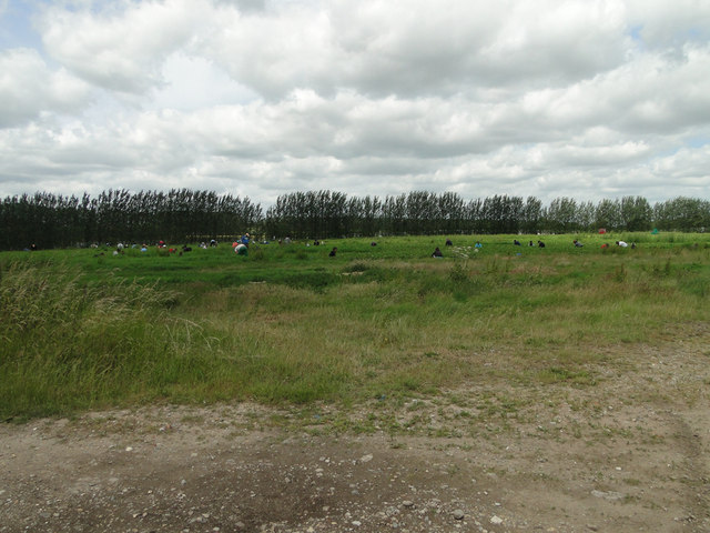
Pithole Plantation, located in Norfolk, is a picturesque woodland area known for its diverse flora and fauna. Covering an area of approximately 200 acres, the plantation is a haven for nature enthusiasts and provides a tranquil escape from the bustling city life.

The plantation is primarily composed of dense woodland, featuring a variety of tree species such as oak, beech, and birch, which create a canopy of greenery. The forest floor is adorned with a rich carpet of wildflowers, adding a burst of color to the landscape. The plantation also boasts a small river that meanders through its heart, providing a source of water for the plants and attracting a range of aquatic creatures.

The diverse ecosystem of Pithole Plantation supports a wide array of wildlife. Birdwatchers can spot species such as woodpeckers, owls, and various songbirds, while small mammals like rabbits, squirrels, and hedgehogs scurry through the undergrowth. The plantation is also home to a variety of insects, including butterflies and dragonflies, which flit amongst the flowers.

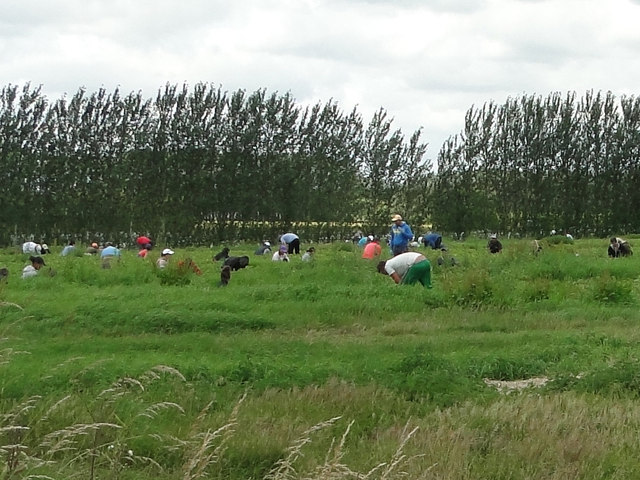
Pithole Plantation offers several walking trails and paths, allowing visitors to explore the natural beauty of the area. These trails are well-maintained and offer a peaceful and serene environment for hikers. The plantation also provides picnic areas, making it an ideal spot for families and friends to enjoy a day out in nature.

Overall, Pithole Plantation in Norfolk is a haven for nature lovers, offering beautiful woodland scenery, a diverse range of flora and fauna, and a peaceful atmosphere for visitors to enjoy.

If you have any feedback on the listing, please let us know in the comments section below.

Pithole Plantation Images

Images are sourced within 2km of 52.73357/1.4439541 or Grid Reference TG3220. Thanks to Geograph Open Source API. All images are credited.

The Old Saddlery At the road-junction in the village of Neatishead.
The Old Saddlery
At the road-junction in the village of Neatishead.
The White Horse Inn, Neatishead
The Street, Neatishead The White Horse Inn <a href="https://www.geograph.org.uk/photo/3329186">TG3421 : The White Horse Inn, Neatishead</a> is on the left, with the Old Saddlery <a href="https://www.geograph.org.uk/photo/3329184">TG3420 : The Old Saddlery</a> to the right.
The Street, Neatishead
The White Horse Inn TG3421 : The White Horse Inn, Neatishead is on the left, with the Old Saddlery TG3420 : The Old Saddlery to the right.
Ashmanhaugh village sign Detail <a title="https://www.geograph.org.uk/photo/6678214" href="https://www.geograph.org.uk/photo/6678214">Link</a>
Ashmanhaugh village sign
Detail Link
Neatishead village sign Village signs are typically placed along the principal road or in a prominent location such as a village green or close by the church. The design often depicts a particularly feature of the village or a scene from its history, heritage, or culture. They are typically made of wood or metal or a combination of both, the designs are often made by the local community.
Although they do appear in villages and towns all over the country they are more prominent in East Anglia than elsewhere in the country.
Neatishead village sign
Village signs are typically placed along the principal road or in a prominent location such as a village green or close by the church. The design often depicts a particularly feature of the village or a scene from its history, heritage, or culture. They are typically made of wood or metal or a combination of both, the designs are often made by the local community. Although they do appear in villages and towns all over the country they are more prominent in East Anglia than elsewhere in the country.
Ashmanhaugh St. Swithin's church From the west showing the small diameter tower; only six feet internally.
Ashmanhaugh St. Swithin's church
From the west showing the small diameter tower; only six feet internally.
Beeston Hall This fine country house is attributed to the architect William Wilkins of Norwich. It was built in 1786 for Jacob Preston near the site of an older mansion which was torn down.  The surrounding park, now largely given over to farming, is believed to have been laid out at around the same time. 

In the 1940s, Beeston Hall was owned by Sir Thomas Preston, O.B.E (1886-1976), 6th baronet, who spent most of his time  overseas. As a young man, he went on mining expeditions in northern Siberia prospecting for gold and he later joined the Diplomatic Service. He was British Consul in Ekaterinburg at the time of the murder in 1918 by the Bolsheviks of Tsar Nicholas II and the Russian Imperial family.  Sir Thomas was succeeded by his eldest son, Sir Ronald Douglas Hildebrand Preston, 7th Baronet, who served as a Major in the Intelligence Corps and later worked for Reuters and The Times as a foreign correspondent. He was also a member of the SOE (Special Operations Executive, a covert military organisation).

From 1940 to 1942, Beeston Hall housed the Norfolk Auxiliary Units' administrative headquarters and it was here where Captain Nigel Oxenden [later Major Nigel Oxenden MC] and his staff were based.  Although the Hall is surrounded by extensive park and farmland, no training exercises appear to have been held at Beeston.  

At present, the estate is known as the Beeston Hall Arabian Stud. 

(Picture taken by kind permission of the owner.)
Beeston Hall
This fine country house is attributed to the architect William Wilkins of Norwich. It was built in 1786 for Jacob Preston near the site of an older mansion which was torn down. The surrounding park, now largely given over to farming, is believed to have been laid out at around the same time. In the 1940s, Beeston Hall was owned by Sir Thomas Preston, O.B.E (1886-1976), 6th baronet, who spent most of his time overseas. As a young man, he went on mining expeditions in northern Siberia prospecting for gold and he later joined the Diplomatic Service. He was British Consul in Ekaterinburg at the time of the murder in 1918 by the Bolsheviks of Tsar Nicholas II and the Russian Imperial family. Sir Thomas was succeeded by his eldest son, Sir Ronald Douglas Hildebrand Preston, 7th Baronet, who served as a Major in the Intelligence Corps and later worked for Reuters and The Times as a foreign correspondent. He was also a member of the SOE (Special Operations Executive, a covert military organisation). From 1940 to 1942, Beeston Hall housed the Norfolk Auxiliary Units' administrative headquarters and it was here where Captain Nigel Oxenden [later Major Nigel Oxenden MC] and his staff were based. Although the Hall is surrounded by extensive park and farmland, no training exercises appear to have been held at Beeston. At present, the estate is known as the Beeston Hall Arabian Stud. (Picture taken by kind permission of the owner.)
A seat and notice board under a tree
Stone Lane, Ashmanhaugh
The  old village school and Ashmanhaugh village sign The old school is now called Preston Room and is available for hire by the local community. <a title="https://www.geograph.org.uk/photo/6678214" href="https://www.geograph.org.uk/photo/6678214">Link</a>
The old village school and Ashmanhaugh village sign
The old school is now called Preston Room and is available for hire by the local community. Link
Strawberry picking at one of the county's largest fruit growers
Passing Places on a narrow country road .... near Shoulder of Mutton Plantation
Passing Places on a narrow country road
.... near Shoulder of Mutton Plantation
Ashmanhaugh World War One Memorial As can be seen, the Memorial tablet bears four names.
There is no record of any WW2 losses.
Ashmanhaugh World War One Memorial
As can be seen, the Memorial tablet bears four names. There is no record of any WW2 losses.
Stone Lane
Stone Lane
Saint Peters Lane
Saint Peters Lane
Hoveton Hall Estate entrance Closed up for the winter.
Hoveton Hall Estate entrance
Closed up for the winter.
Show me another place!

Pithole Plantation is located at Grid Ref: TG3220 (Lat: 52.73357, Lng: 1.4439541)

Administrative County: Norfolk

District: North Norfolk

Police Authority: Norfolk

What 3 Words

///booklets.health.survivor. Near Hoveton, Norfolk

Related Wikis

Hoveton Hall

Hoveton Hall in the parish of Hoveton in Norfolk is a Regency-style country house made of gault brick with a slate roof. It was built between 1809 and...
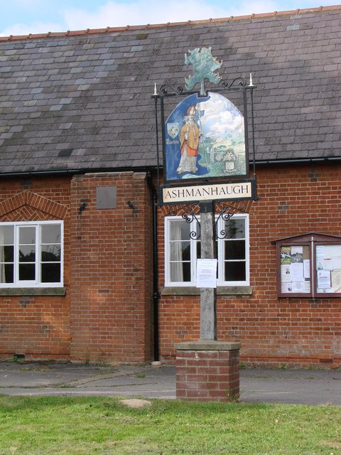
Ashmanhaugh

Ashmanhaugh is a village and civil parish in the English county of Norfolk, situated some 20 km north east of Norwich. See Inside the churches of St Swithins...

Neatishead

Neatishead ( NEET-stəd) is a village and civil parish in the English county of Norfolk. The village is situated some 20 km (12 mi) north-east of the city...

St Michael and All Angels Church, Barton Turf

St Michael and All Angels is the Church of England parish church of Barton Turf in the county of Norfolk in England. See Inside here. It stands about a...

Bewilderwood

BeWILDerwood is an adventure park for families located in Horning, a parish in the English county of Norfolk. Self-described as a "curious treehouse adventure...

Broadland High Ormiston Academy

Broadland High Ormiston Academy is a rural mixed academy in Hoveton, Norfolk for pupils aged 11 to 16. As of August 1, 2018, the school joined Ormiston...

RAF Air Defence Radar Museum

The Royal Air Force Air Defence Radar Museum is a museum on the site of the former Royal Air Force radar and control base RAF Neatishead, close to the...
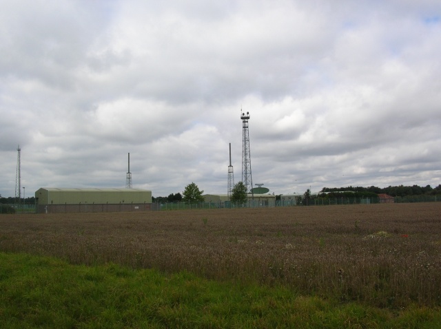
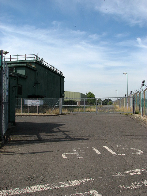
RAF Neatishead

Remote Radar Head Neatishead ( NEE-tis-hed), and commonly abbreviated RRH Neatishead, is an air defence radar site operated by the Royal Air Force (RAF...

Nearby Amenities

Located within 500m of 52.73357,1.4439541
turn, opp
Naptan AtcoCode: 2900A151
Naptan Bearing: S
Naptan BusStopType: CUS
Naptan CommonName: turn
Naptan Indicator: opp
Naptan Landmark: turn
Naptan Locality: Ashmanhaugh
Naptan NaptanCode: nfoadgtg
Naptan ShortCommonName: turn
Naptan Street: Norwich Road
Naptan Verified: no
Source: naptan_import
Lat/Long: 52.7349079/1.4419367
turn, adj
Naptan AtcoCode: 2900A154
Naptan Bearing: NE
Naptan BusStopType: CUS
Naptan CommonName: turn
Naptan Indicator: adj
Naptan Landmark: turn
Naptan Locality: Ashmanhaugh
Naptan NaptanCode: nfoadgtm
Naptan ShortCommonName: turn
Naptan Street: Norwich Road
Naptan Verified: no
Source: naptan_import
Lat/Long: 52.7352156/1.441872
The data included in this document is from www.openstreetmap.org. The data is made available under ODbL.

Have you been to Pithole Plantation?

Leave your review of Pithole Plantation below (or comments, questions and feedback).