Shoulder of Mutton Plantation
Wood, Forest in Norfolk North Norfolk
England
Shoulder of Mutton Plantation

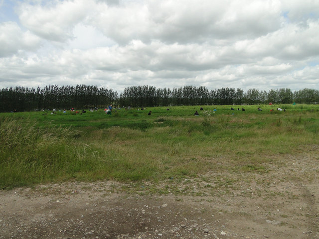
Shoulder of Mutton Plantation is a picturesque woodland located in the county of Norfolk, England. The plantation covers an area of approximately 30 hectares and is nestled within the Norfolk Broads, a renowned national park known for its stunning natural landscapes and diverse wildlife.
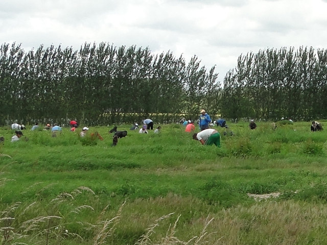
The woodland is primarily composed of native deciduous trees such as oak, beech, and birch, which create a rich tapestry of colors throughout the seasons. These trees provide a vital habitat for a wide variety of fauna, including birds, small mammals, and insects.
Shoulder of Mutton Plantation offers a range of recreational activities for visitors to enjoy. There are several well-maintained walking trails that wind through the woodland, allowing nature enthusiasts and hikers to explore its beauty at their own pace. The peaceful atmosphere and tranquil surroundings make it an ideal location for relaxation and reflection.
The plantation is also home to a diverse array of plant species, including ferns, wildflowers, and mosses, which thrive in the moist and fertile soil. This creates a visually stunning environment, especially during the spring and summer months when the woodland comes alive with vibrant colors and fragrant aromas.
Overall, Shoulder of Mutton Plantation is a popular destination for both locals and tourists seeking a peaceful escape from the hustle and bustle of everyday life. Its natural beauty, diverse wildlife, and well-maintained trails make it an ideal location for nature lovers and outdoor enthusiasts alike.
If you have any feedback on the listing, please let us know in the comments section below.
Shoulder of Mutton Plantation Images
Images are sourced within 2km of 52.735711/1.4436193 or Grid Reference TG3220. Thanks to Geograph Open Source API. All images are credited.


![Beeston Hall This fine country house is attributed to the architect William Wilkins of Norwich. It was built in 1786 for Jacob Preston near the site of an older mansion which was torn down. The surrounding park, now largely given over to farming, is believed to have been laid out at around the same time.
In the 1940s, Beeston Hall was owned by Sir Thomas Preston, O.B.E (1886-1976), 6th baronet, who spent most of his time overseas. As a young man, he went on mining expeditions in northern Siberia prospecting for gold and he later joined the Diplomatic Service. He was British Consul in Ekaterinburg at the time of the murder in 1918 by the Bolsheviks of Tsar Nicholas II and the Russian Imperial family. Sir Thomas was succeeded by his eldest son, Sir Ronald Douglas Hildebrand Preston, 7th Baronet, who served as a Major in the Intelligence Corps and later worked for Reuters and The Times as a foreign correspondent. He was also a member of the SOE (Special Operations Executive, a covert military organisation).
From 1940 to 1942, Beeston Hall housed the Norfolk Auxiliary Units&#039; administrative headquarters and it was here where Captain Nigel Oxenden [later Major Nigel Oxenden MC] and his staff were based. Although the Hall is surrounded by extensive park and farmland, no training exercises appear to have been held at Beeston.
At present, the estate is known as the Beeston Hall Arabian Stud.
(Picture taken by kind permission of the owner.)](https://s1.geograph.org.uk/geophotos/04/36/62/4366233_174a9e27.jpg)
![Beeston Hall This fine country house is attributed to the architect William Wilkins of Norwich. It was built in 1786 for Jacob Preston near the site of an older mansion which was torn down. The surrounding park, now largely given over to farming, is believed to have been laid out at around the same time.
In the 1940s, Beeston Hall was owned by Sir Thomas Preston, O.B.E (1886-1976), 6th baronet, who spent most of his time overseas. As a young man, he went on mining expeditions in northern Siberia prospecting for gold and he later joined the Diplomatic Service. He was British Consul in Ekaterinburg at the time of the murder in 1918 by the Bolsheviks of Tsar Nicholas II and the Russian Imperial family. Sir Thomas was succeeded by his eldest son, Sir Ronald Douglas Hildebrand Preston, 7th Baronet, who served as a Major in the Intelligence Corps and later worked for Reuters and The Times as a foreign correspondent. He was also a member of the SOE (Special Operations Executive, a covert military organisation).
From 1940 to 1942, Beeston Hall housed the Norfolk Auxiliary Units&#039; administrative headquarters and it was here where Captain Nigel Oxenden [later Major Nigel Oxenden MC] and his staff were based. Although the Hall is surrounded by extensive park and farmland, no training exercises appear to have been held at Beeston.
At present, the estate is known as the Beeston Hall Arabian Stud.
(Picture taken by kind permission of the owner.)](https://s3.geograph.org.uk/geophotos/04/36/62/4366235_2e6285be.jpg)


Shoulder of Mutton Plantation is located at Grid Ref: TG3220 (Lat: 52.735711, Lng: 1.4436193)
Administrative County: Norfolk
District: North Norfolk
Police Authority: Norfolk
What 3 Words
///dared.tightrope.novel. Near Hoveton, Norfolk
Nearby Locations
Related Wikis

Hoveton Hall
Hoveton Hall in the parish of Hoveton in Norfolk is a Regency-style country house made of gault brick with a slate roof. It was built between 1809 and...

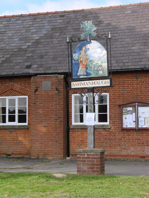
Ashmanhaugh
Ashmanhaugh is a village and civil parish in the English county of Norfolk, situated some 20 km north east of Norwich. See Inside the churches of St Swithins...

Neatishead
Neatishead ( NEET-stəd) is a village and civil parish in the English county of Norfolk. The village is situated some 20 km (12 mi) north-east of the city...
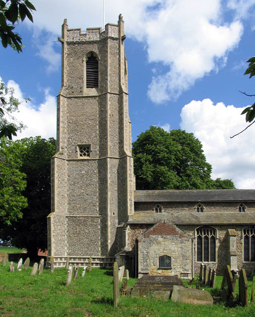
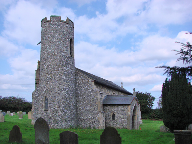
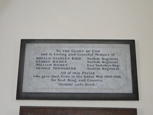
St Michael and All Angels Church, Barton Turf
St Michael and All Angels is the Church of England parish church of Barton Turf in the county of Norfolk in England. See Inside here. It stands about a...

Smallburgh
Smallburgh is a village and a civil parish in the English county of Norfolk. The village is fourteen miles (21 km) south-east of Cromer, fourteen miles...

Bewilderwood
BeWILDerwood is an adventure park for families located in Horning, a parish in the English county of Norfolk. Self-described as a "curious treehouse adventure...
Broadland High Ormiston Academy
Broadland High Ormiston Academy is a rural mixed academy in Hoveton, Norfolk for pupils aged 11 to 16. As of August 1, 2018, the school joined Ormiston...
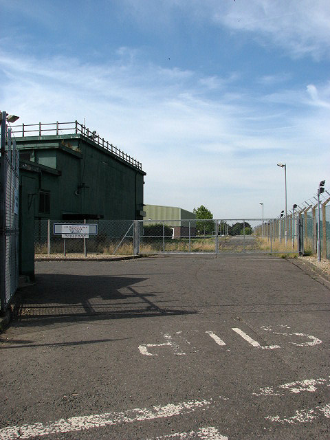
RAF Air Defence Radar Museum
The Royal Air Force Air Defence Radar Museum is a museum on the site of the former Royal Air Force radar and control base RAF Neatishead, close to the...
Related Videos


Family Day at Wroxham Barns
On Good Friday we had a lovely family day out at Wroxham Barns in Norfolk. Come along and enjoy the day with us.

Boat Trip - Day 1 (Leaving the World’s most haunted Abbey)
We didn't see any ghosts but we saw nice views & cows You're going to see all the footage from our trip During the ...

#PennygateStaithe #AlderfenBroad #NorfolkBroads Another Adventure
Hi everyone, Today I went to Pennygate Staithe as I thought there was a boardwalk there...Or that you could get close to the Broad ...
Nearby Amenities
Located within 500m of 52.735711,1.4436193Have you been to Shoulder of Mutton Plantation?
Leave your review of Shoulder of Mutton Plantation below (or comments, questions and feedback).