Frogmore Green

Settlement in Middlesex

England

Frogmore Green

Meri Marzi Adding a splash of colour to South Road, Meri Marzi dispenses Indian snacks from a converted double decker bus.
Meri Marzi Credit: Mark Percy

Frogmore Green is a small village located in Middlesex, England. Situated approximately 20 miles west of central London, it falls within the administrative boundaries of the London Borough of Hounslow. The village is known for its picturesque surroundings and peaceful atmosphere, offering a welcome respite from the bustling city.

The village itself consists of a cluster of residential houses, surrounded by lush green fields and meadows. Its name derives from the abundance of frogs that were once found in the area, signifying its natural and rural character. Frogmore Green is well-connected to nearby towns and cities, with easy access to major transport links such as the M4 motorway and various train stations.

Despite its small size, Frogmore Green offers a range of amenities to its residents. These include a village hall, where community events and gatherings are held, as well as a local pub that serves as a social hub for both locals and visitors. The village is also in close proximity to several schools, making it an attractive location for families.

Nature enthusiasts will find plenty to explore in the surrounding area. Frogmore Green is situated near the River Thames, offering opportunities for scenic walks and river-based activities. The nearby Hounslow Heath Nature Reserve provides a haven for wildlife and boasts a variety of walking trails for outdoor enthusiasts.

Overall, Frogmore Green is a quiet and charming village that provides a tranquil escape from the nearby urban centers. Its natural beauty and sense of community make it an appealing place to live or visit.

If you have any feedback on the listing, please let us know in the comments section below.

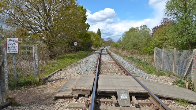
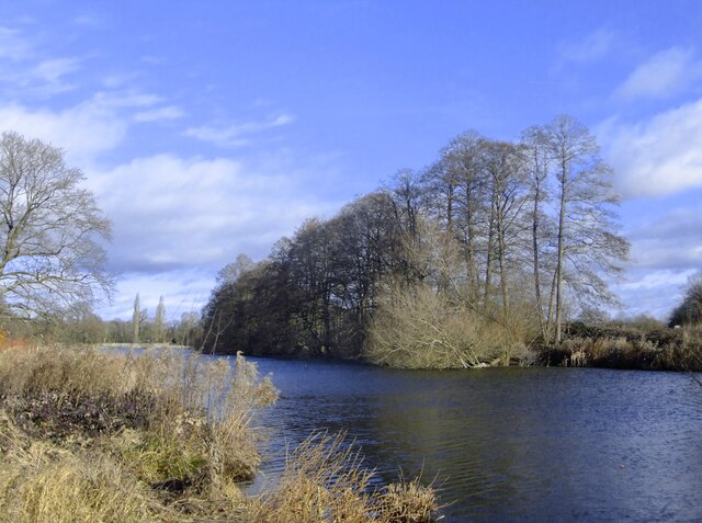
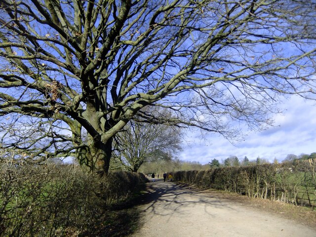
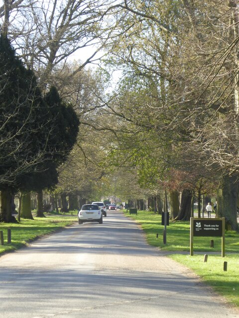
Frogmore Green Images

Images are sourced within 2km of 51.494007/-0.366441 or Grid Reference TQ1378. Thanks to Geograph Open Source API. All images are credited.

Meri Marzi Adding a splash of colour to South Road, Meri Marzi dispenses Indian snacks from a converted double decker bus.
Meri Marzi
Adding a splash of colour to South Road, Meri Marzi dispenses Indian snacks from a converted double decker bus.
Southall Fire Station
Trumpers Way level crossing This well-used pedestrian crossing links Trumpers Way with Warren Farm.  It crosses the freight-only Brentford branch line, which runs for four miles between Southall and a waste transfer station in Brentford.

When it opened in 1859 the line took freight into Brentford Dock, giving the Great Western Railway a connection to the Thames.

Passenger services began in 1860.  By 1904 a halt had been built at Trumpers crossing but it closed in 1926, with passenger services withdrawn in 1942.  <span class="nowrap"><a title="http://www.disused-stations.org.uk/b/brentford/" rel="nofollow ugc noopener" href="http://www.disused-stations.org.uk/b/brentford/">Link</a><img style="margin-left:2px;" alt="External link" title="External link - shift click to open in new window" src="https://s1.geograph.org.uk/img/external.png" width="10" height="10"/></span>

The line is now used infrequently by goods trains carrying refuse and construction aggregates.
Trumpers Way level crossing
This well-used pedestrian crossing links Trumpers Way with Warren Farm. It crosses the freight-only Brentford branch line, which runs for four miles between Southall and a waste transfer station in Brentford. When it opened in 1859 the line took freight into Brentford Dock, giving the Great Western Railway a connection to the Thames. Passenger services began in 1860. By 1904 a halt had been built at Trumpers crossing but it closed in 1926, with passenger services withdrawn in 1942. LinkExternal link The line is now used infrequently by goods trains carrying refuse and construction aggregates.
Osterley Park in January: alders by the lake The image was taken with a simple camera on a day of gusty winds.  All the vegetation was in motion, and the result is less sharp than I'd have wished. 

I can see from my Geograph profile that I often come to Osterley in late January or early February, and this shot is worth comparing with one I took six years earlier: <a title="https://www.geograph.org.uk/photo/4814535" href="https://www.geograph.org.uk/photo/4814535">Link</a>   That day - too - I complained about the wind, but it wasn't strong enough to disturb the reflections in the lake.   January 29th 2022 was mild, reaching at least 14C, but the WNW wind was brisk and distinctly chilly.

The trees along the far side of the lake are nearly all alders - though there's a willow growing part-submerged at the near end of the row,
Osterley Park in January: alders by the lake
The image was taken with a simple camera on a day of gusty winds. All the vegetation was in motion, and the result is less sharp than I'd have wished. I can see from my Geograph profile that I often come to Osterley in late January or early February, and this shot is worth comparing with one I took six years earlier: Link That day - too - I complained about the wind, but it wasn't strong enough to disturb the reflections in the lake. January 29th 2022 was mild, reaching at least 14C, but the WNW wind was brisk and distinctly chilly. The trees along the far side of the lake are nearly all alders - though there's a willow growing part-submerged at the near end of the row,
Osterley Lane in late January
Southall railway station, Greater London Opened in 1839 by the Great Western Railway on the line from London Paddington to Reading. 
View west towards Hayes & Harlington and Reading. Until 1942, this was the junction for the Brentford Dock branch. Since <a href="https://www.geograph.org.uk/photo/3322784">TQ1279 : Southall railway station, Greater London, 2009</a>, the view has been obscured by a new footbridge, a new entrance building has been built on the right (also partially obscured) and the 1876 street-level building is no longer used by passengers.
Southall railway station, Greater London
Opened in 1839 by the Great Western Railway on the line from London Paddington to Reading. View west towards Hayes & Harlington and Reading. Until 1942, this was the junction for the Brentford Dock branch. Since TQ1279 : Southall railway station, Greater London, 2009, the view has been obscured by a new footbridge, a new entrance building has been built on the right (also partially obscured) and the 1876 street-level building is no longer used by passengers.
Osterley House seen across the Garden Lake This impressive neo-classical mansion was built in the 1570s by Sir Thomas Gresham and transformed by Robert Adam in the 1760s.
Osterley House seen across the Garden Lake
This impressive neo-classical mansion was built in the 1570s by Sir Thomas Gresham and transformed by Robert Adam in the 1760s.
Looking down the main drive at Osterley Park
Canal boat Strip the Willow, Grand Union Canal
River Brent at Hanwell Flight
Grand Union Canal at Hanwell Flight of Locks At this point the Capital Ring Walk leaves the Grand Union Canal and follows the Brent River.
Grand Union Canal at Hanwell Flight of Locks
At this point the Capital Ring Walk leaves the Grand Union Canal and follows the Brent River.
Grand Union Canal at Hanwell Flight of Locks
Lockkeeper's house, Grand Union Canal at Hanwell Flight of Locks
Grand Union Canal at Hanwell Flight of Locks
Grand Union Canal at Hanwell Locks, lock #94
Grand Union Canal at Hanwell Flight of Locks
Show me another place!

Frogmore Green is located at Grid Ref: TQ1378 (Lat: 51.494007, Lng: -0.366441)

Unitary Authority: Ealing

Police Authority: Metropolitan

What 3 Words

///whites.frosted.cheeks. Near Southall, London

Related Wikis

M4 bus lane

The M4 bus lane was a 3.5-mile (5.6 km) bus lane on the eastbound (London-bound) carriageway of the M4 motorway between Heathrow Airport and central London...

Our Lady Queen of Apostles Church, Heston

Our Lady Queen of Apostles is a Catholic church in Heston in the London Borough of Hounslow. It is situated between The Green and Heston Road, opposite...

St Leonard's Church, Heston

St Leonard's Church is the Grade II* listed Church of England parish church for Heston in the London Borough of Hounslow. == History == The church dates...

Osterley Park

Osterley Park and House is a Georgian country estate in west London, that straddles the London boroughs of Ealing and Hounslow. Originally dating from...

Nearby Amenities

Located within 500m of 51.494007,-0.366441
Crossing
Crossing: uncontrolled
Crossing Island: yes
Crossing Ref: zebra
Lat/Long: 51.4936388/-0.370642
Mini Roundabout
Lat/Long: 51.4945377/-0.3672946
Ref GB Tflcid: RWG242137
Traffic Calming: cushion
Lat/Long: 51.4947636/-0.3713345
Mini Roundabout
Lat/Long: 51.4977057/-0.3644968
Post Box
Operator: Royal Mail
Operator Wikidata: Q638098
Ref: UB2 5
Lat/Long: 51.4959314/-0.36518
Entrance: yes
Lat/Long: 51.4951465/-0.3660321
London Borough of Ealing/Norwood Green
Information: board
Tourism: information
Lat/Long: 51.4918603/-0.3707196
Ref GB Tflcid: RWG242159
Traffic Calming: hump
Lat/Long: 51.4963443/-0.3721908
Bus Stop
Norwood Green
Bench: yes
Bin: yes
Bus: yes
Covered: yes
Departures Board: timetable
Naptan AtcoCode: 490010447N
Naptan Bearing: N
Naptan CommonName: Norwood Green
Naptan Verified: no
Public Transport: platform
Ref: 50468
Shelter: yes
Tactile Paving: no
Lat/Long: 51.493158/-0.3703045
Bus Stop
Norwood Green
Bus: yes
Naptan AtcoCode: 490010447N1
Naptan Bearing: NE
Naptan CommonName: Norwood Green
Naptan Indicator: Stand
Naptan Verified: no
Note: Bus stand not bus stop
Public Transport: platform
Shelter: no
Lat/Long: 51.493189/-0.3693855
Bus Stop
Norwood Green
Bus: yes
Bus Routes: 120
Departures Board: timetable
Naptan AtcoCode: 490010447S
Naptan Bearing: N
Naptan CommonName: Norwood Green
Naptan Verified: no
Network: London Buses
Network Wikidata: Q1192411
Public Transport: platform
Ref: 53074
Shelter: yes
Lat/Long: 51.4939081/-0.370814
Post Box
Operator: Royal Mail
Operator Wikidata: Q638098
Post Box Type: pillar
Ref: UB2 81
Lat/Long: 51.4919781/-0.3702786
Post Box
Colour: red
Operator: Royal Mail
Operator Wikidata: Q638098
Post Box Type: pillar
Ref: UB2 15
Lat/Long: 51.4947803/-0.3710279
Post Box
Operator: Royal Mail
Operator Wikidata: Q638098
Ref: UB2 23
Lat/Long: 51.4983139/-0.3664084
Traffic Calming: island
Lat/Long: 51.4930077/-0.3700654
Crossing
Crossing: uncontrolled
Crossing Island: no
Crossing Ref: zebra
Lat/Long: 51.4929092/-0.3696859
Barrier: cycle_barrier
Bicycle: yes
Foot: yes
Lat/Long: 51.490773/-0.3641466
Barrier: cycle_barrier
Bicycle: yes
Foot: yes
Lat/Long: 51.4911671/-0.3643478
Norwood Green
Place: neighbourhood
Wikidata: Q83595
Lat/Long: 51.4966058/-0.3693772
Crossing
Crossing: uncontrolled
Crossing Island: no
Kerb: lowered
Lat/Long: 51.4955378/-0.3656305
Wooden Sheep
Artwork Type: statue
Fixme: location within Tentelow Meadow inaccurate
Material: wood
Source: photograph
Tourism: artwork
Lat/Long: 51.4973296/-0.3624685
Restaurant
The Plough Inn (Restaurant)
Addr City: Southall
Addr Country: GB
Addr Housename: The Plough Inn
Addr Housenumber: 10
Addr Postcode: UB2 4LG
Addr Street: Tentelow Lane
Contact Website: http://www.ploughinnnorwoodgreen.co.uk/
Fhrs Id: 590656
Fhrs Local Authority Id: PI/000173184
Source Addr: FHRS Open Data
Lat/Long: 51.4950641/-0.3660159
Street Lamp
Lamp Model: Philips SGS306
Lamp Type: SON
Ref: C27
Source: Survey of 2019-01-21
Lat/Long: 51.4917955/-0.3619634
Street Lamp
Lamp Model: Philips SGS306
Lamp Type: SON
Ref: C26
Source: Survey of 2019-01-21
Lat/Long: 51.491982/-0.3615187
Street Lamp
Lamp Model: Philips SGS306
Lamp Type: SON
Ref: C25
Source: Survey of 2019-01-21
Lat/Long: 51.4921555/-0.3611056
Street Lamp
Lamp Model: Philips SGS306
Lamp Type: SON
Ref: C23
Source: Survey of 2019-01-21
Lat/Long: 51.4924995/-0.360258
Street Lamp
Lamp Model: Philips SGS306
Lamp Type: SON
Ref: C28
Source: Survey of 2019-01-21
Lat/Long: 51.491605/-0.3624086
Street Lamp
Lamp Model: Philips SGS306
Lamp Type: SON
Ref: C22
Source: Survey of 2019-01-21
Lat/Long: 51.4926764/-0.3598343
Street Lamp
Lamp Model: Philips SGS306
Lamp Type: SON
Ref: C29
Source: Survey of 2019-01-21
Lat/Long: 51.4914276/-0.362892
Street Lamp
Lamp Model: Philips SGS306
Lamp Type: SON
Ref: C24
Source: Survey of 2019-01-21
Lat/Long: 51.4923359/-0.3606604
Street Lamp
Lamp Model: Philips SGS306
Lamp Type: SON
Ref: D12
Source: Survey of 2019-01-21
Lat/Long: 51.4899011/-0.3687818
Street Lamp
Lamp Model: Philips SGS306
Lamp Type: SON
Ref: D7
Source: Survey of 2019-01-21
Lat/Long: 51.4903654/-0.3664161
Street Lamp
Lamp Model: Philips SGS306
Lamp Type: SON
Ref: D2
Source: Survey of 2019-01-21
Lat/Long: 51.4910034/-0.3641258
Street Lamp
Lamp Model: Philips SGS306
Lamp Type: SON
Ref: D5
Source: Survey of 2019-01-21
Lat/Long: 51.490596/-0.3654884
Street Lamp
Lamp Model: Philips SGS306
Lamp Type: SON
Ref: D9
Source: Survey of 2019-01-21
Lat/Long: 51.4901583/-0.3673603
Street Lamp
Lamp Model: Philips SGS306
Lamp Type: SON
Ref: D8
Source: Survey of 2019-01-21
Lat/Long: 51.4902585/-0.3668989
Street Lamp
Lamp Model: Philips SGS306
Lamp Type: SON
Ref: D11
Source: Survey of 2019-01-21
Lat/Long: 51.4899848/-0.3683151
Street Lamp
Lamp Model: Philips SGS306
Lamp Type: SON
Ref: D3
Source: Survey of 2019-01-21
Lat/Long: 51.4908599/-0.3645871
Street Lamp
Lamp Model: Philips SGS306
Lamp Type: SON
Ref: D10
Source: Survey of 2019-01-21
Lat/Long: 51.490065/-0.3678377
Street Lamp
Lamp Model: Philips SGS253
Lamp Type: SON
Ref: C28
Source: Survey of 2019-01-21
Lat/Long: 51.4916229/-0.3624227
Street Lamp
Lamp Model: Philips SGS306
Lamp Type: SON
Ref: D1
Source: Survey of 2019-01-21
Lat/Long: 51.4911405/-0.3637127
Street Lamp
Lamp Model: Philips SGS306
Lamp Type: SON
Ref: D6
Source: Survey of 2019-01-21
Lat/Long: 51.4904725/-0.3659497
Street Lamp
Lamp Model: Philips SGS306
Lamp Type: SON
Ref: C30
Source: Survey of 2019-01-21
Lat/Long: 51.4912806/-0.3632889
Street Lamp
Lamp Model: Philips SGS306
Lamp Type: SON
Ref: D4
Source: Survey of 2019-01-21
Lat/Long: 51.490723/-0.3650431
Crossing
Crossing: uncontrolled
Crossing Island: no
Crossing Ref: zebra
Lat/Long: 51.4929713/-0.3697657
Waste Basket
Waste: trash
Lat/Long: 51.4959708/-0.3651089
Waste Basket
Waste: trash
Lat/Long: 51.4936559/-0.3704682
Bench
Backrest: yes
Material: wood
Seats: 4
Lat/Long: 51.494098/-0.370854
Bench
Backrest: yes
Material: wood
Seats: 4
Lat/Long: 51.4939537/-0.3707116
Crossing
Crossing: uncontrolled
Crossing Island: no
Kerb: flush
Lat/Long: 51.4946458/-0.3670228
Waste Basket
Waste: trash
Lat/Long: 51.4933496/-0.3701757
Bench
Material: wood
Seats: 5
Lat/Long: 51.4944512/-0.3701913
Bench
Backrest: yes
Material: wood
Seats: 4
Lat/Long: 51.4939235/-0.3706672
Bench
Backrest: yes
Material: wood
Seats: 4
Lat/Long: 51.494256/-0.3710361
Bench
Backrest: yes
Material: wood
Seats: 4
Lat/Long: 51.4936978/-0.3704396
Waste Basket
Waste: trash
Lat/Long: 51.4942092/-0.3710046
Bicycle Parking
Capacity: 2
Covered: no
Lat/Long: 51.4959994/-0.3650744
Bench
Backrest: yes
Material: metal
Seats: 5
Lat/Long: 51.4936962/-0.3703322
Bench
Backrest: yes
Material: wood
Seats: 4
Lat/Long: 51.4937442/-0.3704703
Waste Basket
Waste: trash
Lat/Long: 51.4934717/-0.3702256
Bench
Backrest: yes
Material: wood
Seats: 4
Lat/Long: 51.4938217/-0.3684568
Bench
Backrest: yes
Material: wood
Seats: 4
Lat/Long: 51.4935964/-0.3701402
Waste Basket
Waste: trash
Lat/Long: 51.4938975/-0.3706243
Waste Basket
Waste: trash
Lat/Long: 51.4958211/-0.3652844
Bench
Backrest: yes
Material: wood
Seats: 4
Lat/Long: 51.4937994/-0.3705352
Bench
Backrest: yes
Material: wood
Seats: 4
Lat/Long: 51.4942793/-0.3677928
Bicycle Parking
Bicycle Parking: stands
Capacity: 2
Covered: no
Lat/Long: 51.4958502/-0.3652425
Waste Basket
Waste: trash
Lat/Long: 51.4944673/-0.3709503
Bench
Backrest: yes
Material: wood
Seats: 4
Lat/Long: 51.4935058/-0.3689287
Bench
Backrest: yes
Material: wood
Seats: 4
Lat/Long: 51.4935824/-0.3703993
Traffic Calming: hump
Lat/Long: 51.4980653/-0.365958
Leisure: fitness_station
Sport: fitness
Lat/Long: 51.4943952/-0.368104
Waste Basket
Waste: trash
Lat/Long: 51.4936264/-0.3687632
Bench
Backrest: yes
Material: wood
Seats: 4
Lat/Long: 51.4941513/-0.3709345
Bench
Backrest: yes
Material: wood
Seats: 4
Lat/Long: 51.4945266/-0.3709344
Bench
Backrest: yes
Material: wood
Seats: 4
Lat/Long: 51.4935428/-0.3703621
Bench
Backrest: yes
Material: wood
Seats: 4
Lat/Long: 51.4944821/-0.3709122
Bench
Backrest: yes
Material: wood
Seats: 4
Lat/Long: 51.4944804/-0.3710094
Waste Basket
Waste: trash
Lat/Long: 51.4944121/-0.3683548
Bench
Backrest: yes
Material: wood
Seats: 4
Lat/Long: 51.4945183/-0.3710204
Traffic Calming: hump
Lat/Long: 51.4977692/-0.3652668
Bench
Backrest: yes
Material: wood
Seats: 4
Lat/Long: 51.4939884/-0.3682126
Waste Basket
Waste: trash
Lat/Long: 51.4944386/-0.3690346
Bench
Backrest: yes
Material: metal
Seats: 5
Lat/Long: 51.4944172/-0.3686826
Waste Basket
Waste: trash
Lat/Long: 51.4945391/-0.3709809
Waste Basket
Waste: trash
Lat/Long: 51.494476/-0.3699565
Recycling
Opening Hours: 24/7
Recycling PET: yes
Recycling Aluminium: yes
Recycling Cans: yes
Recycling Cardboard: yes
Recycling Glass Bottles: yes
Recycling Paper: yes
Recycling Plastic: yes
Recycling Plastic Bottles: yes
Recycling Plastic Packaging: yes
Recycling Type: container
Lat/Long: 51.4931932/-0.3703322
Direction: 175
Generator Method: photovoltaic
Generator Output Electricity: yes
Generator Solar Modules: 10
Generator Source: solar
Generator Type: solar_photovoltaic_panel
Location: roof
Power: generator
Lat/Long: 51.4942497/-0.372258
Direction: 175
Generator Method: photovoltaic
Generator Output Electricity: yes
Generator Solar Modules: 10
Generator Source: solar
Generator Type: solar_photovoltaic_panel
Location: roof
Power: generator
Lat/Long: 51.4942434/-0.3724431
Direction: 175
Generator Method: photovoltaic
Generator Output Electricity: yes
Generator Solar Modules: 10
Generator Source: solar
Generator Type: solar_photovoltaic_panel
Location: roof
Power: generator
Lat/Long: 51.4941186/-0.3725252
Direction: 175
Generator Method: photovoltaic
Generator Output Electricity: yes
Generator Solar Modules: 10
Generator Source: solar
Generator Type: solar_photovoltaic_panel
Location: roof
Power: generator
Lat/Long: 51.4941039/-0.3727246
Direction: 175
Generator Method: photovoltaic
Generator Output Electricity: yes
Generator Solar Modules: 10
Generator Source: solar
Generator Type: solar_photovoltaic_panel
Location: roof
Power: generator
Lat/Long: 51.4942472/-0.3723526
Direction: 175
Generator Method: photovoltaic
Generator Output Electricity: yes
Generator Solar Modules: 10
Generator Source: solar
Generator Type: solar_photovoltaic_panel
Location: roof
Power: generator
Lat/Long: 51.4942579/-0.3721555
Direction: 175
Generator Method: photovoltaic
Generator Output Electricity: yes
Generator Solar Modules: 10
Generator Source: solar
Generator Type: solar_photovoltaic_panel
Location: roof
Power: generator
Lat/Long: 51.4941117/-0.3726251
Traffic Calming: choker
Lat/Long: 51.4977816/-0.3644146
Ref GB Tflcid: RWG242139
Traffic Calming: cushion
Lat/Long: 51.4946765/-0.3690419
Ref GB Tflcid: RWG242177
Traffic Calming: hump
Lat/Long: 51.4966663/-0.3716785
Ref GB Tflcid: RWG242161
Traffic Calming: hump
Lat/Long: 51.4965383/-0.3709205
Ref GB Tflcid: RWG242160
Traffic Calming: hump
Lat/Long: 51.4963945/-0.3716943
Ref GB Tflcid: RWG242162
Traffic Calming: hump
Lat/Long: 51.4966321/-0.37048
Ref GB Tflcid: RWG242140
Traffic Calming: hump
Lat/Long: 51.4946494/-0.368208
Ref GB Tflcid: RWG242163
Traffic Calming: hump
Lat/Long: 51.4969896/-0.3702812
Ref GB Tflcid: RWG242138
Traffic Calming: cushion
Lat/Long: 51.4946974/-0.3700273
Ref GB Tflcid: RWG242145
Traffic Calming: hump
Lat/Long: 51.4984593/-0.3668695
Leisure: fitness_station
Sport: fitness
Lat/Long: 51.4940644/-0.3706831
Man Made: charge_point
Lat/Long: 51.492726/-0.3697673
Capacity: 3
Man Made: charge_point
Manufacturer: Source London Charging Station
Power: 6.9 kW
Lat/Long: 51.4947012/-0.3689059
Man Made: charge_point
Lat/Long: 51.4947549/-0.3707929
Crossing
Crossing: traffic_signals
Lat/Long: 51.4949945/-0.3720434
Crossing
Crossing: traffic_signals
Lat/Long: 51.4947159/-0.3717525
Crossing
Crossing: traffic_signals
Lat/Long: 51.4948392/-0.3716519
Crossing
Crossing: unmarked
Crossing Markings: no
Lat/Long: 51.4952913/-0.3725739
Give Way
Direction: forward
Lat/Long: 51.4928652/-0.3698801
Give Way
Direction: forward
Lat/Long: 51.4928185/-0.3698413
Give Way
Direction: forward
Lat/Long: 51.4933661/-0.3704454
Barrier: kissing_gate
Lat/Long: 51.4924586/-0.3656765
Give Way
Direction: backward
Lat/Long: 51.4929988/-0.3673279
Give Way
Direction: backward
Lat/Long: 51.4936786/-0.3684805
The data included in this document is from www.openstreetmap.org. The data is made available under ODbL.

Have you been to Frogmore Green?

Leave your review of Frogmore Green below (or comments, questions and feedback).